
-
 28702 Hits
-
 88.19% Score
-
 26 Votes
|
|
Area/Range |
|---|---|
|
|
44.10560°N / 71.7493°W |
|
|
Hiking |
|
|
4802 ft / 1464 m |
|
|
Overview
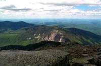
 On Mt. Pemigewasset with the Moosilauke Massif beyond
The Cannon-Kinsman and Moosilauke Range is defined as all of the major peaks west of Franconia Notch (I-93), which includes a number of 4,000fters and some other high peaks. Mt. Moosilauke is the highest at 4,802ft. and the farthest west of the White Mountain 4,000 footers. The range also includes Cannon Mountain (4,100ft.), North Kinsman (4,293ft.), South Kinsman (4,358ft.), Mt. Wolf (3,500ft.), and Moosilauke's sub-peaks of Mt. Waternomee, Jim, Blue, Clough, Hurricane, and South Peak. Other popular hiking destinations/summits within this region include Bald Mountain and Artists Bluff (2,340ft.), Mt. Pemigewasset (2,557ft.), and Blueberry Mountain (2,662ft.).
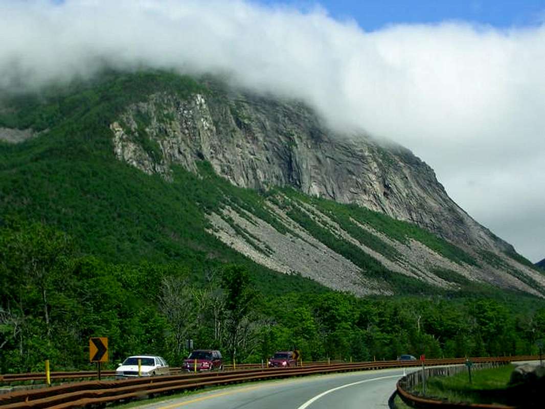
The range is probably most well known for its sheer granite walls which scour the east sides of many of the mountains. Cannon Mountain has the largest and most impressive face in the White Mountains with Cannon Cliffs (former home to the Old Man of the Mountain). Other places include Indian Head on Mt. Pemigewasset and Jobildunk Ravine on Mt. Moosilauke. The geologic layout of this range revolves around a series of jumbled ridges that for the most part run northeast to southwest. The Kinsman Ridge Trail follows this ridge from the north end of the ridge at Cannon Mountain until it drops down to the Lost River and NH Rt. 112, where it meets the Beaver Brook Trail. This trail then heads back up to the large northeast shoulder of Mt. Moosilauke where it terminates at its summit.
Also, the Appalachian Trail follows the main ridge of this range from the southwest end of the ridge all the way to North Kinsman, where it forgoes Cannon Mountain and descends to Lonesome Lake before crossing the notch to the Franconia Peaks. This is one of the most rugged sections of the entire Appalachian Trail and when combined with the rest of its stint in the White Mountains, can be a very challenging couple of overnight hikes.
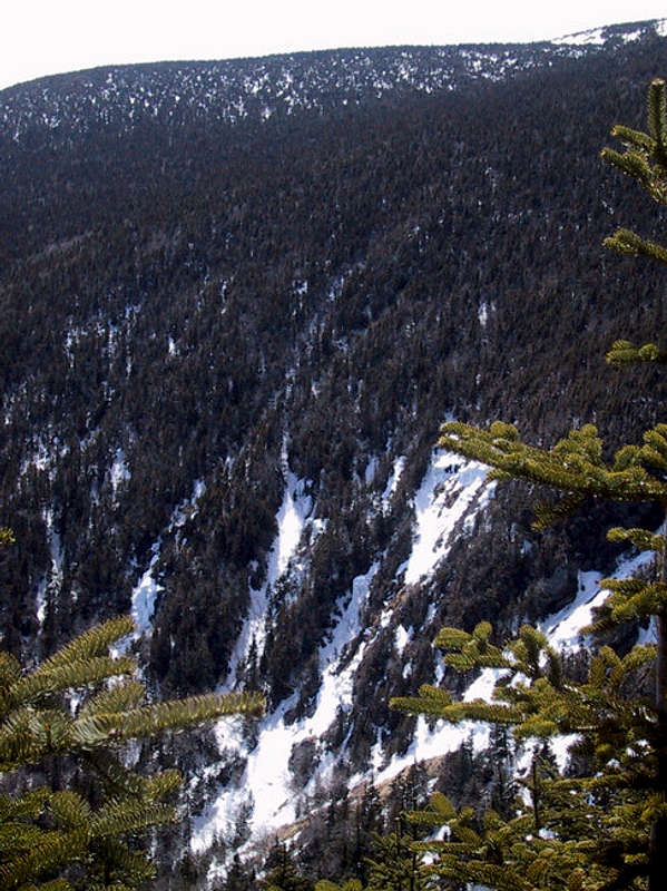
Geologically speaking, this area is pretty much the same as the rest of the White Mountains, as it was glacially carved during the North American Continent's last ice age. There are a number of great places on the west side of "The Notch" to see the results of glacial processes, such as Lost River Gorge, Lonesome Lake, and Cannon Mountain. Lost River Gorge is a walk/tour that takes you through some carved out caverns and a mini-ravine that is similar in formation to the Flume Gorge, just not as dramatic.
 North and South Kinsman with Cannon Mountain
The range also has a small portion of Alpine Zone located on the summit of Mt. Moosilauke which provides hikers who don't want to scale Mt. Washington or the other high peaks a chance to still get above treeline and get a glimpse at the fragile ecosystem of the alpine zone. At most times throughout the summer, a visitor to this region will be able to spot numerous varieties of alpine wildflowers that bloom in the spring and summer months. Moosilauke's broad open summit provides amazing views of the rest of the range as well. Also, if you're a hiker/climber that likes views, this range has tons of them all over the place. There is not a place on these mountains that doesn't have something interesting to offer the visitor.
Getting There
There are numerous access points throughout the range, but here are general directions on accessing different parts of the range at some of the popular trailheads.General Directions from Boston, MA and south:
Take I-93 north for approximately two hours to Franconia Notch. The distance is about 110 miles. Follow directions below for more concise directions to certain trailheads.
Kinsman Ridge Trail (southern access):
From I-93 take the exit for NH Rt. 112/118/Kanacamagus Highway. Take Rt. 112 west, not the Kanacamagus Highway which is east. Continue west on 112 for approximately five miles until you reach the trailhead on your right (north) side.
Mt. Moosilauke's trails (southern access via Moosilauke Lodge):
From I-93 take the exit for NH rt. 112/118/Kanacamagus Highway. Take Rt. 112 west for approximately three miles until you reach its junction with NH Rt. 118. Take 118 west for approximately seven miles over a ridge that affords some nice views. Once you start descending the other side of the ridge you'll see a sign on your right about a mile from the top that says Moosilauke Lodge. Turn here and head back the road to the trailhead parking.
Trailhead access to the following trails is all via exits within Franconia Notch:
Mt. Pemigewasset, Indian Head, Cascade Brook, Kinsman Pond, Bald Mountain-Artist's Bluff, High Cannon, Lonesome Lake, Whitehouse, and Basin-Cascades
 |
 |
 |
 |
Red Tape
Most of this range is a part of the White Mountain National Forest and all National Forest rules apply. My best suggestion is to follow the "LEAVE NO TRACE" program guidelines and then you'll be fine. Leave only footprints (don't even do that if possible) and take only memories.Weather
This area is known for having harsh weather, especially above tree-line. Make sure to check the forecast before you head out and don't be ashamed to turn back during inclement weather. Conditions here can rival the worst conditions found anywhere on earth, so be prepared.For current and up-to-the-minute weather, click on the link below!
Weather for Franconia Notch, NH
Camping
There are quite a few campgrounds in the region. To view them and their prices click on the link below!White Mountain Camping
Below is a link to the list of conditions and restrictions on backcountry camping in the White Mountain National Forest:
White Mountain National Forest Website
There is no camping within Franconia Notch State Park other than at the Lafayette Campground. See the next section for a link to more info. Also, the majority of Mt. Moosilauke is owned by Dartmouth so there is no camping on Mt. Moosilauke.
For more information contact:
Androscoggin Ranger District
Gorham Office
300 Glen Rd
Gorham, NH 03581-1399
(603) 466-2713 x 0
(603) 466-2856 TTY
Evans Notch Information Center
18 Mayville Rd
Bethel, ME 04217-4400
(207) 824-2134
(207) 824-3312 TTY
Pemigewasset Ranger District
Plymouth Office
1171 NH Rt 175
Holderness, NH 03245
(603) 536-1315 (Business Number)
(603) 536-3281 TTY
Bethlehem Office
660 Trudeau Rd
Bethlehem, NH 03574
(603) 869-2626 (Business Number)
(603) 869-3104 TTY
General Forest Information and Passes
(603) 745-3816 (seven days a week)
Saco Ranger District
33 Kancamagus Highway
Conway, NH 03818
(603) 447-5448 x 0
(603) 447-3121 TTY
White Mountain National Forest Supervisor's Office
719 Main Street
Laconia, NH 03246
(603) 528-8721
(603) 528-8722 TTY
Shelters and Huts
Shelters:
There are a number of overnight/emergency shelters along the main trail (Kinsman Ridge Trail). They are listed below from south to north.
- Jeffers Brook Shelter
- Beaver Brook Shelter
- Eliza Brook Shelter
- Kinsman Pond Campsite
- Coppermine Shelter
Huts and Campgrounds of the Range:
There are two huts and two campgrounds that exist within the range. The two huts are the Moosilauke Ravine Lodge and the AMC Lonesome Lake Hut (holds 48). The two campgrounds are Wildwood Campground and Lafayette Campground.
- For more information on reservations and accomodations ath the AMC's Lonesome Lake Hut, click on the following link: Lonesome Lake Hut
- For more information on the Moosilauke Ravine Lodge, click on the following link: Moosilauke Ravine Lodge
- For more information on Lafayette Campground, click on the following link: Lafayette Campground
- For more information on Wildwood Campground, click on the following link: Wildwood Campground
External Links
"LEAVE NO TRACE"White Mountain National Forest
mtmoosilauke.com
Franconia Notch
Cannon Mountain
hikethewhites.com