Started and organized by SP member Bob Burd, the Sierra Challenge, held yearly, is a 10-day affair featuring a different peak to climb each day (some days, there is more than just one to climb). Thus, veterans of the real Sierra Challenge will just laugh at what I am calling, for lack of a better term, "My Own Sierra Challenge." This was merely a 4-day affair featuring just 7 peaks, and some of it developed more or less spontaneously, but it wasn't a bad showing for an Easterner whose legs and lungs were not yet in prime summer mountaineering condition. In the summer of 2012, mountaineering season began for me on July 13 and ended 35 summits later on August 23. By the end of the summer, fit and strong and down to my high school weight, I may indeed have been able to complete the real Sierra Challenge.
Despite the incredible beauty and spectacular climbing opportunities of the Sierra Nevada, my growing obsession with Greater Yellowstone and the Glacier-Bob Marshall country of Montana has meant that I have done very little mountaineering in the Range of Light. Until July 2005, my only Sierra Nevada summit had been, I regret to admit, Whitney in 1999 by the mobbed hiking route out of Whitney Portal (unless you count Moro Rock-- even more regretful-- which I "climbed" in 1996). In 2005, I took a painful break from Wyoming and Montana and made a point to get back to the Sierra, where I climbed Cathedral Peak, Mount Conness, and Mount Dana (by Dana Couloir, not the trail) over successive days. But then the summers called me back to grizzly country and my beloved dark Absarokas.
After my parents moved to Las Vegas in the spring of 2010, I knew that there would be opportunities for summer trips to the Sierra Nevada.
Yes, I evaluate the need to visit people based on proximity to mountains I want to climb. No, I am not ashamed.
Although Las Vegas is a noisy eyesore to someone like me, there is no denying that of all the major cities in the West, it is perhaps the best in terms of proximity to great outdoor recreation. Among my favorite places all within a day's drive of Vegas are Red Rock Canyon (of course), Great Basin National Park, the Wasatch, Zion and Grand Staircase-Escalante, Death Valley, and the Sierra Nevada.
Summer 2010 was already out; I'd had long-standing plans for a road trip out to Montana and Wyoming. So was summer 2011; July was to see a family trip, complete with in-laws, to Montana (bless my wife for allowing me to escape to climb about every other day), and I gave in to my cravings for the Absaroka Range and planned an August trip out to Wyoming via a flight into Jackson Hole (note to those who like window seats-- the flight from Denver to Jackson Hole is the most beautiful I have ever been on, for it goes up the valley of the Wind River very near to the crest of the Wind River Range, and the glaciers, high lakes, and peaks of the roof of the Winds are all on display, and it is amazing to behold even if it does feel like cheating).
So on July 10, 2012, I flew out to Vegas with the kids (on August 1, I would drive up to Great Falls, MT, having left the kids with my parents, to meet my wife and spend a few weeks with her in Montana, Idaho, and Nevada).
Originally, my Sierra plan was to go there at the end of the summer, after my legs were strong and I was adjusted to altitude, but my wife's schedule made that too difficult, and I had to make the Sierra days part of the first leg of the summer. Knowing that would make things a little tougher on me since a major goal was doing at least one 14er that involved a minimum of Class 3 terrain (although I am no list-chaser, I wanted at least one "respectable" CA 14er since Whitney and White Mountain were the only ones I'd done), I tried to do what I could to get myself some exposure and preparation, but I knew things would mostly hinge on how my lungs decided to adjust to the altitude.
At home during the spring, I'd done plenty of biking, running, hiking, and cragging to get myself ready for the summer, but there is no substitute for altitude and real mountains.
July 13-- White Rock Pinnacle in Red Rock Canyon. Not high, but several spots of Class 3-4 and one 5.4, so a good outing, especially in a rain making things treacherous.
July 14-- North Peak in Red Rock Canyon. Drove the 4wd road to Red Rock Pass and hiked the peak around sunset when temperatures were cooler. Spent the night in the car.
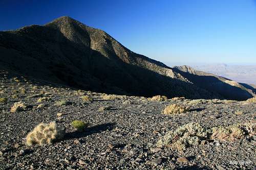
July 15-- Bridge Mountain in Red Rock Canyon. Did that at dawn and then drove out to Death Valley. My brother's old 4Runner had gotten so weak that I had to go into 4-low to reach Mahogany Flat! Along the way, I stopped and hiked up Wildrose Peak, partially for some altitude but also because I'd never been up it before. Spent the night at Mahogany Flat by myself, about the only cool road-accessible place in the park after a day that had reached nearly 120 at Badwater.
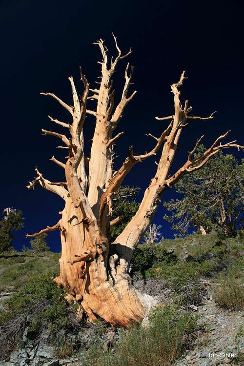
July 16-- Telescope Peak, for both the altitude and the fact that I hadn't hiked it since 1997 (though I tried in April 2003 but turned around due to waist-deep snow at Arcane Meadows). Also, I wanted to photograph the bristlecone pines near the summit. My March 1997 hike yielded a very nice picture, but when I was going through a purity phase a few years later and throwing away all prints and negatives except for those I considered my very best, that picture went to the great album in the sky. One of the dumbest things I ever did.
After hiking Telescope Peak, I drove out to Panamint Springs, got a shower, and then steered for Onion Valley in the Sierra Nevada.
And that is where "My Own Sierra Challenge" began.
July 17-- Kearsarge Pinnacles and University Peak
July 11, 1999 was a formative day for me. From camp at the Kearsarge Lakes, I wandered off to the upper lake and then picked my way up a couloir, wanting to see what sights awaited from the crest above. Inspired by what I saw, I at that moment became a creature of the high off-trail world. Trails became means of accessing passes that provided the means to access peaks. To this day, I have a difficult time mustering any real excitement for a trail hike that is just that, a trail hike.
But I did not reach a summit that day. Getting to within about 10 vertical feet of one of the peaks, I felt too nervous about the scrambling and exposure that then were new and which now I would take on without a second thought. In the years since then, returning to the Kearsarge Pinnacles, where the mountaineer inside was truly born, and climbing some of them became a significant goal. And so the 2013 Sierra trip revolved around two concrete things-- that "respectable" 14er and climbing the Kearsarge Pinnacles.
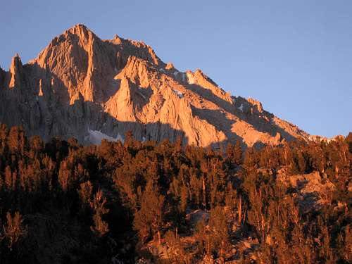
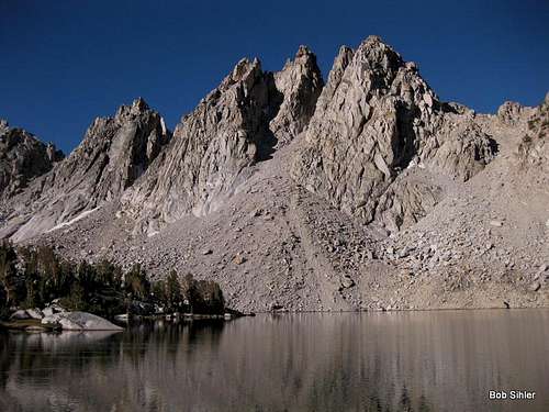
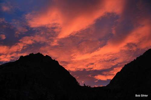
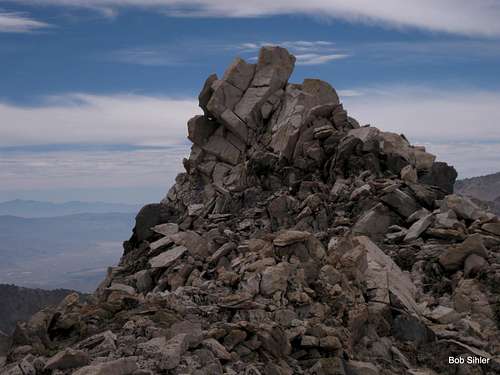
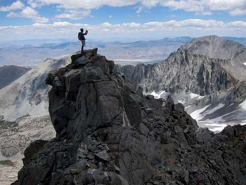
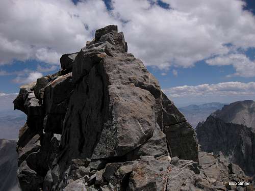
One year, the Sierra Challenge featured the Kearsarge Pinnacles as one of the outings. Completing that day's challenge did not require climbing all of the pinnacles, but Bob Burd and one or two others did it, anyway. My plan was not so ambitious; I just wanted Pinnacles 9 and 10, the former being (in my opinion) the most spectacular and the latter being perhaps the highest (actually, it is the second-highest). Since they share a saddle and are among the closest to the main lakes, knocking off those two together made sense, and that's exactly what I did, starting out at dawn (6)-- my, had I forgotten how beautiful the Sierra Nevada's peaks are at sunrise!
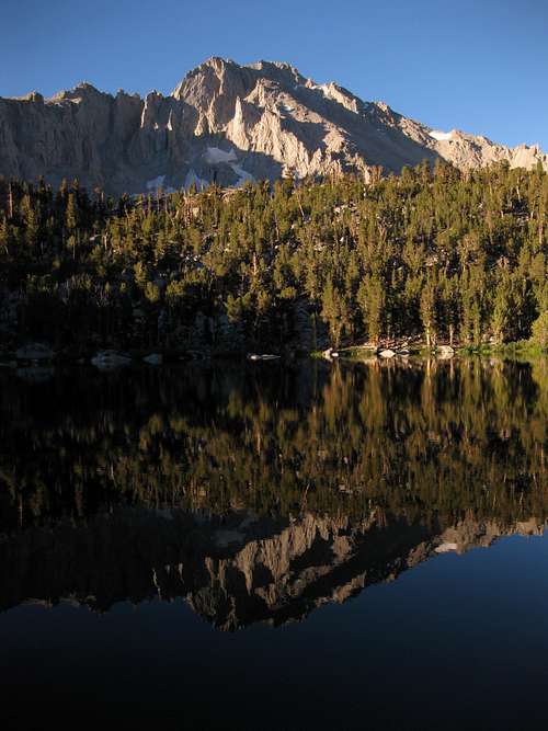
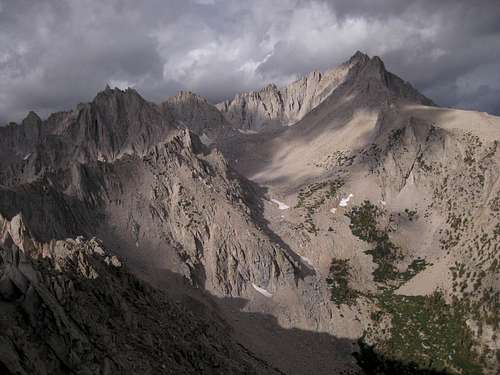
![University Peak, Dawn]()
University Peak
Before 9, I was over Kearsarge Pass and down to the lakes. Shortly after that, I at last was attaining that long-held goal and enjoying the sensation of returning to where it all began.
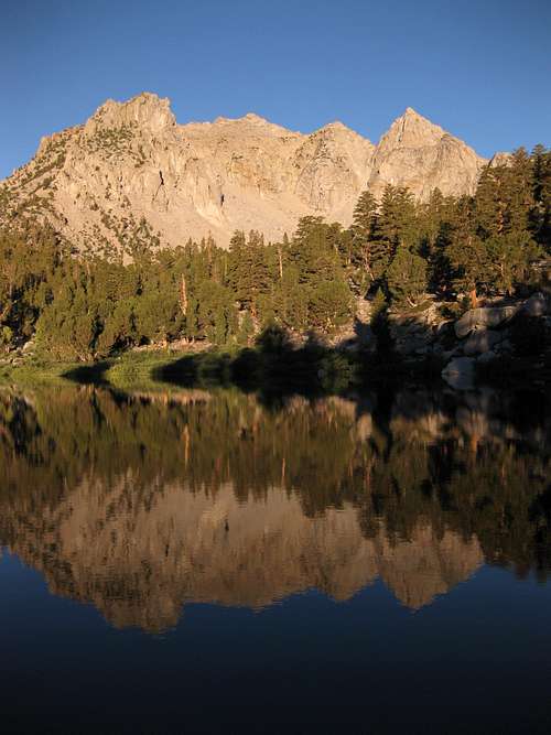
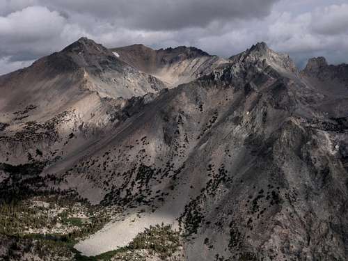
![Kearsarge Pinnacles 6-9]() #9 (right)
#9 (right)
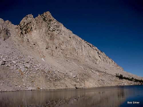
| ![Kearsarge Pinnacle #10]() #10
#10
|
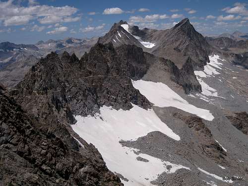
Back down, I had to figure out what to do. It was only about 11 A.M. Hiking back to the campground would take only 2-3 hours, and then I'd be bored for the rest of the day. Studying the view to the west, where the ridge housing the Kearsarge Pinnacles breaks off from the western ridge of University Peak, I decided to head to the saddle up there and check out the views. From there, I'd look for a way to drop into the basin below and cross-country it back to the trail, or I would see if I could traverse north back to Kearsarge Pass. If those options failed, then I could always just grumble and curse and head back the way I came.
Never did I seriously consider attempting to climb University. For one thing, I had no beta and hadn't seen anything too promising during the hike to Kearsarge Pass. But more importantly, as this was my first day of the summer at any kind of real altitude, I wasn't sure my body was ready to go to 13,000' yet.
But end up on the summit I did, for I kept falling prey to that urge to go a little farther and a little higher just to see what there is to see. When I checked out the SP page for University a few days later, I found I'd made the summit route much harder than necessary by sticking to the crest of the ridge or as close to it as possible instead of surrendering elevation to use a Class 2 way through scree, but that actually made the climb and the route-finding much more enjoyable, so I have no regrets.
To descend, I headed back down the ridge to a chute I had spotted earlier and then descended to the unnamed tarn just north of the peak. Then I wasted a lot of time finding a good way back to the trail, in the process visiting Bench Lake and Matlock Lake and some others before crashing through thick brush to find the trail somewhere between Gilbert Lake and Little Pothole Lake, at which point I popped in earbuds to become as antisocial as possible the rest of the way back.
When it came to filling the hours and keeping me from being bored, this unplanned extended outing did the trick. I got back to my campsite in the late afternoon, but not so late that I didn't have some time to laze in the sun and work on my tan. A perfect day: good weather and many hours in the mountains, hot sun and cold beer back at base.
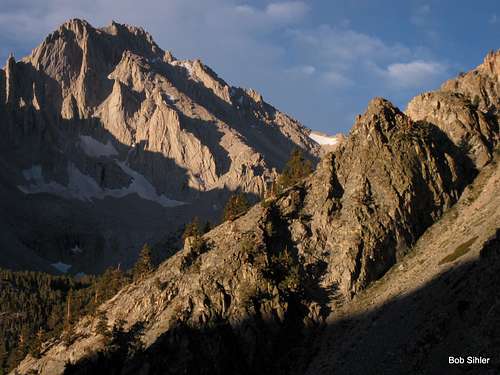
July 18-- Dragon and Gould
Another amazing sunrise:
Wisdom attained this day: anyone who actually wants to hike up Mount Gould from Kearsarge Pass must be out of his f-----g mind! Fortunately, I descended from the summit to the pass after having traversed from Dragon Peak, but as I flew down each section of steep sand, I shook my head as I thought about what a miserable way to go up the mountain that would be.
And I actually have one of SP's proud, self-styled trolls to thank for this day's plan. When I told her several weeks earlier about my intent to climb Gould from the pass, she suggested Dragon Peak as something I might find more challenging and enjoyable. After doing some research and learning about the traverse between Dragon and Gould, I decided to do just that. For several reasons, I chose Dragon as the first objective, and I'm glad I did.
So thanks, Toxo, for the great suggestion!
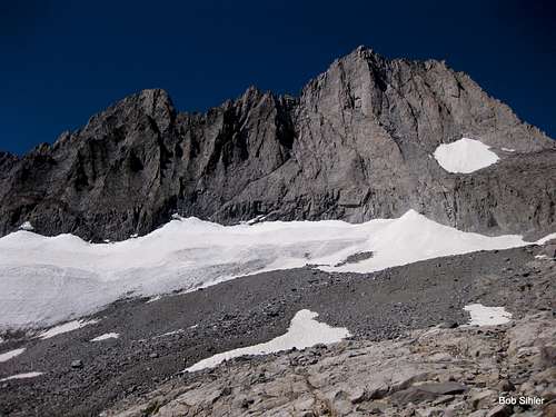
No special stories here. The sustained scrambling and exposure high on Dragon made for a memorable and rewarding climb. The views from the traverse were outstanding even though the traverse itself wasn't too exciting. The Class 3 summit block on Gould was fun but way too short and way too easy; I left thinking that Gould is a fine destination as part of a multi-peak day but not that great as a sole destination unless you actually want to hike up from the pass over all that steep sand and talus for a 10-second scramble at the very end.
![Summit Block of Mount Gould]()
Gould summit block
At Kearsage Pass, the earbuds and antisocial guy reappeared. This day, however, I did not bask in the late-afternoon sun. Instead, I had a craving for a bacon-and-turkey sub from the Subway in Independence, so I got in the 4Runner, started driving down into the valley, picked up some John Muir Trail through-hikers looking for a hot meal and a mattress and a restocking of supplies, murdered them and dumped their bodies in a ditch, and then continued to town for my sub.
(That was to see if you are really reading!)
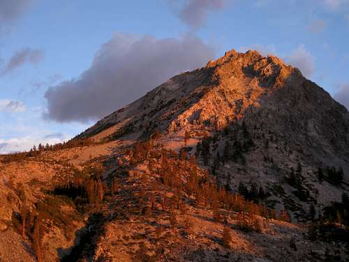
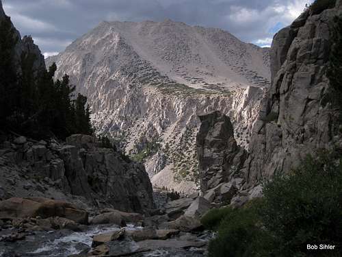
July 19-- Independence Peak
Recurring theme: an awesome dawn--
This was to be a light day since the next day was going to be a pretty big one. Originally, I had planned to climb Kearsarge Peak, but a few factors made me reconsider:
- I'd hiked the entire trail approach to the peak the day before and didn't feel like doing it two days in a row. Boring.
- Although the views must be great, I just couldn't get too excited about the route. I need some exposed scrambling, dammit!
- Independence Peak had been looking a helluva lot more awesome ever since I'd driven in the afternoon of the 16th. Plus, it was closer. So, once again with no beta, I set out...
Changing plans was a great decision in this case. Taking one way up and another down, I got a nice feel for the peak and enjoyed some nice exposure and Class 4-5 terrain. That morning, the sky was moody and threatening, but I loved it because it set up the kinds of photographs that I find spectacular. Menacing skies do it for me (not so much when I'm in exposed terrain, though!).
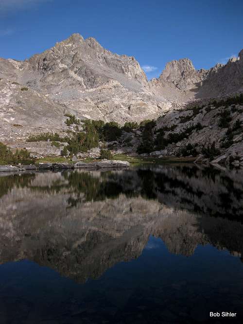
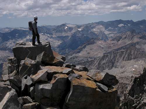
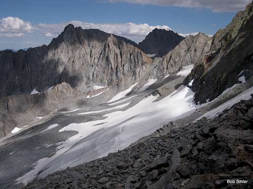
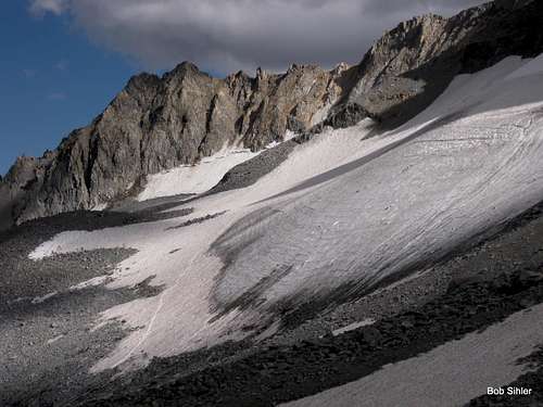
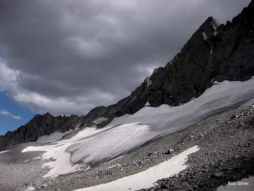
July 20-- Norman Clyde Peak
A familiar refrain by now: my original plan...
Well, my original plan was to do a day climb of Middle Palisade in order to fulfill my goal of climbing a "respectable" CA 14er. More than once, I'd heard that much of it is an awful talus slog, but it is doable in a day. So is the Whitney Mountaineer's route, but permits were long gone.
When I contacted fellow SPer mrchad9 about my schedule and plans, he suggested Norman Clyde Peak. At first, I was a little hesitant since it isn't a 14er and a 14er was a specific goal, but I became sold on it for two reasons: the standard route is harder than that on Middle Palisade, and Chad had never climbed Norman Clyde but had climbed Middle Palisade. To me, it's almost always better if everyone on a climb is climbing that peak for the first time since everyone gets a new experience.
I'd reserved two nights at the Big Pine Creek Campground, which is just a short walk to the trailhead (we drove-- at my suggestion-- just to save a little time and energy). Chad arrived well past dark, but we introduced ourselves and talked a bit and then hit the sack. Apparently a little spoiled by the great summer weather typically encountered in the Sierra Nevada, Chad seemed a little amused at my wish for a dawn start-- I am more accustomed to the Rockies, where afternoon storms are almost a given in the summer-- but he gladly obliged.
Shortly after starting out, I was grimly eating some words I'd passed during a prior conversation with Chad. Having boldly proclaimed that I'd met very few hikers who could match my pace (which was true), I quickly discovered that Chad, even though he was still recovering from a leg injury, was the faster hiker, to the point that keeping up with him was tiring. No, I was not yet in peak summer shape (I think it was actually this day that got me my legs and lungs), but, to be honest, I have to admit I'd still have a tough time keeping up with his hiking pace even when I am in peak shape.
(So I will just fall back on the excuse that I am several years older...)
When the climbing part of the day began, I became the one getting ahead of the other, but that was not due to skill or conditioning-- it was more due to different styles; I tend to go more assault-style on the rock, even if it means getting off-route and having to backtrack, while Chad takes a more studied approach (not wasting as much energy as I do).
Two things to say about the day:
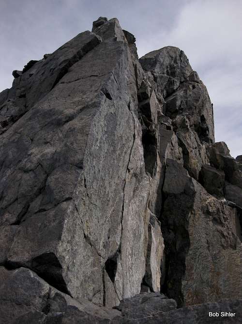
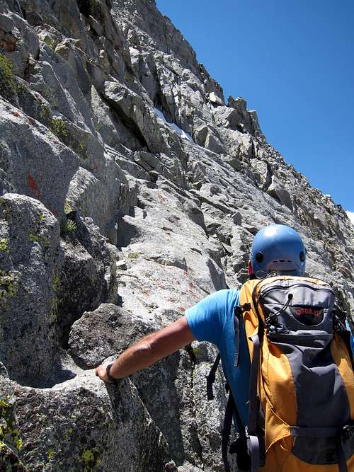
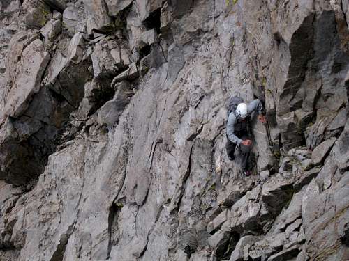
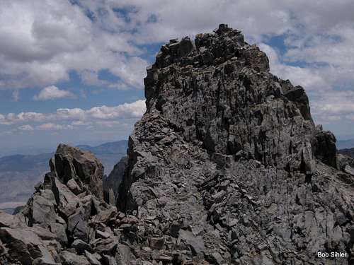
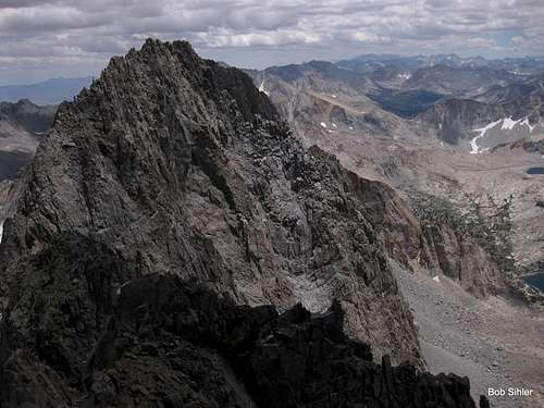
- It is indeed a fun route. Norman Clyde's standard route is Class 4, with a lot of Class 3 and 4 and plenty of exposure, and the route-finding is not simple. Cliffing out or getting onto Class 5 rock is very easy to do. Cairns are not abundant, nor are they necessarily useful; we found some to be pretty pointless (perhaps markers for a prior party rather than markers for the best route). A week after we climbed the peak, someone else fell to his death from the same route. It seemed that he had reached the summit ridge and perhaps the summit itself and then couldn't find his way back down, and so he tried a descent down the other side of the summit ridge and fell somewhere along the way (if that is correct, I am mystified by that decision since a successful descent that way would have put him literally days from his starting point.
![Where the hell do we go?]()
The way up
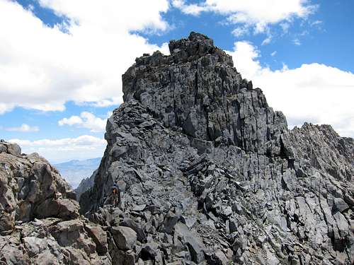
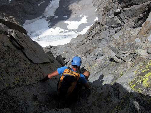
![On Norman Clyde Peak]() Atop a block that is not the summit block but very close to it, mrchad9 surveys the Sierra Nevada high country.
Atop a block that is not the summit block but very close to it, mrchad9 surveys the Sierra Nevada high country.
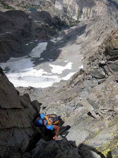
| ![Norman Clyde Peak]() Me on the summit
Me on the summit |
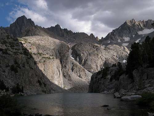
- What scenery! Many assert that the Palisades area of the Sierra Nevada is the most visually spectacular part of the range. Not having truly extensive experience with the range, I can't firmly agree or disagree with that statement, but I can certainly see the case for it. The views, the glaciers, the lakes, the peaks-- just stunning.
Amusing story-- while downclimbing one spot that would have been much easier to rappel (which Chad suggested) but which I preferred to do unprotected simply because I was too lazy to commit the time and effort that would have involved rappelling, I got into a bit of a squeeze and decided it would be better to drop my back. Thinking I'd correctly assessed everything, I dropped my pack, which had my wallet in it; the idea was that it would land and stay on the ledge at the bottom of the pitch.
Oops.
That pack tumbled down and down, almost going over the edge of the mountain and into the basin of Norman Clyde Glacier below. Due to the fact that my wallet was in that pack, I would have had to retrieve it, which would have added grueling hours to my day.
But to Chad, it was all good laughs seeing that tumbling pack. And, frankly, I would have felt the same way about any pack but mine.
Chad and I got back, had a cold beer, and drove down into Big Pine and had a surprisingly good dinner in a restaurant there. After that, he moved north, and I moved east for the White Mountains.
Sierra Nevada 2012-- The End.
Sierra Nevada 2013 has not begun but will in about two months.


Comments
Post a Comment