
|
|
Mountain/Rock |
|---|---|
|
|
40.80934°N / 109.97405°W |
|
|
Hiking, Mountaineering |
|
|
Spring, Summer, Fall |
|
|
12046 ft / 3672 m |
|
|
Overview
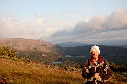
Daggett Peak is a 12,046 foot peak located partly in Daggett County Utah, and partly in Duchesne County Utah. North East of the summit lies Daggett Lake at 10,462 feet in the cirque formed by the mountain's northeast ridge and by Eccentric Peak to the east. As the crow flies located 20 miles west (263.8°) of Dagget Peak is the tallest mountain in Utah, namely Kings Peak. 40 miles (via FR 001 and highways 44 and 191) lies the the famous Cart Creek Bridge at Flaming Gorge National Recreation Area.
Presumably this mountain is named after Ellworth Daggett, the first United States surveyor-general of Utah, who helped developed irrigation for Daggett county (which also bears his last name).
Topo maps reveal that Daggett Lake is contained within in Flaming Gorge Ranger District as is the Daggett County side of Daggett Peak.
Daggett Peak is located in the Utah section of the Ashley National Forest.
Getting There
From Evanston, WY continue east on I-80 for 30 more miles. Take exit 34 and drive to Fort Bridger, WY. Pass through Fort Bridger and take a right on to Highway 414 at the town of Urie. Follow 414 through the tiny communities of Mountain View and Lone Tree. At Lone Tree, the highway turns to the east. Follow Hwy-414 to mile marker 132. Before mile marker 133 turn south onto FR 221. This is just before McKinnon. Stay on FR 221 all the way to Hickerson Park. At Hickerson Park, turn south on FR 001 and drive it six miles to Spirit Lake. Sections of the 221 Scenic By-Way as well as FR 001 are gravel but passable by most any car. See Google Maps.
Route
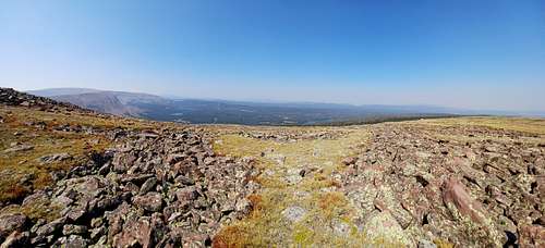
There is no established route to Dagget Peak, so a bit of route finding and bushwacking is needed.
There are two "trailheads" in the area of Spirit Lake. One is on the east side Spirit Lake about half way down it's North to South length and goes east over the ridge and down to Daggett Lake. That is NOT the trail head to parkat if you intend to climb Dagget Peak. Instead, keep driving until you drive past the Spirit Lake Campground entrance and locate another trailhead at the southwest end of the campground. This trail goes to Tamarack Lake, and is labeled Trail No. 024. Park here and head south east at 125 degrees into the trees aiming for the northeast ridge of Daggett Peak. There is no trail to follow from this parking lot to the summit of Daggett Peak (nor is there any trail that leads to Daggett Peak).
After about a half mile of climbing you should notice a small lake to the west (hikers right). On topo maps this small lake is split by the north to south border of Summit and Daggett counties. Continue going up hill through the trees in the same southeast direction until in about another mile and a half you reach the northeast ridge of Daggett Peak. Turn right and head southwest up the ridge gaining another 850 vertical feet to the 12,046 summit of Daggett Peak. The summit of Daggett peak is approximately on the Daggett County/Duchesne County line at N 40.81532 W 109.99413. The total elevation gain from the parking lot is just shy of 1900 ft, and the distance covered to Daggett Peak is 3.5 miles.
If you wish you can continue on to the shared highpoint of both Unitah and Dagget counties, namely Eccentric Peak. From Daggett Peak to Eccentric Peak is another 2.2 miles and you have to drop down to 11,200 feet (a 846 foot drop), and the climb up to 12,276 feet (a 1,076 foot gain). Head SxSE (149.8°) to the 11,200 foot saddle, then climb east (80.9°) to the survey monument on Eccentric Peak located at N 40.80934 W 109.97405.
In September 2021 when I was there the survey monument on Eccentric Peak had a rock wall stacked around. The momument was stamped with the incorrect elevation of 12,280 feet, instead of 12,276 feet. See this photo https://www.summitpost.org/eccentric-peak-survey-monument/1063213.
In total the round trip hike from Spirit Lake to Daggett Peak and over to Eccentric Peak and back to your car is 11.4 miles with 3,800 feet of elevation gain. With a steady pace, and a rest on both Daggett and Eccentric peaks a reasonably fit hiker will need six hours to complete the round trip.
150 yards northeast (52.5°) of the Eccentric Peak survey monument is another survey monument labeled Chepeta Peak and stamped with a 12,267 foot elevation. The Eccentric monument is a polished aluminum color and the other one is gold in color.
Red Tape
No trail to follow
When to Climb
Anytime the road to Spirit Lake is passable.
Camping
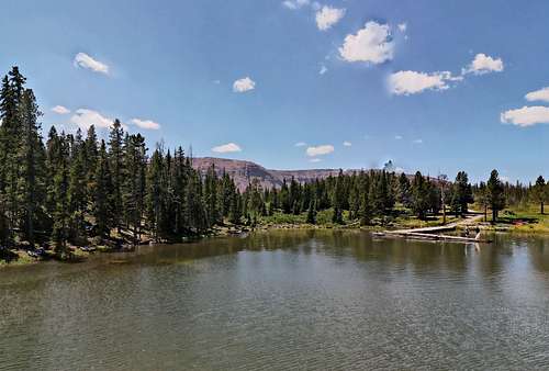
There is a campground at Spirit Lake that charges a fee. Or you can find plenty of free camping along FR 001 en route to Spirit Lake.
External Links
Daggett Peak on Peakbagger.com