
|
|
Mountain/Rock |
|---|---|
|
|
37.24067°N / 112.94495°W |
|
|
Spring, Summer, Fall |
|
|
6921 ft / 2110 m |
|
|
Overview
 Deertrap Mountain
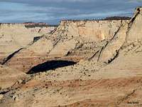
Like the nearby Cable Mountain and Observation Point, Deertrap Mountain is not a true Mountain. It is a spot on the eastern rim of the Zion Canyon with commanding views. To the west of Deertrap Mountain, slickrock walls drop down and eventually reach the bottom of Zion Canyon 2600 ft below. From the east, however, Deertrap Mountain appears as one of the many high points that rise above the surface of a 6700 ft high plateau.
The USGS Map puts the words “Deertrap Mountain” near the edge of Zion Canyon. It does not give it an exact elevation, only contour lines of 6800-6880 ft. A 6921 ft high point is identified a short distance to the northeast of the words “Deertrap Mountain”.
Deertrap Mountain is usually climbed via a well-established trail that branches off of the East Rim Trail. The easily accessible trailheads are a long way away from Deertrap Mountain. The shortest distance to Deertrap Mountain is from the Ponderosa Ranch Trailhead (8.2 miles hiking distance roundtrip). Reaching Ponderosa Ranch Trailhead, however, requires a four wheel drive vehicle. The other two options are the Weeping Rock Trailhead (16.8 miles roundtrip, 2600 ft vertical) and the East Rim Trailhead on Highway 9 (17.8 miles roundtrip, 1250 ft vertical). The Route via Weeping Rock Trailhead is more scenic but is more strenuous. In my opinion, the best route is to start at the East Rim Trailhead on Highway 9, go to Deertrap Mountain and then follow the East Rim Trail to Weeping Rock. You can pay one of the commercial shuttle bus systems in the town of Springdale to drop you off at the Highway 9 Trailhead. Once you reach Weeping Rock, you can take the free park shuttle bus (April through October) back to Springdale.
 Map Map |
Getting There
East Rim Trailhead: From the eastern entrance to the park, drive less than 200 yards west on Highway 9 to a road on the north side of Highway 9 to reach the trailhead.Weeping Rock Trailhead is on the Zion Canyon Road a few miles north of Springdale, UT. No private vehicles are allowed on this road April through October. You must take the park shuttle bus.
Route
This Route starts at the East Rim Trailhead on Highway 9, goes to Deertrap Mountain and then follows the East Rim Trail to Weeping Rock.All distances are per my GPS. Please note that the given distance is to the first viewpoint on the edge of Zion Canyon. From the first viewpoint you can follow the trail a few tenths of a mile north along the edge of the canyon to a dead end.
Please see the page for the East Rim Trail. The description below starts at the junction of the East Rim Trail with the Deertrap/Cable Mountain Trails.
At the junction of the Eat Rim Trail, follow the Deertrap/Cable Mountain Trail. The trail takes you by a small stream up a little hill. You will soon see a small waterfall (when water is flowing).
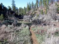 |  |
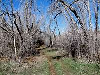
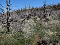
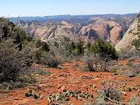
The trail slowly goes up among the trees and bushes.
 |  |
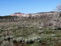
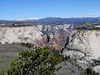
You can see forested high ridgelines in the far distance to the east and north.
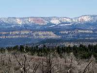 Distant Ridgelines Distant Ridgelines |
After 1.1 miles you will reach the junction of the Cable Mountain Trail. Follow the sign for Deertrap Mountain and turn left. You are now up to 6850 ft in elevation. You can look west to see The West Temple on the west side of the Zion Canyon.
 Jct. of Deertrap & Cable Mtn. Trails Jct. of Deertrap & Cable Mtn. Trails |
You will then slowly go down in elevation to a minimum of 6680 ft. You will note a small valley forming. This valley provides the headwaters of Hidden Canyon.
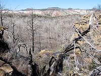 Hidden Canyon Drainage Hidden Canyon Drainage |  Hidden Canyon Drainage Hidden Canyon Drainage |  Hidden Canyon Drainage Hidden Canyon Drainage |
The trail then heads west toward the next high point, 6850 ft. At the base of the high point, it makes a few switchbacks.
 Point 6850 ft Point 6850 ft |  Going up to Point 6850 ft Going up to Point 6850 ft | 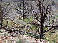 Going up to Point 6850 ft Going up to Point 6850 ft |
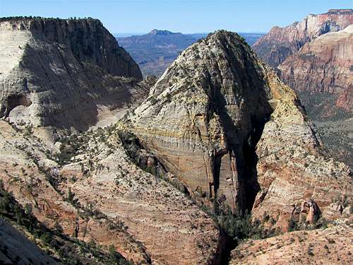
At the top of 6850 ft, you can look west to see Point 6921 ft.
 Point 6921 ft, East face Point 6921 ft, East face |
You will first have to go down again to 6760 ft.
 Low Point Low Point |  Low Point Low Point |
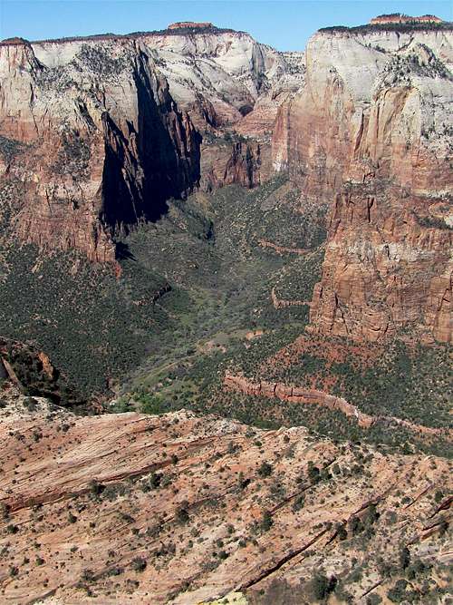
The views from the top of Point 6921 ft are not the best. You can however, look north to see part of the Zion Canyon including Angels Landing and The Great White Throne.
 Angels Landing Angels Landing |  The Great White Throne The Great White Throne |
The trail goes down again to around 6740 ft. You can look back to see the west face of Point 6921 ft.
 Point 6921 ft, West Face Point 6921 ft, West Face |
Just before reaching the main view point, you can look south to see the Pine Creek Canyon.
 Pine Creek Canyon Pine Creek Canyon |
You will then reach the view point at the edge of the canyon and be blown away by the magnificent views. You can follow the trail a short distance north along the edge of the canyon.
 Looking SW at Mountain of the Sun Looking SW at Mountain of the Sun | |
 Looking NW/W Looking NW/W |  Looking W/NW Looking W/NW |
 Looking W/SW Looking W/SW |  Looking SW/W Looking SW/W |
 Looking SW at the Twin Brothers Looking SW at the Twin Brothers | |
Red Tape
You must pay park entrance fee.No permits needed for day hikes. See link below for all rules and regulations:
http://www.nps.gov/zion/index.htm
Weather
See the forecast for Springdale, UTExternal Links
Website:Deertrap Mountain
Books:
A Falcon Guide, "Hiking Zion & Bryce Canyon National Parks", Eric Molvar & Tamara Martin.
Maps:
National Geographic, "Zion National Park, Utah, USA" #214
Bob Sihler - May 6, 2014 10:42 am - Voted 10/10
NameI read in a book I own that the name comes from the fact that Native Americans used to herd deer up on this plateau in order to hunt them.
nader - May 6, 2014 2:55 pm - Hasn't voted
Re: NameThanks Bob, I think I read that somewhere too.