
|
|
Area/Range |
|---|---|
|
|
40.13374°N / 120.336°W |
|
|
Hiking, Mountaineering, Trad Climbing, Sport Climbing, Toprope, Bouldering, Ice Climbing, Scrambling, Skiing |
|
|
Spring, Summer, Fall, Winter |
|
|
8197 ft / 2498 m |
|
|
Overview
 Diamonds sunset
The Diamond Mountains are a subrange of the great Sierra Nevada mountain range, located in northeast California. The Diamonds are basically the extreme northeast major ridgeline of the Sierras, where the range transitions north to the Cascades and east to the Great Basin Desert. Because of this geo-diversity, the vicinity has been nicknamed “the crossroads”.

The Diamonds above the Susan River Gorge
Where in California?

Geography
 quartz summit of Crystal Peak, with a Jeffrey pine growing through
 southern Diamonds
The Diamonds are approximately 50 miles in length, stretching from Beckwourth Pass at the southeast end (near the CA/NV border) to upper Gold Run Valley, at the northwest end. The Diamonds are bordered by the Honey Lake Valley (large remnant of Lahontan Lake) to the northeast, the Long Valley to the east, the Sierra Valley and Feather River to the southeast, and the Indian Creek drainage to the southwest. The range consists of a mix of volcanics and granitics.
The Diamonds include a main ridgeline with many bumps and unnamed highpoints. There are also several significant peaks including: Diamond Mountain (7738’), Thompson Peak (7795’), and Adams Peak (8197’)—the highpoint of the range. Other notable peaks include Sugarloaf (6631’), Meadow View Peak (6965’), McKesick Peak (7096’), Black Mountain (7161’), Cottonwood Peak (6639’), Clarks Peak (7177’), and Red Rock (7596’).
 Lone Rock
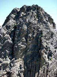
Crags such as Toms Thumb (a subsidiary outcrop of Thompson Peak) and Lone Rock offer solid, steep rock and attract rockclimbers. And there are quartz summits such as beautiful Crystal Peak (7800+); check out Crystal Vista peninsula on the NE side of Frenchman Lake for a view.
The Diamonds biggest rise is nearly 4000 feet, where Adams Peak towers above the Honey Lake Valley. The Diamonds are well known by local residents, expecially in Susanville, where Diamond Peak rises 3500+ feet above the community. Peakbagger.com credits Adams with 2200’ of prominence, which would also translate to the Diamond Mountains range.
Lakes
In addition to massive, seasonal, and shallow Honey Lake on the north side of the Diamonds, there are also two mountain lakes located on the southwest side of the range. Antelope and Frenchman Lakes are both popular reservoirs and are situated in forested locations.See the Plumas National Forest websites for Antelope Lake and Frenchman Lake for more information.
 Frenchman Lake Frenchman Lake |  Antelope paddling Antelope paddling |
History
The Diamonds have played a significant role in local history. The Diamond Mountain crest was the boundary of the Honey Lake Maidu people, who have inhabited the Honey Lake Valley and Long Valley for thousands of years. The Maidu called the Diamonds Om Lu Lyly, which means “rock shining”. This was likely attributed to one of the many quartz crystal outcrops found throughout the range. The Maidu gathered choke cherries, wild onions, tobacco, acorns, pine nuts, and wild mint throughout the Diamond Mountains.
The Diamonds also played a role in more modern history. As gold sparked a western migration, thousands of people began to travel the William Nobles Trail over the mountains between Nevada and the upper Sacramento River Valley. Naturally, these people noticed the beautiful Honey Lake Valley and some decided to stay and make it home. The Diamond Mountains had served as the boundary between Roop County (Territory of Nevada) and Plumas County, California. But when surveys were completed in the early 1860s, it was determined that the area was in California. The Sagebrush War then took place. The fighting lasted a mere 4 hours, and eventually an agreement was developed to allow the states to settle. Ultimately, it was decided that the Roop County people were indeed in California. The Honey Lake Valley residents then formed Lassen County, to gain independence from Plumas County, and put the seat in Susanville, at the base of the Diamonds.

panorama from the top of Diamond Mountain
Fire Lookouts
 Thompson Peak fire lookout
There are three fire lookouts in the Diamonds. Black Mountain, Thompson Peak, and Red Rock all have CCC-era fire lookout structures on the summit. Thompson Peak and Red Rock are still active. Black Mountain is retired, and in 2011 was made available for recreational use. Overnight rentals are now available through the National Recreation Service. Reservations can be made @ http://www.recreation.gov/

first light hits the Diamond Mountains, which stretch across the entire photo
Hiking, Climbing, & Other Recreation
There are lots of dispersed recreation opportunities throughout the Diamonds. Adams Peak draws some peakbaggers, as it is included in the Sierra Peaks Section (SPS) list of Sierra Nevada summits. It is also one of California’s mountains with at least 2000 feet of prominence. Thompson Peak and Diamond Mountain also draw visitors, including skiers and hikers. A forest road accesses the 7795-foot summit of Thompson Peak, where a fire lookout is located. This peak, along with most summits along the Diamond Crest, offer spectacular views looking out thousands of feet above the Honey Lake Valley. Crystal Peak is another highlight, with a pure quartz crystal summit located atop the crest, not too far from Adams Peak.Winter snow coats attract some cross-country and backcountry skiers. There was even a commercial ski area at one time near the town of Doyle, called Eagles Peak Ski Area. This privately owned property is no longer open to the public for skiing, but is often still noted on maps.
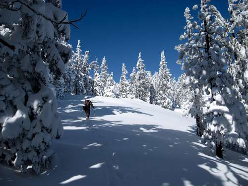 snowshoeing
Dispersed camping is popular in this area. Hunting is popular in the fall, especially for deer. Fishing is popular at Antelope and Frenchman Lakes, as well as in the feeder creeks. Motorized recreationists enjoy travelling the many low-standard forest roads, including the route to the Thompson Peak fire lookout. Four-wheeling is also popular in the southern Diamonds, where some drive all the way to the summit of Crystal Peak. In the winter, snowmobiling is popular throughout the range. Adventurous snowmobilers sometimes travel from Fredonyer Summit, on CA Highway 36, all the way out to Diamond Mountain and beyond. And world-class motocross racing takes place at the Honey Lake Motocross Park, located at the base of the Diamonds on US-395, between Janesville and Milford.
Developed recreation is also available at the many established Forest Service campsites, day use areas, and boat docks. Several campgrounds are situated near Antelope and Frenchman Lakes, which also offer picnicking, fishing, and boating opportunities. Other campgrounds in the Diamonds include (from south to north): Chilcoot, Meadow View, Laufman, all managed by the Forest Service, and privately managed Honey Lake Campground on US-395 near Milford.
How to Get There
US Highway 395 travels the entire length of the Diamonds, on the eastern side. From this major route, several forest roads provide access and cross the range, including: Doyle Grade (County Road 331), Milford Grade (CR 336), and Janesville Grade (CR 208). These roads all connect with Plumas County and the upper Feather River Watershed, on the western slope of the Diamonds. Janesville Grade can be used from the north to access Antelope Lake, as Doyle and Milford Grades provide access to Frenchman Lake.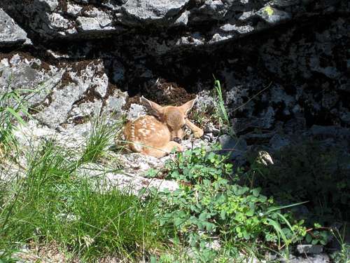 baby deer
From the northwest end, Gold Run Road (CR 204) out of Susanville provides access to the northwest corner of the Range. Diamond Peak and Red Rock can be accessed from this area. Also from here, the Diamond Mountain Motorway provides access near the crest on the south side.
From the south, several routes travel up to the Diamonds from CA Hwy 70 and the Feather River. One option is California Hwy 284, which leaves Hwy 70 in Chilcoot and provides access to Frenchman Lake and beyond, along the southwest side of the range.
Red Tape
Much of the Diamond Mountains are managed by the Forest Service, as Plumas and Lassen National Forests. There are no fees for dispersed camping, parking, hiking, and general recreating in these national forests. As with everywhere else in the State, a California Campfire Permit is required to use a stove, lantern, or campfire outside a developed campground or recreation area. These permits are free and available at any Forest Service office. Forest Service offices serving the Diamond Mountains include the Eagle Lake Ranger District in Susanville, the Beckwourth Ranger District in Blairsden, and the Mt Hough Ranger District in Quincy.  fresh air! fresh air! |  aspens in fall aspens in fall |
 oak & sage oak & sage | 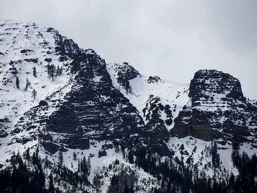 rugged terrain on Thompson Peak rugged terrain on Thompson Peak |
Named After
Due to the role of the Diamond Mountains in local life, several local community things are named after the Diamonds, including: Diamond Mountain Golf Course, Diamond Mountain Casino and Hotel (governed by the Susanville Indian Rancheria), Diamond Mountain Speedway (fairgrounds racetrack), Diamond Mountain Hotshots (BLM wildland firefighting crew), Diamond View Middle School, Diamond Saw Shop, Diamond View Laundromat, and the Diamond Mountain Hot Air Balloon Race.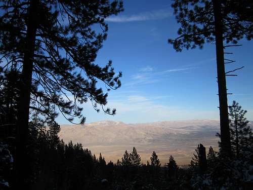 pines of the Diamond Mountains contrast the Great Basin mountains pines of the Diamond Mountains contrast the Great Basin mountains |  Toms Thumb Toms Thumb |