
|
|
Area/Range |
|---|---|
|
|
38.69487°N / 119.98922°W |
|
|
Hiking, Mountaineering, Mixed, Scrambling, Skiing |
|
|
Spring, Summer, Fall, Winter |
|
|
8574 ft / 2613 m |
|
|
Overview
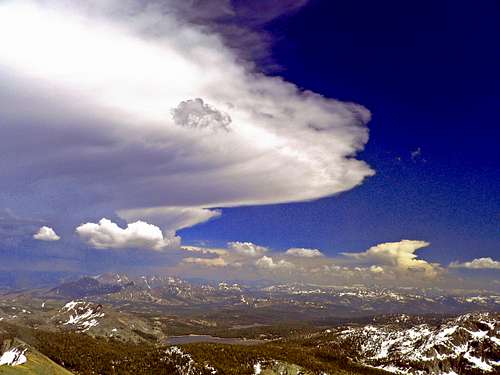 Approaching storm from Round Top
Carson Pass is the fourth highest automobile pass in the Sierra Nevada. It is located in the Northern Sierra between Ebbetts Pass to the south and Luther Pass south of Lake Tahoe to the north. Highway 88 crosses the pass. Carson Pass is a very accessible and popular area for hiking, peakbagging and skiing. It is located mostly within the boundaries of Eldorado National Forest.
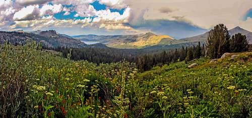
The eastern portion of the extended area of this page is in the Toiyabe National Forest and the area south of the pass is in the Mokelumne Wilderness. The Pacific Crest Trail (PCT) crosses the pass and there is a good system of trails in the area. The terrain is relatively gentle by Sierra standards with some beautiful lake destinations and virtually all of the peaks can be done in a day or less. The profusion of spring flowers just south of the pass are some of the best to be found in the range. Kirkwood Ski Resort about five miles west of the pass is one of the most popular ski areas in the Northern Sierra. Kirkwood also offers tremendous summer hiking options.
The highest peak in the vicinity of Carson Pass is Round Top at 10,381', which despite not being very high, is quite spectacular and maintains features more characteristic of a much higher peak.
For this page we've loosely expanded the boundaries with Silver Lake to the west; Hope Valley to the north; Highway 89 going north from Markleeville to the east; and Blue Lakes to the south.
There are several trailheads in the area, including Carson Pass itself and Woods Lake about 1.7 miles to the west being the main trailheads at Carson Pass.
Appreciation is owed to Windsor Riley (aka Noondueler) who created this page, and who passed away in 2016.
Getting There
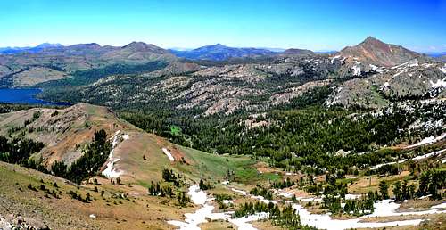
 West from PCT near Carson Pass
 Sunrise from Hope Valley
Carson Pass is reached via Highway 88.
For current road conditions click on this Caltrans link.
From Hwy. 88 out of Stockton: Go northeast up through the west side of the range approximately 100 miles to the pass.
From Sacramento and South Lake Tahoe: From the junction of Hwy. 50 and Hwy. 89 go south on 89 11.5 miles over Luther Pass to the junction with Hwy. 88 in Hope Valley. Go right on 88 (south then west) 8 miles to the pass.
From Hwy. 395: From the junction with Hwy. 89 and 395 (less than 3 miles north of Topaz) go west over Monitor Pass 8 miles to the junction with Hwy 4 coming up from the south. Go right on 89 for 12 miles to the junction with Hwy. 88. Go right 14.5 miles through Hope Valley and up to the pass.
Red Tape
 Hawkins Peak
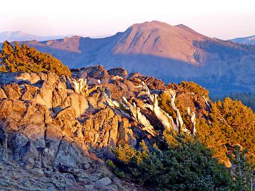 Markleeville Peak from Red Lake Peak south slope
For the greater Eldorado National Forest click on Recreation Passes and Permits.
For Toiyabe National Forest passes and permits click here.
For Carson Pass parking fee details in winter sno-park and summer parking as well as fees and reservations for Woods Lake campground click here.
Carson Pass is open all year round due to the ski area.
For Campgrounds in the Toiyabe National Forest click here
For campgrounds in the Mokelumne Wilderness click on the Mokelumne Wilderness page and scroll down to camping.
![Red Lake Peak and Elephants Back]() Trail to Lake Winnemucca
For a comprehensive list of trails in the Carson Pass Area see this list on All Trails.
Trail to Lake Winnemucca
For a comprehensive list of trails in the Carson Pass Area see this list on All Trails.
![Johnny ascending the west ridge]() Ascending Round Top
Ascending Round Top
![Southwest from Round Top]() Southwest from Round Top
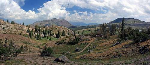
North of Carson Pass and west of Hwy. 88:
Southwest from Round Top
North of Carson Pass and west of Hwy. 88:
Carson Pass Area Trails
 Trail to Lake Winnemucca
Carson Pass Area Peaks and their initial approach routes
 Ascending Round Top
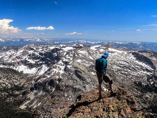 Southwest from Round Top
Little Round Top 9,590': Approach this peak from across from the east side of Caples Lake off of Highway 88
Red Lake Peak 10,063': Approach via the Pacific Crest Tail north of Carson Pass or from Crater Lake to the east via it's trail.
Stevens Peak 10,059': Approach via the Pacific Crest Trail north of Carson Pass or from the Alpine Mine via it's trail up to the east.
Waterhouse Peak 9,497' Via Luther Pass.
Northeast of Carson Pass across Hope Valley and east of Hwy. 88:
Northeast of Carson Pass across Hope Valley and east of Hwy. 88:
Pickett Peak 9,118': Approach from Hwy. 88/89 via Burnside Lake Road.
Hawkins Peak 10,024 : Same as Pickett Peak, with another option a few miles further south on the Burnside Lake Road.
Southeast of Carson Pass:
Southeast of Carson Pass:
Markleeville Peak 9,415': Approach via the Blue Lakes Road out of Hope Valley off of Hwy. 88.
Jeff Davis Peak 9,065': Also the Blue Lakes Road out of Hope Valley a mile or 2 south of Markleeville Peak.
The Nipple 9,342': Via Blue Lakes Road 2 miles west of Jeff Davis Peak.
South of Carson Pass:
Elephants Back 9,585': Approach from Carson Pass trailhead south or from the Woods Lake trailhead via the Woods Lake Road south side of Hwy 88 2 miles west of Carson Pass.
Round Top 10,381': Same approach trailheads as Elephants Back.
The Sisters 10,153': The same trailheads as Round Top and Elephants Back.
Fourth of July Peak 9,537': Also via the Carson Pass trail head or the Woods Lake Trailhead.
Melissa Coray Peak and Peak 9,795: Carson Pass or Woods Lakes trailheads or from Kirkwood Ski Resort or the Caples Lake Trailhead.
Black Butte 9,013': Woods Lake trailhead
Deadwood Peak 9,846': Approach via Blue Lakes Road. The peak is 2 miles west of Upper Blue Lake.
West of Carson Pass and south of Hwy. 88:
West of Carson Pass and south of Hwy. 88:
Thunder Mountain 9,410': From the Thunder Mountain trailhead 1.7 miles west of Kirkwood Meadows on the south side of Hwy. 88.
Thimble Peak 9,805': From the Thunder Mountain trailhead to the north or the Horse Canyon trailhead .5 mile north of the Silver Lake campground north of Silver Lake on the east side of Hwy, 88.
Covered Wagon Peak 9,565': Easiest approach via the pack trail off the southwest shore of Caples Lake. In just over 3 miles the trail passes right below the northeast side of the peak before it crosses a pass. You can also easily access from the Kirkwood Ski Area
Black Butte 9,031': The easiest approach is directly off trail west southwest about .75 mile from the Woods Lake Campground at the end of the Woods Lake Road south of Hwy. 88.
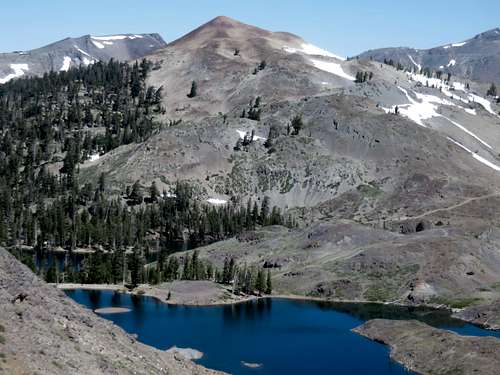
![Winnemucca Lake and Elephants Back, Toiyabe Nat. Forest]() Winnemucca Lake and Elephants Back
Winnemucca Lake and Elephants Back
![Elephants Back, Round Top and The Sisters from Caples Lake]() Elephants Back, Round Top and The Sisters from Caples Lake
Click here for the current weather and forecast for Carson Pass.
Elephants Back, Round Top and The Sisters from Caples Lake
Click here for the current weather and forecast for Carson Pass.
![Red Lake Peak and Stevens Peak from Pickett Peak]() Red Lake and Stevens Peaks from Pickett Peak
Red Lake and Stevens Peaks from Pickett Peak
![Hikers descending to Carson Pass from Red Lake Peak]() Hikers decending to Carson Pass from Red Lake Peak
Christopher (Kit) Carson (1809-1868), a mountain man, scout, soldier and Indian agent. He was with John C Freemont on Freemont's second exploring expedition; the party crossed the Sierra at Carson Pass in February 1844. Freemont named the river for Carson; the other "Carson" names derive from that. "Carson River" appears for the first time on the Pruess map of 1848. "Carson Pass" and "Carson Canyon" are on the Britton and Rey's map of California by George H. Goddard, 1857. In the 19th century the Carson Pass route was known as the "Amador and Carson Valley Road." The Carson Range was at one time called "The Rose Valley Range;" it was changed to it's present name by a BGN decision in 1939. -Place Names of the Sierra Nevada- Peter Browning
Hikers decending to Carson Pass from Red Lake Peak
Christopher (Kit) Carson (1809-1868), a mountain man, scout, soldier and Indian agent. He was with John C Freemont on Freemont's second exploring expedition; the party crossed the Sierra at Carson Pass in February 1844. Freemont named the river for Carson; the other "Carson" names derive from that. "Carson River" appears for the first time on the Pruess map of 1848. "Carson Pass" and "Carson Canyon" are on the Britton and Rey's map of California by George H. Goddard, 1857. In the 19th century the Carson Pass route was known as the "Amador and Carson Valley Road." The Carson Range was at one time called "The Rose Valley Range;" it was changed to it's present name by a BGN decision in 1939. -Place Names of the Sierra Nevada- Peter Browning
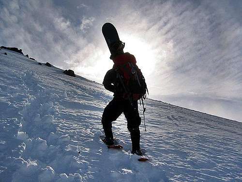
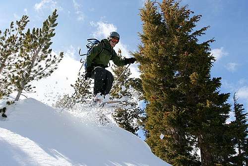
![skiing - red lake peak]() Skiing Red Lake Peak
Skiing Red Lake Peak
![Rob is advancing towards the...]() Ascending Elephants Back in winter
Click on this page for a brief history of the first crossing of Carson Pass.
Ascending Elephants Back in winter
Click on this page for a brief history of the first crossing of Carson Pass.
Current weather and forecast
 Winnemucca Lake and Elephants Back
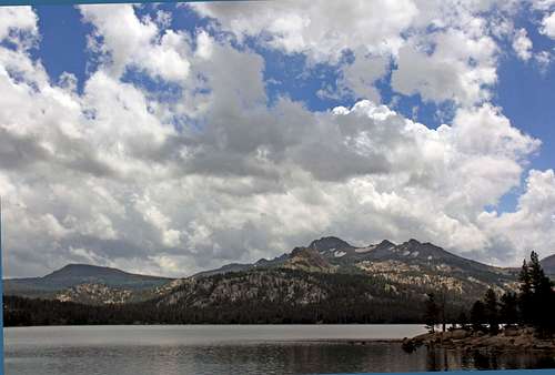 Elephants Back, Round Top and The Sisters from Caples Lake
Etymology
 Red Lake and Stevens Peaks from Pickett Peak
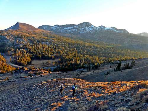 Hikers decending to Carson Pass from Red Lake Peak
Freemont and the first crossing of Carson Pass.
 Skiing Red Lake Peak
 Ascending Elephants Back in winter
Alpinist - May 25, 2021 11:14 am - Hasn't voted
Fossil FindA park ranger stumbled across a major fossil find in an undisclosed location somewhere in the Mokelumne River Watershed in the Sierra foothills, including what looks to be a petrified forest and a 400lb salmon. "In the foothills of the Sierra Nevada Mountains in California, paleontologists have uncovered a collection of fossils, including an eight-million-year-old mastodon skull with both tusks intact, a rhino skeleton, a giant tortoise, 600 petrified trees, and many more specimens. Dating back to the Miocene epoch, the site is considered one of the most significant fossil discoveries in California history, reports Andrew Chamings for SFGate." More...