-
 9386 Hits
-
 80.49% Score
-
 12 Votes
|
|
Mountain/Rock |
|---|---|
|
|
43.91760°N / 115.1348°W |
|
|
Elmore |
|
|
Hiking, Scrambling |
|
|
Summer, Fall |
|
|
9665 ft / 2946 m |
|
|
Overview
Location: Extreme southwestern portion of the Sawtooth Range, between the Queens and Little Queens Rivers, just north of Atlanta. Located just north of Scenic Peak and just south of Browns Peak
Nearby Peaks: Scenic Peak, Nahneke Mountain, Browns Peak, East Warrior, Blizzard Mountain, Greylock Mountain
Linkups: Nahneke, Scenic Peak, Browns, Peak 9521
Difficulty: Moderate to Easy off trail ridge scrambling- Mostly Class 2-3
Usage: Hikers, Backpackers, Horses, Fishermen on approach trails
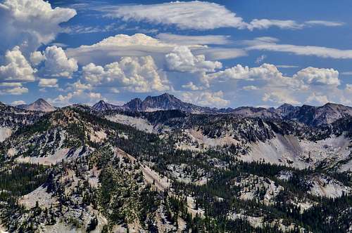
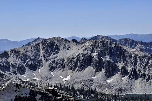
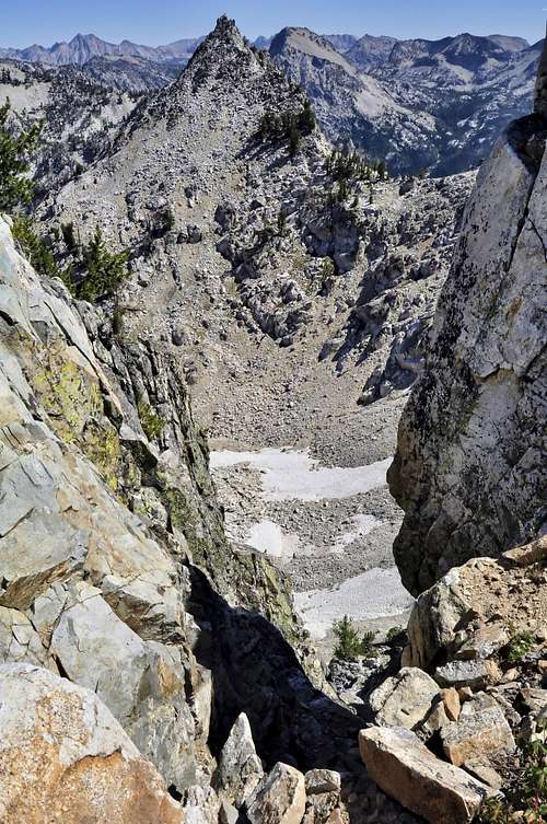
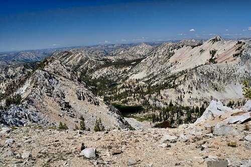
Terrain: Rocky ridgelines with many small rock towers, scree gulleys, large talus piles. In this part of the range, generally speaking, the east slopes are the most steep while the west and south slopes provide the easiest access. This aptly named peak has a large broad summit and is located above many unnamed and beautiful lakes.
Traffic: Very light- original summit register had 10 names
Summit Register: Yes- a black PVC tube with yellow caps. Replaced Baby Jar and Film canister summit log. Placed original signatures in new container.
History / Etymology: Geographical- named after its broad open summit ridge
Getting There
Nearest Paved Roads: ID-21 (from Boise via Edna Creek this drive is about 2.5 hrs)
Nearest Dirt Roads / Conditions: China Basin/ Queens River Road (decent- usually passable without 4WD), Middle Fork of Boise River (Good), Swanholm Peak Road (Good), North Fork Boise River Road (Good), Edna Creek Road (Good)
Approach Trails / Conditions: Little Queens River trail is a good single track trail. Comparatively speaking it is slightly better than nearby Queens River Trail (less downfall and fewer stream crossings)

Routes
Main Route: South Ridge (Class 2-3)- from the lake south of Lake 8850, follow the ridge north to the summit, dropping to the west side to avoid rock towers.
Main Route Stats: 20.3 miles / 6068 (round trip)
Average RT Time: 6-8 hours
Alt Route: Northwest Ridge (Class 3)- From Lake 8901 scramble to the saddle on the northwest ridge. Follow the ridge to the summit.
Other Routes: Ridge Traverse of Browns, Flat Top, Scenic Peak 9554, and Nahneke (Class 3)- follow the Little Queens trail to Browns lake and gain the ridge and take it south. The ridge is quite manageable and requires nothing more than endurance. Avoid rock towers, mostly on the west sides.
Route Stats: 20.3 miles / 7679 feet (round trip)

Red Tape
Jurisdiction: Sawtooth National Forest
Permit: Yes- self registration at trailhead
Other Users / Issues: None- long approach drive keeps this area relatively traffic free
Maps: USGS Quad- Nahneke Mt
Guide Book: Tom Lopez, Idaho: A Climbing Guide

When To Climb
Climbing Season: June - Nov
Ideal Climbing Time: July-Oct
Nearest Weather Station: Atlanta, Smiley Creek
Weather Relative to Region: The trailhead is lower in elevation than much of the region and it similar to the Grandjean trailhead. Expect slightly warmer and drier conditions.
Camping
Car Camping Sites: Queens River CG, Riverside CG, Camp Gulch CG
Backpacking Sites: Above Average- Scenic Lake, Browns Lake, Flat Top Lake 8850, Johnson Lake, Triangle Lake, The Hole- tons of other unnamed lakes!
Flora & Fauna
Potential Wildlife: Badger, Beaver, Black Bear, Mule Deer, Pronghorn, Cougar, Coyote, Elk, Marmot, Marten, Moose, Mountain Goat, Rainbow Trout, Brook Trout, Grouse
Confirmed Wildlife: Elk, Marmot, Pika, Grouse
Vegetation: Ponderosa, Lodgepole, Engelman Spruce