-
 36924 Hits
-
 90.48% Score
-
 32 Votes
|
|
Mountain/Rock |
|---|---|
|
|
44.15240°N / 115.0057°W |
|
|
10635 ft / 3242 m |
|
|
Overview
The peak is quite accessible in Sawtooth terms, located just 5.5 miles southwest of the Stanley, Idaho and just 5 miles from the Redfish Lake Lodge. The mountain's southern slopes and ridgelines offer challenging and exciting scrambling, while the steep North Face offers the peak's classic alpine climb with over 1100 feet or 9 pitches of steep climbing..
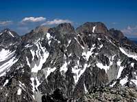
 The impressive East Ridge of Thompson as viewed from Williams
Here are some of the known routes:
1) The June/ North Couloir (III 5.7) - This prominent steep couloir cuts up the northeast face to a notch just below the summit. It's fairly easy access from the Alpine Way Trail trail near Marshall Lake. The couloir often has ice, rock, and snow and is blocked by a large cornice in the winter near the top. The first ascent came in 1986 by Kirk Bachman and B. Franklin.
Rope up at the base of the couloir and expect highly variable conditions on snow and ice. The route is straight-forward. At the top of the couloir, follow the ridge to the west and then the south to the summit. It's only 400 feet from the top of the couloir to the summit proper. The easiest descent is to utilize the south facing routes to get back to the trail.
2) Southeast Slopes (Class 3) - Easy access from the Alpine Way Trail make this method probably the easiest and quickest route on the mountain. Winter time offers great snow climbing and ski descents here.
3) East Ridge (Class 4) - A more challenging route involves up and down scrambling on the prominent southeast ridge above the Southeast Slopes route. There are sections of extreme exposure and steep, loose gullies to cross over. Mountain Goats were encountered on this route.
4) Southwest Couloir (Class 3) - This route is readily accessible from the Thompson / Williams Saddle (Thompson and Williams can be done together) or the Lake 8865 area.
The peak is named after Dave Williams, an early rancher who also delivered the mail from Stanley to Galena (the Sun Valley area). He is credited with the first known ascent of the peak in 1934 along with Robert and Miriam Underhill.
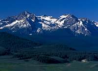
 Snowy winter morning on the Sawtooths
Getting There
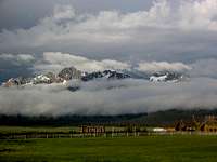
 Sawtooth Evening
Red Tape
No permits of any kind are required. No fees or passes are requiredWhen To Climb
 The East Ridge
 History
Mountain Conditions
Sawtooth Web Cam can give you a good idea of the conditions in the area:http://www.ruralnetwork.net/~dpinney/
SNOTEL site gives latest snow depth readings:
http://www.wcc.nrcs.usda.gov/snotel/snotel.pl?sitenum=845&state=id
Google Maps also gives snow depth maps:
http://www.nohrsc.noaa.gov/earth/
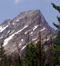
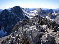 Williams Summit
Camping
- There are many drive-in camp sites near Redfish Lake (near the trailhead)
- If climbing the south facing or east routes, You can camp at the unnamed 9000 ft lake to the south of Williams or the lower lake at 7600 ft, just south of the Alpine Way Trail
- If climbing the June Couloir or any other north side route, Marshall Lake provides an excellent bivy spot.
Further Information Sources
Sawtooth Climbing Beta is hard to come by. There is no official book or publication that gives detailed description. Here are a few references that have some more basic information and photographs:1) Climbing Magazine #15
2) Rock & Ice #44
3) Off Belay: The Mountain Magazine Feb 1975 #19 (Whole issue devoted to rock climbing in the Sawtooths, but hard to find)