
|
|
Area/Range |
|---|---|
|
|
40.01500°N / 107.0832°W |
|
|
Hiking, Mountaineering, Scrambling, Skiing |
|
|
Spring, Summer, Fall, Winter |
|
|
12352 ft / 3765 m |
|
|
Overview
The Flat Tops are more of a huge elevated plateau rather than a typical mountain range, but the plateau has been eroded into many individual peaks and summits, and most of them are flat-topped, or dome-like as are the Lost Lakes Peaks. The mountain area composing the Flat Tops contains over 110 lakes full of fish, and also has some of the most extensive areas above timberline in Colorado.
In the Flat Tops, there are six peaks that have over 300+ feet prominence and above 12,000 feet and 35 that have over 300+ feet prominence and are over 11,000 feet. Because of the flat nature of the summit of the Flat Tops plateau like region, there are a lesser number of peaks that have 300+ feet prominence than might other be expected. Well known peaks such as Dome Mountain or Dome Peak don't quite make the list. See below for the list of peaks in the Flat Tops that are both over 11,000 feet and that have more than 300 feet prominence:
Flat Tops: 11,000+ Foot Peaks with 300+ feet of Prominence
In 1919, Arthur Carhart visited Trappers Lake and this motivated him to become the first U.S. Forest Service official to advocate Wilderness preservation. After these humble roots, eventually, and decades later, the area became the Flat Tops Wilderness, Colorado's second largest designated wilderness area.
The Flat Tops Wilderness, designated a wilderness area in 1975 by the United States Congress and nicknamed “The Cradle of Wilderness”, is the 2nd largest wilderness area in Colorado. The entire expanse of the Flat Tops is located in the White River and Routt National Forests (managed by the US Forest Service). The Flat Tops are a concentration of flat-topped headlands dominated by the White River Plateau, a flattened dome of geological strata capped with lava. The plateau is most prominent at the Chinese Wall and the "Devils Causeway " a narrow ridge between the drainage of the East Fork of the Williams Fork River and the North Fork of the White River. Wide canyons, eroded by wind and water reach far into the plateau forming great amphitheaters ringed by rock escarpments. In some areas, above the cliffs is a gentle rolling grassland dotted with islands of timber. In other areas, sharp peaks rise straight from the Plateau and make interesting climbing objectives.
"Get a good draft working in your nostrils, smell the hot sun on the pine needles, the tangy odor of the sage, the scent of the fire weed in full bloom….Get off your ear muffs and hear the call of the jay, the splash of the jumping trout, the roar of a water fall. Brush the dust of habit away from your eyes and see the lacery of the pine needles, the vivid coloring of the cliff or wild flower, the majesty of the peaks. In other words take stock of the world in which you live…” ---Arthur H. Carhart; during his first visit to the Flat Tops in 1919
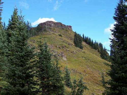
 "West Flat Top" Peak
Introduction to Hiking and Climbing
The Flat Tops actually have many different mountain climbs, from rough scrambles to hikes with trails. The theme of the routes, however, is non-technical. There are very few suitable technical routes here, due to the crumbly nature of the rock.
Many of the peaks in the Flat Tops are rounded and gentle, but a few are quite rugged and steep. Even so, it seems these peaks have 2nd and 3rd routes to the summits if you do some searching and careful route-finding.
The Flat Tops is an excellent place for long distance backpacking, and in fact is one of the best places in Colorado for extended trips. Many loop hikes are possible.
Many Peaks are relatively un-visited, such as Pagoda Peak, but peaks such as Pyramid and Flat Top Mountain are popular climbs, though most people seem to stick to the trails and lakes instead of climbing peaks. The moral of the story is that many peaks are popular, but if you look for solitude, you will find it, and if you want pleasant, but relatively popular trails, you will find those too.
Other popular activities in the range include hunting and fishing. Horseback riding is popular as well.
See the individual mountain pages for much more information on the peaks.
 Pagoda Peak
Red Tape
Standard Wilderness Regulations apply within the wilderness boundary. Directly from the National Forest Service:
Basic Rules
• Entering or being in the area with more than 15 people per group, and a maximum combination of 25 people and pack or saddle animals in any one group is prohibited.
• There is no permit system in place in the Flat Tops Wilderness but we do ask that visitors sign in on provided trailhead registration forms.
• Camping within one hundred feet of any lake, stream or trail, or any “No Camping” or “Wilderness Restoration Site” sign or within ¼ mile of Trappers, Hooper, Keener or Smith Lakes is prohibited.
• Building, maintaining, attending or using a campfire within one hundred feet of any lake, stream, or trail or within ¼ miles of Trappers, Hooper, Keener or Smith Lakes is prohibited.
• Storing equipment or personal property or supplies for longer than 10 days is prohibited.
• Hitching, tethering or hobbling any pack or saddle animal within one hundred feet of any lake, stream or trail is prohibited.
• Possessing any pack or saddle animal within ¼ mile of Trappers Lake except for watering or through travel is prohibited.
• Possessing a dog or other animal that is harassing wildlife or people or damaging property is prohibited. There is no leash law in the Flat Tops, however dogs must be kept under verbal control at all times.
• Possessing or using a wagon, cart or other vehicle including a wheelbarrow or game cart is prohibited.
• Shortcutting a switchback in a trail is prohibited.
Pine Beetle Epedemic
In the 1940’s a pine beetle infestation killed many of the spruce and fir in the Flat Tops. Uncontrolled, the resulting epidemic left 68,000 Acres of spruce devastated. A cold snap in 1951, where temperatures dropped into the -50’s, ended the epidemic. Today a silver sun bleached ''ghost" forest of dead snags stands in memory of the appetite of the bark beetle. But the ravaged acres are beginning to come back to life. Saplings of spruce and alpine fir are beginning to cover the area, growing among the skeletons of the previous forest. Travel in the silver forest can be difficult and dangerous. As increasing numbers of dead trees decay and fall, overland movement will become more difficult and may be impossible in some areas.
Seasons
The Flat Tops (especially the northern section) receive much snow, so despite the lower altitude than the 14'ers, the peaks remain buried in snow until mid-July. Snowshoes are recommended in June. The Flat Tops have many mosquitoes in July, and sometimes into early August. From September and into December is hunting season, so wear blaze orange and use extreme caution. On the plus side, hunter traffic usually keeps some of the access roads open until around Thanksgiving weekend. Late November might be the best time to make “winter” ascents because after the roads close, these peaks would take a long time to climb.
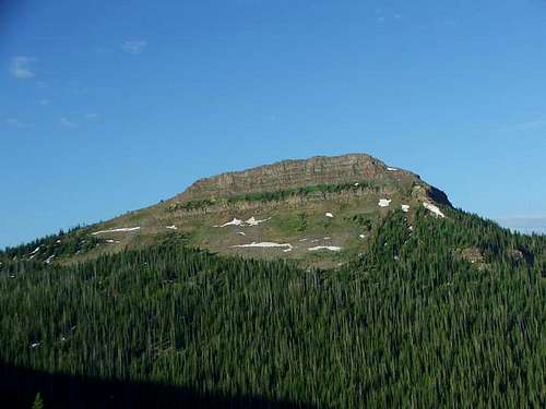 Pyramid Peak in July
CLICK HERE FOR WEATHER FORECAST OF THE AREA
Weather and climate data for Marvine Ranch at 7800 feet elevation is below. *National Weather Service Data 1972-1998. Expect much wetter conditions at higher elevations. The area around the higher peaks will average around 10-15 degrees colder in the daytime than Marvine Ranch; nighttime temperatures won't have as big of a difference.
| MONTH | AVE HIGH | AVE LOW | REC HIGH | REC LOW | AVE PRECIP (in) |
| JAN | 33 | 1 | 59 | -38 | 2.43 |
| FEB | 36 | 3 | 56 | -42 | 2.30 |
| MAR | 42 | 11 | 63 | -32 | 2.55 |
| APR | 49 | 18 | 75 | -16 | 2.20 |
| MAY | 61 | 27 | 78 | 5 | 2.41 |
| JUN | 72 | 33 | 92 | 15 | 1.57 |
| JUL | 77 | 38 | 89 | 23 | 1.94 |
| AUG | 75 | 38 | 90 | 21 | 1.91 |
| SEP | 68 | 31 | 87 | 11 | 2.16<TD |
| OCT | 57 | 22 | 76 | -10 | 2.16 |
| NOV | 40 | 11 | 65 | -30 | 2.26 |
| DEC | 33 | 2 | 63 | -44 | 2.53 |
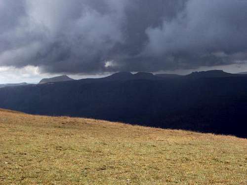 Huge thundercell in the Flat Tops
Geology
The Flattops form the northern extent of the White River Plateau. Though the uplift began about 52 million years ago, the three periods of volcanic activity that formed the peaks happened 2.4 to 7.5 million years ago. The area was heavily glaciated 17,000 to 13,000 years ago, which resulted in many lakes and glacier carved valleys. Only fairly recently did the last of the glaciers disappear.
The lower layers of the Flat Tops are thick limestone formations and water has carved many of caves. There are many caves to explore if you know where to look for them.
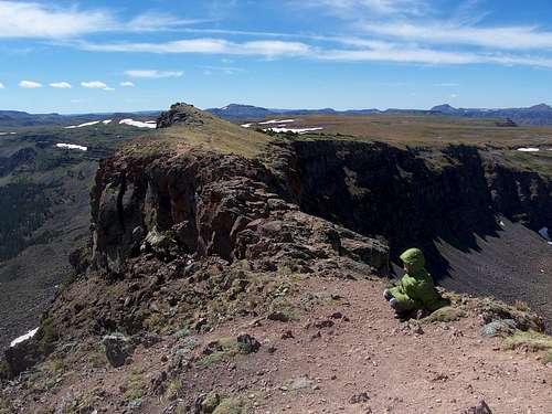 Devils Causeway
Wildlife
The Flat Tops are the home of large herds of elk, deer, as well as many small mammals, birds, reptiles, amphibians, and fish. Bears, coyotes, and cougars are the primary predators.
Area Campgrounds
There are many informal campsites around Ripple Creek Pass. There is also a campground to the northeast of the pass at Vaughn Lake, and many along the road to Trappers Lake to the south.
If driving in from the west or south, CLICK HERE for current campground information for official White River National Forest campgrounds.
If driving in from the east or north, CLICK HERE for current campground information for official Routt National Forest campgrounds.