
|
|
Mountain/Rock |
|---|---|
|
|
39.39824°N / 119.53934°W |
|
|
Storey |
|
|
Hiking |
|
|
Spring, Fall, Winter |
|
|
7337 ft / 2236 m |
|
|
Overview
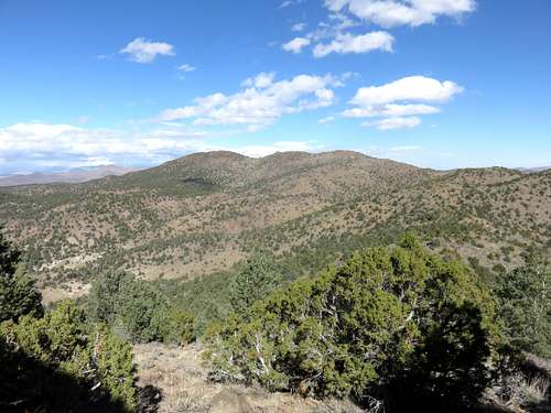
Flowery Range Highpoint from the southwest
The Flowery Range Highpoint sits along a long ridge about 9 miles northeast of Virginia City. The main ridge of the Flowery Range goes east from Virginia City, and then curves north where the highest summits are, including the Flowery Range Highpoint. This north summit ridge itself has three summits, all about the same height. The summit furthest north has a summit register, but the one in the middle might be the actual highpoint. The southern summit is either 2nd or 3rd highest.
Regardless, the ridge isn’t often visited. The summit register had one entry from 2014, and then no others since 2010. While this doesn’t mean the summit went four years without a visitor, it probably indicates that less than a handful of folks meander up to the ridge in any given year.
The Flowery Range Highpoint has impressive views given its status as the highest point in the Flowery Range, which itself is an offshoot of the Virginia Range. The Flowery Range Highpoint is sometimes referred to as Rattler BM, also its name on USGS maps, although Rattler BM isn't necessarily the highest point on the ridge.
Hiking the Flowery Range Highpoint can be done all year, but is recommended between October and April. Late spring and summer months are far too hot.
Getting There
Due to its remoteness, there are two approaches to the Flowery Range Highpoint; from the west and from the south.The southern route is less than 10 miles round trip. It is accessed from US 50 up the Neigh Road. Neigh Road is unmarked. There is a left turn lane off US 50 if coming from the west. Neigh Road is a half mile past Chaves road when coming from the west on US 50. A 2WD can make it 1.5 miles up Neigh Road, and you can park here for a 12 mile round trip hike to the Flowery Range Highpoint. If you want a shorter hike with less approach and even to do a double hike with Tibbie Peak 7,277’, it is advised you drive further. 4WD can comfortably make it another 1.5 miles to where my group parked at 39.3568, -119.5073 at 5,250’.
4WD Trailhead
The western approach starts off Long Valley Road. This is accessed off of Geiger Grade, just north of Virginia City. From Reno, head towards Virginia City. Two miles north of town is a private road called Lousetown Road. Probably a few hundred people live on this road, so although it is private that does not mean it is off limits. The problem would be parking near the residential area. However, for the Flowery Range Highpoint, you take the main road, Lousetown Road, and after a little over a mile, take a right on Long Valley Road. Take this well-graded dirt road about 2 miles where it turns into Barrel Springs Road. You can take a 4WD far up the road and get to nearly within three miles of the summit. But for those not wanting to rough it, they can park at the same access point for Rocky Peak, Horse Benchmark, and Tibbie Peak. To do this, continue straight for another 1/4 mile and park at 39.363, -119.5895 at about 6,030'. Note that there are a few homes and some nasty signs. But this area is visited by 4WD vehicles and you should be fine if you stay off signed private property on the side of the road.
Route
From the south, hike up the road for about 1.5 miles from the parking area noted above. The road heads generally northeast. At 1.5 miles, a lesser road heads up the slope of the mountain range. It is hard to spot the turnoff, but an easy tell is that the main road descends at the turn off. So when the main road descends, take a left. You will see the lesser road heading up the slope. After about 1 ¼ miles the road ends at about 6,600’. Head up steeply to the ridge at about 7,000’ in less than ½ mile. When we did this hike, the road end wasn't obvious, but we could easily find a route to the ridgetop with barely any descent.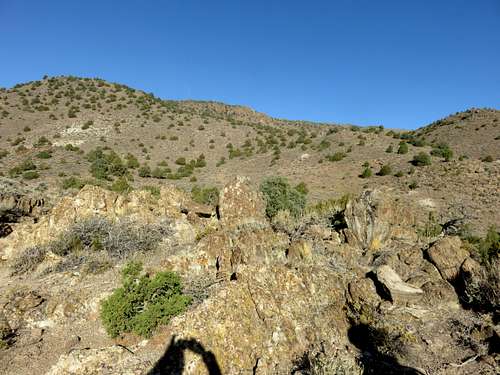
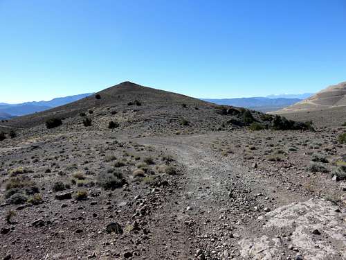
View up to the ridge from the turn off to the lesser road
Once on the ridge, head to the right on the road for about ½ mile and the road heads up the right side of the north ridge towards the three summit bumps. I would advise visiting all three summits, noting that the 2nd appears to be highest (via Google Earth™), but the 3rd has the summit register.
Heading towards the north ridge
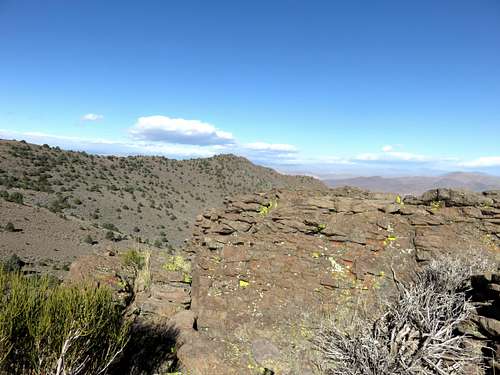
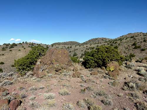
Rattler BM from a rock formation to the south
If you descend the way you came, it is about 9 miles round trip with a one way elevation gain of about 2,320’ if hitting all three summits.
From the west, start at the aforementioned parking area. Continue on the main road in the valley for about 2 miles, and the road curves to the right, and then take a left and continue for another 2 miles to a pass at 39.400676, -119.543362. The Flowery Range Highpoint is a mile away, and nearly 900' up. You'll have to bushwhack. This is a 10 mile round trip hike with about 1,650' of elevation gain one way.