
|
|
Mountain/Rock |
|---|---|
|
|
39.28969°N / 119.72703°W |
|
|
Washoe |
|
|
Hiking |
|
|
Spring, Fall, Winter |
|
|
6231 ft / 1899 m |
|
|
Overview
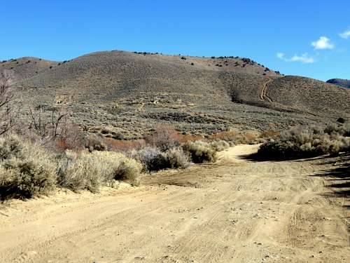
Jumbo Grade Hill seen from Jumbo Grade Way
Jumbo Grade Hill is an unofficial name for a rounded summit rising east of Washoe Lake. It is accessed from Jumbo Grade Way, a mining road that traverses the Virginia Range and connects Virginia City to the Washoe Valley. Several mines are located on the east side of the hill, which no doubt was reached via this mining road over a century ago.
Jumbo Grade Hill itself is not an official mountain. It rises from the valley to the west, but its east side only has a prominence of 220’.
However, because of its accessibility, excellent views from the summit, and proximity to a significant trailhead in the Virginia Range, it is worth noting as a destination for hikers in Reno and Carson City.
Jumbo Grade Way is primarily a hiking destination in winter, spring, and fall. As with most of the lower summits in this area, summer hiking is not recommended due to heat and rattlesnakes.
Getting There
The primary starting point is Jumbo Grade Way. There are several starting points off Jumbo Grade Way, but they are simply variations from the southwest. The best bet for new visitors to the area is to start at the Jumbo Grade Trailhead.To get there, take 580 South from Reno and get off on Virginia Street, exit 57 southbound, and head south on 395 towards Washoe Lake. Just past Pleasant Valley, get on Route 428 (East Lake Blvd), and head south towards Washoe Lake. Once on East Lake Blvd it is approximately 3.8 miles to Jumbo Grade Way. Take a left on Jumbo Grade Way and continue up the road for a mile. At this point there is a trailhead parking area at about 5460'.
From the trailhead head down from the edge of the parking lot and get back on Jumbo Grade Way. There are a few side roads on the left side of the road within a ¼ mile from the trailhead. Take one of these roads and head towards an obvious steep road on the hillside. This leads directly to the summit. Total distance is only a mile from the trailhead gaining about 780’. I built a small cairn on top to mark the summit on January 19, 2015.
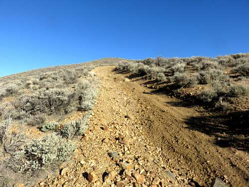
Heading up the steep road up Jumbo Grade Hill
It is recommended you head down the backside of Jumbo Grade Hill and take the first right which leads back down to Jumbo Grade Way. This offers an easy 2.5 mile loop. Of course, this is just the easiest, quickest trip if looking for an hour long hike and a great view from the summit.
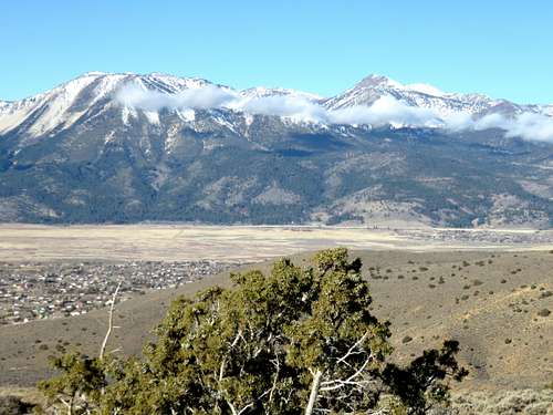
Mount Rose and Slide Mountain seen from near the summit of Jumbo Grade Hill
There are many roads in the area, ideal for trail running, and longer loops are possible, including a longer backside loop that is 4 3/4 miles. For this loop once you descend the back side and continue on the road as it curves left around a hill. The road descends back to Jumbo Grade Way further up. This is a scenic trail run that is easy on the legs and can easily be done.
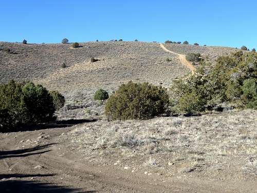
Back side of Jumbo Grade Hill