Overview
![Peak 5987]() Rocky face in the northern Virginia Range - below Peak 5987
Rocky face in the northern Virginia Range - below Peak 5987
The Virginia Range covers a wide area of moderate-elevation mountains in Northern Nevada. The range is located to the East of Reno, North of Carson City, Northwest of Fallon, and Southwest of Fernley. The Western foothills of the range are in Washoe County, but the majority of the range is in Storey and Lyon Counties. Because the Virginia Range is located near these large communities, parts of range are quite accessible, with hiking trails and jeep roads heading from summit to summit.
The highest of these summits is
Mount Davidson at 7,864 feet, which is also the highpoint of Storey County.
![The summit massif]() Hiking down Peak 6075 in late December, with the glow of sunset reflecting on the mountain.
Hiking down Peak 6075 in late December, with the glow of sunset reflecting on the mountain.
The range is very wide, stretching over 30 miles north/south and over 40 miles East to West. In fact, it is this wide coverage area that makes the Virginia Range unlike most mountain ranges in Nevada. Most Nevada ranges have a distinct north-south running ridge, while the Virginia Range has no single ridge and generally runs southwest-northeast. (
Source for this information)
The northern border of the range is the Truckee River, just south of I-80. This often confuses people, because north of I-80 is the southern terminus of the
Pah Rah Range, That mountain range reaches 8367 feet at its highest point, Virginia Peak. Because these ranges are so close to each other, they are often confused for the same range. A low pass actually separates the Pah Rah Range, from the Virginia Mountains which are east of Pyramid Lake. The Virginia Range is often confused with the Virginia Mountains, which are located north of the Pah Rah Range, and 25 miles north of the Virginia Range.
The southeast part of the range, which is mostly north of US Highway 50, is considered part of the Flowery Range - a sub-range connected to the Virginia Range. The Virginia Range is noted more often since it's highest summits are seen from Reno, Nevada.
Three Highest Peaks according to
Peakbagger.com
1.
Mount Davidson 7864
2.
Ophir Hill 7782
3.
Mount Bullion 7682
After this, the highest peaks become muddled, since there are a number of named summits that fail to meet the 300' rule.
The most popular mountains in terms of hikers are probably Rattlesnake Mountain, Mount Davidson and Ophir Hill, Camel Back Peak,Road to Nowhere Mountain, Sugarloaf, and Peak 5987. Rattlesnake probably gets dozens of daily visitors being that it is in the heart of Reno. The others typically aren't too crowded, but get a quite a few hikers daily on their slopes if not the summits themselves.
The most enjoyable hikes to recommend probably are Rocky Peak, Clark Mountain, Sugarloaf, Camel Back, and the Grosh-Rose-Emma combination.
The best time to hike in this range is in winter and early spring and late fall. The range is plagued with mud in late spring, and snakes, and intense heat during the summer and early fall. This is an excellent hiking destination if you want to avoid the deep snow of the Northern Sierras to the West during the winter. Plus, the sunsets in winter time are extraordinary.
![Sugarloaf 5,921]() South face of Sugarloaf - Flowery Range
South face of Sugarloaf - Flowery Range
Roads and trailheads in the Virginia
Principal hikes in the Virginia Range are located in Virginia City and Reno, Nevada. Most of the other mountains of note in the range are outside of town and without hiking trails or defined trailheads. I focus on primary roads and accessible hiking areas on this page; and will grow the page as I collect additional data, or receive comments and suggestions.
Primary roads through the Virginia Range
There are three main roads cutting through the Virginia Range.
Six Mile Canyon and U.S. Highway 50
U.S. Highway 50 runs south of the Virginia Range, and allows for some offshoots to the Virginia Range, including route 79, aka Six Mile Canyon Road, which has several parking areas with access to public lands, where several summits can be reached within a two to four miles. These peaks are in the Flowery Range, an offshoot of the Virginia Range. Six Mile Canyon offers access to most of the Flowery Range, while Neigh Road off of US 50 leads to the highest summits in the range, Tibbie Peak 7,277' and the Flowery Range Highpoint 7,337'.
Route 341
Route 341 (aka Geiger Grade Road) is an extension of the Mount Rose Highway (Route 431). It works its way up and through the Virginia Range to Virginia City, rising to almost 7,000 feet at its highest point. Most of the area along this road is private land, so there are restrictions to exploring along the road until a half-mile or so from Virginia City. Louse Mountain Road, about 2 miles north of Virginia City, offers access to other mountains in the range, including Long BM and Peak 7036, but is a private road. Louse Mountain Road turns into Long Valley Road and can be used to access Rocky Peak, Horse Benchmark, Tibbie Peak, and the Flowery Range Highpoint.
Virginia City is at the base of several high Virginia Range peaks, including Mount Davidson, Ophir Hill, Mount Bullion, and Orleans Hill. Much of this area is on BLM lands, which allows you to explore the area at your leisure. Hiking can be done from just west of Main Street through town. In fact, you can even park on or around Main street in Virginia City and reach Mount Davidson or Ophir Hill within 2 miles.
Just south of Virginia City is the Six Mile Canyon Road. About 1 1/2 miles down the road from Virginia City, there is a parking area on the left side of the road which leads up to a few summits. This includes the
Sugarloaf rock formation 5921', Flowery Peak 6581', and Long Point 6861'.
Emma Peak 6442' and
Rose Peak 6291’ and Mount Grosh 6351’ can also be hiked from near this trailhead. They rise on the south side of the road.
Further down the road is access to higher peaks of the Flowery Range including Peak 7036, Rocky Peak 7082’, Horse Benchmark 7163’, and Tibbie Peak 7277’. A BLM access road leads to all of these within reasonable distance, although Tibbie Peak is about 13 miles round trip. Tibbie Peak and the Flowery Range Highpoint can be accessed via US 50 from Neigh Road to the east of Dayton.
![Rocky Peak massif]() Rocky Peak massif
Rocky Peak massif
I-80 runs through the northern extension of the Virginia Range. Once in the mountains, past Sparks, you can make it out to Point 5570, the highpoint of a ridge south of Lockwood, offers steep gravel roads that make for excellent hiking. A little further up the canyon in Lockwood, you can reach Clark Mountain, 7196'. Clark Mountain used to be reached via USA Parkway, but recent development has blocked off access from the east.
![View of Clark Mountain heading up the meadow]() Clark Mountain 7,196' from the east - no longer accessible
Clark Mountain 7,196' from the east - no longer accessible
North of U.S. Highway 50, the range can be reached from East Lake Blvd (aka Route 428) in Washoe City (which is east of Washoe Lake). Several small roads head east from East Lake Blvd, most notably Jumbo Grade Way. This includes
McClellan Peak at 7,451 feet, which shares a ridge with the slightly higher Scott Peak 7,461', which are both the sites of numerous radio towers. McClellan and other mountains here are primarily on BLM land, so hiking and exploring is allowed, but make sure that the road you take to get to them isn't private. Usually a big warning sign will let you know. Anything accessed from Jumbo Grade Way is fine. This includes Point 6231 "Jumbo Grade Hill" a convenient afternoon hike from the Jumbo Grade trailhead.
Carson City
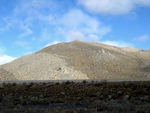
The north end of Carson City offers access to McClellan and Scott Peaks, as well as the more popular Sugarloaf 5,933. Sugarloaf is a lower summit attached to the McClellan-Scott Peak Massif. Sugarloaf offers a straight forward ~3 mile hike from an easily accessible area not far off the main highway.
![Sugarloaf (Carson City) 5,933' from the south]() Sugarloaf (Carson City) 5,933' from the south
Sugarloaf (Carson City) 5,933' from the south
In southeast Reno, the Steamboat Parkway heads out towards the Virginia Range, which can be hiked in the hills behind Damonte Ranch High School. A spectacular canyon (referred to by locals as Eagle Canyon) provides entry into a wide meadow with access to
Peak 6305 and
Louse Mountain (Louse BM on topo maps) 6862', and Peak 6405. Construction in the area affected access for a while, however a trail behind Damonte Ranch High School has been created to bypass construction.
![Peak 6305]() Peak 6305
Peak 6305
In east and northeast Reno, Hidden Valley County Park and Alexander Lake Road head up to prominent summits in the Reno skyline.
Trailheads for these mountains include the Huffaker Hills trailhead and the terminus of Alexander Lake Road, and Hidden Valley County Park.
The Huffaker Hills trailhead, which is located in Reno at the foothills of the Virginia Range. It is accessed off of Alexander Lake Road, which can be reached by taking the first right on East McCarren Blvd past Longley Lane. The highest of the Huffaker Hills is
Rattlesnake Mountain at 5,011'.
![Parking lot from summit]() The parking area for the Huffaker Hills 4617'
The parking area for the Huffaker Hills 4617'
To get to the Virginia Range from Alexander Lake Road, you go past the Huffaker Hills trailhead, and follow the road to its terminus. From here, you can hike
Peak 6075 and its sub-peaks.
![Route to the summit for Peak 6075]() Peak 6075 in winter, with the red line showing the route up to the summit; as seen from Alexander Lake Road.
Peak 6075 in winter, with the red line showing the route up to the summit; as seen from Alexander Lake Road.
Perhaps the best hiking spot in the Virginia Range accessible in Reno is in Hidden Valley County Park. To get to the Park, take East McCarren Blvd to Pembroke Lane, heading towards the mountains. Take Pembroke for 1.8 miles until you see Parkway Drive. Take a right on Parkway Drive which enters Hidden Valley County Park in less than half a mile.
Hidden Valley Park sits below
Peak 6075,
Point 5768 and the Colored Hills, and
Peak 5987.
There are several miles of hiking trails in these hills, with steep slopes, colorful rocks, and great views from the summits. Details on hiking these mountains are explained on their respective pages.
![Zoom shot of the Colored Hills]() The colorful hills in December 2007. They are only snow covered for a few weeks each year.
The colorful hills in December 2007. They are only snow covered for a few weeks each year.Red Tape
Hiking in the Virginia Range is generally allowed in areas near state parks and scenic areas such as Washoe Lake, Hidden Valley County Park, and Virginia City. Some of the more remote sections of the Virginia Range require longer approaches on tough dirt roads with lots of ups and downs if trying to avoid staying in areas with unrestricted access. So, if you are inclined to explore these areas make sure to look out for "No Trespassing" signs or use a nice 4WD.
Ongoing construction in South Reno changes the access points and access will be unclear as new areas are developed.
Jeep roads run all throughout the front part of the range near Reno, heading through the upper reaches of the mountains down to the other side of the Western front of the Range. This is primarily a spot for ATV riders and for people who go out target shooting. If you hike in this area, make sure to look out for these people, and make your presence known. Deer, coyote, and wild horses are found within this range, and you should watch for their droppings.
External Links
Virginia Range Wildlife Protection Association
Peakbagger

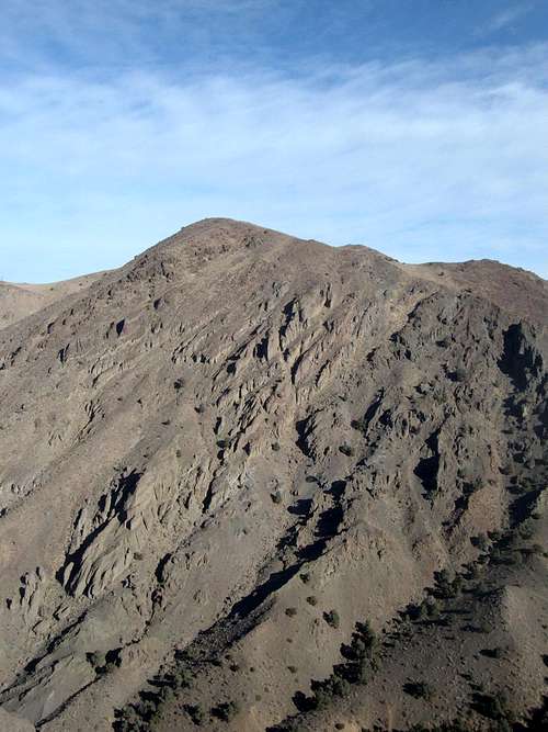 Rocky face in the northern Virginia Range - below Peak 5987
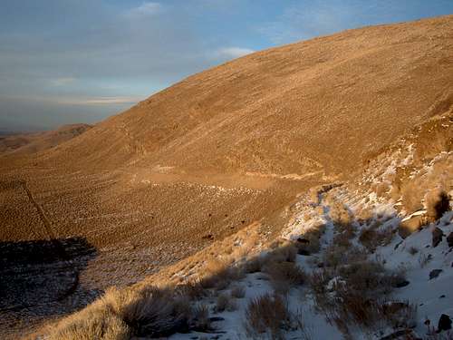 Hiking down Peak 6075 in late December, with the glow of sunset reflecting on the mountain.
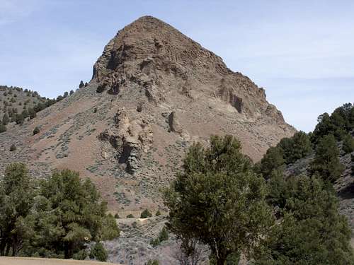 South face of Sugarloaf - Flowery Range
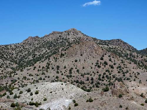 Rocky Peak massif
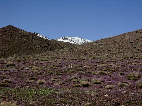 Clark Mountain 7,196' from the east - no longer accessible
 Sugarloaf (Carson City) 5,933' from the south
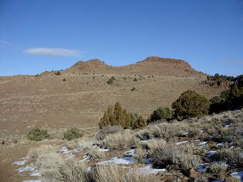 Peak 6305
 The parking area for the Huffaker Hills 4617'
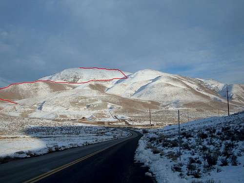 Peak 6075 in winter, with the red line showing the route up to the summit; as seen from Alexander Lake Road.
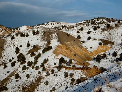 The colorful hills in December 2007. They are only snow covered for a few weeks each year.