-
 5106 Hits
-
 71.06% Score
-
 1 Votes
|
|
Trailhead |
|---|---|
|
|
45.26960°N / 113.7526°W |
|
|
Spring, Summer, Fall |
|
|
5700 ft / 1737 m |
Climbers' Access for Freeman & Copperhead Peaks
From Hwy 93, approximately 4 miles north of Salmon, ID, turn east onto Carmen Creek Road. Follow the road for a little over 5 miles as it meanders in a northeasterly direction.
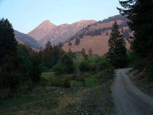
Turn right (east) onto Freeman Creek Road. Go about 3 miles, then take the left fork (main road). The right fork takes you into a rather large clearing where some choose to camp.
Drive for approximately one half mile, cross a cattle guard, and begin looking on your right (south) for a small clearing between the road and Freeman Creek. This is a good place to park and begin your expedition unless you have faith in your driving abilities.
If you wish, you can drive an additional half mile to a spot where the road forks. The road is a little rougher this last half mile, but even a 2-wheel drive vehicle should be able to make it if you’re careful. There are very good camping spots near the creek and several places to park along the right (south) side of the road.
Copperhead Peak Access
The left fork makes a hard switchback and proceeds uphill to the northwest. This is the road to take if you’re planning to climb Copperhead Peak. It is passable with a 2-wheel drive vehicle. Continue for 1.2 miles to an elevation of about 6,600' and take the left (northeast) fork. There is a rock cairn and arrow here marking the correct road. From here the single track continues to an elevation of roughly 6,800' into the Golway drainage and eventually ends.
Freeman Peak Access
The right fork proceeds directly ahead (east) and is the way to Freeman Peak. The road beyond this point requires excellent driving skills plus 4-wheel drive at several points. Proceed at your own risk. Personally, I would not drive beyond this point (toward Freeman Peak) without having first hiked the road.
There are no restroom facilities at any of these spots (clearings) along Freeman Creek Road nor are any of the spots marked with signs; however each of the clearings can be recognized as having been previously used by the existence of fire rings constructed out of the local stone.
For information about the climbers' route accessed from this trailhead, see the links included in the picture's description.
 |
|---|


