

-
 3211 Hits
-
 73.06% Score
-
 3 Votes
|
|
Trailhead |
|---|---|
|
|
45.47307°N / 113.61678°W |
|
|
Beaverhead |
|
|
Spring, Summer, Fall, Winter |
|
|
6800 ft / 2073 m |
Access to Jumbo Mountain
From Hwy 278 about 6.6 miles south of Wisdom, MT, turn west at the Twin Lakes Campground exit (RD 12).Travel 8.2 miles to a sign pointing toward Big Swamp Creek Road and turn left (south).
In approximately 8.5 miles, turn right (southwest) onto Big Swamp Creek Road 625.
In a little more than 1.5 miles, you will see a gravel road to your right (southwest).
Turn onto the road and drive approximately 1.5 miles to the end where the Rock Creek Pack Trail begins.
This trail runs all along the south side of Jumbo Mountain, then over a saddle on the mountain’s west ridge before joining up with the Moose Creek Pack Trail which turns in an easterly direction to run along Jumbo’s north side.
By choosing the correct point of departure from the Rock Creek Trail, you can climb Jumbo Mountain’s East Ridge, South Face, or West Ridge.
The Forest Service roads in this area are closed to motorized traffic (except snowmobiles) until May 15.
External Links
For information about the climbers' routes accessed from this trailhead, see the link included in the picture's description.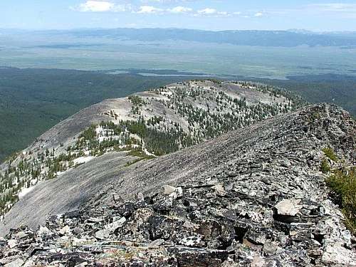 From the summit, Jumbo Mountain's east ridge.