
|
|
Mountain/Rock |
|---|---|
|
|
46.46364°N / 7.64739°E |
|
|
Hiking, Mountaineering, Trad Climbing, Sport Climbing |
|
|
Spring, Summer, Fall |
|
|
7493 ft / 2284 m |
|
|
Overview
The Gällihorn is a striking mountain above Kandersteg. Despite its height, 2282 meters / 7493 feet, the Gällihorn is a pretty impressive feature. The north and east side of the peak are dominated by a 200 meter high rock face. The Gällihorn is located at the northern end of the Üscheneridge, which is bordered by the Gällihorn (north) and the Wyssi Flue (south).The mountain is frequently done via the normal route, which is a T3 hike from the cable car station of Sunnbüel. This hike is rather short, but can be tricky when wet. The normal route can be extended by following the üscheneridge instead of going down directly to Sunnbüel. This ridge is almost 2 kilometers long. The north and east face offer two great rock climbing routes. The limestone is not always reliable, but the views and the short approach make up for that. Recently both routes have been re-bolted and now meet with the needs of the modern "Plaisir climbers".

Getting There
To KanderstegKandersteg used to be the entrance to the Swiss Canton Wallis/Valais. The Lötschbergtunnel was the only connection through the center of the Bernese Alps. However, since a few years the Lötschberg-basis-tunnel opened. This leaves Kandersteg out of the main corridor between Berne and Wallis. Still, Kandersteg can be easily reached by train, bus and car. The village is located at the end of the Kandervalley and has its own SBB trainstation.
- See the website of the village of Kandersteg for more detailed information of how to get there.
- See the website of the SBB if you're planning to travel by train.
Routes
Normal Route from Sunnbüel (1934 m): Exit the upper station of the Kandersteg-Sunnbüel cable car and head right to reach a path junction at the Winteregghütte. Start to climb across the eastern flank of the Gällihorn. As you climb higher the path zigzags across steeper ground to reach a viewpoint (2165m). Continue by climbing the western slopes of the mountain. This last part is pretty steep and can be tricky when wet. The route is marked and there are several signs.Sunnbüel - Gällihorn: 2 hours, T3.
Rock climbing routes: There are basically two interesting rock climbing routes on the Gällihorn. There is the classic northeast-face and the modern Löwenherz.
- NE-face/Gälliwändli: 200 meters, 5a (4b obl.).
- Löwenherz: 200 meters, 6a+ (6a obl.).

Guidebooks and Maps
Map 1:25 000:- SAC Map: 1247 Adelboden
- SAC Map: 1267 Gemmi
Map 1:50 000:
- SAC Map: 263 Wildstrubel
Online Maps:
Guidebooks:
- SAC Guidebook: Clubführer Berner Alpen Band 1 - Sanetsch bis Gemmi, Ueli Mosimann , ISBN: 978-3-85902-197-6
- Schweiz Plaisir West (for the rock climbs), Filidor, ISBN 3-906087-19-0
To order SAC Maps: www.toposhop.ch
To order SAC Guidebook: www.sac-cas.ch
To order Schweiz Plaisir West: www.filidor.ch
External Links
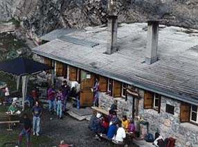
Winteregghütte 1888 mSelf-catering mountain hut!
Roland Zulauf
Phone (hut): 0041 79 417 85 24 (Obligatory!)
Homepage:www.sac-biel.ch
Other useful links:
WSL Institute for Snow and Avalanche Research SLF - Avalance Bulletin
Weather Forecast - Detailed weather forecast by Meteoschweiz
Railroad information - Railroad schedule
Bus information - Postbus schedule
Kandersteg - Tourist Office Kandersteg