
|
|
Mountain/Rock |
|---|---|
|
|
46.54635°N / 8.01435°E |
|
|
Mountaineering |
|
|
Summer |
|
|
12903 ft / 3933 m |
|
|
Overview
This Bernese Oberland mountain rises like an island in a sea of ice. Trugberg is surrounded by the Jungfraufirn on the west side and the Ewigschneefeld on the east side. The north end starts at the Oberes Mönchjoch and it stretches almost down to the Konkordiaplatz in the south. The 4½ km long N-S ridge has several separate tops with the highest being 3932.9 meter. Comparing to the neighbouring 4000 meter peaks, Trugberg does not attract much attention from mountaineers. The situation would have been different if the summit had been just 67.1 meter higher. Still the long ridge of Trugberg is worth a visit with many interesting views of the Oberland mountains.The famous glacier researcher Agassiz was deceived when in 1841 from the Grossen Aletschgletscher he mistook the Trugberg for the Jungfrau. Realizing the mistake he gave the mountain the dubitative name Trugberg (Cheating mountain).
Trugberg was first climbed 13 July 1871 by Dr. Emil Burckardt from Basel, with the two local guides Peter Egger and Peter Schlegel. The route they took was by the east flank.
 From Swiss Map: 1:25.000 No. 1249, Finsteraarhorn
Getting There
Jungfraujoch at 3454 meter is reached by train from Kleine Scheidegg coming from Grindelwald or Lauterbrunnen.The Mönchjoch hut (3650 meter) is a 45 minutes walk from Jungfraujoch.
From the south the Konkordia huts (2850 meter) are approached from Fiesch. From Jungfraujoch allow two hours over the Jungfraufirn and the Konkordiaplatz.
See also:
Mönch
Jungfrau
 Trugberg north ridge. Photo taken from mönchsjoch hut
Routes
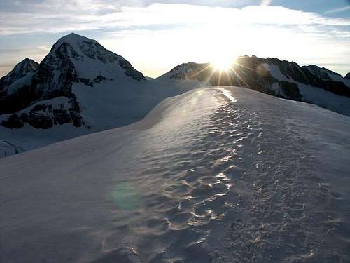 Sunrise behind the Trugberg
When to climb
Mid June to end of September. Trugberg as seen from the summit of Mönch
Maps and books
Swiss Maps:Guide books:
Show larger map
Red Tape
No permits or fees.External Links
Climbing photosTrip report (Swedish)