
-
 55855 Hits
-
 91.04% Score
-
 35 Votes
|
|
Mountain/Rock |
|---|---|
|
|
46.46670°N / 7.98330°E |
|
|
Mountaineering |
|
|
13756 ft / 4193 m |
|
|
Overview
Aletschhorn
What's New on this Page?
* Jan 6, 2023 - Ownership switched by Antonio Giani
* Jan 6, 2023 - Page under review
The Aletschhorn is a beautiful 4.000m peak located directly in the center of the Berner Oberlands, on the border with the Walliser alplen. It is pyramid shaped and it has enormous flanks on every sides. The most prominents are the south side, with 1.700 meters of rocks and ice above the "Oberaletschgletscher", and the north complitely covered of ice, very steep and high more or less 1.200 meters, part of the "Grosser Aletschfirn". It can be considered a "north wall". Very interesting is also the east side, that hosts the "Mittelaletschgletscher" and the omonimous bivouac. Characteristic of this massif is, the "Himalayan" dimensions and shapes. Different than other important mountains. The glacier basins very flat and long and the very long approaches remind (in small) the Karakorum valleys. Huts and bivouacs are placed far and very isolated from the summit and villages.
L'Aletschhorn è una bellissima vetta di 4.000 m situata direttamente al centro dell'Oberland bernese, al confine con le Alpi Vallesi. Ha forma piramidale e ha enormi fianchi su ogni lato. I più importanti sono il versante sud, con 1.700 metri di rocce e ghiaccio sopra l'"Oberaletschgletscher", e quello nord completamente ricoperto di ghiaccio, molto ripido e alto più o meno 1.200 metri, parte del "Grosser Aletschfirn". Può essere considerato un "muro nord". Molto interessante è anche il versante est, che ospita il "Mittelaletschgletscher" e l'omonimo bivacco. Caratteristici di questo massiccio sono le dimensioni e le forme "himalayane". Diverso da altre montagne importanti. I bacini glaciali molto piatti e lunghi ei lunghissimi accessi ricordano (in piccolo) le valli del Karakorum. Rifugi e bivacchi sono posti lontano e molto isolati dalla vetta e dai paesi.
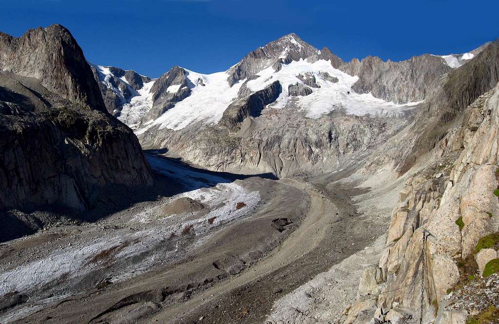
The south side
- The Aletschhorn is the second highest peak in the Bernese Alps.
- First climbed in 1859 by Francis Tuckett, J.J. Bennen, P. Bohren, Victor Tairraz
- The Aletsch-Glacier next to it is the longest in Europe, the "Konkordia Platz" in front of it is the largest Glacier-Get-together in the Alps.
- The views to all the famous neighbors like Eiger, Monch and Jungfrau are fantastic as well as to the other side to the Wallis and even to France with the Mt. Blanc.
- It sports many routes, of different grades, it can done with alpine skis, by foot, climbing the ice on the North Face or on Rocky ridges.
- Many huts are located nearby to accommodate you before your summit attempt.
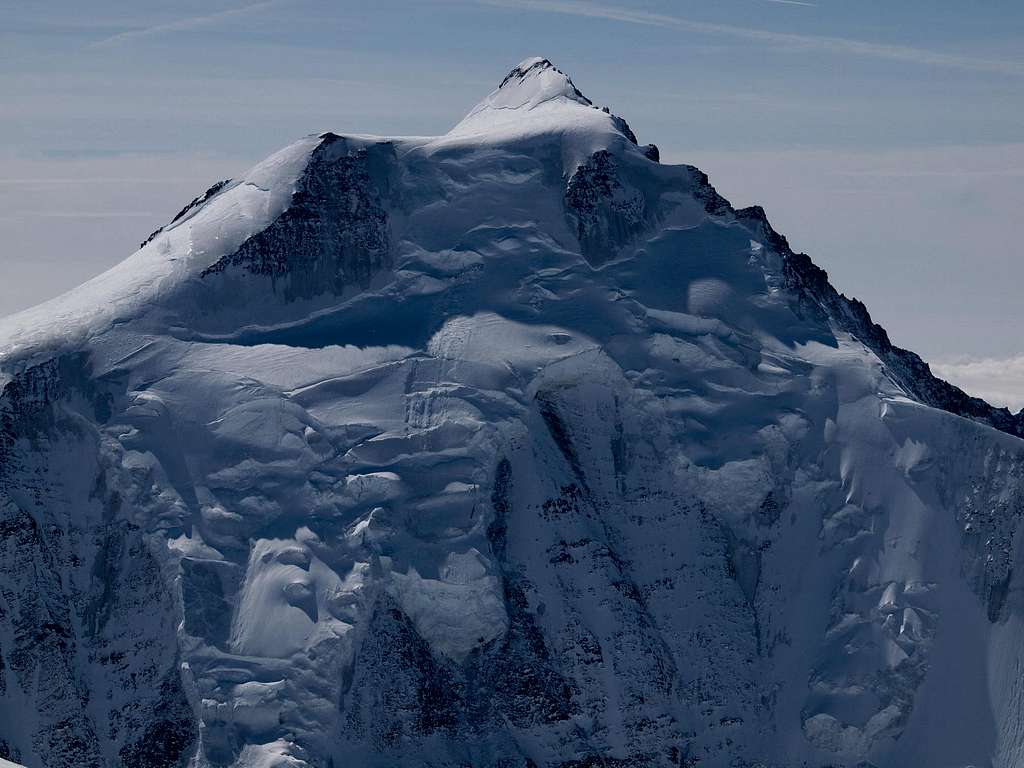
The north side
Getting there
Starting points are very far. It's impossible to get the top in one day. Huts and bivouacs are very far too. There are at least 3 starting point: From Jungfraujock: Approach usefull only for the north wall. The route has the problem that during the return must climb up 500 meters from the Grosser Aletschfirn to the rail station. Approach is however very long in distance. From Bettmeralp: For who want to climb the mountain along the Mittelaletschgletscher. From the top cablecar station of "Bettmeralp", get down to the Aletschgletscher. Cross it till the opposite side. Reach the Mittelaletschgletscher and avoiding it climb along its left side following stone piles until the Mittelaletsch biwak. From here "normal route" to the top. Very long journey 5h'00/6h'00 + 4h'00/5h'00.From Belalp: Approach for the normal route on the SW side. From the village of "Belalp", path to the "Oberaletschhütte". From here get down to the base of the Oberaletschgletscher and than to the summit. During the return, must be climbed 100m up to get the refuge. Very long journey, even longer than others. 3h'00/4h'00 + 7h'00/8h'00 On the west side of the moutain, a hut called Hollandiahütte is placed on the Lotschenlücke. Near to the summit, but useful only for who want to climb the NW ridge. Not commonly climbed.
I punti di partenza sono molto lontani, molto lontani anche i rifugi ei bivacchi. Ci sono almeno 3 punti di partenza: Da Jungfraujock: Avvicinamento utile solo per la parete nord. Il percorso ha il problema che durante il ritorno deve salire 500 metri dal Grosser Aletschfirn alla stazione ferroviaria. L'avvicinamento è comunque molto lungo. Da Bettmeralp: Per chi vuole scalare la montagna lungo il Mittelaletschgletscher. Dalla stazione a monte della funivia "Bettmeralp" si scende all'Aletschgletscher. Attraversarlo fino al lato opposto. Raggiungere il Mittelaletschgletscher ed evitarlo si sale lungo il suo lato sinistro seguendo mucchi di pietra fino al bivacco Mittelaletsch. Da qui "via normale" fino in cima. Percorso molto lungo 5h'00/6h'00 + 4h'00/5h'00
Da Belalp: Avvicinamento per la via normale sul versante SW. Dal paese di "Belalp", sentiero per la "Oberaletschhütte". Da qui scendere alla base dell'Oberaletschgletscher e poi in vetta. Durante il ritorno, bisogna salire 100 m fino a raggiungere il rifugio. Viaggio molto lungo, anche più lungo di altri. 3h'00/4h'00 + 7h'00/8h'00 Sul versante ovest della montagna, sul Lotschenlücke si trova un rifugio chiamato Hollandiahütte. Vicino alla vetta, ma utile solo per chi vuole salire la cresta NW. Non comunemente scalato.
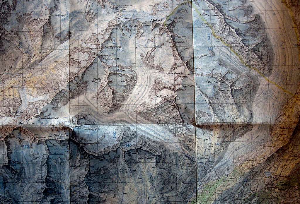
The map of Oberland
Accommodation
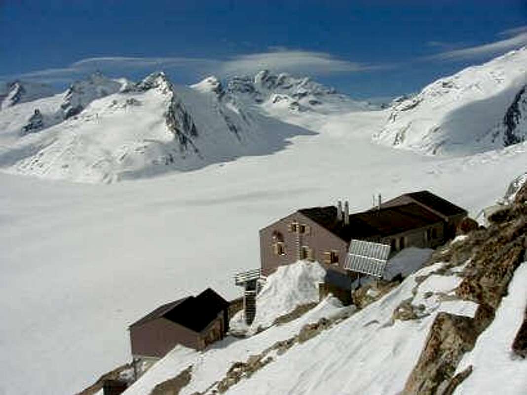
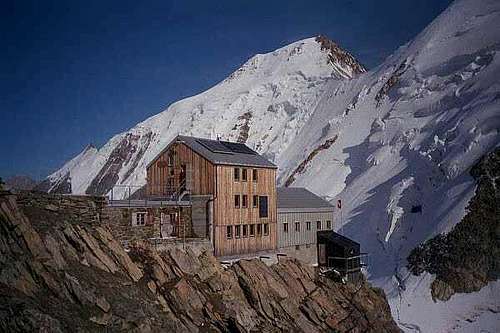
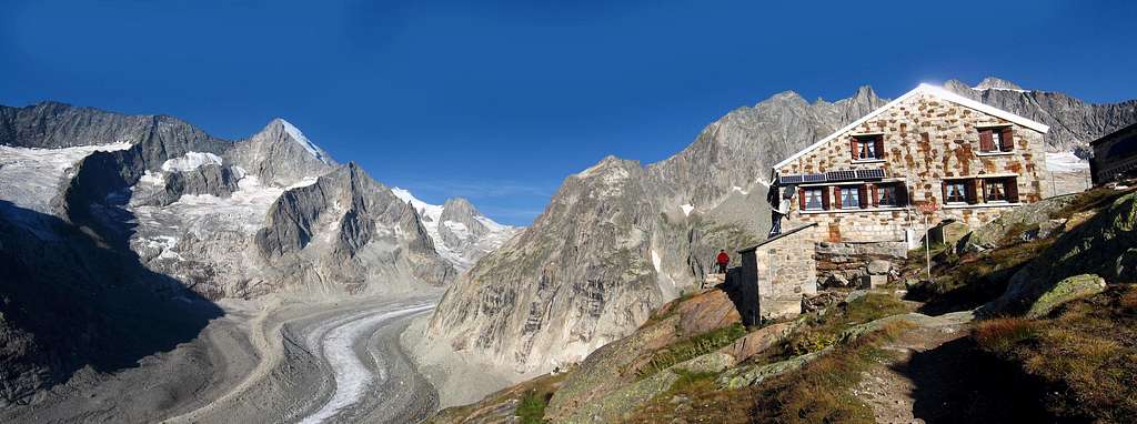
Huts 99% of the mountaineers in this area spend the night in one of the many huts that are very conveniently located. For example:
Moenchsjochhütte (further away only if others are full)
Camping is usually not the way to go here. You can certainly do it, and nobody will get into trouble, if you pitch your tent anywhere on the glacier at dusk and pack it away by dawn, even in the more crowded areas. In the more remote areas, you could probably also leave it for one day
 |
 |
Mountain Conditions
- Grindelwald:Accommodation, Weather and Snow reports, Webcam, U-Name-It ...
- Bergsteigerzentrum Grindelwald: Montaineers Info: Phone Numbers, Website, etc.
- Basislager.ch: Log of previous attempts,including description of ice conditions (German !)
Meteo
Aletschgletscher
Here are some photos from the longest glacier in the Alps.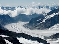
|

|

|

|

|
External Links
- Peakware Counterpart to this site More infos, more Summit logs
- slide show (scroll down for english captions) of my ascent in May 2003
- Aletschhorn at www.4000er.de Images, routes, coordinates and more information about the highest peaks of the Alps