

-
 5670 Hits
-
 78.27% Score
-
 9 Votes
|
|
Area/Range |
|---|---|
|
|
46.93566°N / 10.68439°E |
|
|
Hiking, Mountaineering, Scrambling, Skiing |
|
|
Spring, Summer, Fall, Winter |
|
|
11007 ft / 3355 m |
|
|
1 - Overview
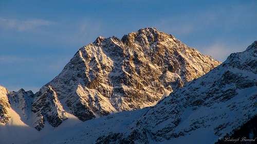
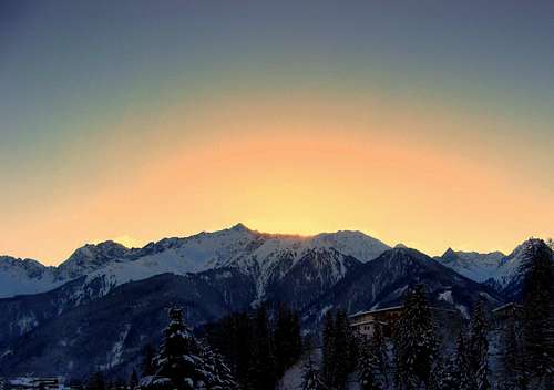
 The Glockturm: Bell's Tower by Mathias Zehring | 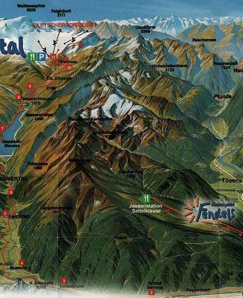 The Glockturmkamm |
The Glockturmkamm is the westernmost ridge of the Otztal Alps. The ridge is named after its highest mountain, Glockturm, which literally means ‘’Bell’s tower’’ because the shape of the mountain resembles it . The Glockturm is 11007 ft / 3355 m high and a popular hikers/climbers destination, especially in summer. Other well-known peaks in this range are Kuppkarelsspitze, a broad rock tower, Pfroslkopf and Glockhaus. The ridge is directed from North to South.
From north to south the ridge gains in elevation. The first higher peaks in the northern part of the ridge are Feichtener Karlspitze (2918m) and Kuppkarleskopf (2992m). From this poiint on the 3000m barrier is first exceeded by the Rifenkarspitzen (3008m). The highest point in the northern part of the range is Pfroslkopf (3152m). In the Southern part of the ridge most peaks are above 3000 meters with Glockturm being the highest at 3355m.
The glockturmkamm is one of the lesser visited areas of the Otzal Alps, since it is also one of the lowest subranges in altitude. It is also less glaciated as the neigbouring Kauergrat ridge. Still, it has multiple peaks of over 3000 meters, especially in the southern end of the mountain chain.
The Glockturmkamm Ridge is the first of the S-N ridges on the northern side of the border of the Otztal Alps. The ridge is 20 km long. The subgroup is bounded by
- the Inntal Valley to the north and west
- the Radurschlbach Creek to the south-west
- the Otztaler main ridge & Langtaufener valley to the south
- the Kaunertal Valley to the east
In the east the mighty Kaunergrat ridge borders the Glockturmkamm, in the west it is the northern part of the Samnaun Group with peaks like Furgler and Hexenkopf.
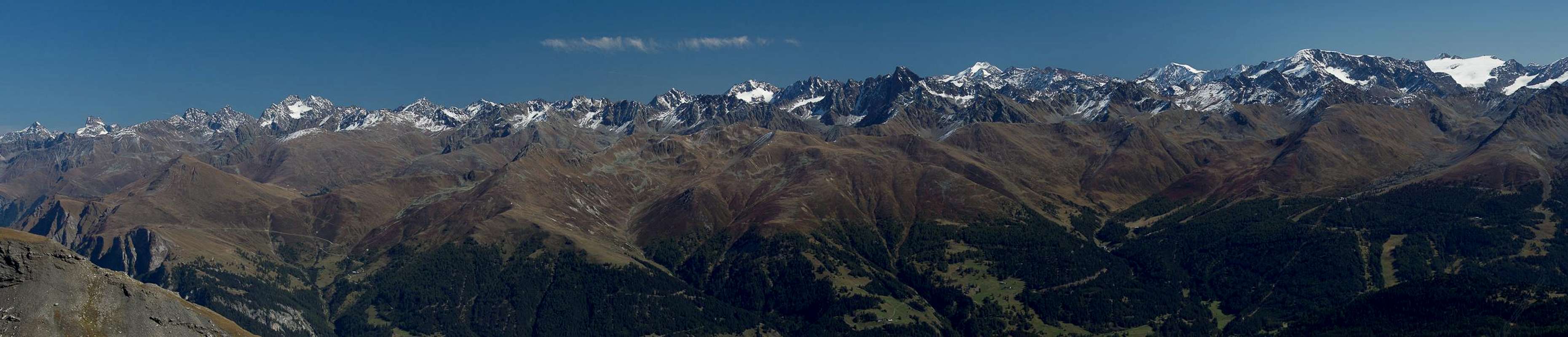
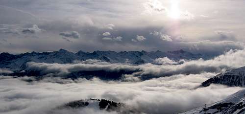
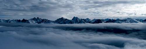 The whole Glockturmkamm above the clouds; The Kaunergrat ridge is behind it |
In the valley directly west of the Glockturmkamm (Oberinntal valley) there are multiple villages. From north to south bordering the ridge are Prutz, Ried (im Oberinntal),Fendels (up the mountain), Tosens and Pfunds. In the valley directly to the north and subsequently to the east of the Ridge (Kauntertalvalley) the villages are from North to south: Kaunerberg, Kauns, Nufels, Boden,Feichten im Kaunertal and Kuphoff. More to the south lies the Gepatch-Stausee Reservoir.
From north to south trough the Kaunertal valley goes the Kaunertaler Gletscherstrasse (Glacier Road). This toll-road leads up to the base of the Kaunertaler Glacier.The glacier with its ski facilities is the main tourist attraction in winterand in summer. Some of those people visiting the glacier also visit the mountains of the Glockturmkamm with the Glockturm itself as its major attraction.
Still, the Glockturmkamm remains a wild and rugged area. If you want to hike or climb in a great mountainous area, but you don’t want to see too many people; the Glockturmkamm is the place to go to. Even the 3000meter + peaks don’t see to many visitors each year. Pfroslkopf and Glockhaus are great examples of this. Standing on these mountains will offergreat views. To the west you’ll have a direct view on the mighty Kaunergrat with imprsesssive peaks like Rofelewand, Seekogel, Verpeilspitze and Watzespitze. Towards the east you look down on the Samnaun Group. Since most ofthe peaks in the northen part of this Group are below 3000 meters, you can evensee past the Samnaun Group towards the Nordliche Kalkalpen and towards Hoher Riffler/Verwall. Towards the south you can enjoy the view of the heavyglaciated Weisseespitze (3520m).
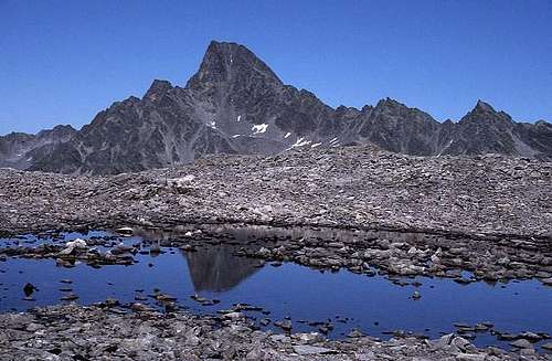
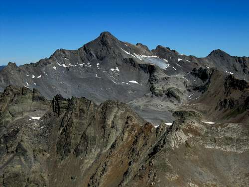
 Kuppkarlesspitze (2991m, W-Face) |
2 - Glockturmkamm on SP
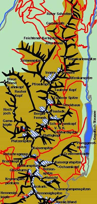
  |
- Glockturmkamm
3 - The Summits
- Roter Schrofen (Wetterkreuz, Hoher Ochsenkopf, 2704m)
![]()
- Gamsköpfe (2807m)
![]()
- Feichtener Karlspitze (2918m)
![]()
- Alter Mann (2883m)
![]()
- Kuppkarlesspitze (Rauher Kopf, 2992m)
![]()
- Äussere Rifenkarspitze (3003m)
- Mitterschragen (2966m)
- Innere Rifenkarspitze (3008m)
- Pfroslkopf (3148m)
![]()
- Zirmesspitze (2945m)
- Tauferer Kopf (3067m)
- Tauferer Spitze (3047m)
- Glockhaus (3101m)
- Bergler Fernerkopf (3104m)
- Fissladkopf (3113m)
- Atemkopf (2792m)
![]()
- Schwarzseekopf (3132m)
- Gebhardspitzen
- Vordere Gebhardspitze (3118m)
- Hintere Gebhardspitze (3110m)
- Vordere Gebhardspitze (3118m)
- Plattigkopf (3174m)
- Platzerspitze (3106m)
- Gamsköpfe (3110m, 3116m)
- Hochjoch (2896m)
- Rauher Kopf (2695m)
- Lahnkopf (2471m)
- Blaue Wand (2468m)
- Kaiserspitze (3090m)
- Rotschragenspitze (3113m)
- Bruchkopf (3013m)
- Rifflkarspitze (3219m)
![]()
- Höhlenspitze (3202m)
- Kaisergratspitze (3158m)
- Ochsenkopf (2944m)
![]()
- Gratfernerköpfe
- Western Gratfernerkopf (3007m)
- Eastern Gratfernerkopf (3003m)
- Western Gratfernerkopf (3007m)
- Planggeroßspitze (2949m)
![]()
- Riffljochturm (3237m)
- Glockturm (3355m)
![]()
- Habicht (3094m)
![]()
- Krummgampenspitzen (3111m, 3090m, 2885m)
- Krummgampenturm (3126m)
- Arzkarkopf (3121m)
- Hennesiglspitze / Punta della Gallina (3144m)
- Nasswanderegg (3066m)
- Nasse Wand / Croda dell'Acqua (Nasswandspitze, 3092m)
![]()
- Eastern Hennesiglkopf / Il Sasso (3119m)
- Western Hennesiglkopf / Il Campanile (3100m)


4- Main Mountains to be climbed
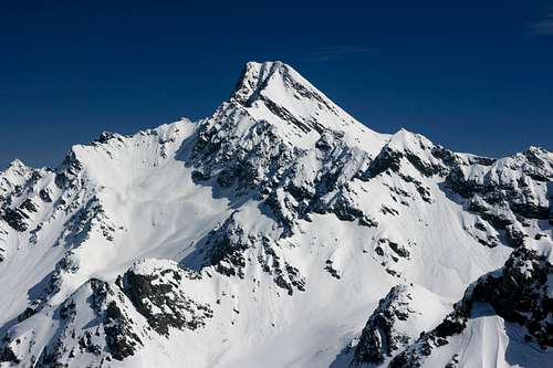 Glockturm (3355m) | Difficulty: T3+ Altitude Gain: 1020m Starting Point: Rifflerboden (2330m, along the glacier street) Duration (up & Down): 5 hours |
 Rifflkarspitze (3219m, the peak at right) | Difficulty: T3+ Altitude Gain:890m Starting Point: Rifflerboden (2330m, along the glacier street) Duration (up & Down): 4,5 hours |
 Pfroslkopf (3147m) | Difficulty: PD Altitude Gain: 900m Starting Point: Anton-Renk Hut (2261m) Duration (up & Down): 4,5 hours |
5 - Getting There
Glockturmkamm can be reached from two sides, Inntal Valley in the west and Kaunertal Valley in the east. Both connect at Prutz to the north-west of the subrange.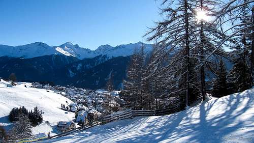
Glockturmkamm & Serfaus
From Austria:
- Take motorway A12 / E60 to Landeck
- Switcch to B180 into Inntal Valley
From Italy:
- Take Motorway A22 to Bozen / Bolzano
- Switch to SS38 to Sponding / Spondinga
- Stay on course on SS40 to Reschenpass / Passo di Resiawhere it turns into B180 north of the Austrian border
From Switzerland:
- Take motorway A3 and A13 to Landquart
- Switch to B28 across Flüelapass to Susch
- Switch to B27 to Vinadi
- Across the border the road turns into B180 through Inntal Valley
6 - Accommodation
Mountain Huts:
| Name | Elevation | Summer | Winter | Telephone | Photo |
| Hohenzollernhaus | 2123m | june - oktober; 40beds | 15 lager | 0043/664/5311915 | 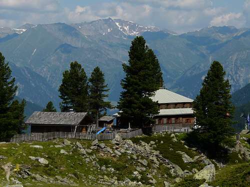 Hohenzollernhaus |
| Gepatschhaus | 1928m | june -september; 46 beds, 60 lager | 8 lager | 0043/664/4319634 | 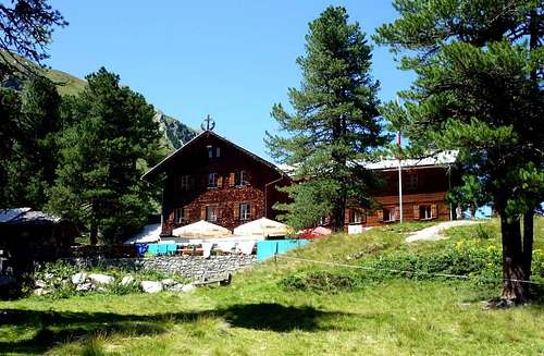 Gepatschhaus |
| Anton-Renk Hutte | 2226m | No host; 6 lager | 6 lager | 0043/676/4073503 | 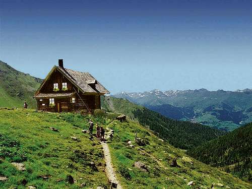 Anton Renk Hut |
7 - Red Tape
There's no red tape to speak of on Glockkturmkamm. The southernmost part runs along the border between Austria and Italy so that taking an ID is mandatory.8 - Weather Conditions
Glockturmkamm Panorama from Serfaus
9- Maps & Books
8.1 - Maps
- Ötztaler Alpen, Kaunergrat
Map No: 30/3
1:25000
ISBN: 978-3928777414
- Ötztaler Alpen, Nauderer Berge
Deutsche Alpenvereinskarte 30/4
1:25000
Art.Nr: 100031
- Landeck - Nauders - Samnaungruppe
Kompass Map WK42
1:50000
ISBN: 978-3-85026-542-3
- Ötztaler Alpen
Kompass Map WK43
1:50000
ISBN: 3-85491-049-5
8.2 - Books
- Ötztaler Alpen
W. Klier
Alpenvereinsführer
Rother Verlag
ISBN: 3-7633-1123-8
- Kaunertal – Oberinntal
Hubert Mayr
Rother Verlag
ISBN: 978-3-7633-4027-9