
-
 6196 Hits
-
 81.18% Score
-
 13 Votes
|
|
Area/Range |
|---|---|
|
|
46.75021°N / 10.62103°E |
|
|
Hiking, Mountaineering, Skiing |
|
|
Spring, Summer, Fall, Winter |
|
|
11394 ft / 3473 m |
|
|
1 - Overview
 Portles Spitze, Pleres Spitze, Gabelz Spitze, Valvel Spitze, Rabenkopf Portles Spitze, Pleres Spitze, Gabelz Spitze, Valvel Spitze, Rabenkopf |
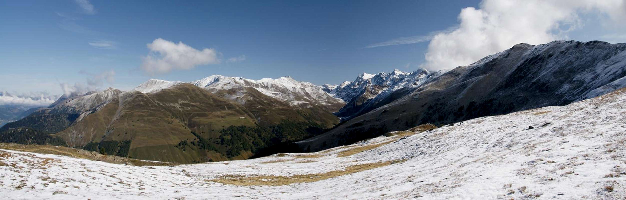
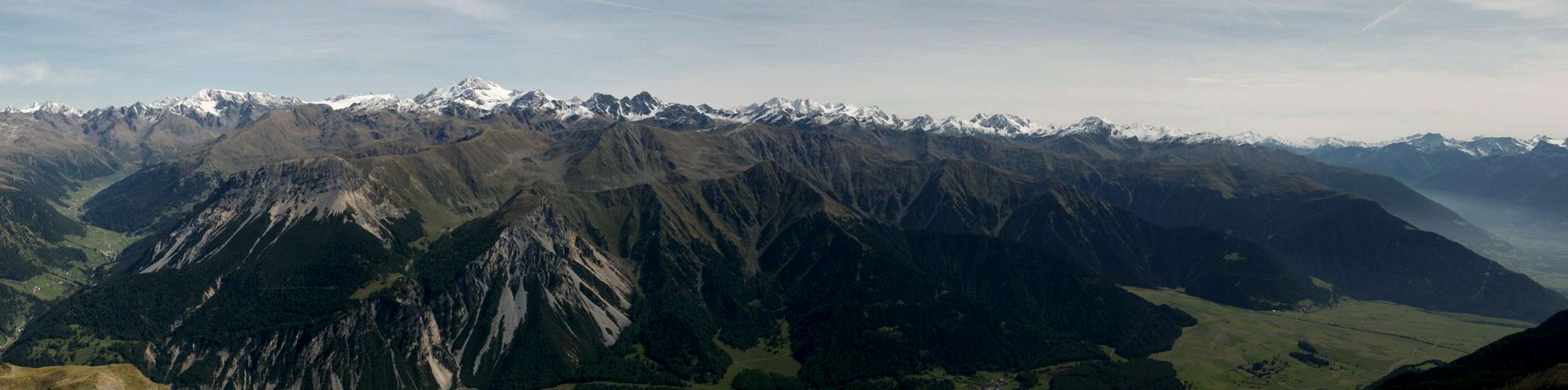
In the south-west of the Ötztal Alps you find an obscure mountain group, which nevertheless makes its appearance on many a photo of the area: Planeiler Berge. The name means Planeil Mountains and is based on the village and valley of Planeil / Planol, which turns off nothwards from the large and well known Vinschgau Valley / Val Venosta. The name makes its appearance mostly in the mountain listings of the German and Austrian Alpine Clubs while I'm not aware of any specific Italian name for the group though it is located on Italian ground exclusively (Monti di Planol would be the best guess). It shares its somewhat murky naming state with its direct neighbour, Saldurkamm but in an area where the vast majority still speaks German this might not be too surprising.
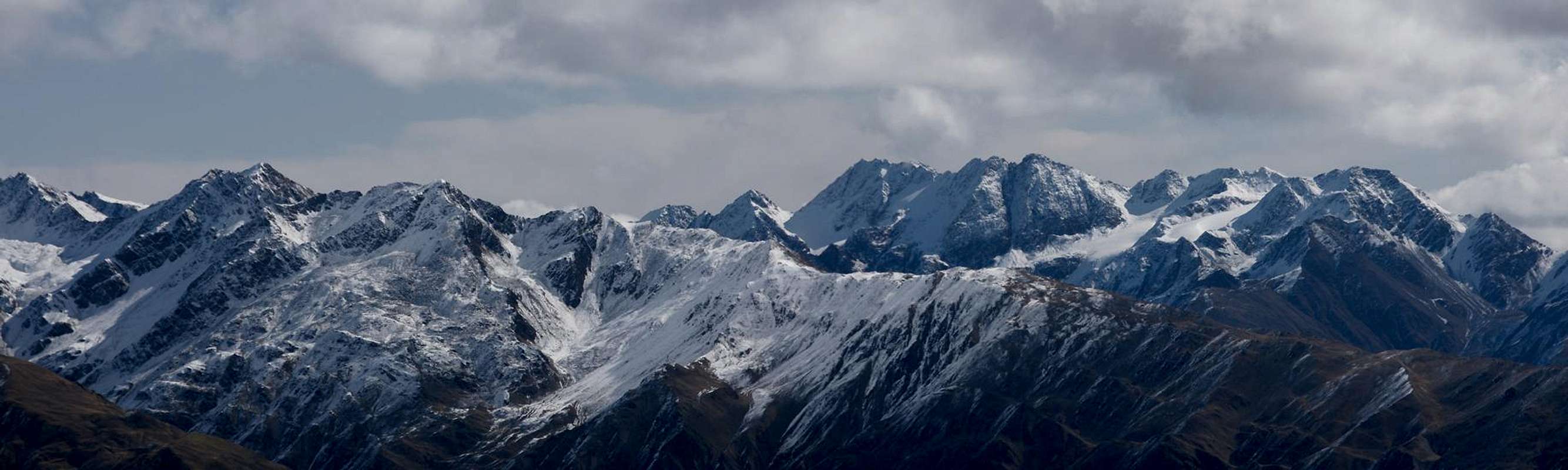
The group consists of two ridges which frame Planeiltal / Valle di Planol and which come down from the mighty Weißkamm Ridge in soth-westerly direction. In addition, a third smaller ridge can be found in the north-west of the group. It consists of three mountains which form a vast pasture above the confluence of Langtauferer Tal / Vallelunga and Vinschgau / Val Venosta. Only few glaciers remain in the group and all can be found in its very north where it connects to Weißkamm. Here, also the highest mountains can be found, all 3000ers with Äusserer Bärenbartkogel / Cima Barba d'Orso di Fuori being the highest one.
The eastern ridge contains a number of rocky peaks but runs out in a broad, plateau-like ridge which stretches between Jafant and Spitzige Lun / Piz Lun. From there it quickly drops down the remaining 1000m to the Vinschgau valley floor. The eastern ridge is similar but here you find only very few rocky mountains in the north. And the Endkopf Group, as has been mentioned before, is a large plateau. Consequently much of the group is used for cattle and horse grazing. Though many of the pastures can be well above 2000m they still are a reasonably good feeding ground. Several summer farms can be found high up in the group.
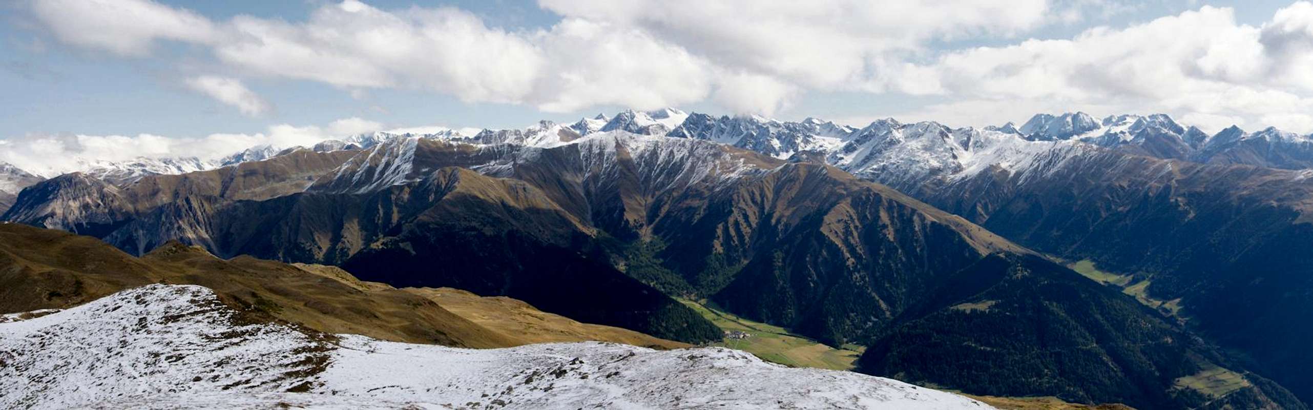
Though there are many trails in all parts of the group, most of them are very solitary. The sole exception is Spitzige Lun / Piz Lun, the south-westernmost cornerstone of the group. It can be found in any of the guidebooks which cover the area and is famous for its exceptional views. In winter, however, matters are turned upside down. The most prominent ski tour peaks all lie in the north and east of Planeiler Berge, passing by the south-western part completely. The north-eastern mountains cannot be reached by hiking trails and remain interesting mountaineering destinations. The vicinity of mighty Weißkugel / Palla Bianca ensures that they remain rarely climbed, however. There are no mountain huts within the Planeiler Berge Range.
2 - Planeiler Berge on SP
  |
- Planeiler Berge
3 - The Summits
 |
- Äusserer Bärenbartkogel / Cima Barba d'Orso di Fuori (3473m)
![]()
- Freibrunner Spitze / Cima della Fontana (3366m)
![]()
- Rabenkopf / Cima dei Corvi (3394m)
![]()
- Valvelspitzen / Punte Valbella
- Northern Valvelspitze / Cima Gabelz di Dentro (3334m)
- Southern Valvelspitze / Punta Valbella (3360m)
![]()
- Gawelzspitze / Gabelz di Mezzo (3176m)
![]()
- Pleresspitze / Cima di Pleres (3188m)
- Portlesspitze / Pizzo Portles (3074m)
![]()
- Jafant (2899m)
- Hohes Joch (2593m)
![]()
- Niederes Joch (2474m)
- Spitzige Lun / Piz Lun (2324m)
![]()
3.2 - Western Ridge
- Roter Kopf / Cima Rossa (3244m)
- Rotebenkogel / Cima del Piano Rosso (3157m)
- Falwanairspitze / Punta di Val Benair (3199m)
![]()
- Am Tiergarten (3068m)
![]()
- Schwarzer Kogel (2996m)
- Mitterlochspitze / Punta Luco di Mezzo (3174m)
- Rote Köpfe (3148, 3053, 3050m)
- Danzewell / Cima Dentrovalle (3148m)
- Zerzerköpfl (2955m)
- Mittereck / Punta di Mezzo (2909m)
- Steinmandlköpfl / La Mandola (2817m)
- Kofelboden / Piano del Covolo (2604m)
- Steinmandl (2482m)
- Salisatis (2106m)
- Großhorn / Corno Grande (2630m)
3.3 - North-Western Ridge
- Habicher Kopf / Cima Sparvieri (2901m)
- Angerlikopf (2822m)
- Endkopf / Cima Termine (2652m)
![]()
3.1 - Eastern Ridge


4 - Getting There
 |
Main access to the group is from three sides: Vinschgau / Val Venosta in the west, Matscher Tal / Val di Mazia in the east and Langtauferer Tal / Vallelunga in the north. The latter two valleys can be reached from different points in Vinschgau / Val Venosta. Planeiltal / Valle di Planol itself can be used for access as well but there are only few hiking trails to the lowest, outlying mountains of the group.
From Austria
- Take B180 from Landeck, which at the border turns into SS40 / SS38.
- Follow the road through Vinschgau / Val Venosta and both Langtauferer Tal / Vallelunga and Matscher Tal / Val di Mazia turn off to the left from it.
From Italy
- Take SS38 from Bozen / Bolzano passing Meran / Merano into Vinschgau / Val Venosta
From Switzerland
- Take B28 across Ofenpass / Pass dal Fuorn and through Münstertal / Val Müstair.
- At the border it turns into SS41 to Glurns / Glorenza.
- There turn onto SS38 east or north into Vinschgau / Val Venosta.
5 - Accommodation
6 - Red Tape
There's no red tape anywhere in Planeiler Berge.7 - Weather Conditions
 |
8 - Maps and Books
Maps
- Vinschgau / Val Venosta
Kompass Map WK52
1:50000
ISBN: 978-3-85491-058-9
- Alta Val Venosta / Vinschgauer Oberland
Tabacco Map 43
1:25000
Books
- Ötztaler Alpen
W. Klier
Alpenvereinsführer
Rother Verlag
ISBN: 3-7633-1123-8
- Vinschgau
Rother Wanderführer
Rother Verlag
ISBN: 978-3-7633-4204-1
- Vinschgau / Ortlergruppe
Kompass Wanderbuch 950
Kompass Verlag
ISBN: 3-87051-404-3