Kolakchal

Page Type Page Type: Mountain/Rock
Location Lat/Lon: 35.85920°N / 51.45750°E
Additional Information Elevation: 10991 ft / 3350 m
Sign the Climber's Log

Overview


south-east view from near Sad'abad castle
 

Introduction to Tochal massif


Tochal massif or the mass of mountains covering north Tehran, actually compacted with the city, are a vast east-west sub range of the Alborz mountains which build one of the most south ridge lines of Central Alborz, including some distinct peaks with the highest point (3964m) called Tochal peak or Sar Tochal.
These mountains build a big wall at the north part of Tehran. Being a part of the city, giving a great site and view to the capital of Iran.

The base of south slopes and routes of these mountains are one of the north Tehran areas like Velenjak, Darband, Darabad, Golabdarreh, Darakeh... the slopes rise up fairly steep from this regions with about 1800m altitude.

Tochal slopes are always full of people sometimes to much crowded, there is no record of the number of trekkers and climbers but I'm sure it's one of the most climbed and trekking mountains in the world.

The main east-west ridge line of Tochal holds this peaks:
 
Shahneshin(King's seat) 3850m
Hoomand 3900m
Tochal 3964m
West Lezoun 3600m
East Lezoun 3500m
Darabad 3100m
 
The sub east-west ridge line south and parallel to main Tochal ridge line  holds this peaks:
 
Spillet ("Es-Pi-let") 3120m
Kolakchal2 (Kolakchal west) 3330m
Kolakchal (Kolakchal east) 3350m

Click for Introduction to Central Alborz Mountains
Click for Map of Central Alborz
Click for Nader's Tochal page
Click for Nader's map of Tochal massif
 

Kolakchal


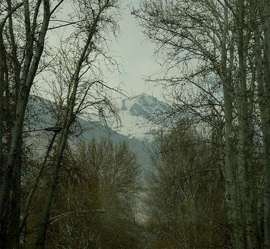
south view from Farmaniye

Koolak means heavy storm, and Chal means pit in Persian so Kolakchal would mean storm pit.

Kolakchal summit area serves heavy storms, on a winter or spring morning when the air is clear, watching Kolakchal from north Tehran, you can clearly see the powdery snow vastly being spread in the air.

This peak is the most distinct and photogenic peak of the south Tochals, it looks like a perfect cone with a narrow peak from western parts of Tehran and like a big straight rocky wall dominating some part of the city from east Tehran.
You can take great pictures of it from north Tehran and take the most great pictures when going up on the Tochal tele-cabin line.

South face:
Under the summit there is a cliff called Kolakchal wall.
At 2750m there is a vast plate, lot's of people trek to this point all the time, there is a playground, restaurant, shelter and a funny spiral white building that can be seen from Tehran, at nights the lights are on so  you can see a shining white point on the mountain.
Lower slopes drop down fairly steep to Golabdare valley and Jamshidiye park (parts of north Tehran), the trekking route is fairly easy.

North face:
At north of the peak there is a valley called Piazchal valley which joints the ridgeline including Kolakchal to Tochal's ridgeline, when climbing to Tochal summit you will clearly see the north face of Kolakchal and Piazchal valley, a river flows in the valley it's spring is under Kolakchal summit.

From west Kolakchal joints to the rocky block of
Spillet (Band-e-Yakhchal)3120m, and from east the ridgeline goes on a bit then drops down fairly steep by rocky and scree slopes.

Ignoring Kolakchal ! when I'm climbing from Darband, first I'm enchanted by the beauty of Kolakchal so I'll decide to climb it, but when I reach to Shirpala shelter, the majesty of Tochal will capture me to climb Tochal instead of Kolakchal ! anyway if you feel you are out of shape, you can first climb Kolakchal, it would be a good pre climbing for Tochal.
Some people climb Tochal via Kolakchal in two days.

Summery: Kolakchal is an easy and fun trekking climb !

* There are two peaks one at the top of the Kolakchal wall(3300m) and one a little bit back-east to it (3340). In some maps the Kolakchal peak is marked 3340m and in some 3300m leaving the 3340m peak un-named. I can think Kolakchal is these two peaks!
 

About Iran and Tehran


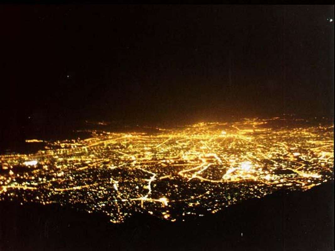
Tehran from Tochal summit

 
[I added this section to give a small glance to people who want to travel to Iran]

Iran is high plane hosting two vast ranges of mountains Alborz and Zagros including hundreds of 4000+m summits. Even taught there are two big deserts in the middle of Iran still it's been said 3/4 of the plane is covered by mountains, there are still lots of 4000+m and 3000+m outside the Alborz and Zagros ranges scattered all over the Iran plane like Kerman mountains and Taftan volcano, the weather varies from dry hot to mountain conditions and to the thick green lush and humidity of the north Caspian sea coast.
The behavior of Iranians is friendly and they are helpful to foreign people from Europe and America (this friendly behaves may no be applied to Arabs), you can quickly make a friend who would be glad to guide you and stay beside you and invite you to his/her home.

The pipe-supplied and mineral water and food served in restaurants and supplied from stores is safe (avoid food from road sellers in downtown).

Security is granted by the police, there are two kind of polices in Iran the green ones and the blue ones, blue is only for traffic control, greens are for security and criminal matters.

Alcoholic drinks are forbidden in Iran, Christians won't be punished for carrying, anyway most people use drinks in their house and parties illegally and they have their own illegal alcohol suppliers who supply drinks from Iranian native drinks to Russian and western drinks, if you needed drinks you can easily find it illegally.

Tehran is like a slight slope for Tochal, the down town 1200m to the north 1800m, downtown ends to central desert planes so there is no high zones to dump Tochal's view that's why Tochal can be seen from miles away. Even the weather differs about 5~10 centigrades north Tehran to South Tehran, it might be snowing in Velenjack while raining in city center! the air is cooler and cleaner at north. The city area (buildings and roads) suddenly end at a 1800m~1900m border where the mountain slopes rise up steeply from there, this is the placement of the north Tehran fault which may causes dramatic earthquakes.

Tehran has four distinct seasons, summer is dry and hot 26~40 centigrades (almost clean air), autumn is moderate half dry half rainy (polluted air), winter is cold with snow falls specially heavy at north Tehran -10~10centigrades (almost clean air), spring is moderate and rainy (cleanest air).

Tehran is Secure, too much crowded, heavy traffic, people drive in a bad and madly mood, friendly to foreigners less friendly to Iranians ;) try to stay in north parts of the city.
60% of the water supply of Tehran is from the pure water sources of the northern mountains (too pure and poor of minerals), the water supply is pure and clean anyway use bottled mineral water.

One of the hobbies for people specially those who live in north Tehran, these days is trekking on the lower slopes of Tochal at night, Bame-Tehran is the trail from Velenjak st. to Tochal Telecabin's first station, there are some restaurants, coffee shops, a gym and a pain ball ground by the trail, lot's of boys, girls and old people trek the trail, anyway I'm not too proud seeing a gym and cars driving often in the mountain area  and a paint ball ground located at the base of a secret route I used to climb.


Getting There + Normal Routes...

South routes:

Red lines are routes, left to right :
1-Darband sarband route
2-Routes and sub routes to Spillet area
3-Golabdarreh route
4-Jamshidiyeh park route
5-Darabad routes


West route:

Darband-Sarband:
The most obvious, simple and straight forward main starting point to Tochal, Kolakchal, Spillet and Lezoun peaks is Darband st - Sarband SQ.

The first part of this route heads up northward:

Go to Tajrish SQ. at north Tehran (you can reach Tajrish from almost anywhere in Tehran by a taxi), the north street from Tajrish SQ. reaches Sarband SQ. via Darband road (take a taxi shouting "DARBAND DARBAND").
Hike to Pas-e-ghal-e village(1900m) or bypass the boring hike using the big elevator and chair lift (for 500tomans or about half a $).
At the end part of the village there is a 3way go in to the middle branch and reach Shirpala shelter(2750m) by the steep guarded rocky route.

The second part of this route hits Kolakchal summit from west:

From Shirpala shelter looking east you will see the rocky mass of Band-e-Yakhchal and Spillet(3120m), you have to hike through the valley between north face of Spillet and south face of the Tochal crest slopes.
The route is obvious enough to reach Kolakchal without any problem.

Jamshidiyeh park (normal south route):
To reach Jamshidiyeh park from Tajrish SQ. take a Jamshidiyeh park taxi or drive toward east from Tajrish SQ. and follow the road until you are on Niavaran road, one of the steep roads that branch toward north named Amirarsalan (Manzariyeh area) ends up the Jamshidiyeh park parking.

The first part of the route is a zigzag hiking trail which ends at the Kolakchal big shelter at 2400m.  Kolakchal big shelter is located at a big flat made to hike ground restaurant and playgrounds... almost all people trek to this place and back and no more.

Kolakchal steep south slope, Kolakchal wall and summit are located directly at the top of this place, you may customize your own route and start a fairly technical climb heading north, or you may go on the normal route. The normal route is to climb north-west until you are on the blade looking Spillet-Kolakchal ridge at the 3000m saddle, south joints the west route and you have to climb the end trail on the west route.

Golabdareh valley (a south route):
Go to Tajrish SQ., go to Golabdareh street (take a taxi shouting "GOLABDARE GOLABDARE"), follow on the Golabdarreh hiking route until you clearly see the Jamshidiyeh park route above a hilly slope at right(east), climb up until you are on the route...
East/south-east:
Reach Darabad area, from Tajrish SQ. take a Darabad  taxi or drive toward east from Tajrish SQ. and follow the road until you are on Niavaran road follow until Niavaran SQ. take the north-east branch and you are at Darabad road and area you will have two options:

1-After the Darabad animal gallery/zoo head up the trail from a place named Rahman-abad.
2-Reach Darabad - Darabad parking and trekking area - two routes branch from here the right route goes into the Darabad mountains and the left route followed by the river reaches Kolakchal.

Both options finally join at 2300m, just climb north-west until you reach Piazchal valley and the north side of Kolakchal peaks (3340m and 3300m).

 
North routes:
 

The north face is actually a short soft slope dropping into the high Piazchal valley. Descending or ascending this slope happens when a climber is ascending to the main Tochal crest via Kolakchal and Lezoun peaks of descending from the crest to Tehran.


Red Tape and Regional Hints

The whole Alborz mountains area and it's wild nature is a protected place, hunting, fishing and abusing the nature is prohibited
No fees of permission is required for climbing or camping
Before performing a climb on Tochal peaks from south first make sure that the air is clean, an air inversion in Tehran, would only bring you hell on the mountain, ... climbing with headache ! all spring days, most winter days, some summer days and few autumn days are clean
All parts of north Tehran mountains become too much crowded on holidays and Fridays, people come there to hike. I don't recommend climbing in these days. if you are serious to do it start before 5am.

When To Climb

Best Spring and autumn
Photography Spring and winter
Summer I really hate climbing under straight burning sunlight with you may not!
Winter Heavy snow, storms and windy... but still I believe climbing on a clear sunny winter day is the best option.

Mountain Conditions

In General:

Summer Dry, hot at lower parts.
Winter Heavy snow and serious snow storms at the top, I hear about deaths of people who underestimate the conditions of Tochal massif every year ! the conditions are not always mellow.
Avalanches occur so often on Tochals after snowfalls and that's a danger for those who climb out of route and forget that avalanches occur on the Tochals (the normal routes are safe).

Snow Forecast:
There isn't a direct forecast for Kolakchal peak on this site but the weather is mostly to be like the Tochal, the peaks on Tochal massif are close to each other and likely have the same conditions at the same altitudes. for Kolakchal summit you can think of something between 2897m and 3962m:

1832m
3962m
2897m

Nader's snow melt-off reference:
Note that the very right doted peaks are Kolakchal

April 15, 1981.
April 26, 1981.
May 11, 1981.
May 23, 1981.
June 3, 1981.
July 11, 1981.
August 7, 1981.


Children

Children

Children refers to the set of objects that logically fall under a given object. For example, the Aconcagua mountain page is a child of the 'Aconcagua Group' and the 'Seven Summits.' The Aconcagua mountain itself has many routes, photos, and trip reports as children.