
|
|
Mountain/Rock |
|---|---|
|
|
35.85580°N / 51.44480°E |
|
|
10236 ft / 3120 m |
|
|
Overview
 Spillet summit | |||||||||||||||||||||||||||||||||||||||||||||||||||||||||
| Introduction to Tochal massif | |||||||||||||||||||||||||||||||||||||||||||||||||||||||||
|
Click for Introduction to Central Alborz Mountains | |||||||||||||||||||||||||||||||||||||||||||||||||||||||||
| Spillet / Band-e-Yakhchal / Shervin / Ossoon walls | |||||||||||||||||||||||||||||||||||||||||||||||||||||||||
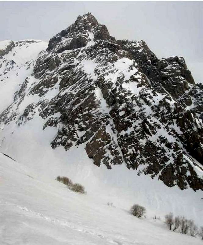
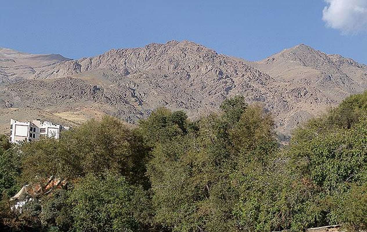 Spillet and Kolakchal South-east to Tochal summit, east to Kolakchal summit and above Pas-ghal-e village is the most rocky, ragged and technical part of the Tochals making six or seven narrow lower peaks having about 3000m height and the heighest peak is named Spillet(3120m). This extremely rocky crest is limited to Abshar-do-Gholoo waterfall and Darband river from west and ends to a 3000m saddle from east after the saddle the narrow ridge rises up and connects to Kolakchal peak. South and north faces are solid 5m~20m~100m~200m blocks of walls shaped rocks good for technical practicing, the amount of broken blocks of rock fallen down from the south face make a big plane looking like a cemetery of rocks above Pas-Ghal-e village passing this zone needs care, the gaps between the blocks are deep I can't think of falling in them, this place is the practice zone for rock climbing schools and beginners, they work on the bigger blocks. There are both technical and easy scrambling routes to the crest and Spillet summit. The base of this sedimentary block starts from 2100m, with a top-down height about 1000m. Rocks are commonly low. The most impressive thing about this area is the solid vertical Shervin/ Band-e-Yakhchal wall located at the south east part, the shining wall can been clearly seen from most parts of Tehran there is a cap at the top. There is a hut at the base of the wall called Shervin hut. Shervin was a climber who has died on this wall, the wall and the hut are dedicated to his name. Also there is a wall in northern part with 120m height, about 20 to 25 meters of route had been already set up by fixed protection like rolls. 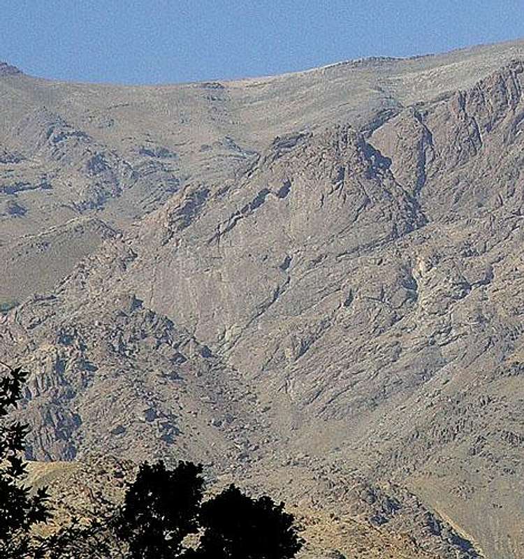 The wall and the cap Shervin wall needs a technical climb, but I have climbed to the top by passing the wall from the right ragged edge, the rocks are stable and no technical equipments needed at summer, anyway the scrambling is crazy and I didn't see anyone crazy enough as me to climb that part ! Where is Ossoon ? Ossoon is the valley west to Darband river Ossoon route at this valley is a beautiful but longer route to Shirpala shelter and Tochal's Gooll-e-band ridge, the rock wall north to the route and valley are named Ossoon walls, these are actually the west follows of Spillet and Band-e-Yakhchal block. The weather is mostly like north Tehran, almost moderated but being unsheltered under the sun hurts at mid summer, the snow melts faster than the other parts of Tochal and hard mountain conditions usually don't exist. Anyway if the other peaks of Tochal massif are a walk up or a hike, this zone of the massif gives a chance to the rock challengers. | |||||||||||||||||||||||||||||||||||||||||||||||||||||||||
| About Iran and Tehran | |||||||||||||||||||||||||||||||||||||||||||||||||||||||||
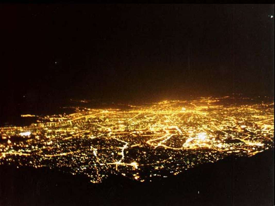 Tehran from Tochal summit | |||||||||||||||||||||||||||||||||||||||||||||||||||||||||
| [I added this section to give a small glance to people who want to travel to Iran] Iran is high plane hosting two vast ranges of mountains Alborz and Zagros including hundreds of 4000+m summits. Even taught there are two big deserts in the middle of Iran still it's been said 3/4 of the plane is covered by mountains, there are still lots of 4000+m and 3000+m outside the Alborz and Zagros ranges scattered all over the Iran plane like Kerman mountains and Taftan volcano, the weather varies from dry hot to mountain conditions and to the thick green lush and humidity of the north Caspian sea coast. The behavior of Iranians is friendly and they are helpful to foreign people from Europe and America (this friendly behaves may no be applied to Arabs), you can quickly make a friend who would be glad to guide you and stay beside you and invite you to his/her home. The pipe-supplied and mineral water and food served in restaurants and supplied from stores is safe (avoid food from road sellers in downtown). Security is granted by the police, there are two kind of polices in Iran the green ones and the blue ones, blue is only for traffic control, greens are for security and criminal matters. | |||||||||||||||||||||||||||||||||||||||||||||||||||||||||
Getting There
| Darband-Sarband route to south/north face -> Amateur/ practise/ beginears / low rocks / Shervin, Band-e-Yakhchal wall: (Case 2) The easier route to Spillet summit is obvious at right, there is a thick short ridge, keep right and hike to the summit, the upper parts needs some scrambling. |
| Golabdareh valley: Go to Tajrish SQ., go to Golabdareh street (take a cab shouting "GOLABDARE GOLABDARE"), hike the route until you reach a two way, keep left soon you have to scramble the east/ south-east route to Spillet summit. |
Red Tape and Regional Hints
| The whole Alborz mountains area and it's wild nature is a protected place, hunting, fishing and abusing the nature is prohibited |
| No fees of permission is required for climbing or camping |
| Before performing a climb on Tochal peaks from south first make sure that the air is clean, an air inversion in Tehran, would only bring you hell on the mountain, ... climbing with headache ! all spring days, most winter days, some summer days and few autumn days are clean |
| All parts of north Tehran mountains become too much crowded on holidays and Fridays, people come there to hike. I don't recommend climbing in these days. if you are serious to do it start before 5am. |
When To Climb
| Best | October to May |
| Photography | October to May |
| Summer | Unguarded work under the extreme sun beams and there is no way to find a shadow! I do hate climbing at summer. |
| Winter | I believe climbing any of Tochals at a clear winter day is the best "when". |
Mountain Conditions
In General:
| Summer | Hot and dry. |
| Winter | Better to climb when the mountain is not under fog and snow falls. Avalanche danger after heavy snowfalls on the steep slopes before the rocky sections. |
Snow Forecast:
There isn't a direct forecast for Spillet peak on this site but the weather is mostly to be like the Tochal, the peaks on Tochal massif are close to each other and likely have the same conditions at the same altitudes. for Kolakchal summit you can think of something between 1832m and 2897m:
1832m
3962m
2897m
Nader's snow melt-off reference:
Note that the second right doted lower peak in front of the others is Spillet.
April 15, 1981.
April 26, 1981.
May 11, 1981.
May 23, 1981.
June 3, 1981.
July 11, 1981.
August 7, 1981.