

|
|
Area/Range |
|---|---|
|
|
40.15690°N / 124.1231°W |
|
|
4087 ft / 1246 m |
|
|
The Lost Coast - Please Note:

*Please note that I've recently adopted this page after the original owner, Henry Timmer, left SP abruptly. It will take me a little while to rebuild it and though it will never hold a candle to Henry's former page, I'll do my best. Thanks for your patience.
Introduction to the Lost Coast and the Kings Range
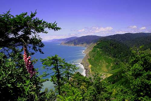
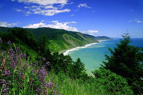
The Lost Coast and the Kings Mountain Range is a stunningly beautiful and remote chunk of wilderness. While some folks may believe that an area such as the Lost Coast and the Kings Range do not deserve a seat at the table, if you have a chance to go there and experience the trails and mountains, the draw of this magical place may change your mind. It is simultaneously a place for fitness and climbing, and a place to relax, heal, and rebuild for a future high-altitude climb. Depending your pace, it can be a relaxing or strenuous multi-day trek. There are also day-hiking options from the South, from the North, or from Shelter Cove. Primitive resupplying in Shelter Cove is also possible.
Climbing and Hiking Trails
If you are hiking the Lost Coast trail from one end to the other, there are two ways to do it: south to north or north to south. Highway 1 abandons the coast for this 40 or so mile section of coastline, requiring the California Coast lovers to earn their views with hiking boots rather than with the internal combustion engine.
There are actually a number of trails that split off of the main lost coast trail as well. Some of them lead up into the mountains, some of them provide a different route and parallel the existing Lost Coast Trail. A few are listed below:
- Horse Mountain Creek Trail
- Buck Creek Trail
- Rattlesnake Ridge Trail
- King Crest Trail
- Lightning Trail
- Kinsey Ridge Trail
- Spanish Ridge Trail
- Cooskie Spur Trail
- Cooskie Trail
![]()
Overview
The Lost Coast and Kings Range can roughly be divided into two sections: a north section and a south section, with the small seaside hamlet town of Shelter Cove dividing the two sections.
There are two main sections to the Lost Coast trail. Put together, they represent the Lost Coast.
The northern section is contained within the BLM King Range wilderness section. This 24 mile stretch of trail follows the coast from the resort hamlet of Shelter Cove to the south to the Mattole River to the north.
The southern section is located within the Sinkyone Wilderness California State Park. This 16 mile section of steep coastline trail, characterized by rugged topography and spectacular wilderness views, runs along the coast to the south of the King Range.
Watch out and plan carefully vehicle access-wise. Wet weather - and the Lost Coast gets 100-120 inches of rain per year - makes many of the access roads impassable and dangerous. Plan accordingly. If buckets of rain are forecast, go down to Bishop or something else.![]()
Directions to Northern Section of the Lost Coast
If you decide to begin from the North Trailhead, you'll be starting at the Mattole River. This is probably the most popular direction to go -- North to South -- if you are through-hiking. There is also a campground located at this end -- the Mattole Campground. To reach the Mattole campground, take 101 South to Hwy 211 through Ferndale. Follow signs toward Petrolia, turn on Lighthouse Road toward the ocean. The Mattole Campground is semi-developed with picnic tables, cooking grills, a portable restroom, and water supply.![Lost Coast Bouldering]()
The southern portion of the trailhead begins near the town of Shelter Cove. Go west from Highway 101, exiting in the town of Redway. Follow the road 22 miles from Redway out to Shelter Cove, following the signs to Shelter Cove, King Range National Conservation Area.
The Northern Portion of the Lost Coast Trail
This is primarily wilderness hiking along the beach. The entire section runs 22-25 miles one way, depending on where you left your car.
Unlike the southern portion of the trail, the northern section trail has less topographic relief, and the seasonal water supply in the streams is less reliable, according to the BLM. This is true wilderness country and you are on your own.
In places, the trail/path is impassable at high tide, so be armed with a tide table to plan the journey accordingly. These tables can be obtained from the BLM ranger station along the way to Shelter Cove or the BLM office in Arcata.![]()
Directions to Southern Portion of Lost Coast Trail
The southern access to Sinkyone Wilderness is from the Usal Road/Mendocino County Road 435. To get to Usal Road, exit Highway 101 at Leggett, taking Highway 1 westbound for 15 miles or so. Drive until you reach the turnoff for Mendocino County Road 435/Usal Road. It is well disguised, so if you reach the coastline, you went too far.
Take Usal Road for 6 miles until reaching the Usal Campground. Drive through the campground to its end, the trailhead is located to the left of the road. Usal Road is maintained, but impassable to two-wheel drive roads after and during the frequent rainstorms that ravage the Lost Coast.
The northern access to the Sinkyone Wilderness State Park is accessed via Briceland Road. Like access from to the southern portion of the King Range portion of the Lost Coast, exit Highway 101 at Redway, taking Briceland Road.
After 15 miles or so, a prominent road junction indicates the way to Shelter Cove. Take a left turn here, which keeps you on Briceland Road. After about a 1/4 mile, the BLM/King Range visitor center can be found. This is a good place for information.
Keep going down the road, which will turn into Mendocino County Road 435, a steep dirt road. Once the road turns to dirt, it is another 3.5 miles to the Needle Rock visitor center, another good place to obtain information. Another 2.7 miles along the dirt road leads to Bear Harbor, a lovely beach and campground. Bear Harbor is the northern terminus of the southern portion of the Lost Coast trail.The Southern Portion of the Lost Coast Trail
The southern portion of the Lost Coast trail, located entirely within the confines of the Sinkyone Wilderness State Park, is an underrated backpacking and hiking adventure.![Lost Coast South End]()
The “trail” is more of a use trail, poorly maintained in spots, requiring the hiker to overcome many obstacles along the journey, although the hazards are generally confined to sprained ankles and exposure to poison oak.
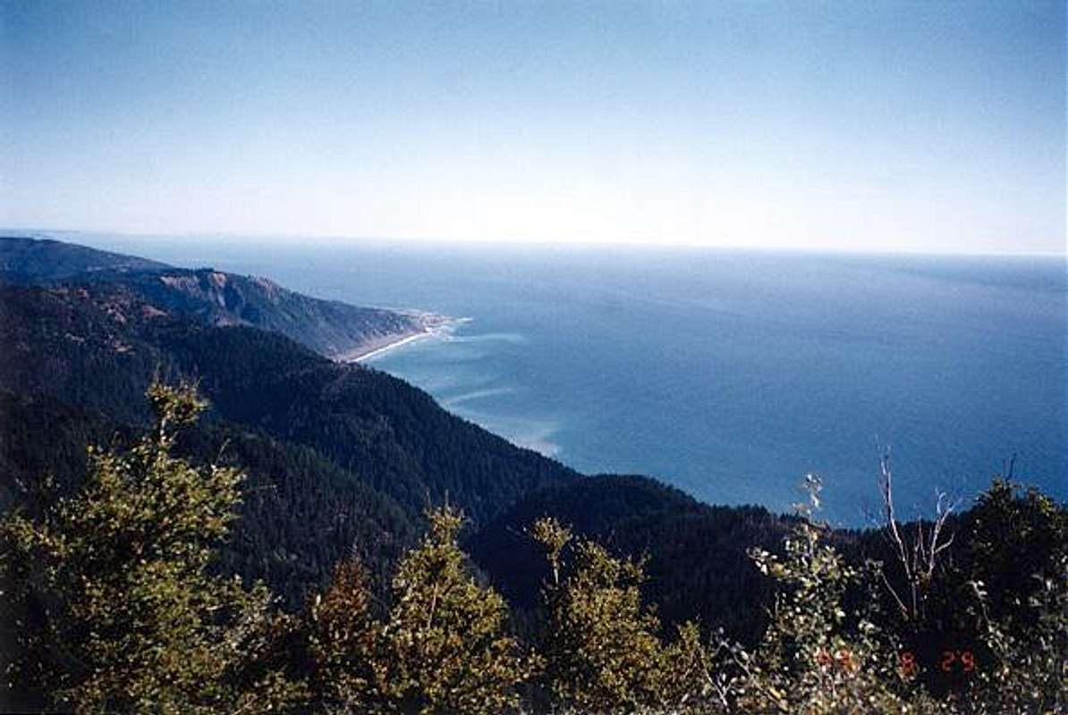
However, by any standard it is well worth the trip. The views from coastal cliffs towering 1,000 feet above the ocean floor reveal endless vistas of wild California coastline, with no ribbon of highway or evidence of human existence to mar the scenery. Caltrans’ loss is the hiker’s gain.
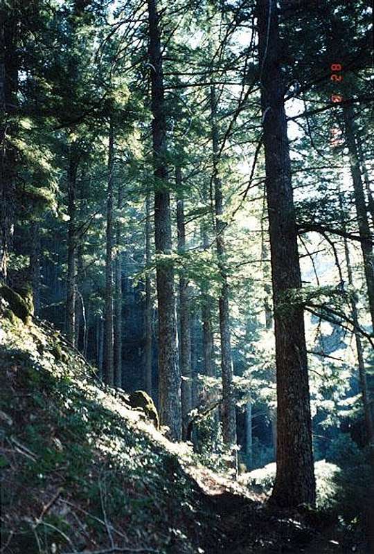
The trail also winds through several groves of old-growth redwood. Also to be enjoyed are wildflower carpeted meadows, ferns by the thousands, and several clear flowing perennial streams that provide a reliable source of fresh water along the way.
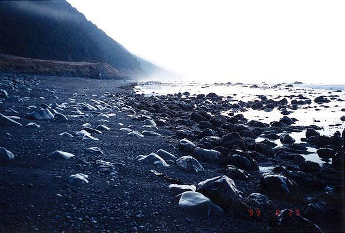
No coastal trail would be complete without a trip to the beach. Three lovely black sand wilderness beaches can be found on this portion of trail. Not surprisingly, these beaches correspond to the location of the three wilderness camps established along the trail.
One should not forget the abundant wildlife either. In addition to the usual suspects coveting backpacker food, curious harbor seals will swim within a few feet of shore to watch beach hikers. Massive Roosevelt bull elk also like hanging around the coastal wilderness camps.
Camping on two of them is recommended. Both Wheeler Camp (5 miles from the northern terminus) and Little Jackass Camp (7.5 miles from the southern terminus) are wonderful and provide ample camping opportunity on both the black sand beaches and in the grassy meadows above the beaches. Highly recommended.
The third beach, located near the Anderson Camp five miles from the southern terminus of the trail, is not recommended for camping as none of the shore appears to be above the high tide mark. Anderson Camp itself is a jungle with a few sopts cleared out, but neither is particularly nice or recommended.
Length of the trail is approximately 16 miles, one way. This trip can be completed in a leisurely three days or a more strenuous two days. There are a number of significant elevation gains and losses along the trail, including several 1,000 foot ups and downs.![]()
Topographic and Satellite Maps
The BLM has prepared an excellent trail map for the entire Lost Coast area. This map may be obtained from the BLM Office in Arcata or at the BLM King Range visitor center located on Briceland Road.
Essential Gear for the Lost Coast Trail
Bring wet weather gear and sturdy boots. It rains a lot in this area. A trail map or topo map is also nice to have, but routefinding is not difficult. Don't forget the camera, as the entire place is incredibly photogenic on blue sky days.
If doing the northern portion of the Lost Coast within the King Range area, pick up a copy of the tide table so the journey can be timed accordingly.Red Tape and Legalese on the Lost Coast
A backcountry camping permit is required for the Sinkyone Wilderness State Park section. Cost is $3 per person per night of camping. Permits may be obtained at the Needle Rock visitor center or self-issued at the Usal Road end of the wilderness. Bear canisters are recommended, but not required, but food needs to be hung.
Courtesy of BLM: A new self-service permit system is now in place for the King Range National Conservation Area, affecting hikers and backpackers who plan to spend at least one night in the back country, including the popular Lost Coast Trail. The free permits, which also serve as California campfire permits for the King Range, are available in self-service boxes at King Range trailheads, at the King Range Office in Whitethorn and at the Bureau of Land Management Arcata Field office in Arcata. Hikers will be asked to complete a brief form, leaving one part in the permit collection box or at the office, and keeping the second part with them while in the King Range.
Bear canisters are required within the King Range/BLM section. Checking in with the BLM office is an excellent idea for tide tables and trail/road condition updates.Shuttle Services to the Trailheads
According to the BLM, the following shuttle services have been approved:
Lost Coast Trail Transport: contact Roxanne Beijan - (707) 986-9909.
Sherri Luallin (707) 223-1547
Setting up a two car shuttle with a friend's car takes a while, but is worth the time.Areas Deemed Impassable at High Tide
Courtesy of the BLM's website:
The area near Punta Gorda from Sea Lion Gulch to Randall Creek; and from Miller Flat to Gitchell Creek may be impassible during high tide. Carry a tide table, and when in doubt, hike these stretches during an outgoing tide to avoid being trapped.
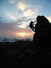
Bouldering and Other Activities at Shelter Cove
There are lots of cliffs and granitic type rocks along the shoreline to test your skills.
Shelter Cove itself is something of an exotic getaway, so some of the finer things in life may be had there. Beach walking and camping opportunities abound along with hotel lodging.Camping on the Lost Coast
There are a number of lovely campgrounds in the area and in the surrounding redwood country along Highways 1 and 101. There is no shortage of camping opportunities.
Campgrounds are located on either end of the Lost Coast trail in Sinkyone State Park, Usal Campground on the south end and the very lovely Bear Harbor campground on the north end. However, both ends are only accessed via narrow dirt roads impassable in wet weather.
The King Range/Lost Coast area to the north has several campgrounds, the largest being the Mattole Campground on the northern end of the King Range Recreation Area.External Links
- King Range National Conservation Area
BLM Arcata's website on the King Range - Sinkyone Wilderness state park
California state parks website - <TARGET=_blank>Tide tables for Shelter Cove.>
Website for Mobile Geographics - tide tables - <TARGET=_blank>North Coast Weather Forecast>
Weather Underground report and 5 day forecast for the North Coast area, Arcata in particular. Click on Shelter Cove for more precise report, if the station is reporting - <TARGET=_blank>Lost Coast Trail Transport Service>
Web page for the Lost Coast Transport Service, a company providing transportation and shuttle service between trailheads, particularly for the Lost Coast Trail
- King Range National Conservation Area

brutus of wyde - Apr 16, 2006 5:17 pm - Hasn't voted
King PeakWhen I last visited (King Peak to Mattole River) there was a lean-to shelter on the summit of King Peak. Is it still there? Brutus
keema - Jul 12, 2013 6:47 pm - Hasn't voted
South Section InfoBriceland Road is closed at Needle Rock. We were told there was a washout before the summer of 2012 between Needle Rock and Bear Harbor with no plans for repair. So add the 2.7 miles on to the hiking distance. Also the Usal Road between Usal Campground and Briceland Road is very rough and rutted and not recommended for low clearance 2-WD even when dry.