
-
 12660 Hits
-
 81.18% Score
-
 13 Votes
|
|
Mountain/Rock |
|---|---|
|
|
44.24920°N / 10.40774°E |
|
|
Hiking, Skiing |
|
|
Spring, Summer, Fall, Winter |
|
|
6739 ft / 2054 m |
|
|
Overview
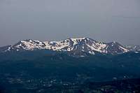
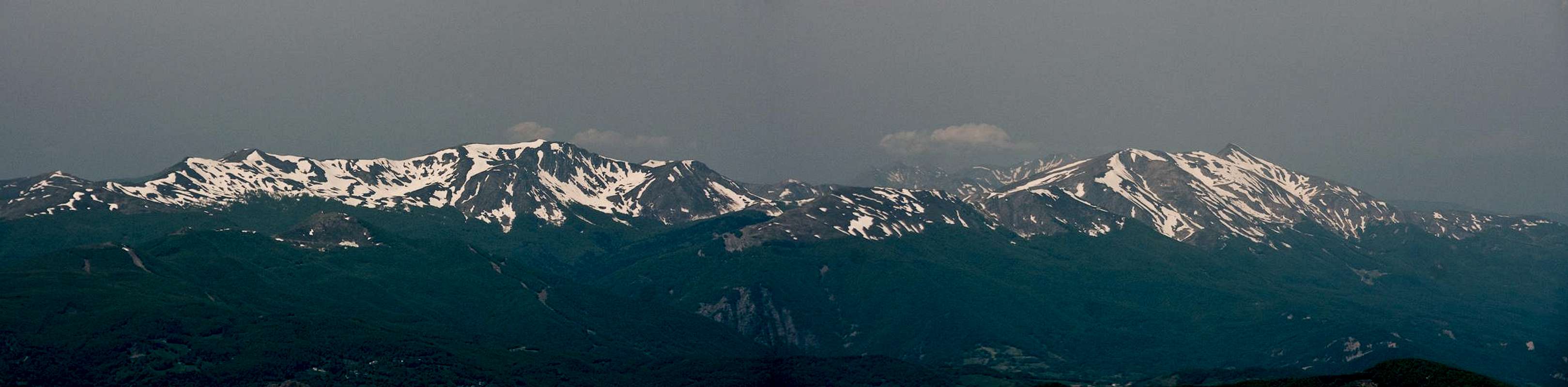
 Monte Prado seen from Monte Vecchio Monte Prado seen from Monte Vecchio |
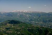
Italy's Toscana (Tuscany) region is not known for its mountains - wine, museums, beautiful architecture come to your mind first. However, it contains two mountain ranges which in themselves make a visit worthwhile: the Alpi Apuane, a Dolomites like limestone range and the long chain of the Apennino, which in this area is made up mostly from sandstone. Among the mountains of these two ranges, one mountain stands out: the highest summit of Toscana, Monte Prado.
 |  | 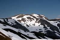 |
To avoid misconceptions: Monte Prado is located on the main ridge of the Apennino Tosco-Emiliano, which makes up the border between Toscana and neighbouring Emilia Romagna. Strangely enough, it is surrounded by higher peaks, Monte la Piella (2078m), Sasso del Morto (2079m) and Monte Cusna (2121m), which firmly stand on the Emilian side of the mountain range. Like all the mountains in the vicinity Monte Prado lacks drama. It is a round-topped big bulk of a mountain which is easy to get to. The main challenge in climbing might be the distance from the nearest trailhead which is 7km horizontally and 1100m vertically.
 |  |  |
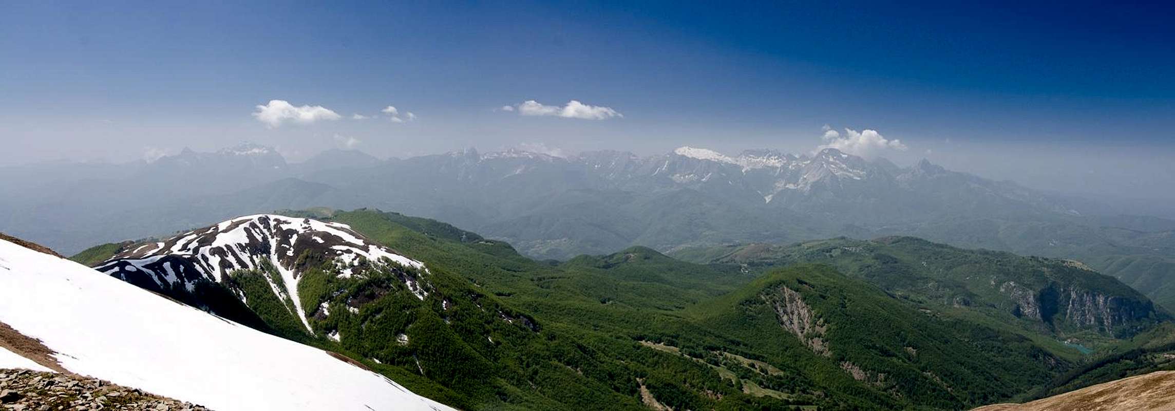
Still, as the highpoint of Toscana, Monte Prado is definitely one of the most popular mountains of the area. It is reached by a panoramic hike along the crest of the Apennine main ridge, which includes climbing Monte Cella and Monte Vecchio. In normal conditions the hike is easy but in early spring you might have to fight with remaining snow fields. Since the starting point of the ascent is the small ski area of Casone di Profecchia, the mountain also sees quite a number of ski tour ascents in winter. Standing somewhat aside from other groups of the Apennino Tosco-Emiliano, Monte Prado gives a good overview across the range. Also, on fine days, it is one of the best vantage point to view the Alpi Apuane.
360° Summit Panorama
  |
Getting There
 |
The best trailhead is at the small ski area of Casone di Profecchia a bit to the south-west of Passo delle Radici. It can be reached as follows:
- From Firenze and Pisa
- Take motorway A11 to Lucca.
- Switch to SS12 in direction Abetone
- At Borgo a Mozzano switch to SP2 direction Castelnuovo di Garfagnana
- Switch to SS324 direction Passo delle Radici.
- From Bologna
- Take motorway A1 direction Modena
- At the southern exit of Modena turn onto SS12 south direction Abetone.
- At Pievepelago switch to SS324 across Passo delle Radici
Red Tape
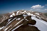
 Sprone di Monte Prado, a barrier of steep faces to the east of the mountain
Being a border mountain between Toscana and Emilia Romagna, Monte Prado is part of the Parco Nazionale dell'Appennino Tosco-Emiliano. The usual restrictions for such parks apply. Visit the park's site for more information.
Accommodation
 |
The closest town to Passo delle Radici is Castelnuovo di Garfagnana on the Toscana side of the pass. The big cities - Modena and Bologna as well as Firenze and Lucca are about an hour away from the pass so staying there is a definite possibility.
If you want to stay closer you can make use of Agriturismo, holiday farms, which offer rooms, apartments and food. Good places are somewhat hard to find if you don't speak Italian. The site of the Parco Nazionale dell'Appennino Tosco-Emiliano
has a listing here:
Lodging in Parco Nazionale dell'Appennino Tosco-Emiliano
Weather Conditions
Maps & Books
Let me know if you know more books or better maps. This is the set I used.Maps
I have not been able to find detailed maps of this area so the following one is a road map, scaled 1:150000
- Tuscanny - Florence
Freytag & Berndt
1:150000
ISBN: 978-3-7079-0281-5
Maps Online
Books
- Tuscany North / Toskana Nord
Wolfgang Heitzmann / Renate Gabriel (translation: Gill Round)
Rother Verlag
ISBN: 978-3-7633-4812-1 (English)
ISBN: 978-3-7633-4115-3 (German)