
-
 1180 Hits
-
 81.84% Score
-
 14 Votes
|
|
Mountain/Rock |
|---|---|
|
|
46.50070°N / 11.95420°E |
|
|
Veneto |
|
|
Hiking, Mountaineering, Scrambling, Skiing |
|
|
Spring, Summer, Fall, Winter |
|
|
7953 ft / 2424 m |
|
|
Overview
Monte Sief 2424 m
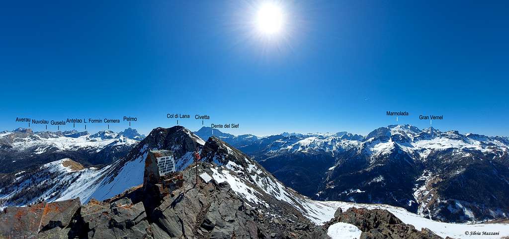
Monte Sief 2424 m belongs to the small Col di Lana group which is volcanic in nature and therefore from a geological point of view it differs markedly from the Dolomite peaks that closely surround it (Fànis group with the Sett Sass and the Lagazuoi and many others more distant). This small group is located between the Val Cordevole (Belluno, Veneto side) and the upper Val Badia (Bolzano side). This small group includes some peaks which are, starting from the South-East, Panettone 2125m, Cappello di Napoleone 2200m, Col di Lana 2452m, Monte Sief 2424m and Col de la Roda 1971m. Rising in the very center of Dolomites, Monte Sief, as well as the nearby Col di Lana, excells with superb views above many of the highest summits of Dolomites standing around it.
The group is very famous not only for the striking panorama, but also in reason of the furious and bloody fighting that took place there, in particular on the nearby summit of Col di Lana, during the World War I. On these group some of the most fierce fightings on the Dolomites front took place during the World War I. That is why Italians also call Col di Lana Colle di Sangue (Bloody Mountain). Less famous than the nearby main summit of Col di Lana, which was conquered by the Italian army in the spring of 1916, Monte Sief was instead firmly occupied and held by the Austro-Hungarian army.
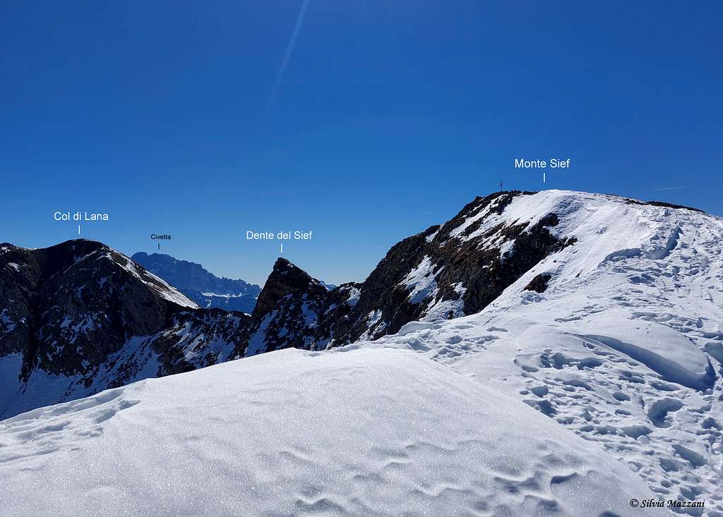
The summit of Monte Sief is formed by a narrow rocky ridge, about 250 meters long, from which three ridges branch off. The West Rib, where the Höhle command position was located, as well as the entrenchment Peterstellung and "Il Fortilizio", which descends to the village of Ruaz along the Dolomiti road. The South-East Rib, which descends steeply and rocky, connecting Monte Sief to Col di Lana by means of a small rocky saddle. The North Rib which descends and joins the Southern slopes of Settsass, forming the wide saddle called Forcella del Sief (Siefsattel) at an altitude of 2209 m, where the An der Front cross is located, powerfully defended by the Austrian position "Edelweiss".
Notes of WWI history
With Italy's entry into the war in May 1915, the whole mountain area around the Col di Lana group became a war zone. Located on the border between the Austro-Hungarian Empire and the Kingdom of Italy, the Col di Lana group was the scene of fierce fighting during the First World War that left several thousand of dead on the ground (hence the nickname " Hill of Blood"). Due to its strategic position high above Cordevole valley, both armies fought for the top of Col di Lana. Originally, at the outbreak of the war in 1914, the whole group was occupied by the Austro-Hungarian army. Starting from July 1915 the Italians were attacking it with strong forces moving from the peak known as Cappello di Napoleone. Italians took the summit of Col di Lana on 1915, November 8th, but the Austrians retook it the following day. After the harsh winter 1915-1916 with many victims due to frost and avalanches, severe fightings soon resumed. As no army gained advantage, soon it was developed the mine war. It culminated on 1916, April 8th with the explosion of a gigantic mine just below the top of Col di Lana which was semi destroyed.
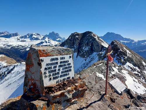
After the explosion, the Italians assaulted the main peak and the northern summit of Col di Lana. The Austrian garrison was decimated, but the subsequent assault was rejected up on the Monte Sief crest by the Austrian reserves. The following day the Austrians attempt to regain the lost positions failed, so they were forced to withdraw and definitively lost the main summit of Col di Lana. The new center of the fighting became Monte Síef and the saddle of the same name, but despite fierce fighting the Austro-Hungarians never lost their positions on Monte Sief. About the WWI in the Dolomites, you can see my SP page: The World War I in the Dolomites, may 1915 - may 2015.
Getting There
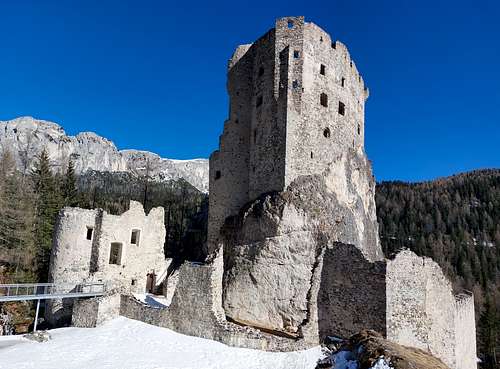
Monte Sief can be approached from many sides, included the summit of Col di Lana. However, the most direct and simple access, above all to make a beautiful and profitable ascent on skis or snowshoes, takes place from the beautiful Castello di Andraz, a medieval fortress located in the municipal area of Livinallongo del Col di Lana (province of Belluno) in the hamlet of Castello. Its architectural structure is very characteristic, due to the fact that it stands on a rocky outcrop. The castle houses a museum.
More info here: Castellodiandraz.
- Coming from Cortina d'Ampezzo or Val Badia, reach Passo Falzarego and from here drive down in the direction of Caprile and Alleghe (South) along the SR 48 with some hairpin bends. Reach Pian Falzarego and shortly after take the road to the right to Castello di Andraz.
- Coming instead from the side of Val Cordevole, follow the SR 203 and then the SR 48 in the direction of Passo Falzarego and just before Pian Falzarego, turn left towards Castello di Andraz.
If the access road to the castle is clear of snow, parking is available at the castle. Otherwise you have to leave your car along the road before the castle.
Monte Sief from Castello di Andraz
Summit quote: 2424 m
Difficulty: Alpine F (in winter), otherwise E
Difference in level: 684 m
Starting point: parking lot near Castello di Andraz
Very interesting and satisfying route with the second part along a super panoramic rib. Absolutely to be recommended.
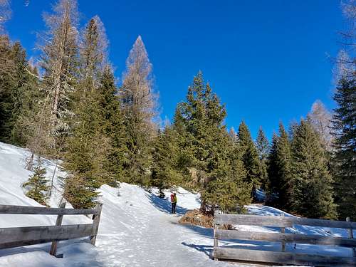
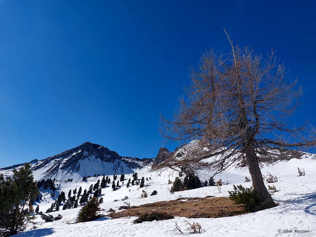
From the beautiful Castle of Andraz 1740 m, take a small road in the thick fir forest which after about half an hour leaves the forest into open terrain and crosses a vast plateau dotted with the traditional tabià, beautiful small wooden mountain cabins.
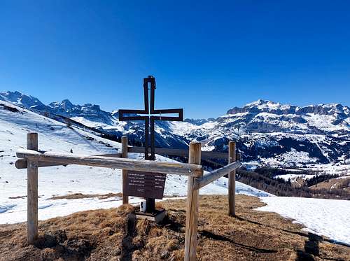
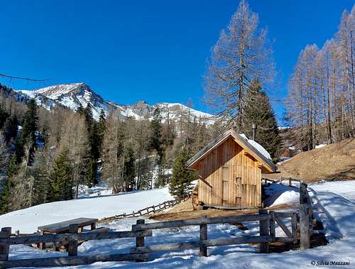
After crossing the plateau from where it's already possible to see our destination in front of us and Col di Lana to its left, we climb up through sparse larch and stone pine trees, until we reach a wooden crucifix and immediately after the beautiful refuge in wood "Chi de Teresa" at an altitude of 2050 m now at the head of the wide valley. Here the climb becomes steeper to reach Forcella Sief at an altitude of 2209 m, a large saddle located between Monte Sief on the left and the Southern offshoots of Settsass, where the An der Front cross is located.


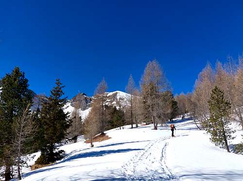
Once you have reached the wide saddle, turn sharply to the left to reach the base of the great northern ridge of Sief, where it begins the so-called Crinale delle Seleghe, furrowed by the remains of trenches and war tunnels, the steepest and most demanding part of the route begins.


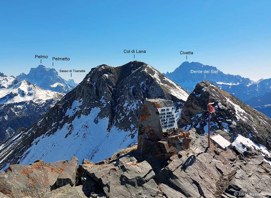
Go up the beautiful crest with 360-degree views of the Dolomites, reaching the cross and the marble plaque on the summit. The panorama is truly extraordinary over the nearby Settsass, the Belluno Dolomites towards the east, with Pelmo, Civetta, Lastoni di Formin and Tofane, towards the south-west the Marmolada with the Gran Vernel, the Sassongher and the Ciampac.
Descent: reversing the same route
Red Tape
No fees no permits required.
When to Climb
All year round. In winter time the ascent requires specific equipment, such as snowshoes or skis (fresh snow), or ice ax and crampons (frozen snow), depending on the snow conditions.
Accomodation
Different possibilities of accomodation both in Val Badia and Valle Cordevole.
Meteo
Arpav Dolomiti Meteo
Dolomiti Meteo - Veneto
ARPAV DOLOMITI METEO Phone +390436780007 fax +390436780008
CENTRO VALANGHE DI ARABBA Phone +390436755711 fax 043679319 e-mail cva@arpa.veneto.it
Guidebooks and maps

“Dolomiti Orientali Vol. I – Parte I” by Antonio Berti - Collana Guide dei Monti d’Italia, CAI TCI
Maps:
Tabacco sheet 03 – Cortina e Dolomiti Ampezzane 1:25.000