
|
|
Mountain/Rock |
|---|---|
|
|
38.59255°N / 106.35791°W |
|
|
Chaffee/Gunnison |
|
|
Mountaineering |
|
|
Summer |
|
|
13369 ft / 4075 m |
|
|
Overview
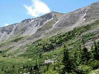
 Monumental peak on right, SE Face |  East Face of Monumantal Peak |
Monumental Peak rise on the Continental Divide in the Sawatch Mountains of Central Colorado. To the north, Monumental Peak connects to Van Wirt Mountain (via Point 13254 ft) and to the south, it is connected to Vulcan Mountain (via Point 12842 ft).
The 12150 ft Chalk Creek Pass sits to the northeast of Monumental Peak. This pass separates Chalk Creek Valley to the north from a branch of South Arkansas River to the south. A good way to reach the summit of Monumental Peak is to hike to Chalk Creek Pass and then follow a boulder covered ridge-top first to the top of Point 13254 ft and then Monumental Peak. Chalk Creek Pass can be approached from the north via the town of Buena Vista or from the south via U.S. Highway 50.
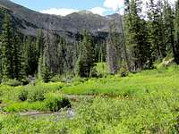
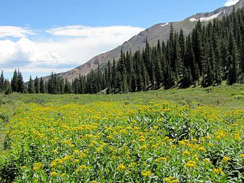
On the south side of Chalk Creek Pass, you will find a beautiful basin that houses a number of ponds. In summer, the basin becomes covered with wild flowers. Monumental Peak rises directly above this basin. On the north side of Chalk Creek Pass, there is an equally beautiful basin where the Hancock Lakes are located.
 NE face of Monumental Peak | 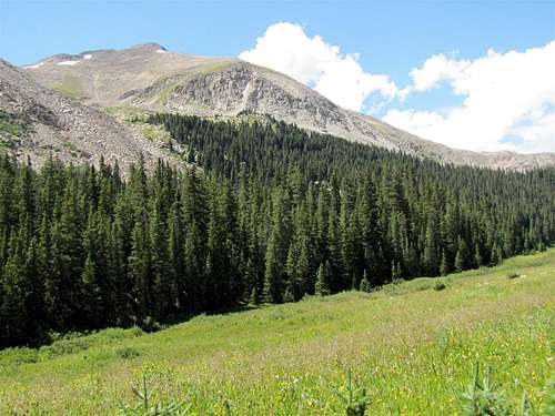 SE face of Monumental Peak |
Pictures
BASIN ON THE SOUTH SIDE OF CHALK CREEK PASS: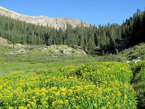
|

|
||
 Monumental
 |
 Monumental
 |

|
 Monumental
 |

|
 Monumental
 |
|
 Monumental
 |

|
|
||
BASIN ON THE NORTH SIDE OF CHALK CREEK PASS:
Fore more pictures see the pages for Sewanee Peak and Van Wirt Mountain.
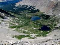 Hancock Lakes |
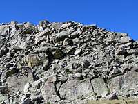
RIDGE-TOP TO POINT 13254 FT AND MONUMENTAL PEAK:
 Ridgetop | 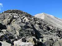 Point 13254 | 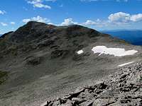 Monumental from 13254 | 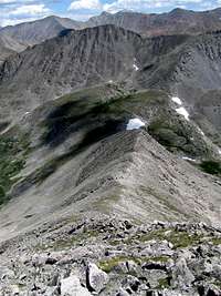 Slopes of 13254 |
VIEWS FROM THE SUMMIT OF MONUMENTAL PEAK:
 NE |  North | 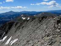 South |
 West | 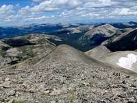 NW |  SE |
Getting There
Approach from the south:Directions to Road 230:
From the junction of Routes 50 and 285 North in Poncha Springs, drive 12.4 miles west on Route 50 to a pull-off across from Monarch Mountain Lodge. Road 230 is on the west end of the pull-off near a building. You will find a sign on a tree for parking. Road 230 is a rough 4WD road. With an appropriate vehicle, it can certainly be driven.
Approach from the north:
Directions to the ghost town of Hancock:
From the town of Buena Vista drive 8 miles south on Route 285 to a place known as Nathrop and then turn west onto Route 162. Drive this road 15.3 miles to just before the ghost town of St. Elmo (the first 10 miles are paved and the rest is a well graded dirt road).
Turn left onto Route 295. This road is rougher but is still passable by most/any car. Continue 2.7 miles until you see a detour around an old decaying railroad bridge (The detour is rather steep and the road beyond it is much rougher. I did not need to use 4 wheel drive but I will probably not drive this road in anything less than an SUV). Continue another 2.8 miles to the remains of the old mining town of Hancock.
 On Road 230 |