
-
 29500 Hits
-
 84.82% Score
-
 19 Votes
|
|
Mountain/Rock |
|---|---|
|
|
36.97390°N / 114.5005°W |
|
|
Lincoln |
|
|
Hiking |
|
|
Spring, Summer, Fall, Winter |
|
|
7414 ft / 2260 m |
|
|
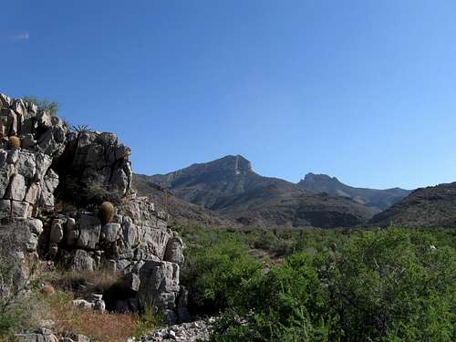
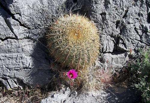 Local flora
Overview

NOTE: This page was originally written by DesertRat.
Getting There
 |
 |
 |
 |
NOTE: Getting to the trailhead for Mormon Peak requires lots of travel over very tough terrain on primitive roads. Enter at your own risk. Definitely need 4x4 and make sure you have spare tires!!!
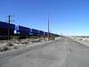
From exit 90 on I-15 in Nevada (exit 90 coming from Las Vegas, Exit 91 when coming from Mesquite), drive west on NV 168 about 2.7 miles to Meadow Valley Road on the north side of the highway. Zero your odometer, turn north here, and drive about 8.4 miles to the end of pavement, passing some business. At mile 10.6, cross under the railroad from east to west, avoiding the "no trespassing" sign straight ahead. This is the mainline of the UPRR you're following between LA and Salt Lake. At mile 14.1, go thru a hopefully-open gate. On our first attempt here, this gate was locked and , but was open in 2008. At mile 14.5, cross under the tracks again from west to east, possibly encountering some shallow water. At mile 14.7, cross the Meadow Valley creek. Put on your sandles and walk it first and decide if you are comfortable driving it. Our Nissan Xterra rental 4WD had no problem with the 1.5 feet or so of water in early June. At mile 15.3, turn right at a fork. At about mile 19.8, turn right from the main road and head up a track in a wash toward the mountains. This track will leave the wash fairly soon and head up a low bench. Drive as far as you're comfortable, but you should be able to go at least six miles on this last section of road from that last right turn into the wash. You'll probably be able to make seven miles and park somewhere near one of the "prospect"s shown on the topo map. Park in a safe spot. It may take you 1.5 to 2 hours from the interstate to your parking spot. High-clearance vehicles are needed after the first RR crossing.
Note: As of 11-30-04, a new wilderness designation has affected the roads into the area. See link.
 Meadow Valley Creek
Red Tape
 Desolate country
Camping
Typical primitive car camping at the "trailhead". No nearby official campgrounds. The little town of Glendale at the interstate has very few services other than a simple gas station near the exit.Weather

External Links
The benchmark

wingman - Dec 15, 2012 11:02 am - Hasn't voted
Mormon Mtn.If you are coming from Mesquite the exit number is 91. It is exit 90 if coming from Las Vegas. As of Dec 11,2012 there were two gates to past thru, both were open. We turned right ~ 0.2 after the second gate and made our way over to the "first ruins". 2.5 hours up from there to the summit.
Candace66 - May 2, 2019 10:18 pm - Hasn't voted
Road access commentsToday (May 2nd 2019), I drove to Mormon Peak in hopes of climbing it tomorrow. First, I attempted to reach the starting point for the Southwest Ridge Route. This is the one from the canyon below Davies Spring, where the ruins are shown on the topo map. However, almost immediately after turning off the road along the railroad tracks, I was stopped by the first stream crossing. The water was muddy so I waded it, and before I got halfway across it was up to my knees. And the bottom is rather mushy. Being on my own, I didn't attempt it. So I returned to the road along the railroad tracks. And tried to drive to the more distant starting point for the other known route. However, I encountered an abundance of "private property - no trespassing" signs posted by the railroad. I drove to that starting point with no problems in January 2015 (but didn't quite reach the summit during my climb). So I don't know if I simply messed up somehow this time, or if the signs are new.