
-
 39408 Hits
-
 83.1% Score
-
 16 Votes
|
|
Mountain/Rock |
|---|---|
|
|
39.17146°N / 107.06954°W |
|
|
Pitkin |
|
|
Mountaineering |
|
|
Summer |
|
|
13300 ft / 4054 m |
|
|
Overview
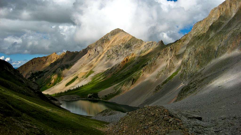
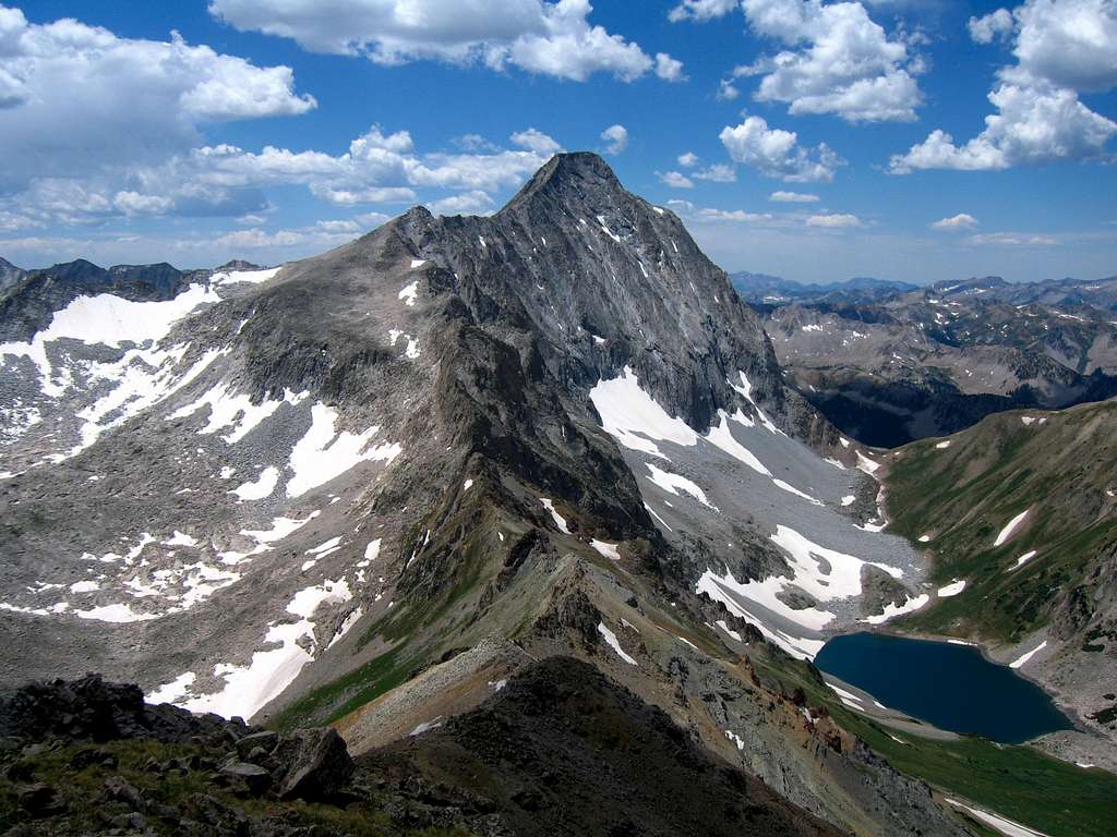
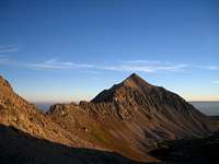 Mount Daly
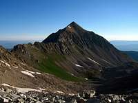 Mount Daly
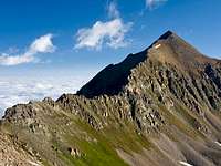 Mount Daly
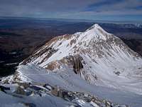 Mount Daly under snow
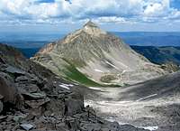 Mount Daly from near K2
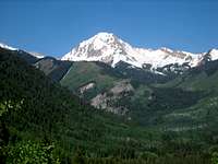 Mount Daly under spring snow
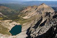 Mount Daly and Capitol Lake
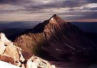 Mount Daly twilight glow
Located in the Maroon Bells-Snowmass Wilderness Area, Mount Daly is the most prominent peak as seen from Snowmass Village, Colorado. It's elevation is 13,300 ft. One of it's most distinguishing features is a broad diagonal layer of rock running through the mountain's east face. The standard route up is the third class south ridge from the Daly Saddle. which is gained from either Capitol Lake on the west or Moon Lake on the east. An alternate route is the East Face Route from the east. Daly is often climbed in conjunction with Capitol Peak and makes a great double summit from camp at Capitol Lake. Daly is tied with 11 other peaks as the 339th highest peak in Colorado. Located within the Maroon Bells/Snowmass Wilderness, it has one of the longer approaches of the Colorado peaks. This area is an unspoiled area and one of Colorado's last so please preserve this place during your visit.
Getting There
There are two Trailheads that can be used to access Mount Daly; the Capitol Creek Trailhead or the Maroon Snowmass Trailhead. The nearest town to both of these is Aspen however it's likely more common to approach from the north on Highway 82 from Glenwood Springs.
Capitol Creek Trailhead From Glenwood Springs, follow US 82 for 28 miles south to the town of Old Snowmass which is unrelated to the Snowmass Ski Resort. Take a right (south) onto Snowmass Creek Road marked by a streetlight and measure from this point. Follow this road for 1.7 miles and turn right at the T intersection onto Capitol Creek Road. Stay left at mile 1.9 and at mile 3.2. Continue on the road and then stay right at mile 4.7 and again at mile 5.9 where the road turns to dirt. Pass the cattle guard taking the narrower left road and continue up the narrow, rough road to the trailhead at mile 9.5. This road is passable for tough passenger cars with good clearance like a Subaru Outback or similar station-wagon. A 4WD isn't necessary but decent clearance is.
Maroon Snowmass Trailhead From Glenwood Springs, follow US 82 for 28 miles south to the town of Old Snowmass which is unrelated to the Snowmass Ski Resort. Take a right (south) onto Snowmass Creek Road marked by a streetlight and measure from this point. Follow this road for 1.7 miles and turn left to stay on Snowmass Creek Road. At mile 10.7, cross Snowmass Creek and at mile 10.9 turn right. Continue to the well marked trailhead at mile 11.3. If you're coming from Aspen, a shorter but rougher approach is to go 4.6 miles north on Highway 82 from the Maroon Creek intersection. Turn left (west) onto the Snowmass Village Road and measure from this point. Head 5 miles to the intersection with the Brush Creek Road and Divide Road and turn right onto Divide Road. At mile 6 turn right onto the dirt road just before reaching The Divide Lodge. Descend switchbacks across some ski runs and stay straight at mile 7.6 and reach the trailhead at mile 8.
Check road conditions here.
Approaches
 Daly and Capitol
 Daly from Capitol
 Mount Daly flowers
 Mount Daly
 Mount Daly from trail
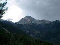 Mount Daly during storm
 Daly south ridge
 Mount Daly
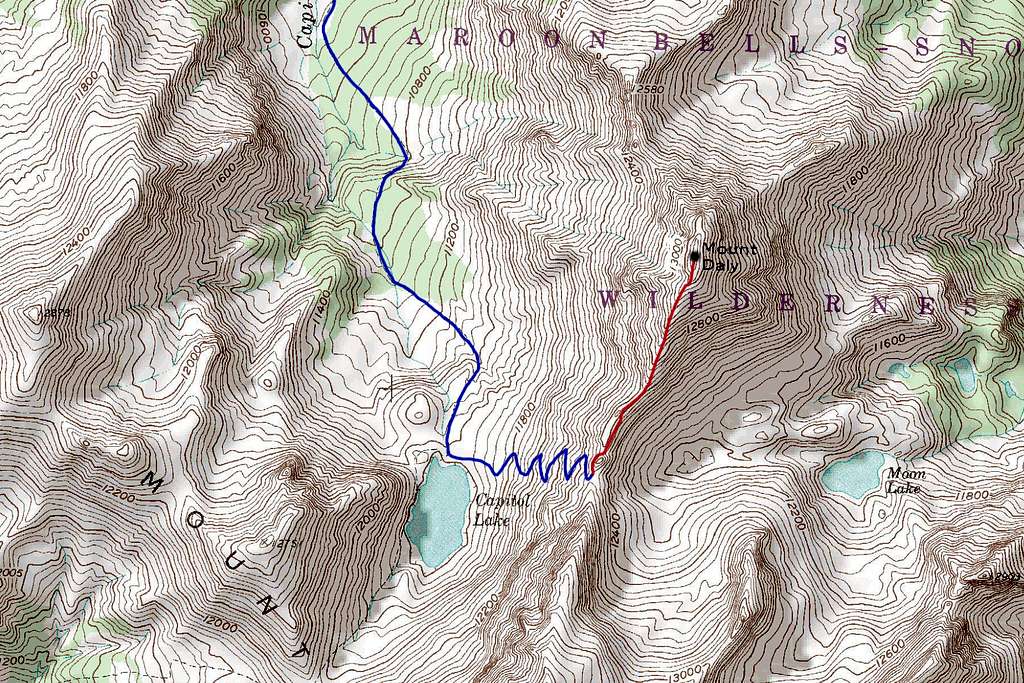
Capitol Creek Trail From the Capitol Creek trailhead I would recommend using the Capitol Ditch Trail because it doesn't drop the 400 feet like the other trail does plus it is more traveled. This trail starts out very flat for the first mile and climbs gently on some nice benches with beautiful wildflowers in summer. After 3 miles it meets the main Capitol Creek Trail. You will have to cross the creek which may require you to wade or find a log. Continue right up the trail 3 more miles to Capitol Lake where you will find great designated camping. From Capitol Lake look up the grassy slope to the east and you will find a CFI trail heading up to the Daly Saddle. This switchbacking trail climbs 900 feet in about a mile. Reaching the Daly saddle is key to the route.
RT Distance from TH - 14 miles
RT Elevation Gain from TH - 3,000 feet
 Capitol Peak Capitol Peak |  Capitol Lake from Trail Capitol Lake from Trail |  View south from TH View south from TH |
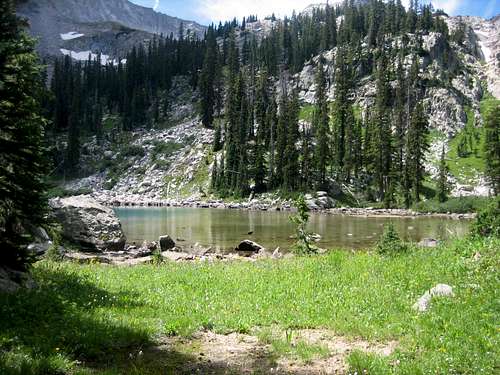
Moon Lake Approach
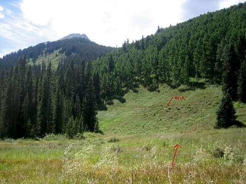
From the Maroon Bells/Snowmass Trailhead, hike on Maroon Snowmass Trail for approx 1 mile and then turn right (west) onto West Snowmass Trail. You will need to cross the stream without a bridge but there is also an option to use the beaver dams in this area. Go through the cow pasture and through an entry gate. Follow this trail up to the meadows at 10,000 ft. For the standard South Ridge Route via Moon Lake, locate the unmarked trail from the cow pasture at 10,000 feet, where the main trail splits. Locating this boot path will make the trip to Moon Lake much more pleasant. To find the boot path, go to the middle of the cow pasture (100 yards from the trail junction) and look directly at Mt. Daly and you will see a grassy hill that is part of the pasture you are standing in. The trail (red on the map image and in the photo) starts here. This is a good trail but hard to find at times. Try to stay on it to avoid bushwhacking. Continue up through trees and talus for 4 more miles from the cow pasture to a side creek draining the unnamed tarns northeast of Moon Lake at 11,200 feet. Continue up the left and climb south, then southwest up a 400 foot talus slope directly to Moon Lake at 11,750 feet. From the lake hike around its north side on rough talus and continue due west up a big talus gully for 300 vertical feet just right of some cliffs guarding the headwall of Moon Lake. At 12,000 feet, reach grass and continue west for 0.3 miles to the Daly Saddle at 12,500 feet.
RT Distance from TH - 16 miles
RT Elevation Gain from TH - 4,100 feet
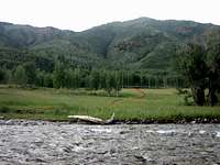 Crossing Snowmass Creek Crossing Snowmass Creek |  Twilight over Moon Lake Twilight over Moon Lake |  Moon Lake from Daly saddle Moon Lake from Daly saddle |
 Trail to Moon Lake boulder field and Drainage Trail to Moon Lake boulder field and Drainage | 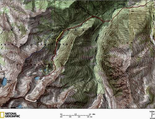 Map of Moon Lake Approach in Red Map of Moon Lake Approach in Red |
Standard Route - South Ridge Class 3
This route starts at the Daly Saddle. From the saddle begin climbing north towards the tower right above the saddle and contour around to its left (west) side along its base to a very loose gully. Climb 50 feet up this gully through a small arch in the ridge crest. This arch is very noticeable and can't be missed! Once through the arch, continue on an ascending traverse on the east side of the ridge below the cliffs guarding the crest on very loose rock. This is the loosest part of the route and extreme caution should be taken when traversing this slope. Reach the crest again just above 12,600 feet and continue along the crest of the ridge or just to the right (east) side to bypass any difficulties exceeding 3rd class. There is one spot where you will have to climb up a 10 foot difficult class 3 chimney just off the crest at about 12,850 feet. Above this the route eases considerably and the final 0.3 mile on the ridge is Class 2. You will notice a big change in the color of the rock to a bright orange near the summit. On the summit the views of Capitol are outstanding and the summit register is rarely signed.
RT Distance from Saddle - 1.4 miles
RT Elevation Gain from Saddle - 800 feet
 Tower just above saddle Tower just above saddle | 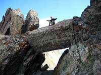 The small arch The small arch |  Looking down the south ridge Looking down the south ridge |  More mellow upper ridge More mellow upper ridge |
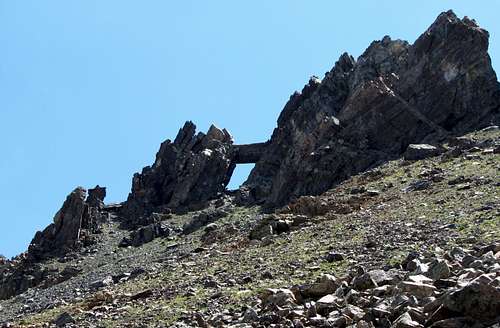 Hike up through this arch
 Looking up at Daly Saddle Looking up at Daly Saddle |  Down from Daly Saddle Down from Daly Saddle |  Daly South Ridge Daly South Ridge |  Mellow Ridge near summit Mellow Ridge near summit |
Summit View
Camping
There is abundant camping near the Capitol Creek Trailhead. Capitol Lake has camping available around the northern shore. There are preexisting sites that should be used. If you wish to camp on the Moon Lake Approach, there are a couple of options. One can camp at the trailhead at the spots just west of the road near the bridge. If you hike in, there are horse camps in the meadows between 9,600 and 10,000 feet. The cow pasture can also be used for camping and can house an army. Camping is also available near the small tarns below Moon Lake around 11,250 feet. On the map above, good campsites are marked in pink. Wilderness Area rules apply. Pack it in/pack it out. Be helpful and courteous to other campers and climbers. Don't be loud at night while camping. This is black bear habitat so hang your food and practice safe food and cooking techniques. Standard hiking and/or backpacking gear for Colorado. In winter add full winter clothing, leather boots, ice axe, crampons, skis or snowshoes, avalanche beacon, probe and shovel.
 Site at the middle lake Site at the middle lake | 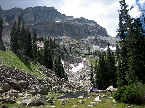 Best camping near the falls and first lake Best camping near the falls and first lake |
External Links
Moon Lake Approach Trip Report
Another Moon Lake Approach Trip Report
Capitol Creek Trailhead Current Conditions