

-
 18738 Hits
-
 82.64% Score
-
 18 Votes
|
|
Mountain/Rock |
|---|---|
|
|
45.26093°N / 109.83712°W |
|
|
Stillwater |
|
|
Hiking, Mountaineering, Scrambling |
|
|
Spring, Summer, Fall, Winter |
|
|
12323 ft / 3756 m |
|
|
Overview
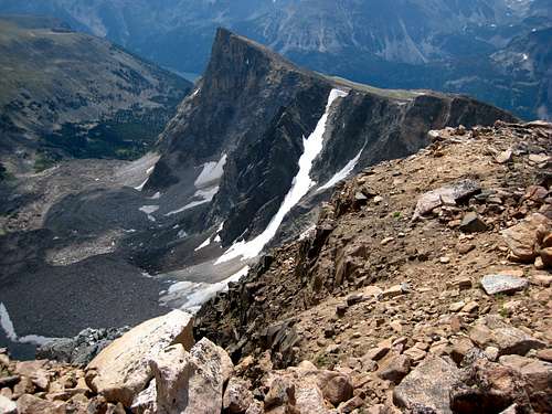
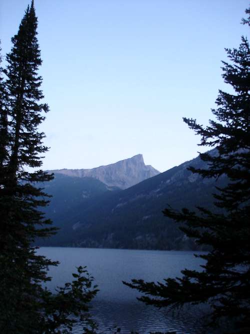 Mystic Equinox Tower above Mystic Lake
This Page was transferred to me by SP member CBakwin who is credited for some of the text shown below. Thank you for allowing me to add to this page!
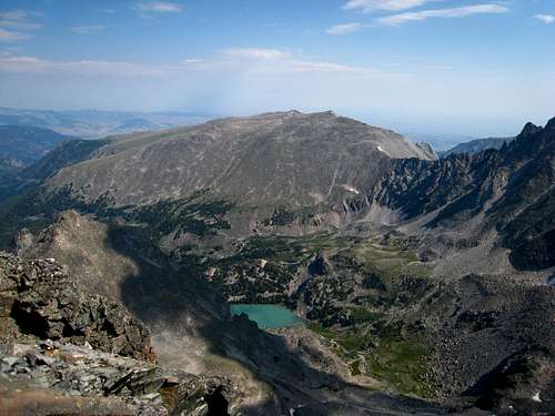
Mount Hague is located NNW of Mystic lake and can be climbed in a day from the Trailhead which is at 6,557 feet in elevation. It's about eight miles one way and an elevation gain of about 5,800 feet therefore it would be a long day hike. If you want to break it up, you can camp at the large flat area between Mystic Lake and Island Lake just across the famous logjam. There is room for an army here but if you are looking for a smaller area there is also a good campsite right at the Western end of Mystic Lake just off the trail near the south shore. From camp anywhere near the logjam crossing, the summit day would be very straightforward. The east end of Mystic Lake (at the dam) is about three miles from the trailhead, at 7,673 feet and the hike around the lake along the south shore is about 2.5 miles long. There is great fishing all around Mystic and Island Lakes.
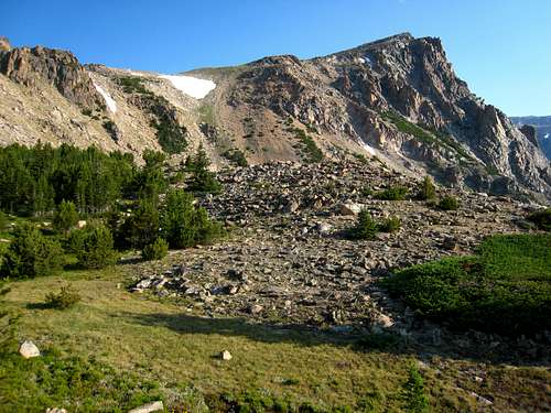
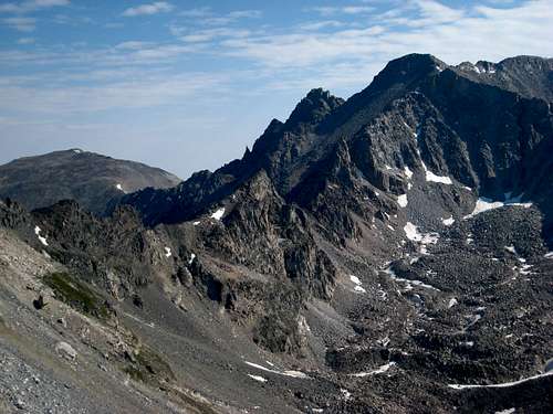
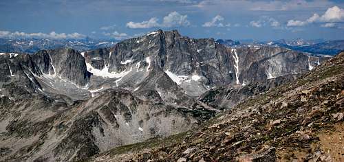
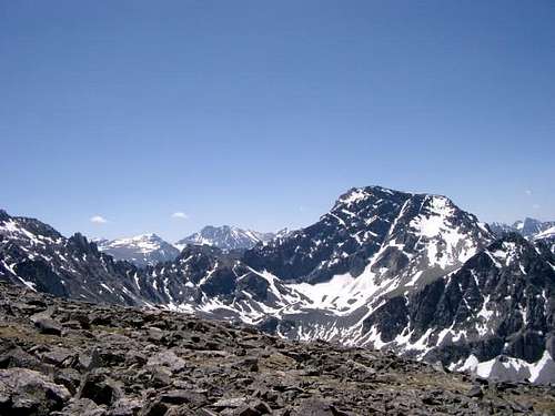
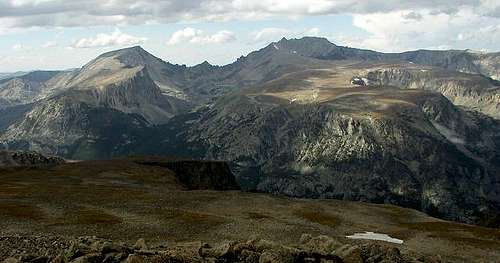
Mount Hague is similar to many Beartooth peaks in that it's the apex of a tilted plateau strewn with rocks, so travel basically involves lots of talus and rock hopping with a little bit of bush whacking on the lower slopes however compared to other 12ers in the Beartooth Range, Mount Hague isn't bad. The last 1.5 miles is a hike on the plateau with glorious views in every direction. Spectacular views to the south of Granite Peak, NW Granite, Villard, Glacier and Mystic peaks can be had. The view of the spectacular rock tower jutting above Mystic Lake is Mystic Equinox Tower. This isn't really a tower but more like a face on the east side of the plateau. It had its first ascent long ago on the autumn equinox and the route up the face is reported to be solid 5.9 with a walk off route down the plateau. The actual summit of Mount Hague cannot be seen from Mystic Lake, but once you reach the plateau you will be able to see the true summit off to the northwest.
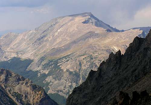 Mount Hague from Granite Peak Mount Hague from Granite Peak |
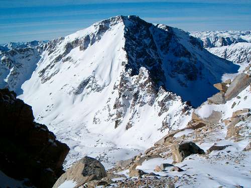 Mount Hague and the traverse from Mount Wood Mount Hague and the traverse from Mount Wood |
Getting There
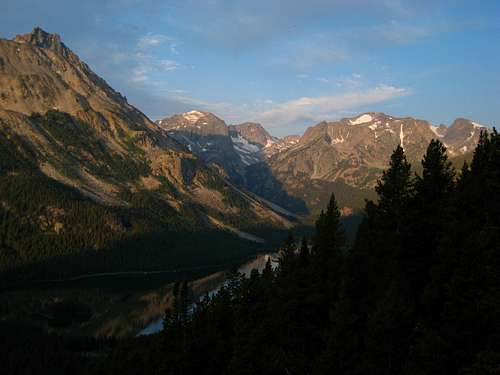
Mount Wood from Hague
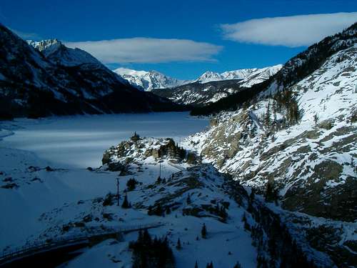
Mystic Lake in February
WEST ROSEBUD (MYSTIC LAKE) TRAILHEAD
The West Rosebud Trailhead is located approximately 80 miles southwest of Billings. To reach the trailhead, take the Columbus exit from Interstate 90, and take Montana Highway 78 through Absaroka and turn west (right) toward Fishtail (approximately 17 miles from Columbus). From Fishtail, drive west and south for 1 mile and turn south (left) on West Rosebud Road. Follow this paved road for 6.3 miles until reaching a fork in the road and a large brown Forest Service sign. The sign will indicate West Rosebud Lake Road #2072. Turn left here and follow the dirt road for 14.4 miles until reaching the trailhead. The trailhead has toilet facilities, and a large parking area. Please obey the posted private property signs and do not drive beyond the trailhead parking area.
The trail actually begins up the road about 200 yards, and is reached by walking through the Montana Power Company facilities where the trailhead is clearly marked with a Forest Service sign. From there, the trail leads up toward 7,637 foot Mystic Lake, one of the most popular day hikes in the Custer National Forest. The trail is relatively flat for about the first two miles, leading to switchbacks that eventually bring the hiker to a point looking over Mystic Lake Dam. The total elevation gain is about 1,200 feet over 3 miles. Once at the dam overlook, descend down to Mystic Lake and continue hiking for a half mile until reaching an intersection for the Phantom Creek Trail #17 branching to the left (south). Continue straight at the junction and continue an additional 2 miles along the south shore of Mystic Lake to its west end where the trail crosses a series of logjams right at the outlet to Island Lake. Crossing these logs can be difficult in early season. Once across the logs, there is a huge flat area offering great camping in sparse forest. If you are doing the climb as an overnight, camp here as the route up starts heading steeply up shortly beyond.
Route Description - South Ridge Class 2
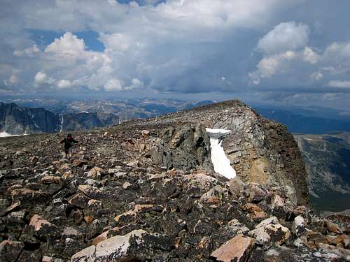
From the large flat area between Mystic and Island Lakes, hike north until the terrain begins to steepen. Stay to the left (west) side of the creek along a small ridge and through the trees. Continue working your way up fairly steep slopes until you reach an east-west oriented ridge with good views of Mystic Equinox Tower. Turn left and follow this ridge to treeline and a small meadow at 10,000 feet which offers good camping but water may be sparse. Continue northwest up talus and some grass steeply for 500 feet and reach the plateau and hike over or around to the right side of Point 10,562 and continue northwest up the plateau. From Point 10,562 it is a 1.5 mile hike to the northwest up gentle slopes on the plateau to the summit. You will hike slightly to the left of the high point of Mystic Equinox Tower and reach the cliffs dropping down to the east around 11,600 feet. The final 700 feet follow the top of these cliffs to the summit. Views of Mount Wood are fantastic the whole way. Once you reach the summit area, the high point is actually the northern peak marked with the small cairn. There is a memo book summit register inside an old pipe that was placed in 1981. It was well hidden and I was the first to sign it in 10 years. I added a pencil to it and placed it in a slightly more visible place. The lid to the pipe was broken off so keep it under the cairn when you leave. Lets all take care of this piece of history!
 Sawtooth and Iceberg Peaks above Island Lake Sawtooth and Iceberg Peaks above Island Lake |
 South side of Mystic Equinox Tower South side of Mystic Equinox Tower |
 Granite Peak from the flat south ridge Granite Peak from the flat south ridge |
 The traverse to Mount Wood The traverse to Mount Wood |
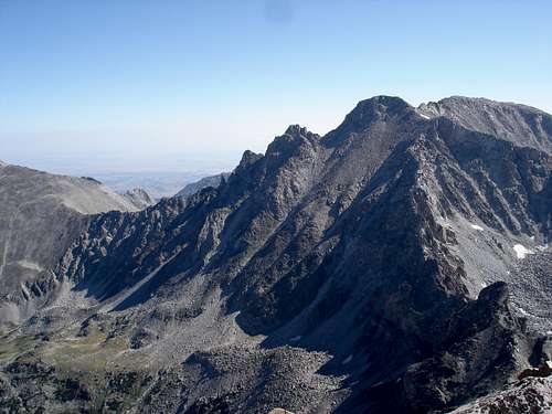
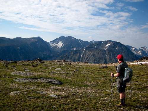
 Stillwater Plateau from the summit Stillwater Plateau from the summit |
 On the summit On the summit |
 Twin Peaks from the summit Twin Peaks from the summit |
 Looking down on the Tower Looking down on the Tower |
Camping/Red Tape
Mt. Hague from the Stillwater Plateau
Many camping sites along the route in and once you are on the trail you can camp anywhere except within I think 200 feet of the lake shore, or 100 feet of a stream or whatever the government has decided now (subject to change). Regs are posted! Take note, if you want to camp on the mountain, there is only a couple sites where Water is available above the stream that empties into Mystic on the nw corner, so carry water or your options are limited. Right as you reach the Plateau, there are some pools/springs below and to your left, you'll see the greener grass later in the season, hopefully. This entire area is in the Absaroka Beartooth Wilderness so regulations apply. No motorized vehicles, bikes or pets are allowed. Campfires should only be made in pre-established fire rings only when burn bans are not in effect. Contact the rangers in Red Lodge for information regarding current fire bans.
Beartooth Ranger District
6811 U.S. 212, Red Lodge, Mt 59068
(406) 446-2103
 Mt. Hague is on the left with Mt. Wood seen from the summit of Froze to Death Mountain to the south.
Map
Light green shows the approach hike with dark green showing the off trail ascent.