

|
|
Mountain/Rock |
|---|---|
|
|
35.23833°N / 74.58867°E |
|
|
Diamir |
|
|
Mountaineering |
|
|
Summer, Winter |
|
|
26660 ft / 8126 m |
|
|
Overview
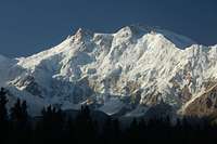
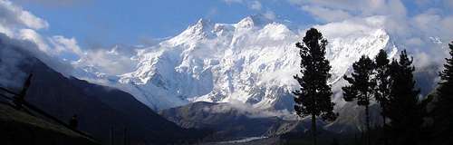
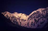
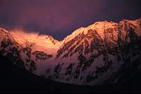
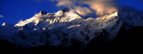
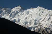
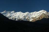
Raikhot Face of Nanga Parbat
Nanga Parbat is located in the Northern Areas of Pakistan and is the Western bastion of the Himalaya. It is the nineth highest mountain in the world and the second highest in Pakistan after K2. Steeped in a history matched by few others in Asia it has staged some of the greatest Himalayan ascents of all time. From Hermann Buhl’s solo first ascent in 1953 via the Upper North ridge to Gunther and Reinhold Messner’s first ascent of the Rupal Face in 1970 via the South South East Spur, Messner’s solo climb of the Diamir Face in 1978, and more recently Vince Anderson and Steve House’s Alpine-style ascent of the Central Pillar of the Rupal Face. These epic climbs continue to inspire climbers to attempt yearly what is considered to be the second hardest 8000m mountain after K2.
Nanga Parbat is a truly awesome spectacle. The south face is the largest in the world extending over four kilometres above base camp. To date there have only been five ascents from the south. Nanga Parbat means "Naked Mountain" in Hindi/Urdu and is with reference to the south face's exposed rock buttresses. The north face is equally intimidating. In contrast to the south face’s steep rock and ice the snowy north face is guarded by a broad barrier of seracs that extend the width of the mountain. Climbers before the Second World War were convinced that the only way to climb the mountain was from the north via a long arc extending over Rakhiot Peak (7010m), between the two summits of Silberzacken and finally to the summit of Nanga Parbat thereby avoiding a more direct ascent of the north face. The route was dangerously prone to avalanche and exposed to bad weather. 31 people died attempting to climb the mountain leading to it acquiring the infamous name of the “Killer Mountain”. Nowadays it is not such a killer and there are other peaks that could inherit the nickname (eg Ultar or Batura I). Hermann Buhl’s summit route has only been repeated once (Slovak, 1971) to this day. His ascent marked only the third 8000m ascent after Annapurna I (1950) and Everest and was the only first summit of all the 8000ers to be done without oxygen and of course solo. Most attempts nowadays are via the Westerly Diamir face which is generally considered to be the easiest and safest with the Kinshofer Route the normal route. Nanga Parbat as of 2005, had received 263 ascents by 261 individuals (Messner and SP Member Qudrat Ali have climbed it twice) at a price of 62 deaths. Sixteen women have summited the mountain. Numerous challenging lines still await. The most difficult is an ascent of Nanga Parbat via the unclimbed Mazeno Ridge which constitutes the longest ridge in the world. A number of expeditions have made ‘attempts’ on the mountain during winter but to no avail.
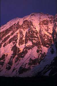
 The Rupal Face of Nanga Parbat
Climbing History
| Year | Team | Route | Summit? | Significance | Description |
| 1895 | British | Mummery Rib | N | First attempt led by Alfred Mummery. Reached 6100m on the Diamir face. Mummery and two Gurkha companions later died reconnoitring the Rakhiot Face | |
| 1930s | German | N | Six German expeditions attempt the maintain, all of which end in failure with dozens dying in avalanches and storms. Among them some of Germany's finest climbers Willi Merkl and Willo Welzenbach perished on the mountain. | ||
| 1950 | British | ? | N | Two more deaths after a three British make a failed winter attempt | |
| 1953 | German | East Ridge | Y | 1st Ascent | First ascent by Austrian Hermann Buhl (member of a Austrian-German team led by Karl Herligkoffer) via the East Ridge from the Rakhiot side. From a Camp at 6900m beneath the Silberzacken (Silver Col) Buhl climbed solo after his companions turned back and summited a staggering 40 hours later. He was forced to bivi at 7900m following the summit before descending next day to 6900m. |
| 1962 | German | Kinshofer Route | Y | 2nd ascent & 1st ascent of Diamir Face | Second ascent by Toni Kinshofer, Siegfried Löw and Anderl Mannhardt via a buttress to the left side of the Diamir face (the Diamir Flank). The route (the Kinshofer Route) has become the normal route of ascent in recent years |
| 1970 | German | Messner Route | Y | 3rd ascent & 1st ascent of Rupal Face | Reinhold and Günther Messner make a first ascent the Rupal Face via the SSE Spur and Merkl Couloir. They descended the Mummery Rib on the Diamir Face with Günther being killed by an avalanche on route. Peter Scholz and Felix Kuen summited the day after the Messners and descended back down the Merkl couloir. Previous German expeditions in 1960 and 1968 had tried and failed at this route. |
| 1971 | Slovak | East Ridge | Y | 4th ascent & only climbers ever to repeat Buhl's route | Ivan Fiala and Michael Orolin summit Nanga Parbat via Buhl's 1953 route while other expedion members climb the SE peak (7600m / 24925 ft) above the Silbersattal and the foresummit (7850m / 25760 ft) above the Bazhin Gap |
| 1976 | Austrian | Schell Route | Y | 5th ascent via new route | Gimpel, Schauer, Schell and Sturm climb the Rupal face via the Mazeno Col (c.6940m) and Southwest Ridge. The route had been reconnoitred in 1975 by a German expedition however bad weather had stopped them. The Germans returned to the route in 1976 but their attempt was aborted when Wastl Arnold fell to his death. |
| 1978 | Czech | N/A | 1st ascent of north peak | A six man team successfully made a 1st ascent of Nanga Parbat's North peak (7816m / 25644 ft) | |
| Austrian | Kinshofer Route | Y | Five climbers made the second ascent of the Kinshofer route | ||
| Reinhold Messner | Diamir Face | Y | New route & 1st solo ascent, 1st Alpine style ascent | Messner solos the right side of the Diamir Face. This was the first completely solo climb on the mountain (Buhl only soloed the latter part of his climb) and also the first in a modern Alpine style. He previously acclimatised on Ganalo Peak (6600m) | |
| 1979 | French | Mazeno Ridge | N | First attempt of the Mazeno Ridge. Hampered by bad weather and only managed to climb the first Mazeno peak | |
| 1981 | Dutch | Schell Route | Y | Only one member, Ronald Naar reached the main summit | |
| Italian | Kinshofer Route | Y | Four camps were made and three climbers made the third ascent via the Kinshofer route. | ||
| 1982 | International Team | SE Buttress | N | New Route to S Summit | Siege attempt of the SE Spur, in which five camps were established on the mountain. From camp V four climbers attempted the south summit but three soon gave up leaving only Ueli Buhler to continue alone. With no bivouac gear he was forced to spend an unsheltered night on the mountain before reaching the south summit of Nanga Parbat at noon the following day. He was unable to continue to the main summit and descended to reach camp V by 6pm with seriously frozen hands and feet. |
| 1984 | French | Kinshofer Route | N | French climber Lilliane Barrard becomes the first woman to climb Nanga Parbat, accompanied by her husband Maurice Barrard. They climbed the Kinshofer route in an alpine style above camp 1. | |
| 1985 | Principally Polish | SE Buttress | Y | Completion of the SE Spur to the Main summit | Poles Zygmunt Heinrich, Jerzy Kukuczka, Mexican Carlos Carsolio and American Slavomir Lobodzinski climbed Ueli Buhler's SE Spur but finished on the main summit as opposed to the south summit. Kukuczka fell 600m during the descent but was remarkably only stunned. Piotr Kalmus was less fortunate and was struck by an avalanche between camp 1 and 2. |
| Polish | Kinshofer Route | Y | 1st ladies-only ascent | Anna Czerwifiska, Krystyna Palmowska and Wanda Rutkiewicz reached the summit with no porter support | |
| 1988 | Italian | Rakhiot Face | N | New Route Attempt | From an ABC at 4500m six climbers ascended to a buttress at 6500m in ten days fixing 1600m of rope. At that point they gave up because of a strong rise in temperature. Throughout the climb there were great objective dangers with avalanches continuously sweeping the face. |
| 1989-9 | Polish | Messner Route | N | 1st winter attempt | Maciej Berbeka, Piotr Konopka and Andrzej Osika reached a high point of 6800m but the attempt was abandoned amidst deteriorating weather. |
| 1990 | Austrian / Swiss | Kinshofer Route | Y | 1st ski descent | Austrian Hans Kammerlander and Swiss Diego Wellig reached the summit then, from the North summit 100m below the main summit, skiied back down to base camp. Sections needed to rappelled or rock climbed down. Skiing was very difficult because of the couloir's steepness and the intermittent rock bands. |
| 1990-1 | Anglo-Polish | Messner Route | N | Winter attempt | Amidst increasing strong winds and deteriorating weather the team reached a high point of 6600m. During the attempt the base was flattened by a pressure wave of an avalanche high on the Rupal wall. Fortunately no one was hurt. |
| 1992 | - | Mazeno Ridge | N | Doug Scott attempts Nanga Parbat via the Mazeno Ridge. Fails but climbs three Mazeno peaks | |
| 1995 | International | Mazeno Ridge | N | Wojciech Kurtyka (Polish), Andrew Lock (Australian) and Rick Allen (UK) managed to traverse the first three Mazeno peaks but then decided to retreat. | |
| 1996 | Japanese Route | Japanese Route | Y | North Face new route | A Japanese team established a direct route to the Silbersattel upon where they continued to the summit via a similar route as Hermann Buhl's. |
| Krzysztof Wielicki | Kinshofer Route | Y | 1st Solo ascent of the route | Krzysztof Wielicki made the first solo ascent of the Kinshofer Route and became the fifth man to summit all the 8000 mountains. He climbed continuous for 48 hours then descended 5800m the same day as summiting. | |
| British | Kinshofer Route | N | Winter attempt | Reached a point below 6000m then retreated. | |
| Polish | Kinshofer Route | N | Winter attempt | Polish expedition to the Diamir Face come very close to making the first ascent in winter of any 8000m mountain in Pakistan. Krzysztof Pankiewiez and Zbigniew Trzmiel retreat just 250 meters below the summit with severe frostbite Unfortunately the team needed evacuating from BC by helicopter due to frostbite injuries. | |
| 2000 | German | NE Face | N | New Route to 7500m | Reinhold Messner, Hubert Messner, Hanspete Eisendle, Wolfgang Tomaseth climbed to 7500m where the route met with the 1978 Czech route at 7500m but went no further due to poor snow conditions. |
| 2003 | Jean Christophe Lafaille | Tom and Martina Route | Y | New Route | Jean Christophe Lafaille climbs a new route on the Diamir Face via a spur to the left of the Kinshofer route that meets Kinshofer two thirds up. For the first part of the climb Lafaille has joined by Simone Moro but descended on route to camp 4 at 7400m due to acclimatisation difficulties. For the latter half of the climb Lafaille was joined by Ed Viesturs who had climbed the Kinshofer route and rendezvoused at camp 3 |
| 2004 | Steve House / Bruce Miller | Direct SE Face | N | New Route Attempt | Attempted a new route on the Rupal Face of Nanga Parbat reaching c.7550m before House's altitude sickness forced a retreat. |
| Doug Chabot / Steve Swenson | Mazeno Ridge | N | Traversed all the Mazeno peaks but then descended the Schell Route | ||
| 2005 | Korean | Messner Route | Y | 2nd Ascent of Messner Route | Koreans make a south-north traverse ascending via the Messner route on the Rupal Face and then descending the Kinshofer Route on the Diamir Face |
| Tomaž Humar | New route on Rupal Face | N | New Route Attempt | Pakistani military helicopters rescue renowned Slovenian mountaineer Tomaž Humar, stuck under a narrow ice ledge at 5900m for six days having descended from 6300m. One of the few successful rescues carried out at such high altitude | |
| American | Central Pillar | Y | New Route | Vince Anderson and Steve House climb the Central Pillar of the Rupal Face Alpine-style in six days. They were later award that Piet-Dor. More direct than the Messner's route the climb has been heralded as one of the greatest ascents of all time | |
| 2006-7 | José Antonio Delgado Sucre | ? | Y | José Antonio Delgado Sucre, an elite high altitude climber from Venezuela, dies a few days after making the summit, where he was caught by bad weather for 6 straight days and was not able to make his way down. He was the only Venezuelan climber, and one of the few Latin Americans, to have summited five eight-thousanders. | |
| Polish | Schell Route | N | Winter attempt | Polish winter attempt of the Schell Route fails |
Routes Overview
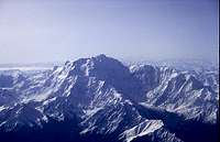
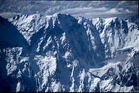
Nanga Parbat massif from the air
Nanga Parbat has three faces with three long ridges dividing these. The Diamir (West) face is by far the most popular face attempted by teams with a minority attempting the huge Rupal (south face). The Rakhiot (north) face has received sporadic attempts over the decades with only two routes completed. Between the vast faces are three extensive ridges. The Mazeno Ridge divides the Diamir and Rupal Faces and is described below. Between the Rupal and Rakhiot faces is a long ridge that descends to Siberzacken then to Rakhiot Peak, and the Chongra Peaks. Dividing the Diamir and Rakhiot Faces is a ridge that descends a short distance from the main summit to Nanga Parbat North then continues to descend to Ganalo Peak.
The Rupal (South) Face
The Rupal Face
South South East Spur (Messner Route)
First Ascent: Reinhold Messner, Gunther Messner, Peter Scholz and Felix Kuen,
1970
Upper South West Ridge (Schell Route)
First Ascent: Gimpel, Schauer, Schell and Sturm, 1976
South East Pillar
First Ascent: Zygmunt Heinrich, Jerzy Kukuczka, Carlos Carsolio and Slavomir Lobodzinski, 1982
Direct South –East Face
Unclimbed; Steve house and Bruce Miller reached c.7550m in
2004
Direct South East Face - Central Pillar
First Ascent: Steve House & Vince Anderson, 2005
Grade: 5.9, M5 X, WI4
South Face Direct
Unclimbed; Attempted by Tomaž Humar in 2005; Reached 6300m
The Diamir (West) Face
Mummery Rib
Unclimbed; Mummery reached 6100m in 1895. Route never attempted since.
Descent: Reinhold Messner, 1970
Diamir Flank (Kinshofer Route)
First Ascent: Toni Kinshofer, Siegfried Löw and Anderl Mannhardt, 1962
First solo ascent: Krzysztof Wielicki
First Ski Descent: Hans Kammerlander, Diego Wellig, 1990
Kinshofer Route Photos
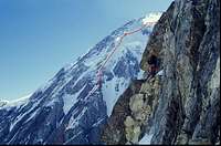 The Kinshofer Route |
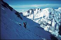 Traverse from Camp III to Bazhin shoulder |
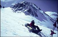 Near Bezhin Gap with summit pyramid in background |
Diamir Face
First Ascent: Reinhold Messner, solo, 1978
Czech Route
First Ascent: Andrej Belica, Joseph Just, Marian Zatko, Juraj Zatko, 1978 (to north summit)
North-East Face
First Ascent: Reinhold Messner, Hubert Messner, Hanspete Eisendle, Wolfgang Tomaseth climbed to 7500m where their route met the 1978 Czech Route
'Tom and Martina' Route
First Ascent: Jean Christophe Lafaille, 2003
The Rakhiot (North) Face
Rakhiot Glacier and East Ridge
First Ascent: Hermann Buhl, 1953
Japanese Route
First Ascent: Hiroshi Sakai, Yukio Yabe, Takeshi Akiyama, 1996
Rakhiot Face - Pilar Val Fiemme
Unclimbed. Attempted once in 1988 by an Italian team
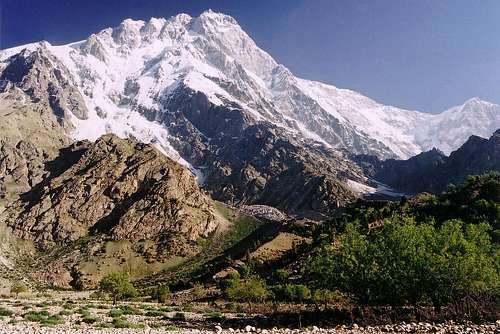
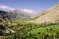
 Nanga Parbat massif from Fairy Meadows
The Mazeno Ridge
Unclimbed; attempts made in 1979, 1992, 1993, 1995 and 2004.
All the Mazeno Peaks have been traversed however nobody has continued to Nanga Parbat’s summit.
More About the First Ascent
Buhl on the Summit
The first summit in 1953 by Hermann Buhl was from the north via the Rakhiot Glacier and East Ridge. Buhl formed part of a large German-Austrian expedition led by Dr Karl Herrligkoffer (although leadership was transferred to Peter Aschenbrenner upon reaching base camp) that was wracked by disorganisation. Sherpas from Nepal never arrived and there was a drastic shortage of high altitude porters that severely limited the siege attempt with higher camps never formed. Bad weather, altitude sickness and porter strikes had led to many members (including Buhl’s most regular climbing partner Kuno Reiner) throwing in the towel and descending to base camp.
When four climbers Otto Kempter, Walter Frauenberger, Hans Ertl and Hermann Buhl made a last push for the summit from camp III (20125ft) with a small elite of high altitude porters they had been under persistent orders from base camp to abandon their attempt and descend immediately - to which they firmly refused. Beyond camp IV (22000ft) only the younger Kempter and Buhl continued as Camp V (22640ft) had never been properly established and there was only one small tent pitched. On summit day Buhl left ahead of Kempter who did not rise for the appointed 2.30am departure. Kempter eventually followed one hour after but never caught up and soon turned around leaving Buhl the task of climbing solo to the summit. Buhl reached the summit (without bottled oxygen) at 7.30pm shortly before sunset after 17 hours of climbing. Having only descended a short distance before nightfall he was forced to bivouac in the open at 26000ft until sunrise, which he amazingly survived. This was the highest ever bivi at the time. Next morning he continued his descent arriving at camp V 41 hours after his departure exhausted, feet frostbitten and suffering wild hallucinations. Three days later he reached base camp by which time many of the party had already packed up and left.
The only other expedition to repeat Buhl's route were a Czech team in 1971. Having been pinned in camp IV on Rakhiot Peak for three weeks the team were able to make camps V and VI. From camp VI on the Silbersattel Ivan Fiala and Michael Orolin reached the main summit while other members reached the southeast peak (7600m / 24925 ft) above the Silbersattal and the foresummit (7850m / 25760 ft) above the Bazhin Gap.
 Silberzacken (L) & Nanga Parbat's subsidiary summit (R) |
 Buhl on Nanga Parbat's flanks |
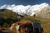 Memoral at the Rakhiot BC |
First Ascent of the Rupal Face
The 4th Face of Nanga Parbat - Reinhold Messner
The first ascent of the Rupal Face was as much of an epic as the first ascent from the North side by Hermann Buhl. Having sieged the mountain via the South-South-East Spur, Reinhold and Günther Messner climbed to the summit from camp V at 7200m (23625 ft). After leaving camp at 3am they reached the summit by 5pm via the Merkl couloir (named after one of Germany's most famous climbers who died on Nanga Parbat in the 1950s). The pair then descended and bivouacked just above the Merkl couloir at 7925m (26000 ft). Günther's conditions was rapidly deteriorating and rather than risk descending the couloir, where there was no fixed rope, the pair decided to descend the Diamir Face. They reached 6250m (20500 ft) by nightfall on the Mummery Rib. The following day they continued their descent with Reinhold continuing ahead. After waiting for some time for his brother he backtracked to fin him only to discover he had been buried by an avalanche. After hours of searching, Reinhold continued his descent to the Diamir valley. Messner's account of this incident involving his brother's death was disputed by some, casting a further shadow over the climb's achievement. In 2005 however, Günther's remains were found on the Diamir Face, corroborating Reinhold's story.
The day after the Messners' ascent Peter Scholz and Felix Kuen reached the summit via the same route. With the pair having part fixed ropes in the Merkl couloir they descended back to camp V.
More info on the 1970 ascent
National Geographic: Murdering the Impossible
PlanetMountain.com: Nanga Parbat 1970. Reinhold Messner told the truth
Outside Magazine: Es Ist Mein Bruder!
ExWeb Messner brothers' special: Remains found at Nanga Parbat suspected Asian
The Central Pillar
In 2005 Steve House and Vince Anderson made what is arguably one of the greatest climbs in Himalayan mountaineering history when they completed a first ascent of the central pillar of the Rupal Face Alpine-style. They went on to win the Piolet d’Or that same year. They completed the climb in five days and took a further two days to descend down the Messner Route. The route was graded at US VII 5.9 M5 X WI4.
This was actually Steve House’s Third attempt at Nanga Parbat. His first attempt had been in 1990 when he was only 19 and part of a 19-member Slovenian expedition that successfully climbed the Schell Route. House unfortunately only reached c.6400m. His second attempt was with Bruce Miller in 2004 when they made a bold attempt at the Direct South East Face. The pair reached c.7550m before House’s altitude sickness forced a retreat. In 2005 House had planned to attempt the same route but then decided to follow the more direct Central Pillar during the climb amidst excellent weather.
The Mazeno Ridge
Nanga Parbat (L) & Mazeno Peak (R)
The Mazeno ridge is the longest ridge on any 8000m mountain and includes eight 7000m peaks. Contrary to often incorrect information on the net, all the Mazeno peaks have now been climbed although nobody has managed to traverse the ridge and continue to the summit of Nanga Parbat. The best attempt to date was that by Doug Chabot and Steve Swenson in summer 2004. They managed a full 10km traverse of all the Mazeno peaks to the point where the ridge meets the Schell Route at 6940m. First ascents were made of Peak 7060m, Peak 7120m (Mazeno Peak), Peak 7100m and Peak 7070m. Illness and exhaustion forced them to descend. Previous attempts included that by Doug Scott in 1992 that climbed the first three peaks. Scott also attempted the ridge in 1993 and 1995 but got no higher. Wojciech Kurtyka and Erhard Loretan made an attempt in 1997.
 Mazeno Peak at sunset |
 The Mazeno Ridge from the air |
 Mazeno Peak |
 The Diamir Face |
Getting There
Nanga Parbat is the most easily accessible of all 8000m mountains with base camps reachable in as little as two days from Gilgit. The north face is visible from the Karakoram highway which is the main artery between Islamabad and Rawalpindi to the south and the Chinese border to the north.
Islamabad is the international gateway for those arriving by air. Emirates also fly to Lahore and Peshawar however Islamabad is in close proximity to the start of the KKH and also has onward flights to Gilgit. Karachi in the south of Pakistan is sometimes cheaper to fly to but connecting Karachi to Islamabad flights cost around Rs50,000 meaning any saving is immediately lost.
Step 1:Reaching Gilgit
From the south
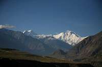
Nanga Parbat from the KKH
PIA opperate daily flights between Islamabad and Gilgit the largest town in the Northern Areas. Seats sell quickly and it is advisable to book as far ahead as possible. Tickets can be booked online or at international or national PIA offices.
Daily buses travel between Pir Wadhai bus station in Rawalpindi and Gilgit along the KKH. Buses pass through Mansehra (change here for Muzzafarabad and the Kaghan valley), Besham (change here if heading to/from Swat or Chitral) and the Indus Kohistan region and eventually Gilgit. The Northern Areas Transport Company (NATCO) is the largest company and has several services a day. Masherbrum Tours and the Silk Road Transport Company also run several buses. Book seats early else you will have the joys of experiencing a night with no sleep on the back seat. The 573km trip takes atleast 14 hours.
From China & the north
Gilgit can also be reached from China with the trip from Kashgar to Sost taking 2 nights with an overnight stop in Tashkurgan. Hi-Ace vans travel between Sost and Gilgit throughout the day leaving as soon as they are full. There is now a direct bus between Tashkurgan and Gilgit, however, if travelling from China, it is better to buy a ticket to Sost only then take local transport to Gilgit as the international bus sits in the customs yard at Sost for a couple of hours while luggage is checked before continuing to Gilgit. The Chinese side of the KKH (called the "Sino-Pakistani Highway" by the Chinese" has been a distaster area for the last couple of years due to roadworks. Rather than repair small sections of road at a time as most countries do, the Chinese labour force likes to dig up great strectes at a time. The journey to the border therefore means a lot of off-road travel. The road works have also unfortunately caused significant soil errosion either side of the road that will be irreversable.
From Chitral
Vehicles leave Chitral (in the Hindukush) for Gilgit at least once a week, the journey taking about 16 hours by Land Cruiser. The road crosses the Shandur Pass (3,734m/12,251ft), which is passable for an even shorter period than the Lowari Pass. Otherwise Private Landcruisers can be hired for the journey which allows you to plan your own itinerary.
From India
A fortnightly bus service started on April 7th 2005 between Srinagar and Muzaffarabad however, it is not available to foreigners. Only Indians and Pakistanis can take the bus. For those crossing from India the border crossing of Wagah, east of Lahore, is still the main point of entry.
Step 2:Reaching Base Camp
The North Side
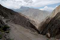
Jeep track to Jhel
The north face is reached via Fairly Meadows from the Raikot Bridge on the KKH. This is a large steel bridge that spans the Indus River. Raikot is easy to reach from either Gilgit or Chilas as regular minivans ply the route between these towns. Jeeps are also easy to arrange in Gilgit. At Raikot though you will need to change to local Jeep transport as the Jeep track to Tato is a private road. The local Jeep monopoly means that the trip is not cheap. In 2007 the prices rose to 2000/3500Rs one-way/return. For the return leg you either need to agree a date to be picked up or wait in Tato for someone to come up the hill. The Jeep track has been widened in the last few years and is no longer the death trap that it used to be.
From Tato walk to Fairy Meadows in a few hours along a broad, obvious path. Initially the incline is gentle but becomes steeper as you approach Fairy Meadows. During this climb the landscape transforms from an arid one to rich conifer forest. Those requiring porters should easily be able to sort something in Tato or Jhel.
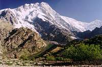
 The Raikot Face from Fairy Meadows
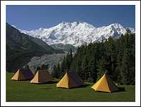 Rakhiot Sarai, Fairy Meadows |
 Nanga Parbat from a village adjacent to Fairy Meadow |
 Fairy Meadows Cottage |
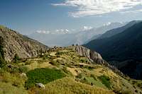
From Fairy Meadows it is an easy day's walk to base camp via the village of Beyal. The way is easy to navigate, bearing south for the entirety. I managed it without a map (just the Lonely Planet trekking guidebook description).
From Fairy Meadows the path initially hugs the edge of the terrace above the Raikot Glacier's terminus, overlooking the valley and glacier but soon moves away from it. The trail passes through chir pine and fur forest with a birch-lined stream for 30 minutes. The trail is braded in places but the paths soon meet up again.
Beyal
After approximately 90 minutes you arrive at Beyal (3500m). There's plenty of accommodation at Beyal however I found the setting of Fairy Meadows to pleasanter. Plus there wasn't the constant sound of chopping wood (Beyal was undergoing a 'construction boom' when I was there in 2006).
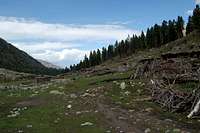
From Beyal the trail becomes steeper and soon climbs to a large boulder aptly known as "View Point" (3667m). From here there are great views of both the Nanga Parbat Massif and the Chongra peaks together with the vast broken glaciers that flow from their flanks. The Rakaposhi-Haramosh range is also visible in the distance to the North-east.
Ignore the path that descends to the glacier from the boulder as this way is no longer used due to surges in the Ganalo Glacier. The route stays right and soon winds back and forth through birch trees to the top of the moraine. From here the path briefly flattens out before reaching the Ganalo Glacier.
The way across the Ganalo Glacier is marked by cairns and no glacier experience is required for the crossing. The glacier is covered in scree and rubble and there is no chance of falling in any crevasses. If you do get lost, just look for the path ascending from the south side of the glacier and head for it. The base camp is just a short walk beyond the Ganalo Glacier.
Views from Rakhiot Base Camp
 Nanga Parbat massif from BC (summit hidden to South) |
 Avalanche on Nanga Parbat's north face |
 Nanga Parbat massif soon after sunrise |
The South Side
Tarashing is the gateway to the Rupal valley. Gilgit-Tarashing special hires can be arranged for about Rs2500. Travel to Tarashing takes the best part of a day; maybe longer as rocksldes between Jaglot and Astor are frequent (or even temporary closure of the road). There is local transport but is obviouly unsuitable for carrying large expedition loads.
From Tarashing a shepherd trail leads west up the Rupal valley to base camp easily crossing the Bazhin glacier on route.
 The Rupal Valley |
 Foreshortened Chongra Peaks above Tarashing |
 Rupal Face |
The West Side
The trek to base camp begins at a village called Bunar which is approximately 12km west of Rakhiot Bridge. From Bunar follow the Bunar valley south 12km to Halaley Bridge. From here the Diamir Valley ascends SE to the Diamir Glacier.
Red Tape
Visas
A valid visa is required. Visas are NOT issued at the airport and must be obtained prior to arrival. Some embassies such as those in Central Asia are reluctant to issue visas and advise you to obtain them from your home country. A single-entry tourist visa is valid for 3 months from the date of arrival in pakistan and for 6 months from the date of issue. Some visas are only valid for 3 months from the date of issue so check if necessary when applying. Visa prices vary. Americans pay the most for their visa whilst Japanese get theirs free! Visa extensions and reentry stamps used to almost impossible to obtain however the process has become remarkably easier in the last few years. Gilgit DC is an obvious place to try.
Permits
Nanga Parbat is not in a restricted zone and no trekking permit is required.
Climbing Royalties
The Ministry of Tourism has decided to maintain the 50% reduction in mountaineering royalty fees for peaks above 6500m for 2009. Royalties have been 50% now since 2002 with the intention of attracting more expeditions to Pakistan. Royalties per expedition are based on a party of 7. Persons additional to this number will be subject to an additional royalty fee. Current royalties are listed below for Nanaga Parbat and other peaks on the masif.
No liaison officer is currently required!
Royalties are only 5% for winter attempts!
| Peak | Normal Fee | Fee for 2009 | ||
| Expedition Royalty | Additional royalty per person | Expedition Royalty | Additional royalty per person | |
| Nanga Parbat | $9000 | $1500 | $4500 | $750 |
| 7501-8000m | $4000 | $500 | $2000 | $250 |
| 7001-7500m | $2500 | $400 | $1250 | $200 |
| 6501-7000m | $1400 | $200 | $700 | $100 |
| Peaks up to 6500m | $1400 | $200 | No fee | No fee |
When To Climb
June to September is the normal time to try the mountain. Outside these months snow can be problematic at high altitude. Winters are extreme but with the current 5% Royalties there is an obvious incentive. Of the seven 8000 peaks climbed in winter none have been in Pakistan.
Books
Nanga Parbat Pilgrimage: The Lonely Challenge by Hermann Buhl Classic!
Solo : Nanga Parbat by Reinhold Messner
The Naked Mountain by Reinhold Messner
All Fourteen 8000ers by Reinhold Messner
Maps
Online Maps
AMS topographical Map (1:250,000)
1936 German Map
NASA satalite map
More to follow...
External Links
Links relating to Steve House and Vince Anderson's ascent of the Central Pillar of the Rupal Face in 2004
Grivel - Rupal II: A New Route on the Rupal Face Climbed in Alpine Style by Steve House
Patagonia - A New Route On The Rupal Face by Steve House
PlantetMountain.com - XV Piolet d'or to Steve House and Vincent Anderson
Bend's Steve House and Vince Anderson top Rupal Face alpine style in Pakistan
Video - Steve House and Vince Anderson: Gear for Nanga Parbat Ascent (Alpine Climb)
Video - Steve House: Patagonia Clothing System for Nanga Parbat Ascent (Alpine Climb)
The Eight Thousanders: Nanga Parbat Excellent photos and large-scale sketch map
K2climb.net: Nanga Parbat SUMMIT - Korean Traverse and 9 summits on the normal route
Nanga Parbet: The Killer Mountain
Damien Gildea - Feb 15, 2008 1:23 pm - Hasn't voted
More Than Five"To date there have only been five ascents from the south" There has been more than one repeat of the Schell, plus the Koreans repeated the Messner route in 2005 just before Anderson/House did their route. I'd say it's at least eight ? D
dmiki - Mar 24, 2008 5:58 am - Hasn't voted
"seven 8000 peaks climbed in winter"Eight have been climbed. Everest - 17 February 1980, Leszek Cichy and Krzysztof Wielicki (PL) Manaslu - 14 January 1984, Maciej Berbeka and Ryszard Gajewski (PL) Dhaulagiri - 21 January 1985, Jerzy Kukuczka and Andrzej Czok (PL) Cho Oyu - 12 February 1985, Maciej Berbeka and Maciej Pawlikowski (repeated three days later by Andrzej Heinrich and Jerzy Kukuczka) (PL) Kangchenjunga - 11 January 1986, Jerry Kukuczka and Krzysztof Wielicki (PL) Annapurna I - 3 February 1987, Jerzy Kukuczka and Artur Hajzer (PL) Lhotse - 31 December 1988, Krzysztof Wielicki (PL) Shisha Pangma - 14 January 2005, Simone Moro (IT) and Peter Morawsky (PL) K2 - none Makalu - none Nanga Parbat - none Gasherbrum I - none Broad Peak - none Gasherbrum II - none Some further info
BigLee - Apr 16, 2009 2:58 pm - Hasn't voted
Re:It's actually nine 8000'ers that have been climbed in winter as Makulu got climbed this this year. Cheers
dmiki - Apr 19, 2009 1:38 pm - Hasn't voted
Re: Re:Thanks for the update! "On or about January 27, 2006, the French mountaineer Jean-Christophe Lafaille disappeared on Makalu while trying to make the first winter ascent. Makalu was first climbed in winter on February 9th 2009 by Italian Simone Moro and Kazakh Denis Urubko. It was the final Nepali 8000er to be climbed in winter conditions."
dmiki - Feb 4, 2011 7:57 am - Hasn't voted
Re: Re:GII 02 Feb 2011 Simone Moro (Italy), Denis Urubko (Kazakhstan), Cory Richards (Canada)
aaporik - Oct 6, 2009 1:58 am - Voted 9/10
HiMountain Nanga Parbat Winter Expedition 2006/2007Members of the Team; Krzysztof Wielicki - The expedition leader, Jan Szulc - The deputy expedition leader, Jacek Berbeka - climber, Artur Hajzer - climber, Tommy Heinrich - climber and photographer, Jacek Jawien - climber, Przemyslaw Lozinski - member, Ghulam Rasool from Pakistan as a climber, Hassan Sadpara from Pakistan as a climber, Robert Szymczak as a expedition doctor, Krysztof Tarasewicz as a climber, Dariusz Zaluski as a climber. Route the expedition choose was Schell Route. Local partner: Asghar Ali Porik - Jasmine Tours
aaporik - Oct 6, 2009 2:05 am - Voted 9/10
Polish Winter Nanga Parbat Expedition 2008/2009Members Jacek Teler - The leader of the expedition, jaroslaw Zurawski as a team member. Route: Normal Diamir Face Period of permit: 14-12-2008 to 15-02-2009 Result: unsuccessful reach until Camp 1. Base camp: successful to establish winter base camp near summer base camp Local partner: Asghar Ali Porik - Jasmine Tours
aaporik - Dec 22, 2010 1:33 am - Voted 9/10
Russian Solo Winter Nanga Parbat Expedition 2010/2011Russian solo Winter Nanga Parbat 8125m Expedition 2010/1011. Diamir Face Date of start December 9th, 2010 permit until Feb., 8th, 2011 Climber name Mr. Sergey Tsygankov Nikolayevich His climbing background Alps: Monteblanc Matterhorn (some times, different routes) incluging solo after 15-th October (almost winter:)) and others less 4000 meters Caucasus: Elbrus (solo, winter, normal route) Ushba (solo NE route) Laila Shkhara and others (3000 - 4000 meters), including solo and winter Ural (only winter): Kruglitsa Narodnaya Manaraga (partly solo, traverse 5 peaks, tempreture -40 C, before -50 C night, winter 2010) Pamir: Lenin peak (winter, normal route) Communism peak (SW route) Tian Shan: Khan Tengri (solo, right part of north face) Andes: Aconcagua Altai: Belukha (some times, incl. winter and solo)
Luc - Jan 24, 2011 12:57 pm - Voted 10/10
New Route July 11, 2009Austro-Canadian north-west buttress. Alpine Style! http://www.louisrousseau.com/ http://www.youtube.com/watch?v=aFLg3qwFBIk http://www.explorersweb.com/everest_k2/news.php?id=18965
Fausto79 - Jun 3, 2013 4:57 am - Hasn't voted
Need to UpdateShould update the story facts. MAzeno Ridge was completed last year by Rick Allen and Sandy Allan. Scottish/English team. Took them 11 days i think and some members of the team turned back due to cold weather. Rick and Sandy kept going though and made it to the top via the ridge. More info here: http://mazenoridge.com/
Simosava76 - Jun 30, 2016 6:30 pm - Hasn't voted
First winter ascentOn February 27 2016 Alex Txikon, Ali Sadpara and Simone Moro successfully made the first winter ascent on the Nanga. A fourth member, Tamara Lunger, stopped just few feets below the summit. They climbed by the Kinshofer routte on the Diamir side.
runout - Dec 22, 2018 10:18 am - Voted 7/10
North-East Face -> North-West FaceI think this is about the year 2000 expedition which was on the North-West Face and even Messner was not the first there: I'd call it 'Diama Route' after the Diama Glacier (not to confuse with Diamir which is next to it). Mummery disappeared on the Diama Glacier trying to reach the Ganalo Pass. There were at least two previous expeditions on that route. Wörgötter stated to us that they had been on around 7400m when they turned on the face below the north summit. We (Clara and me) reached 7760m on that route in 2008 using ski. Messner didn't provide any information to us and local people say that he had never been over 6000m on that route. We couldn't find any pictures from Messners expedition which were made from the ground on higher altitude. Later Eisendle wrote to me that they didn't look at the altimeter when they turned. This route was finished by a Polish/French team in winter 2018. https://www.summitpost.org/diama-route/993778 https://www.summitpost.org/diama-expedition-2008/993779 AAJ 2017: http://publications.americanalpineclub.org/articles/13201214246/Nanga-Parbat-Northwest-Face-via-Diama-Glacier-Previously-Unreported-Attempt-and-Other-History https://www.nangaparbat.at
Nicholas S - Jul 21, 2021 5:26 pm - Hasn't voted
Another book suggestionA cool book that details the first successful Mazeno Ridge ascent of Nanga Parbat: "In Some Lost Place," by Sandy Allan