
|
|
Mountain/Rock |
|---|---|
|
|
39.02190°N / 102.037°W |
|
|
Wallace |
|
|
4039 ft / 1231 m |
|
|
Overview
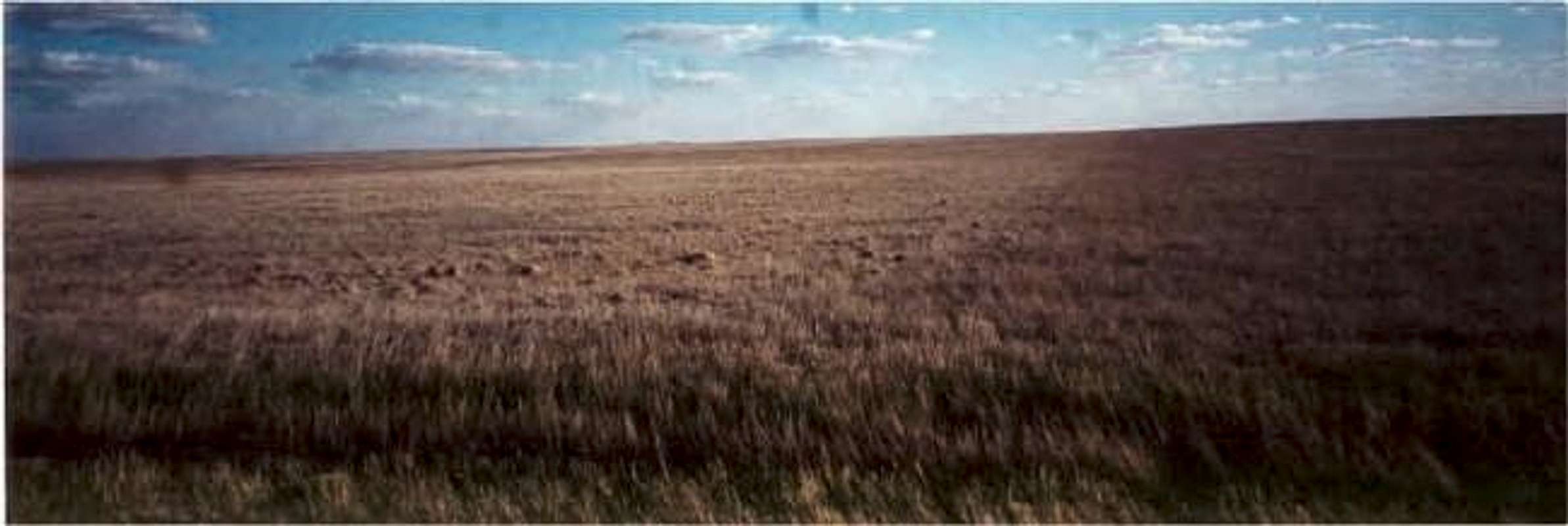
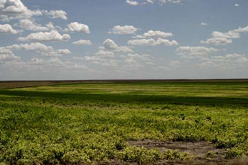
WEST KANSAS TOPOGRAPHY
Mt. Sunflower is the high point of Kansas, hence the name Mt. "Sunflower" since Kansas is the "Sunflower State". What Kansas is not is a mountain state. I do believe that state high points should count as summits, as long as there is a reasonable hill with a view from the top. Kansas is a flat state however, and not very exciting to drive through, except for the Central Kansas hill country. Mt. Sunflower is in extreme Western Kansas (near the Colorado border) in Wallace County, and is actually a hill, with a nice view. It is probably not much more than 50 feet up from the beginning of the trailhead to the top.
It is certainly a high point in the area because the wind was pretty substantial blowing in my face, coming down directly from the summit. In fact, Kansas is certainly not the flattest state highpoint (DE, FL, IN, IA, and RI are all flatter). The Kansas highpoint is actually high enough to have an unobscured view of the surrounding areas, so that a person can see for miles and miles.
 |
 |
 |
 |
Getting There
The summit is 38 miles from I-70 if coming from the east. To get there, take exit 17 in Goodland Kansas, which is route 27 South (speed limit of 65). 17 miles later, there is a sign to Mt. Sunflower. Take a right onto a dirt road. The road goes about 15 miles to another sign to the mountain. 6 miles later there is another dirt road that says, "1 mile to Mt. Sunflower." I took that and parked at the base of the hill leading to the summit sign.
If coming from the west, take Exit 1 just after crossing over the border from Colorado to Kansas, and head south on County Road 3. Stay on CR 3 for approximately 22 miles. You will eventually see the sign for Mt. Sunflower.
From the base of the hill, it is about a half mile to the metal sunflower that marks the highpoint. There is a summit register.
 |
 |
 |
 |
Highpointing
Some may ask why anyone would want to travel to this remote area of the country. Mount Sunflower certainly does not provide the best Kansas has to offer, but highpointing takes you places you would never think of going. Like a unique tour of America that few get to experience. Mount Sunflower is one of the few flatland highpoints, but it is accessible from I-70, a highway that goes from Baltimore to Central Utah, and is used by many to drive cross-country. For more information on highpointing, check out the Highpointers Club.
Red Tape
There are no permits, just drive there, park on the dirt road, and hike the last half mile to the summit. Remember that Mount Sunflower is on private land, so be respectful.
When To Climb
Climb any time of year, but remember that if there is a huge rainstorm or snowstorm, the dirt roads can get especially nasty.
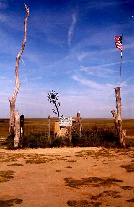
Welcome to Kansas!
External Links
- Goodland, Kansas
Weather in Goodland, Kansas - Is Kansas Flatter than a pancake?
Although Kansas has hills and even rock formations within state boundaries, much of the state is very flat, with few perturbations that would result in any part of the land rising noticeably above the surrounding area. Kansas rises to over 4,000 feet at its highest point, but it is all gradual. Check out the site. - Kansas rock formations
Kansas is flat, but odd chalk rocks reside on the Western Kansas landscape. Check out this page to learn more about these areas.
HasseFamily - Apr 9, 2015 10:06 pm - Hasn't voted
Directions from the NorthwestFrom eastbound I-70: Just after crossing over the border from Colorado to Kansas, take Exit 1 and head south on County Road 3. Stay on CR 3 for approximately 22 miles. You will eventually see a sign for Mt. Sunflower. Turn right (west) at the gate onto a narrow road and continue for a couple of bumpy miles. Turn right (north) at the cattle gate and a short distance to the summit marker.
hgrapid - Apr 10, 2015 12:12 pm - Hasn't voted
Re: Directions from the NorthwestThanks! Nice addition.
Billsouser - Jun 12, 2015 2:59 pm - Hasn't voted
Road ConditionsAs a state high-pointer on a cross-country roadtrip, I attempted to make the trek to Sunflower this morning. BE ADVISED: with any rain, the dirt roads required become impassable morasses of slick mud and gravel. Even in a well-laden four wheel drive with an experienced driver, we became stuck thirteen miles off the highway. The AAA tow truck dispatched to our aid was two-wheel drive and (wisely) refused to come out there. Even some of the street signs are missing. We finally got pulled out by a passing farmer's tractor. I can't speak for the dry roads, but if they are at all wet, give your trip a second thought.
mickic - May 26, 2019 7:16 pm - Hasn't voted
Mount SunflowerGreat visit and way to start our Memorial Weekend peak trip. This isn't an "exciting" summit, but the owners have a done a great job making it photo worthy! We also enjoyed a book from the Free Little Library. Agree with an earlier post about the roads if they are wet; we had some trouble with some segments that were muddy and definitely would not have made if if there had been more recent rain.
James Bednar - Oct 7, 2019 10:15 am - Hasn't voted
My 1st state highpointMt Sunflower, in the great state of Kansas, became my very 1st state highpoint to visit (currently visited 29/50). Visited this site in May 2005, and have returned many times whenever I am in the area. Think been here about 8 times or so - probably more. As other visitors have stated in their logs, not much to see here for you are actually standing on a barely perceptable lump in the Earth's surface. There is a nice monument and a mailbox with a log book inside to sign. You can access the highpoint from KS HWY 27, between the towns of Sharon Springs/Goodland, KS. There should be a large brown sign pointing the way. This route is roughly 26 miles or so on well maintained gravel roads, that can become questionable in inclement weather. Shorter route, roughly 12 miles, can be taken off of US HWY 40 in the vicinity of Weskan, KS. Just follow the signs pointing the way. This route is also well maintained gravel roads. The 3rd route coming in from I-70, I have never taken, so cannot comment on the conditions/distance.
MarkDask - Oct 15, 2020 10:48 am - Hasn't voted
Approach from the SouthOn U.S. Rt 40 heading east not far from the Colorado Border you'll see a little brown sign pointing to the left (north) for Mt. Sunflower, 11 miles. This is Route 3. After 10 miles, turn left on Washboard Road for 1 mile, then turn right and go up the hill to the High Point. You can drive right up to it. All the turns are signed. All the roads are dirt/gravel and in good shape (in dry weather). It was windy, but not so bad that we had lunch on the picnic table there. There's also a little wooden house library on the picnic table. A sign on the mailbox/summit register said to leave a beer, so we did. Great view in all directions. Windmills to the Northwest. Cattle to the East.
hgrapid - Oct 15, 2020 12:26 pm - Hasn't voted
Re: Approach from the SouthDo I need to add this to my directions?
MarkDask - Oct 15, 2020 10:59 am - Hasn't voted
Also nearby and not to be missedAfter visiting Mt Sunflower, head east about 50-60 miles to see Monument Rocks just off U.S. 83 between Oakley and Scott City. It's a much more interesting geologic feature than the HIgh Point. Watch for signs on 83--it's a few miles of gravel road to the Rocks. On the west side of 83 in the same vicinity is Little Jerusalem State Park with some hiking trails to chalk formations similar to the Monument Rocks. The Rocks are free. Little J costs $5 (honor system). A little further south is Scott State Park, where you could camp if travelling through the area.