

-
 125543 Hits
-
 90.83% Score
-
 34 Votes
|
|
Mountain/Rock |
|---|---|
|
|
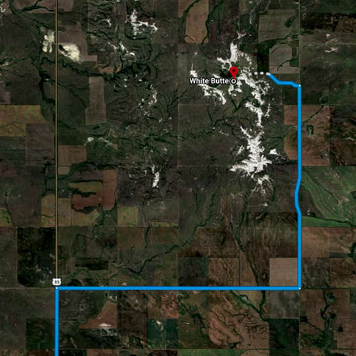
46.38703°N / 103.30257°W |
|
|
Download GPX » View Route on Map |
|
|
3506 ft / 1069 m |
|
|
Overview
White Butte, North Dakota is located between the towns of Amidon, ND and Bowman, ND. White Butte is the highest point in the state of North Dakota. Rising to an altitude of 3,506 feet (1,069m) above sea level, it is the 31st highest summit of U.S. state highpoints [Wikipedia link].
While best known for its status as the North Dakota state highpoint, White Butte is also the highpoint of Slope County. The second highest point in the state and county, nearby Black Butte [Peakbagger link], with an elevation of 3,470 feet (1,058m) and a prominence of 448 feet (137m) is approximately 17 miles away [Google Maps link].
Southwestern North Dakota, with its badlands, buttes, and broad vistas is largely the result of hundreds of thousands of years of erosion. The landscape here is not glacial. It has been carved from layers of flat-lying sandstone and other materials.
White Butte and nearby Rattlesnake Butte were originally named the Chalky Buttes because of their white color. White Butte has a sandstone caprock of Oligocene age White River and Miocene age Arikaree rocks, formations that make up the landscape in Badlands National Park in South Dakota. Below that can be seen the smooth, dark gray slopes of the South Heart Member of the Chadron Formation [Credit John Bluemle].
When To Climb
While the route is open year round, seasonal changes on the Northern Plains present a variety of challenges. During Summer, cactus and scrub brush may be a minor annoyance, while rattlesnakes are a true danger to humans and pets alike. In addition, intermittent thunderstorms may roll in with little notice. Winters are generally cold, often with periods of significant snowfall and blustery winds leading to wind chill temperatures dangerously below zero.
The chalky terrain is extremely slippery when exposed to rain, snow, and ice. Considering the relatively short hike and mild elevation gain, a successful ascent is well within reason for an adventurer with seasonally appropriate clothing, footwear, hydration, and adequate navigation skills.
Theoretically, it's possible to claw and scramble one's way to a successful summit during foul weather through brute force alone. However, for off-season and winter ascents, gaiters, snowshoes, MICROspikes, or Yaktrax may be beneficial if you've already invested in the equipment and have it readily available.
Getting There
There are discrepancies among online resources regarding the naming conventions for various navigation points. The correct, pre-populated destination on Google Maps is labeled "White Butte Trailhead." In actuality, the Google Maps destination for "White Butte Trailhead" leads to the White Butte parking area. "White Butte Trailhead" as identified on Google Maps is not the actual trailhead; however, it is the correct destination for purposes of vehicle navigation along the state highways and county backroads to the general location of the trailhead parking area.
When using Google Maps for highway navigation, make sure to select "White Butte Trailhead" and not "White Butte, Chalky Butte, ND" from Google's pre-populated destinations. "White Butte, Chalky Butte, ND" is owned by a different landholder, fenced off, and clearly marked with multiple no trespassing signs [Credit sam807].
Vehicle access is only allowed at the trailhead parking area. Do not drive up the access road to the abandoned farmhouse or the trailhead gate.
- Drive 21.8 miles [Google Maps link] from Bowman, ND [Wikipedia link]; population ~1650, to the White Butte Trailhead.
- Drive 8 miles [Google Maps link] from Amidon, ND [Wikipedia link]; population ~20, to the White Butte Trailhead.


Camping and Lodging
- The Frontier Travel Center truck stop [Google Maps link] in Bowman, ND provides 24-hour bathrooms, free wifi, food, gas, and overnight parking.
- Campgrounds are available in and around the area of Amidon, ND [Google search link] for fair-weather ascents during tourist season.
- Bowman, ND is the closest city with hotel lodging [Google search link] for non-campers and off-season ascents.
Red Tape
- No permits are required.
- No fixed fee is required to access the trail. Access is granted on a free-will donation basis to be deposited in the Iron Ranger at the trailhead parking area.
- Vehicle access is only allowed at the trailhead parking area. Do not drive up the access road to the abandoned farmhouse or the trailhead gate.
- Make sure to close the trailhead gate to prevent livestock from escaping onto the surrounding land.
- Make sure not to stray onto the adjoining land to the East. It is private property owned by a different landholder and is clearly marked "No Trespassing."
- Please respect the rights of the private property landowners and Leave No Trace!


Route
- 1.7 miles from the trailhead parking area to the summit (3.4 miles roundtrip; discrepancy due to rounding).
- 0.7 miles from the trailhead parking area to the abandoned farmhouse.
- 0.3 miles from the abandoned farmhouse to the trailhead gate.
- 0.2 miles from the trailhead gate to the sandy wash.
- 0.1 miles from the sandy wash to the downed barbed wire cross fencing.
- 0.3 miles from the downed barbed wire cross fencing to the summit.

Miscellaneous Info
- 2018-12-31: Strong and consistent cellular voice and data service was confirmed on the highway and backroads en route to the trailhead and at the summit.
Trip Reports
- 2018-12-31 New Year's Eve winter ascent by Adventure Harder
- 2017-07-22 fair weather ascent by Restless.Sarah
- 2016-08-12 fair weather ascent by James Suits
- 2012-05-27 fair weather ascent by Sm0421
External Links
- 50 States Highpointing Facebook Group
- Highpointers Foundation.org
- Highpointers.org
- Peakbagger.com
- Wikipedia.com
Version History
- 2019-01: Fully revamped the page; it hadn't been touched for over 14 years.
- 2019-01: Corrected the elevation by -1 foot from 3507 feet to 3506 feet and summit coordinates per GPX track and Highpointers.org.
- 2019-01: Cleaned up outdated and erroneous comments regarding bad directions, incorrect coordinates, required fees, and vehicle access allowed to the abandoned farmhouse.
- 2019-05: Corrected information about the geological composition and topography.
- 2019-05: Uploaded GPX file.
slayte - Aug 6, 2013 9:46 pm - Hasn't voted
A few notes/clarificationsNotes from a July 21, 2013 visit: • Regarding whether the road to the abandoned farmhouse is passable by vehicle or not—as of our trip, the road past the mailbox is clearly marked with a “Road Closed” sign. Since the landowners don’t want folks driving to the farmhouse, we respected that (the distance from the mailbox to the farmhouse is a flat, pleasant 0.65 miles—certainly not worth losing access over). • As others have noted, the trail can be hard to follow in the section where it follows a sand wash. There is also a fork in the trail on the ascent up the butte (hint: take the right fork). I found that there was a well-placed cairn in every place where the trail was unclear. So, if in doubt, look around for a cairn. • The trail was overgrown with prairie grass, shrubs, and other vegetation in many places. We were in shorts; I found it irritating to my legs, and one in our party broke out in welts. I would recommend long pants for this hike. • The wind was blowing a steady 15mph on the flats and 25mph on the ridgelines. I found it very dehydrating and used a lot more water than would be expected. • About 5 feet SW of the USGS marker is a small ledge. There was a prairie rattlesnake sunning on this ledge that let us know it was there and then retreated into a burrow under the ledge. So, I would advise caution before doing your highpoint victory dance until you’ve made sure you’re not about to step on the highest rattlesnake in North Dakota. • The summit log only had about 4-5 blank pages left. If you’re heading up, bring a fresh one (needs to be small—3x5 or 4x6). • There were a few lingering wildflowers and a lot of dying ones--it looked like they peaked 1-2 weeks prior. The right timing would add a really nice extra dimension to this hike.
iowahawk43 - Oct 25, 2013 10:06 pm - Hasn't voted
One Main TrailReached this highpoint in October 2013. Here is some input. * White soil is slippery when wet, brown soil is a much better grip * It is called White Butte, but if you head to the highpoint you had better think brown over white when offered a choice * Some instructions suggest right when at a fork, ravine, etc. I recommend you think LEFT when ascending. The best advice is the fence line. You can't literally walk within reach of the fence the entire way up, but you should error in the direction of the fence. * More on the trail up...after the gate you walk a few yards along the fence, trail and a thin drainage ditch to the base of the bluffs. Think left. We set up a few small cairns to assist but we see those being knocked over by wind, rain, snow or cows. * Even more on the trail...it is VERY obvious trail. We went up the wrong ravine and the trails we convinced ourselves was correct were more like animal trails - the kind you have so sort of look at sideways to convince yourself it is indeed a trail. Seriously, the proper trail is 100% obvious trail so move towards the fence line when in doubt. * Stunted trees. If it is possible to follow directions and be wrong, we did it. We found "stunted trees" - about 10 in a grouping. The writer meant the larger group, a grove of maybe 50-70 trees. The main trail is by these, so no matter how you scramble up to the top, make your way towards these make grove of stunted trees. Again, in the direction of the fence line until you hit a trail that makes you KNOW you are on a real trail. * We crossed the grass area after passing by the 3 stunted trees and following an animal trail. Once we could see both sides, the higher peak is the correct one. Where we stood it was...wait for it...in the direction of the fence line we followed from the parking area! If you try to go the direction of anything white, it is likely the wrong direction. SUMMARY: Think left and brown on the way up. Hope this helps.
Hyadventure - Aug 22, 2023 10:56 am - Hasn't voted
New Trail Under ConstructionVisited 8/19/2023 and there is a new trail being constructed. The basic trail work is complete and is usable. The crew was laying down base material on the trail and compacting it into all weather surface. It should be complete very soon. The bugs were horrible.