
-
 34162 Hits
-
 81.84% Score
-
 14 Votes
|
|
Mountain/Rock |
|---|---|
|
|
47.58378°N / 120.1474°W |
|
|
Douglas |
|
|
Hiking |
|
|
Spring, Summer, Fall, Winter |
|
|
4254 ft / 1297 m |
|
|
Overview


Reaching the summit of this peak requires driving 1.5 miles on a Primitive Road. One will encounter a “Private Road” sign when reaching this road. However, it is ok to drive to the summit as long as you stay on this road and don’t drive off onto someone’s property. I checked with one of the property owners on this road to be sure.
The summit of Badger Mountain offers views over to the Enchantments, Mission Peak, and peaks to the North around Chelan. The Columbia River is not visible from the summit. Finding the true summit once up here can be difficult if you don’t know where to go.
Note: Topo Maps don’t mark the high point of Badger Mountain. They show Badger Mountain as the whole table top section on the East side of Wenatchee. Some maps that point out a summit location for Badger Mountain put it way south of the true high point. Some Topo maps show “Ski” as the name at the high point. Another note, Badger Mountain also is a ski area in the winter.
There was not a summit register when I went to Badger Mountain.
Getting There
 |  |  |  |
From Wenatchee drive across into East Wenachee and head North on Eastmont. Once you reach the end of Eastmont and turn on the curve onto Badger Mountain Road reset your odometerto zero.
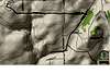
Drive for 16.3 miles on Badger Mountain road. Then turn left onto Chipmunk Road. If you turned right here you would be on Wild Turkey. Below is a Map Trace and GPS Coordinates of the Route.
A 4WD with high clearance would be recommended for the last 1.5 miles. There is one steep hill you have to go down and up. You might get some brush marks on the side of your vehicle as well.
| WPT | Description | Latitude | Longitude | |
| WPT 1 | Turn Left onto Chipmunk | N 47.5808° | W 120.1474° | |
| WPT 2 | Park | N 47.583° | W 120.17926° | |
| WPT 3 | Badger Mountain Summit | N 47.583779° | W 120.179396° |
Red Tape
There is no Red Tape to drive to and hike Badger Mountain. Just respect the land and people’s private property. I would not recommend camping here as one of the nearby property owners might get mad.
Gaining the Summit
 Cool Cloud Formations
 Badger's Summit
External Links
Weather

Dean - Jul 16, 2009 9:55 pm - Voted 10/10
My trip report from 2003Badger Mountain (4,254 ft) Date: May 26, 2003 Authors: Bob Bolton and Dean Molen On Memorial Day 2003, we met at a convenience store in Orondo and drove toward Waterville on US 2. After climbing up over the pass and starting back down toward Waterville, we took the first road to the right (south). This road is dirt but is well graded and smooth. This road Ts on the paved Badger Mountain road, where we turned right and followed it for several miles, ascending up to the tower farm at the 5-way intersection. From here the road trends southwest, and just after a swing around to the west is the junction with the private Hummingbird Road. We turned right here, then drove north until the GPS was pointing due west at the HP, turning west at the next opportunity. There are lots of "For Sale" signs, which removed much of the anxiety from driving the private road among the many shanties and junky yards. We continued on to the west, following a couple of ups and downs until we came to an intersection that has a small shack and trailer on the left in the southwest quadrant. Here we continued west, ascending a hill on a rough road which could be driven in the Honda. Bob got out of the car on a couple of occasions and removed rocks that threatened the Honda's oil pan. Using two GPS units to zero in on the coordinates we had picked up from Topozone, we drove to within yards of the highpoint. A little post and metal sign indicates the location of the SKI BM. We took lat/lon and elevation readings on the GPS units. Looking to the west, we could see the 2nd candidate mentioned by Trapper Robbins in his report, an area containing a barn and a camper shell. The road remained somewhat rough but very passable. It was obvious that there hadn't been anyone around in some time so we crawled through the gate and made our way to the back of the property to find the high spot noted by Trapper. Before long, the highpoint was realized and we again took GPS readings, which indicated that we were about 10 feet lower than the SKI BM, which tempted us to conclude that the SKI BM is indeed the HP. The reward for visiting the second area was a wonderful view of the Cascades to the west, as well as north to Glacier Peak and south to Mt. Rainier, although it was hazy and not clear enough for sharp photos. There was also a great view down to the Columbia River. The third candidate to the south with the towers, 4243 ft, was obviously lower, so it wasn't worth the time and wear and tear on the poor Honda to make our way over to it. More Trip Reports can be found HERE.
gimpilator - Oct 20, 2017 4:15 pm - Hasn't voted
Road Update September 2017Several parties have described difficulties with Chipmunk Road. There is another road running parallel to the north called Falcon Ridge Road. If you take this road directly from Badger Mountain Road, you won't have any issues at all.