
|
|
Mountain/Rock |
|---|---|
|
|
39.05427°N / 106.5651°W |
|
|
Chaffee |
|
|
Mountaineering |
|
|
Summer |
|
|
12957 ft / 3949 m |
|
|
Overview
Ouray is an inconspicuous peak that sits in the Sawatch Mountains of central Colorado south of Route 82. It rises on the crest of a ridgeline that connects Grizzly Peak to Star Mountain. Except for a few spots east of Independence Pass, Ouray Peak is otherwise not visible from Route 82.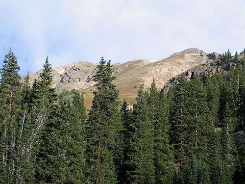 South face of Ouray, true summit on the right
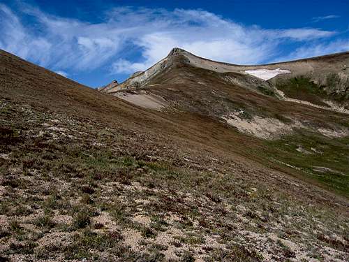
The summit of Ouray Peak consists of two high points with roughly the same elevations. The USGS Map designates the eastern point as the summit of Ouray.
 The east face of the east summit
 West Summit, South Face
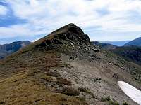 East Summit, West Face
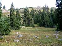
Ouray Peak can be accessed from Mc Nasser Gulch to the south. The USGS Map shows a trail that goes from the Mc Nasser Gulch Trail to the top of the mentioned ridgeline (see map). This trail is also referenced in some of the guidebooks. In August of 2009, however, I was not able to see any sign of this trail. If such a trail ever existed, it has now most likely faded away. Reaching the summit of Ouray, therefore, requires hiking up steep grassy and/or rocky slopes (See “Route” section).
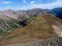
Ouray can be climbed along with the nearby Star Mountain in a single day. The beautiful ridge-top hike from Ouray to Star Mountain will take you past several unnamed high points with elevations in the 12000 ft range.
Views From the Summit of Ouray Peak:
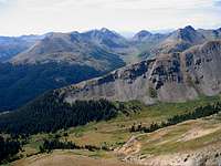 Middle Mountain Middle Mountain | 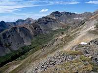 Garfield Peak Garfield Peak |  Grizzly Peak Grizzly Peak |  Graham Gulch Graham Gulch |
 Independence Pass Independence Pass | 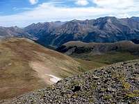 Lackawanna Peak Lackawanna Peak | 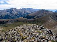 Mt Elbert/Star Mtn Mt Elbert/Star Mtn |  La Plata La Plata |
Getting There
From Independence Pass on Route 82, drive 9.3 miles east (or 14.5 miles west from junction of Routes 82 and 24) to the “South Fork of Lake Creek Road” (FR 391) (the parking area for La Plata Peak Trail is in the same area). This is a dirt road that is rough with many pot holes but is technically a 2WD road.Turn south onto the South Fork of Lake Creek Road. At 2.8 miles go straight (right). After 3.3 miles you will reach the junction of “Mc Nasser Gulch Road” (FR 394). This is your trailhead (10760 ft)
4WD can continue another 1.1 miles to road closure at 11360 ft.
 |  |  |  |
Red Tape
No fees or permits for day hiking.For other regulations, see the site for San Isabel National Forest.
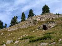
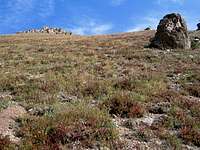
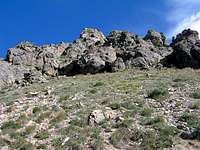 Rocky Area Below West Summit Rocky Area Below West Summit | 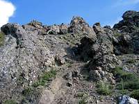 Rocky Area Below West Summit Rocky Area Below West Summit |  Rocky Area Below West Summit Rocky Area Below West Summit |
Weather
See the forecast for the nearby town of Leadville, CO. Southern Slopes of Ouray
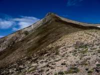 East Summit, East Face East Summit, East Face | 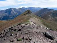 East Summit from West Summit East Summit from West Summit | 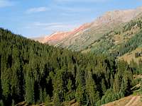 Red Mountain Red Mountain |  Mc Nasser Gulch Trail Mc Nasser Gulch Trail |