
-
 40215 Hits
-
 84.27% Score
-
 18 Votes
|
|
Mountain/Rock |
|---|---|
|
|
49.81136°N / 125.83676°W |
|
|
6774 ft / 2065 m |
|
|
Overview
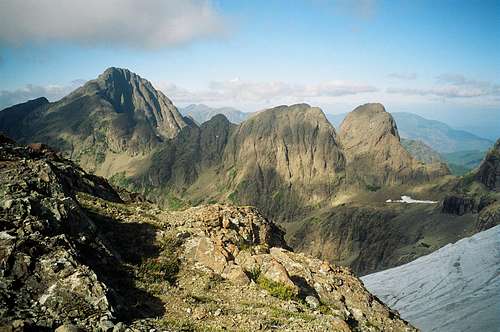
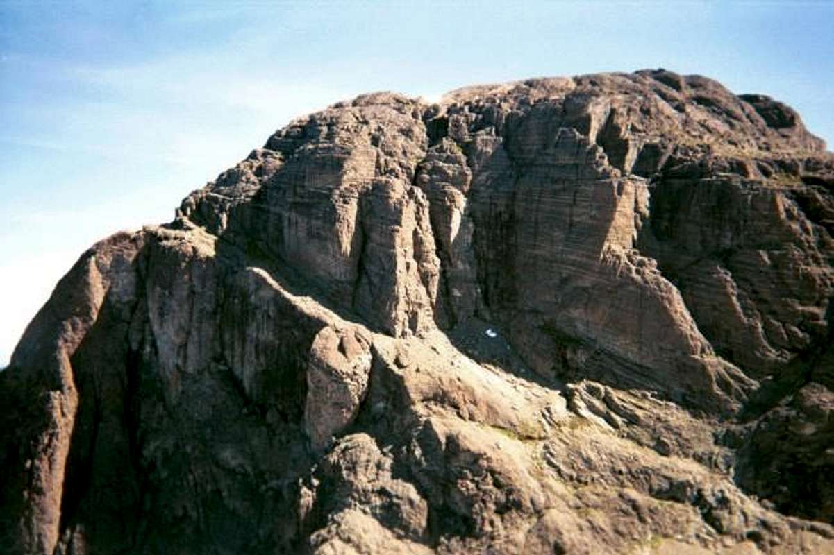
Located in Strathcona Provincial Park and one of the higher peaks on Vancouver Island, King's Peak is a double-peaked glaciated mountain at 6,774 feet high (2065 m). The higher peak (the east one) is called King's Peak and the smaller, western one is called Queen's Ridge. King's Peak has a trail to its summit and it is extremely demanding. It starts at about 1000 feet and climbs over 5700 feet in about 4 miles over tree roots, scree fields, meadows, gullies and rock ridges. You can also climb snow routes into the Spring. The route up the narrow gully from a hanging valley to the glacier looks like it would be awesome. Additional summer routes include: North Ridge on King's Peak (4th and low 5th class) On Queen's Ridge are Pauper's Buttress (5.7 - 2 pitches), Tea With Her Majesty (5.8 - 8 pitches), Jester (5.8 - 2 pitches) and Northern Lights (5.10c - 5 pitches). For additional info, see wildisle.ca. (Do a Google search inside wildisle.ca for King's Peak and you'll get a picture of these routes.) The glacier sits between the two summits and is crevassed, at least late in the season it is. Views extend from the mainland to out near the Pacific and include Elkhorn Mountain and Mt. Colonel Foster to the south. I don't think alot of climbers are aware of what is on Vancouver Island but it's well worth the trip.
 |  |  |  |  |
Getting There
From the USA you need to travel north on Interstate 5 to the Canadian border. Cross over and it becomes Highway 99. Take this north about 30 kms or so (don't quote me on that distance) to Highway 17 near Delta, BC. Take Highway 17 to Tsawwassen, BC where you can catch the ferry to Nanaimo on Vancouver Island. It's about a 2 hour ride over to Vancouver Island. From Nanaimo, take Highway 19 north to Campbell River. Once there, turn left onto Highway 28 and take that to a point 11.5 miles past Buttle Lake Campground to a logging road on the left. This logging road is just after a large red and white marked post on the right hand side of the road. Take this logging road about half a mile or so to the trailhead on the left. The trailhead is not identified but there is a yellow sign warning of avalanche dangers, etc. The trailhead is also just before a small bridge across Elk River. Vancouver Islander also added a shortcut if you have the vehicle for it: You can save 20-30 minutes each way by driving the "power line" road. This puts you on the standard trail 2 minutes before the Heathens trailhead sign at the river crossing. You do, however, need a high clearance 4WD vehicle. Approaching on Highway 28, cross over the head of Buttle Lake on the bridge in the direction of Gold River. Drive about 20km and immediately after crossing under the power lines watch for a gravel road on the left. It's quite easy to miss. There is a gate but I've never seen it closed. Drive the rough and narrow road as far as you can. It eventually peters out not too far from where the power line overhead goes up and over a rocky bluff. At this point you will see the standard approach trail coming out of the forest on the right. This makes a nice quiet spot to car camp if you're contemplating a day trip up King's and want to get an early start.
Red Tape
No fees or permits required.
When To Climb
June to October for hiking the trail. Late Spring would be best for the snow routes.
Camping
Buttle Lake Campground is 11.5 miles east on Highway 28 from the trailhead. NOTE: Campgrounds here are gated and locked at night until 7 am unless there is a medical reason you need to leave. We had to beg the camp host to unlock the gate for us at 6 am so that we could catch the ferry on time in Nanaimo.
Mountain Conditions
Strathcona Provincial Park Link to local weather forecast
vancouver islander - Nov 13, 2008 6:23 pm - Voted 10/10
Better trail accessYou can save 20-30 minutes each way by driving the "power line" road. This puts you on the standard trail 2 minutes before the Heathens trailhead sign at the river crossing. You do, however, need a high clearance 4WD vehicle. Approaching on Highway 28, cross over the head of Buttle Lake on the bridge in the direction of Gold River. Drive about 20km and immediately after crossing under the power lines watch for a gravel road on the left. It's quite easy to miss. There is a gate but I've never seen it closed. Drive the rough and narrow road as far as you can. It eventually peters out not too far from where the power line overhead goes up and over a rocky bluff. At this point you will see the standard approach trail coming out of the forest on the right. This makes a nice quiet spot to car camp if you're contemplating a day trip up King's and want to get an early start.