
|
|
Mountain/Rock |
|---|---|
|
|
36.39500°N / 51.00880°E |
|
|
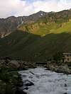
Kelardasht-Vandarbon |
|
|
Hiking, Bouldering, Scrambling |
|
|
Spring, Summer, Fall |
|
|
13366 ft / 4074 m |
|
|
Overview
Click for Introduction to Central Alborz Mountains
Click for Introduction to Takhte Soleyman Massif
Click for Nader's map of Takhte Soleyman Massif
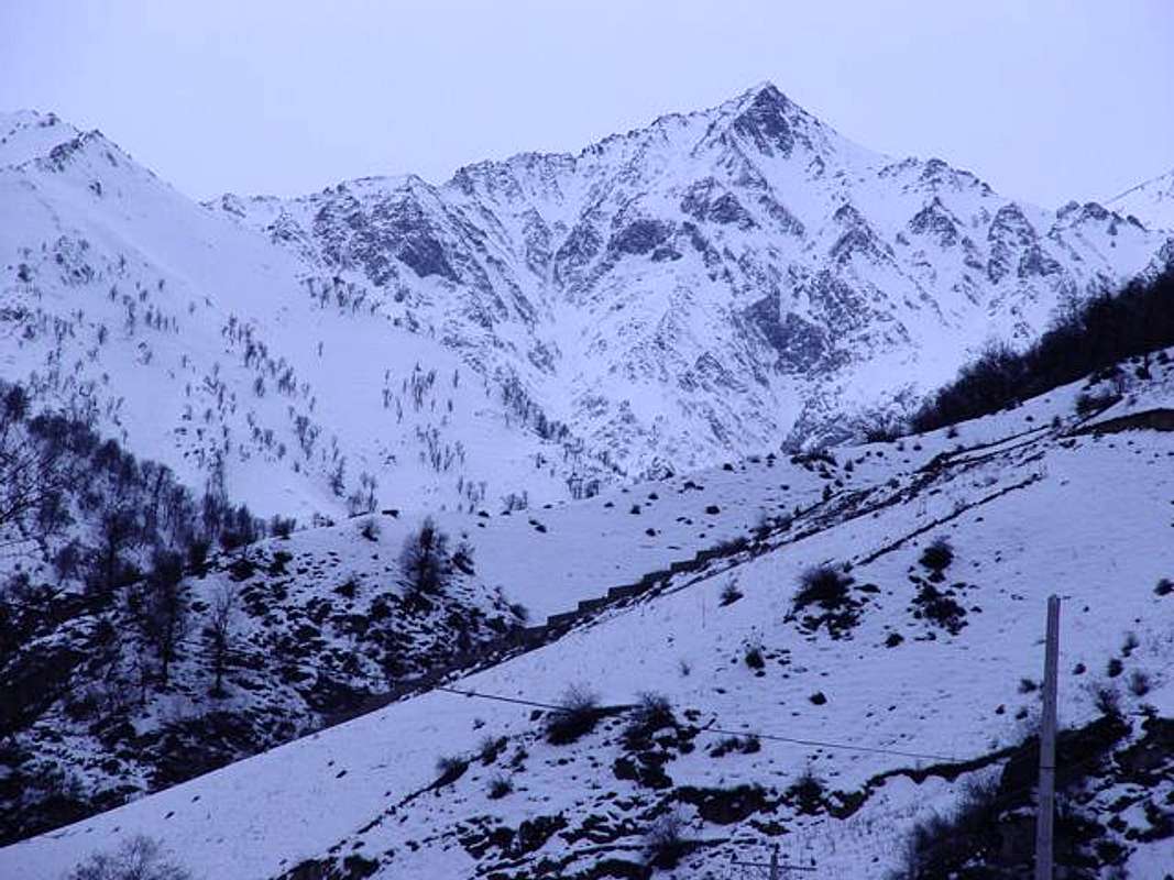
| North face: |
 |
| Alborz range, Takht-e-Soleiman massif sub range is one of the most famous technical mountaineering places of Iran. |
| Topography and location |
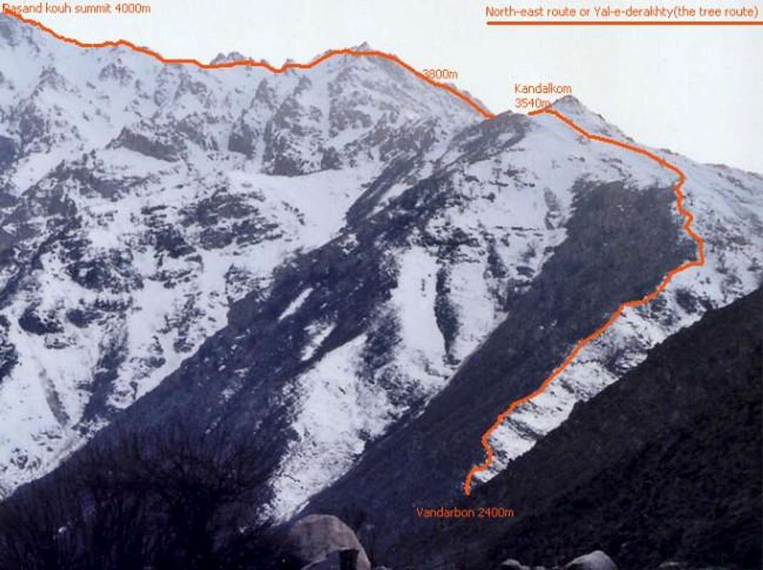
| Pasankooh is one of the most outer parts of the Takht-e-Soleiman massif and it can be easily accessed from Roudbarak village by car. The north, east and west faces are steep rocky slopes which drop down straight into the valleys, but the south face makes joint with other peaks of the Takht-e-Soleiman massif, the [north to south ridge line] that sticks to Pasandkooh's south face, includes the following summits : Pasandkooh - Marsheno(4000m) - Naftchuk - Kalbazan - Kaleh gardanak(4260m) - Clauch band(4480m) - and a flank joints them to (Big Chaloun(4516m) - Siahsang(4604m) ridge line) from north-east. |
| Routes Introduce |
| (1) East route: Maybe a glance from Vandarbon [looking left toward the summit] to the east route gives the feeling that this route is the easiest way to reach the summit, but existence of several rocky towers on the route makes it a technical and hard climb, this route is reachable from Vandarbon. (2) Yal-e-derakhty route: The normal and easiest route. The starting pitch from Vandarbon (looking to front/right toward the summit) looks like a steep hilly lower summit in front of Pasandkooh with some trees on it, top of the route is called Kandalkom(3540m) from this point toward south passing some rocky blades will end up to the summit. Avalanche danger exists on this route at winter and early spring, climbing via this route at winter requires at least 3days. (3) South ridge: Reaching Pasandkooh via the south ridge line is hard, and has the specifics of the east route, generally it's a drop down from Chaloun(4516m) to Pasandkooh |
 |  |  |  |  |
Getting There
Leaving Roudbarak to the Vandarbon Pasandkooh...
From Tehran :
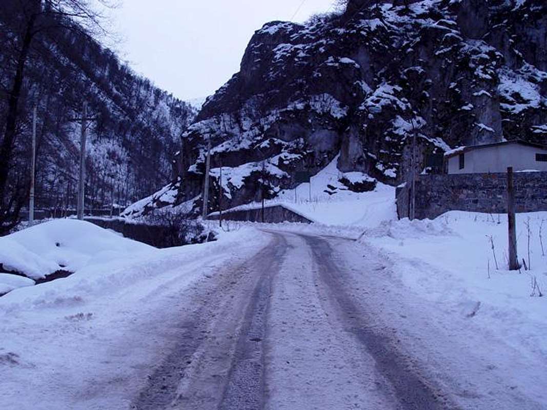
| (1) Using car Drive Tehran -> Karaj (by a 30Km highway takes less than half a hour) -> Drive Karaj-Chalous road(a lovely writhen road inside Alborz range), 24Km before Chalous at Marzanabad village turn left toward Kelardasht (2.30 to 4 hours) -> drive to Hasankif (about 40minutes) -> drive to Roudbarak village(1400m (about 10 minutes). |
| (2) Prepare for climbing There is a 8Km dirt road from Roudbarak that goes directly to the northern slopes of Pasandkooh, you can drive it even with your sedan car in about 30-40 minutes, but there is no place to park the car and feel comfortable about it, I recommend leaving the car in Roudbarak hotel. Any way a van or 4W Car driver would take you to the slopes, paying him about 8000Tomans(about 8$). As you go forward on the dirt road, Pasandkooh north face appears in front of you until you reach the end where Pasandkooh rises up, this place is Vandarbon and you must start climbing "Yal-e-derakhty" route. |
| Yal-e-derakhty route: |
 |
Red Tape
| The whole Alborz mountains area and it's wild nature is a protected place, hunting, fishing and abusing the nature is prohibited |
| No fees of permission is required for climbing or camping |
| No problem for camping but avalanche danger |
| Karaj-Chalous road becomes 1way at 6.30pm on summer Fridays and Iranian holidays so cars can only drive to Tehran. |
| Not bad idea if you talk about your climb with Federation of Mountaineering Hotel (IFM)' or the locals! |
When To Climb
| Best | June, May to September is well |
| Photography | A clear day after a rain or snow fall |
| Winter | Routes are steep so avalanche danger exists |
Camping
|
Mountain Conditions
| General | The weather of Mazandaran and Kelardasht is unstable, even if the sky is clear and sunny, it may change state to rainy or thick fog in less than an hour. and rainy Kelardasht means storm, snow or hail for high altitude points of Takht-e-Soleiman massif. |
| Winter | Heavy snow, frequent snow storms + wild wind, avalanches all around ! |