Realizing a Dream (the Northeast Ridge)…

Realizing a Dream (the Northeast Ridge)…

Page Type Page Type: Trip Report
Location Lat/Lon: 39.11780°N / 106.4447°W
Date Date Climbed/Hiked: Jun 30, 2008
Activities Activities: Hiking
Seasons Season: Summer

Realizing a Dream...

Ever since I cut my teeth hiking the mountains of New Hampshire my gaze has always traveled west. There, towering snow-capped peaks dwarfed the fuzzy green mountains of the east. For over a decade now I have lived & hiked numerous hills high and low all over the eastern United States. Life (aka. college, marriage, and kids) was good but never had things come together just right to make that trip west. Finally, this summer, we had our excuse to do something big…our 10th Anniversary.

As anyone who has made a first trip to Colorado knows the shear number of things to do in the state boggles the mind. We had eight short days to see and do all that we could. I wanted to climb at least a couple 14-er’s but soon realized that to do anything else would require a less ambitious hiking schedule. The choice was obvious. When you can only climb one mountain which one do you choose…well, the highest one of course!! As it so happens Colorado’s highest point is only a moderate hike-up, easily done in a day, which is just what we were looking for.

We would ascend via the north-east ridge which is one of the two standard hiking routes up Elbert (the other being the south ridge). We arrived at the trailhead at about 8:00am and were welcomed with clear blue skies and cool temps. It was time to make my dreams come true…off the flatlanders went to bag their first 14-er…

Mt. Elbert from US 24Mt. Elbert

9,500' - We headed into Leadville from the north and were treated to some wonderful views of Elbert in the distance...


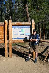
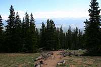
Mt. Elbert TrailheadTrailhead

10,040' - Mt. Elbert Trailhead. The northeast ridge, the one we'd be climbing, rises above the trees...


Only 4,700  To Go...Ready to Go

10,040' - We were both pretty pumped to get on the trail. Only 4,700' of vertical to go from here!!


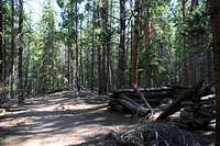
Old Mining Shack...Old Mining Shack

10,600' - We passed the remains of an old mining shack about 3/4 of a mile from the trailhead...


Colorado Trail Junction...Colorado Trail

10,560' - At the junction with the Colorado Trail this sign pointed us toward the ridge...


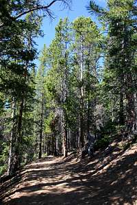
Wide & Steep...Steep Trail

10,700' - The trail climbed quite steeply above the Colorado Trail as it attemts to top the ridge. We were looking forward to tree line…


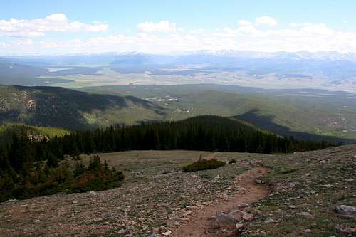
Open MeadowRidge Clearing

11,600' - We finally reached the little clearing atop the ridge, about a quarter mile before tree line, and were treated to some views ahead as a reward...


Ominous Clouds...Ominous Clouds

11,750' - I had been warned about afternoon thunderstorms in the high peaks so these clouds worried me a tad…


Tree Line...Treeline

11,900' - Treeline...the mosquitoes were pretty bad at this point and the nice breeze we were looking for was non-existent...


Halfway Point...Halfway

12,000' - The halfway point of the trail, but still some 2400’ of vertical to climb...


A Hikers Perspective...Hikers View

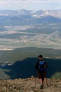
12,200' - Amazing views were ever-present but this is the view the hiker sees for most of the ascent...the seemingly endless trail...


Sensory Overload...Sensory Overload

12,350' - The smells of the alpine wildflowers combined with the views resulted in a pleasant assault on the senses...


Dwarf CloverMoss Campion

12,600' - I believe this pretty little flower is Moss Campion that has yet to fully bloom...


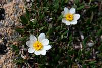
Hooker s Mountain-avensHooker's Mountain-avens

12,600' - This large flower with the tiny leaves is known as Hooker's mountain-avens, or Dryad. I was impressed with the size of this flower despite the elevation...


Mt. MassiveMt. Massive

12,650' - Mt. Massive, to the north, is only a few feet shorter the Elbert and offered a good gauge as to how far we had climbed...


Crossing the Ridge...Crossing the Ridge

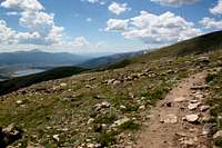
12,650' - Here, the trail crossed from the north to south side of the ridge allowing the blue-green waters of Twin Lakes to come into view...


The Climb Ahead...The Climb Ahead

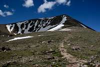
12,700' - As the trail once again gained the top of the ridge we were quickly reminded there was a lot of climbing yet to go...


The South Ridge...South Ridge

12,850' - We broke for lunch before the big climb and took in the view across to the south ridge. We could just make out a pair of hikers slowly making their way up the ridge which provided some entertainment…


The Crux...The Crux

12,850' - This ridge, which my guide called the "crux" of the route, is the toughest section of trail. We'd be climbing around 1,000' in less than a mile...


The Eastern View...Lunch View

12,850' - As you can see we made sure to pick a spot with a nice view for lunch…


Frequent Breaks...Frequent Breaks

13,200' - It wasn't long after lumch that we were sucking wind pretty hard again. Breaks were becoming more and more frequent...


Curious Bystander...Marmot

13,300' - Numerous times we'd look up to find we were being watched by one of these cute little guys...


Box Creek RavineBox Creek Ravine

13,400' - The trail closely followed the edge of Box Creek Ravine for a time...


Slow Progress...Slow Progress

13,450' - It really didn't feel like we were making much progress at times...


Mt. Massive...Getting Higher

13,600' - I did notice, however, we were no longer so much looking UP at Mt. Massive as OVER. This was a good feeling...


Top of the Crux...Top of the Crux

13,850' - FINALLY, the steep section was behind us, only...


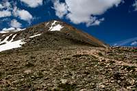
False Summit...False Summit

13,600' - ...yet another false summit ahead, this was getting depressing...


Mt. Massive...Another Break

13,950' - Taking another short break before climbing the next false summit...


Mt. Elbert Summit Ridge...Summit Ridge

14,400' - At long last, the summit ridge...you have no idea how relieved we were at this point...we were going to MAKE IT!!


Mt. Elbert Summit - 14,433 The Summit

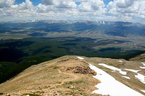
14,433' - The summit of Mt. Elbert, with all of Colorado spread out below...


User Profile ImageHappy Couple

14,433' - On our honeymoon we had climbed Mt. Washington, now on our 10th Anniversary we were on Elbert...what an amazing road it has been...


Mt. Massive from ElbertMt. Massive

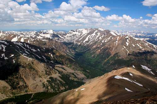
14,433' - The view up the valley of North Halfmoon Creek to Mt. Massive (14,421), right, was particularly impressive...


The Far Side...West Summit Ridge

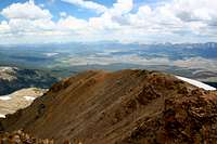
14,433' - Looking west along the summit ridge across the jagged peaks of the Sawatch Range...


Twin Lakes from ElbertTwin Lakes

14,433' - Looking the almost a vertical mile down to Twin Lakes was quite amazing...


Halfmoon Creek Far Below...Halfmoon Creek

14,433' - We decided to have a snack on the north side of the summit enjoying the view 4,000' down to Halfmoon Creek...


Mountain Grandeur...Mountain Grandeur

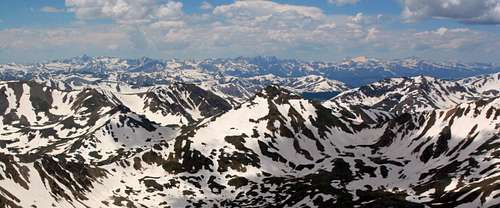
14,433' - An endless sea of snow-capped peaks stretched away to the western horizon. Just how I always dreamed it would be...


Leaving Mt. Elbert Summit...Time to Go

14,433' - Our half hour on the summit seemed over all too soon. Regretfully it was time to descend...


Leadville = Ice CreamLeadville = IceCream

14,000' - Our thoughts now turned to getting down and getting our hands on dinner...a milkshake at Wild Bill's in Leadville looked a LOONG ways away...


Leaving Elbert...Leaving Elbert

13,900' - I don't know if I'll ever get the chance to do something like this again, but I thank the Lord for the ability to have the chance now...


***At this point the clouds were really starting to move in and darken. I decided to stow the camera so we could make the best time down to treeline. Sure enough by the time we made it back to the upper junction with the Colorado Trail huge claps of thunder were rolling down from the summit. Thankfully, the rain held off until we were on the road. Our timing couldn't have been more perfect. It was a perfect end to one of the most amazing hikes I've ever had the pleasure of doing. I can only hope someday I'll be back.***

Trip Info...

Trailhead: Mt. Elbert Trailhead north of Halfmoon Campground

Distance Hiked: 9.0 miles round-trip

Elevation Gained: ~4,700'

Mosquito Bites: at least 12

Marmot Sightings: 6

Fellow Michiganders Met on Trail: 4

Blisters: None!!!

Time on Trail: ~8 Hours

Morale of the Story:“I Ain’t As Good As I Once Was, But I’m As Good Once As I Ever Was…”


Online Exclusive Bonus Features!!!!!


For even more pics of the climb come on over to my Mt. Elbert Smugmug page!!


Comments

Post a Comment
Viewing: 1-8 of 8
StarMan

StarMan - Jul 29, 2008 6:47 pm - Voted 10/10

Good job!

Also growing up an "Easterner", I share your excitement as Elbert was also the first 14er that I hiked up back in 2005 (via the same trail)! (though I had already driven up both of the summits of Pikes and Evans before)

dwhike

dwhike - Jul 29, 2008 7:16 pm - Hasn't voted

Re: Good job!

Thanks, we ended up driving up Evans the last day we were out there. Beautiful of course, but what a disappointment with all the people!! We should have expected it but what a difference from Elbert...

Deltaoperator17

Deltaoperator17 - Nov 17, 2008 11:18 am - Voted 10/10

Great Story!

Great story. Two of my buds and I are going to try to do this trip with a duplicate effort on Massive after a day of rest in June of 09.

Love the pics, and thanks for voting on my article

Cheers,

Steve

dwhike

dwhike - Nov 17, 2008 5:59 pm - Hasn't voted

Re: Great Story!

Thanks so much for stopping by. I soooo wanted to do Massive but we only had a week and simply didn't have the time. Massive or Longs are definitely on my short list for my next trip out there. Cheers!

MarkDidier

MarkDidier - Jan 4, 2009 7:55 pm - Voted 10/10

Nice Report and Pictures

As always, great photos. Nice report.

Being from the midwest I know how the 1,200 miles can deter plans to get to Colorado. Having done it 4 years in a row now, it has gotten easier - it's a long drive, and I'm scheduled again for this July. I hope you're successful in getting back out there soon - and yeah it sure gets frustrating trying to decide which awesome hike/climb to do.

dwhike

dwhike - Jan 5, 2009 2:10 am - Hasn't voted

Re: Nice Report and Pictures

Thanks so much. I tell ya what, I'm hooked. Only spent a week there and for the last 6 months I've been in serious withdrawl! We're headed west or bust this summer...probably the Dakotas/Wyoming. Here's to hoping the gas prices stay low!

stinkycheezman33

stinkycheezman33 - May 14, 2009 10:20 am - Voted 10/10

haven't seen this one before...

nice little page! how exciting to be able to get out there finally...my wife and i have had the itch ourselves, and we actually decided to scrap our isle royale plans ($130 pp for a boat ticket--what??!?) and head out to CO this summer. i have been there once before, but she hasn't... i'll never forget the first time (first of 5 roadtrips west) that my dad loaded us all up in the van and drove out to the tetons; i've been obsessed ever since! thanks for sharing :)

HikingMan

HikingMan - Jun 28, 2016 9:59 am - Voted 10/10

Nice job!

Thanks to you and your spouse for making the effort to make this post. Planning a summit of My Elbert June 20, 2016. Reading your post heightened my excitment.

Viewing: 1-8 of 8