
|
|
Mountain/Rock |
|---|---|
|
|
41.69070°N / 113.74174°W |
|
|
Box Elder |
|
|
Hiking |
|
|
Spring, Summer, Fall |
|
|
9000 ft / 2743 m |
|
|
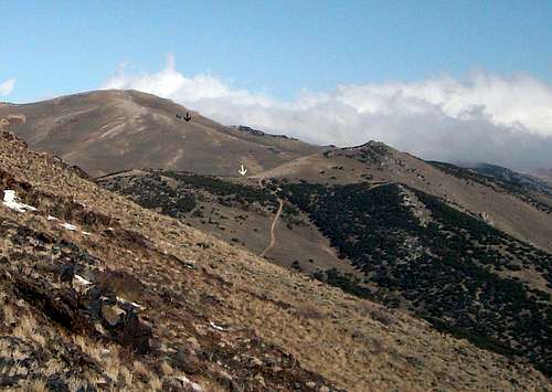
Check out the arrows for route
Overview
Despite the name which makes this one sound like it is to be found in southern Utah or Arizona, Red Butte is located in the northwest corner of the state of Utah. Its main attraction is that it is the highest mountain in the Grouse Creek range and the 87th most prominent peak in the state with 1940 feet of prominence which puts it in the top 100. So the main appeal of this one is that it is a range highpoint and has decent prominence. There is nothing technical about getting to the summit but the drive to get close is rather daunting. It is pretty doggone isolated but does put you in a rarely visited area of the state so you get to feel a bit like a modern day Jim Bridger. The register we found indicated that we were the first peakbaggersto be on the summit in almost ten years.

Rarely visited register
Once you get to Ingram Pass, it is a relatively easy hike, even if you hike from the pass although with a high clearance 4WD vehicle, you can get much closer. This is cattle country and most likely you will encounter cattle during your visit unless you go in October as we did.
Getting There
Drive to Snowville Utah on I-84 and turn onto highway 30 which heads west. After 16 miles, a junction with highway 42 is reached but stay on highway 30 by turning left as it heads southwest. Turning left at SR-30/42 junction and head southwest on SR-30 passing through the ranching communities of Park Valley and Rosette. About 42 miles after the junction with highway 42, you will come to an intersection with a dirt road. GPS coordinates on map. On the left you will see piles of dirt for road maintennace. Take the right turn. There is a mailbox there for the Rosebud BLM Field Office. Follow this road for roughly 11 miles, (see map) to a parking area at Ingham Pass. See also the description by SP member Imontop on his page for nearby Ingham Peak, accessed from the same pass.Mountaingazelle shared this on her superb Northern Utah ranges page:
"These are not difficult peaks to hike. The hardest part may be driving to get to these mountains. The range is located northwest of Ogden. This part of Utah has a very desolate appearance to it. There are also excellent views south toward the Hogup Mountains and the Salt Flats. Passenger cars won't be able to make it up most dirt roads leading to the high peaks. A high clearance vehicle is recommended. Make sure you have a full tank of gas and extra just in case. The town of Snowville along I-84 is a good place to top off with fuel before heading out. Once on the dirt roads, private property is well marked with signs and fences. This area is administered by the BLM and most land is marked so respect the range and try not to trespass off the graded roads. I noticed that this area is popular with hunters during the fall season." She visited this mountain about a week or so after we did.

| 
| 
|
Route & summit
See the map for a route description. This is a very seldom visited mountain.John Vitz left a register in 2001 and it was 9 years later in 2010 before Greg Jagielski, Kadee Smith and myself visited this lonely peak. Ironically, the next visitor was Mountaingazelle (Melinda) about two weeks later. The next visitors came in 2014 and they are the prolific Utah peakbaggers, John Hardink and ZeeJay. Don't expect to see anyone else out here. In retrospect, I am sorry we didn't also climb Ingram Peak but we were hoping to get Goose Creek HP the same day.
 Route Map
 |  Road up
 |  The summit cairn
 |

Two of the best
Red Tape
This area is managed by the BLM although there are private parcels of land which the BLM road passes through. There is a warning about staying on the main road (see pic below) but other than that aspect, there isn't any red tape to deal with.
Faded BLM sign
Camping
There are no campgrounds in the area but it is probable that you could car camp at the pass. If there are cattle present, that wouldn't make a reasonablechoice. The nearest campground otherwise would be at City Of Rocks to the north or a community campground which may be available in Goose Creek.
Weather for the area


Pics
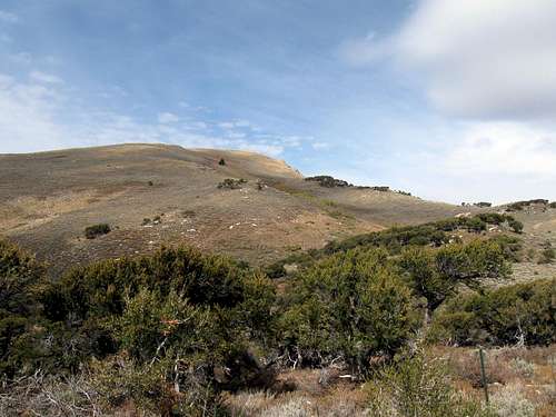
Mountaingazelle's pic of Red Butte canyon