
-
 60584 Hits
-
 98.3% Score
-
 80 Votes
|
|
Area/Range |
|---|---|
|
|
41.91145°N / 111.67537°W |
|
|
Hiking, Mountaineering, Scrambling, Skiing |
|
|
Spring, Summer, Fall, Winter |
|
|
9979 ft / 3042 m |
|
|
Overview
Northern Utah is an area of mountain and desert terrain. When people think about visiting Utah for the first time, they usually decide to see the national parks in the south or go hiking in the Wasatch Mountains east of Salt Lake City. There are some people who come to visit the northern end of the state. The main thing I have noticed about hiking and climbing here is the feeling of isolation. The purpose of this page is to describe all of different mountain ranges and show the variety of places that many people may not know about. This includes areas south of the Idaho border and north of Interstate-80.
There are a few designated wilderness areas in Northern Utah. The Mount Naomi Wilderness was established in 1984 and has over 44,500 acres of land. All of the wilderness is entirely in Utah and is managed by the Forest Service. It is located in the Bear River Range on the Utah-Idaho border located northeast of Logan, Utah. Naomi Peak is the highest point in the range, and the mountain for which the wilderness is named after. There are several other peaks above 9,000 feet elevation. There are many beautiful lakes and deep, scenic canyons that provide access to the area.
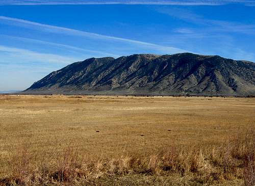
The Wellsville Mountains Wilderness is located above Cache Valley. It was established by Congress in 1984. It occupies an area of 23,850 acres. The wilderness was once overgrazed but has recovered and now has populations of deer, elk, moose and mountain lions. The highest peak in the range is Box Elder Peak. Day hikers, hunters, and bird watchers are the people that use the area the most but it is usually not very crowded. There are many miles of trails and canyons to explore.
The other mountain ranges are much less visited and information is limited. Many peaks require driving long distances on dirt roads. Perhaps the most interesting mountains are the ones that surround the Great Salt Lake. A few of these are easily accessible while most are small islands surrounded by salt flats and water. The ranges farther west like the Silver Island Range and Newfoundland Mountains all have great mountains and scenery. If those ranges were located closer to the Wasatch Front there would certainly be more people climbing mountains in these areas.
Some of the larger mountain ranges have their own page. The highest point of smaller ranges or sub-ranges may also be added. Mountains ranges in the area and described on this page include: the Bear River Range, the Wellsville Mountains, Monte Cristo Range, Northern Wasatch Mountains, Promontory Mountains, Antelope Island, Stansbury Island, Silver Island Mountains, Newfoundland Mountains, Hogup Mountains, Grouse Creek Mountains, Goose Creek Mountains, Hansel Mountains, Blue Spring Hills, West Hills, Lakeside Mountains, Grassy Mountains, Crawford Mountains, and the Raft River Mountains.
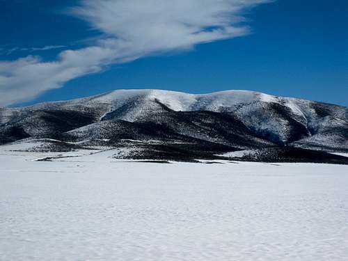
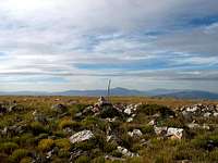
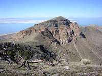
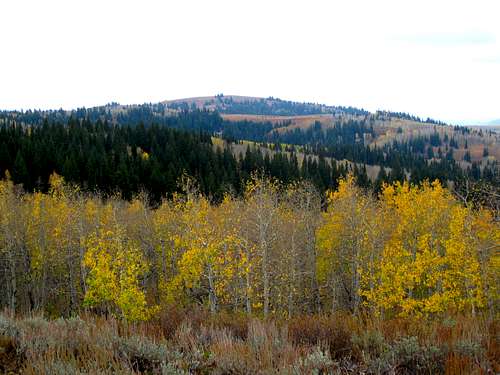 Monte Cristo Peak in Northern Utah
Northern Wasatch
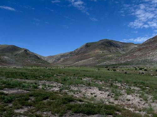
Bear River Range
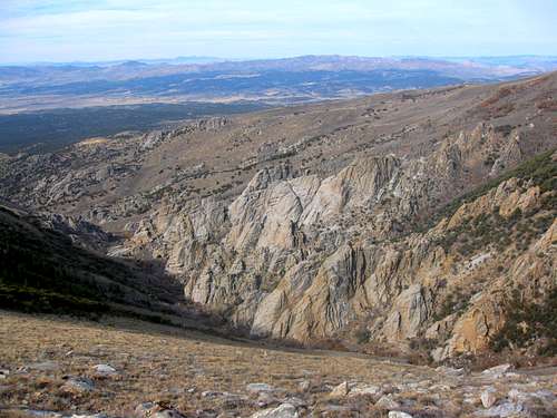
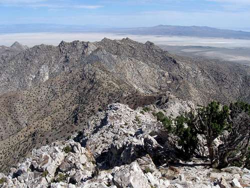
The Bear River Range is the northernmost extension of the Wasatch Range. It is located on the border of Southeast Idaho and Northern Utah. The largest city in the area is Logan. I have hiked many of the trails and find it to be very quiet most of the time. Naomi Peak is the highest mountain in the range and sees the majority of traffic. The other mountains are around 9,000 feet in elevation and are worth climbing as well. This is a limestone mountain range that has formed several caves. Most of them are not well known and are open to anyone who is willing to do some off-trail exploring. Steep limestone cliffs are located on both sides of Logan Canyon. Hundreds of sport and trad routes line these walls.
Wellsville Mountains
The Wellsville Mountains are the most compact range in Utah. What it lacks in size, it makes up in steepness. The mountains rise over 4,500 feet above the valley floor with very few foothills. It is a sub-range of the Wasatch Mountains. The highest mountain is Box Elder Peak with Wellsville Cone coming in at a close second. It is mostly a dry mountain range and you will have to carry all of your water with you when hiking. A trail goes over the crest of the main peaks including the smaller ones to the north. The southern peaks above Sardine Canyon don’t have any trails but can be climbed with some bushwhacking up to the ridgeline. The main reason people climb in the Wellsville Mountain is to see the large migration of hawks and other birds from summer through early fall.
Northern Wasatch Mountains
The Northern Wasatch Mountains run north to south from Brigham City to Parleys Canyon. These mountains are lower in elevation than others areas in the Wasatch but offer several excellent peaks to climb. The highest mountain is Willard Peak near Ben Lomond at the northern end of the range. Other high peaks include Mount Ogden and Thurston Peak. The range is composed of folded layers of quartzite on its west side which is highly visible near Ogden. These cliff bands have rock climbing routes. On the east side of the range the rock turns into limestone. Many of the summits in this area tend to be rounded with long ridgelines. Ridge traverses are my favorite form of hiking and the Northern Wasatch offers plenty of possibilities.
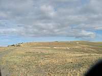
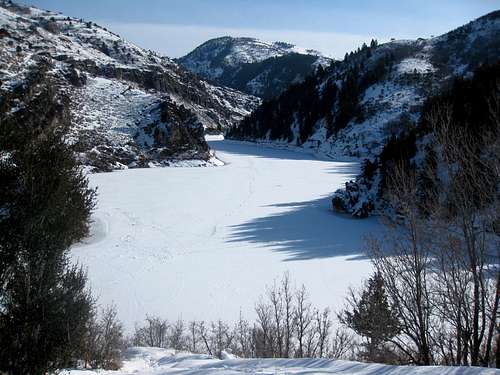 Causey Reservoir in winter
Monte Cristo Range
The Monte Cristo Range is a subrange of the Wasatch Range located at the junction of two areas. It is to the east of the Northern Wasatch Mountains and is separated from the Bear River Range by Ant Valley to the west. These mountains are near the confluence of three counties, Weber, Cache and Rich. There are not as many hikers that come here though. The range is used primarily by people riding four-wheelers, motorcycles, and mountain bikes. There are many dirt roads in the area that goes near the summits of peaks. A high clearance vehicle can get you to many places but some roads are narrow.
Highway 39 runs through the range. This is also known as the Ogden River Scenic Byway. After passing Monte Cristo Peak, the highway cuts through Walton Canyon on its way to the city of Woodruff. Highway 39 is closed to vehicles during winter. You can drive up the west side to a large parking area that is used by snowmobilers. This is where they stop plowing the road several miles from Monte Cristo Peak. Causey Reservoir is located in the southwestern area of the Monte Cristo Range. The reservoir receives its water from the South Fork of the Ogden River. There are some hiking trails here.
There are a few theories as to where the name Monte Cristo originally came from. The first theory is that miners returning from California may have thought this mountain range had a similar appearance to the San Gabriel Mountains where the Monte Cristo Gold Mine was located. The second theory is that French Canadian trappers may have called the range a hybrid literal version of the name meaning, "Mountain of Christ". The last theory is that one of the early road builders in the area had the book, The Count of Monte Cristo, which he read to his coworkers.
Here are other peaks located in the Monte Cristo Range. Mount McKinnon has a dirt road leading to its summit. It's located a few miles north of Monte Cristo Peak. Eccles Peak, 9,062 feet, is accessed from Forest Road 059 off of Highway 39. Road 059 is a dirt road that runs north to south through the range. Strawberry Ridge, 8,103 feet, is located east of Eccles Peak. Red Spur Mountain is located on a northern ridge that is 8,872 feet elevation. Peak 8904, is a nearby highpoint in that area. Squaw Butte, 8,767 feet, is located southeast of Monte Cristo Peak. Baldy Peak is located on Baldy Ridge which is a spur ridge of Wasatch Ridge. Twin Peaks, 7,698 feet, is located south of Laketown Canyon and west of Randolph. Monument Peak, 8,219 feet, is north of New Canyon which is west of Randolph. Red Mountain, 7,861 feet, is above Birch Creek Reservoirs to the north and Woodruff Reservoir to the south.
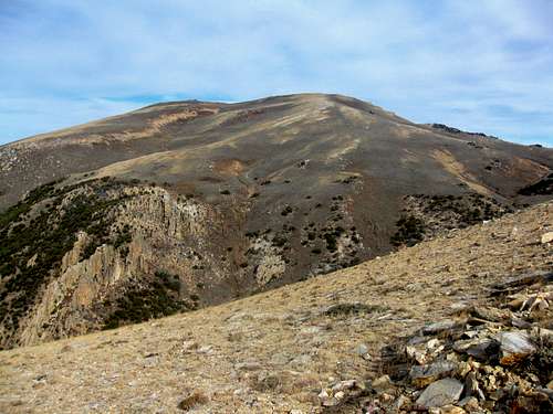
 Monte Cristo Peak |
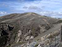
 Mount McKinnon |
 Mount McKinnon View |
Monte Cristo Peak - (9,148')
This is the highest mountain in the Monte Cristo Range. It received the same name as the range. It's an easy peak to get to because there is a dirt road that goes right next to the summit. It is not far from Highway 39. From here, you get a good view of the rest of the Monte Cristo Range and Northern Wasatch to the west. Another nearby peak is Little Monte which is located on the ridge to the southwest.
Mount McKinnon - (9,081')
Mount McKinnon is a peak that anyone can get to. Even when the dirt road is muddy or snow covered, you can hike the short distance from Highway 39. This mountain was named after Archibald McKinnon, Jr. He was an early settler to the city of Randolph, Utah. McKinnon was a visionary supervisor of the construction of ten miles of the gravel road linking Woodruff to Monte Cristo.
Peak 8904 - (8,904')
This peak is located southwest of Red Spur Mountain. It is near dirt road 059 above Spencer Basin. The road is in good condition when dry. Red Spur Mountain, 8,872 feet, is visited often and has a road to its summit. There is a radio facility farther north on the same ridge.
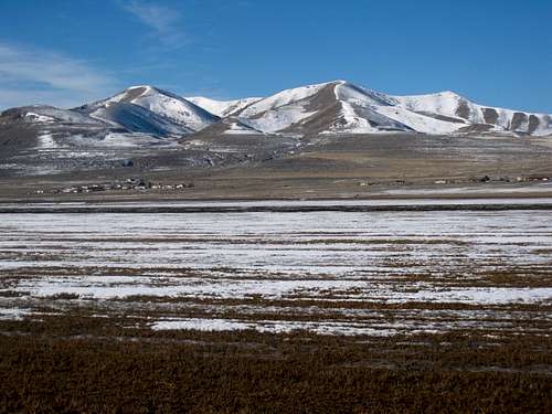
 Malad Range along the Utah and Idaho border
Northern Subranges
Bannock Range
The Bannock Range is located in Southeast Idaho with the southern end of the range extending into Northern Utah. The main crest of the range runs for about 65 miles traveling in a north to south direction. It is an interesting mountain range that few hikers and climbers seem to know about. The mountains are covered in green vegetation and forests with several streams and no alpine lakes. It is a great place to go if you like solitude. These ranges are sometimes referred to as the northern Promontory Ranges in Utah. The Bannock Range consists of several sub-ranges on the border of Idaho and Utah. The subranges are called by different names in books and on maps but I will refer to them by their most common name.
Malad Range
The Malad Range is a subrange of the Bannock Range. The range runs south from Idaho over the Utah border. The mountains were named for their proximity to Malad Valley and the city of Malad. Gunsight Peak is part of a long ridge called Clarkston Mountain. The west side of the peak rises precipitously over Castlegate Canyon and Dutchmans Canyon. The easiest route is from Elgrove Canyon to the northwest but this road is located on private property. Other mountains include Sheep Dip Mountain, 7,057 feet, and Red Knoll, 6,813 feet. The highest mountain in Idaho is unnamed Peak 7,005.
Gunsight Peak - (8,244')
Gunsight Peak is the highpoint of the Malad Range. It is seen by everyone driving along Interstate 15 near the border. The Malad Range is also known as the Clarkston Mountains. The southern end of the range is called the Junction Hills and run south toward the Wellsville Mountains. The east side of Gunsight Peak is in Cache County and the west side is in Box Elder County where the actual summit sits. Gunsight Peak has over two thousand feet of prominence.
 Gunsight Peak in the Malad Range
West Hills
West of what is the question? The West Hills are located west of Malad Valley and the Malad River which is a western tributary to the Bear River. These mountains rise above 7,000 feet and are the continuation of the Samaria Mountains in Idaho. The West Hills are located north of the Blue Spring Hills and north of Highway 84. The range parallels Interstate 15 on the west near the Idaho and Utah border. The southern point of the West Hills is called the Point Lookout Mountains. The highest point in Utah is West Benchmark. The highest point in Idaho is the Samaria Mountains Highpoint, which is also known as Wood Benchmark, 7,780 feet elevation. There are three peaks in the West Hills with over a thousand feet of prominence.
West Benchmark - (7,196')
West Benchmark is the highpoint of the West Mountains in Utah. There are several canyons near the mountain. They include Portage Canyon to the north and Broad Canyon to the south. Ruff Canyon to the east seems to be the closest access. You can get there from the town of Washakie. A dirt road leads up the canyon which turns into a rougher road as it gets closer to the summit.
Peak 6718 - (6,718')
This unnamed peak is west of the town of Plymouth. It sits between Whites Valley to west and Malad Valley to the east. Duro Benchmark, 6,552 feet, is a peak located on the ridge to the north and it has a jeep road to its summit. A ridge traverse can be done between both peaks. There are several other jeep roads in the area and one runs along the west side of Peak 6,718.
Cal Mtn Benchmark - (6,880')
Cal Mtn Benchmark is located at the southern area of the West Hills. It is northwest of the cities of Tremonton and Garland. There are dirt roads on the east side of the mountain that you can use to approach it. One goes over Point 5787 along its east ridge. Another route starts from the Point Lookout Mountains and then follows the long south ridge to Cal Mtn Benchmark.
 The West Hills
Blue Spring Hills
There are indeed several water springs in the Blue Spring Hills so the name is appropriate. The Blue Spring Hills are located northeast of the Promontory Mountains and south of the West Hills. An unnamed peak, 6,506 feet elevation, is the highpoint in the range. Thatcher Mountain is another prominent peak in the Blue Spring Hills. These mountains are north and east of Highway 83 and south and west of Highway 84. Engineer Mountain is west of the main ridge of the Blue Spring Hills near Thiokol. The Salt Creek State Waterfowl Management Area is southeast of the range. There are many dirt roads throughout these mountains. The road that goes through Faust Valley is used often and is in good condition and can be driven by any vehicle.
Blue Spring Hills HP - (6,506')
The Blue Spring Hills Highpoint is an unnamed peak located at the northern area of the range. This is south of Highway 84 which separates it from the West Hills to the north. There are fences in the area around the mountain so I suspect this peak to be on private property. A jeep trail gets close to the southwest ridge. This is accessed from a dirt road that goes through Third Canyon to the south.
Thatcher Mountain - (6,240')
The town of Thatcher was named after Moses Thatcher who was a Mormon apostle. This mountain would also receive that name. There is a road that crosses over Faust Valley. It is located between Thatcher Mountain and Thatcher Benchmark, 6,205 feet, farther north. I ran into a sign that said the upper part of the mountain is located on private property. That would explain why few people hike to the summit. I also came across a herd of cattle on Thatcher Mountain.
 The Blue Spring Hills
Hansel Mountains
The Hansel Mountains are located west of the Promontory Mountains. They begin at the north end of the Great Salt Lake near Spring Bay. The southwest section of the range is next to the Locomotive Springs Wildlife Management Area. The highest point in Utah is an unnamed peak that is 6,303 feet elevation. The Hansel Mountains and North Hansel Mountains are divided by Highway 84. The northern part of the range continues into Idaho. The highest point in Idaho is an unnamed peak at 6,986 feet elevation. The Hansel Mountains were named after Samuel J. Hensley but his named was spelled incorrectly on maps. He is known for finding an alternative northern route known as the Salt Lake Cutoff to the California Trail.
Hansel Mountains HP - (6,303')
The Hansel Mountains Highpoint in Utah is an unnamed peak. It is located south of Highway 84 where the road separates it from the North Hansel Mountains which run into Idaho. Hansel Valley is below the east side of the peak. Although this summit is unnamed, the peak to the northwest is labeled as Hans Benchmark, and it is only three feet lower in elevation, but is also worth hiking to.
Monument Peak - (5,999')
Monument Peak is located near the northern end of the Great Salt Lake. It is northwest of Golden Spike National Historical Site. Most people view Monument Peak while driving past Lone Rock to the south. This peak is also known as Hansel Benchmark and that is what it is labeled on maps. It isn't the highest peak in the range but it has over a thousand feet of prominence.
 Messix Peak in the Promontory Mountains
Promontory Mountains
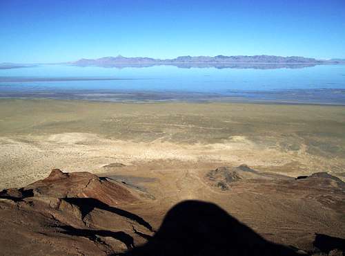
The Promontory Mountains are a long mountainous peninsula located at the northern end of the Great Salt Lake. The range was named for the large promontory cape projecting south into the Great Salt Lake. There is also a Northern Utah weather station on the nearby hill. Native Americans were the first people to live in the area. Artifacts indicate that many of them wintered along the lake shore and mountains. Several caves show evidence of human inhabitance and many arrowheads of various sizes have been found. Buffalo roamed the area during this time and also when the early Mormon pioneers arrived.
Several ranchers live near the eastern and western side of the mountain range and there are fences with No Trespassing signs posted everywhere. The good news is that people have been able to get permission and hike in some areas of these mountains. This is a really interesting mountain range that is similar to Antelope Island but higher in elevation. Other mountains include Lead Mountain on the south end and Mount Tarpey on the west side of the range.
The main attraction in the area is Golden Spike National Historical Site. The small settlement of Promontory was an early construction camp. It was a typical camp used by workers until it was decided that it would become the meeting place for the two railroads. There are several historic markers that tell of the significance of this. The status of the town varied from complete abandonment, to cattle town, to a national historic site under the National Park Service. This is where the Central Pacific Railroad from the east and the Union Pacific Railroad from the west met on May 10, 1869. They drove four symbolic spikes, two of which were gold, celebrating the completion of the first transcontinental railroad.
The Spiral Jetty is something to see if you are going to the Promontory Mountains. It is a 1,500 foot long and 15 foot wide counterclockwise coil jutting from the northeastern shore of the Great Salt Lake at Rozel Point. It was built in 1970 by Robert Smithson. At the time of its construction, the water level of the lake was unusually low because of a drought. Within a few years, the water level returned to normal and submerged the jetty for the next three decades. The jetty re-emerged and exposed the black basalt rock layer on top. The lake level rose again during the spring of 2005 due to a near record-setting snow pack in the mountains and partially submerged the Jetty again. The level of the water fluctuates so conditions may vary each year.
 Mount Tarpey |
 Messix Peak |
 Messix Peak |
Messix Peak - (7,372')
Messix Peak is the highpoint of the Promontory Mountains. This peak and others in the range are located on private property. So this is the reason why Messix Peak isn’t climbed very much. I know that the area is open by special permit to controlled hunting during fall. You'll need to get permission from land owners to be on their property even if you are just hiking. The best route is from Messix Canyon on the east side of the range. This peak is located in the southern Promontory Mountains near the northern section.
Chockcherry Peak - (7,218')
Chockcherry Peak is located several miles south of Messix Peak. It is unofficially named but I called it this because Chockcherry Canyon is below the east side of the peak. This would be the best route up the mountain. It starts near Chockcherry Spring which is reached via dirt roads. Also in the area is Owen Spring to the north and Broadmouth Canyon to the south.
Long Peak - (7,075')
Long Peak is the highest point at the southern end of the Promontory Mountains. Long Canyon is the large canyon leading up the west side of the peak. Brushy Canyon is on its north side. Maple Canyon is on the east side and that would be the easiest way to reach the mountain. Promontory Benchmark, 6,592 feet, is a named peak across the valley to the east.
Mount Tarpey - (6,979')
Mount Tarpey is west of Messix Peak and they are separated by Maple Canyon. Mount Tarpey has over 1,100 feet of prominence even though it seems like a small peak. It is best seen from the west where the shortest route starts from Maple Canyon although you’ll need permission to hike here. Mount Tarpey overlooks the northern end of the Great Salt Lake above Rozel Flat.
 Bull Mountain in the Raft River Mountains - by Moogie737
Raft River Mountains
The Raft River Mountains are located in the northwest corner of Utah not far from the Idaho border. This mountain range goes in an east to west direction rather than north to south. It is about twenty five miles long by seven miles wide. It's north of Park Valley which is east of the Grouse Creek Mountains. The name of the range comes from the Raft River. This river starts in northern Utah and flows north to join the Snake River near the Albion Range in Idaho near the City of Rocks. The river had a strong current and was an obstacle for early Mormon pioneers. It was named after a crossing of the Oregon Trail where they built rafts out of whatever was available to aid in crossing the river. The river is now dry for much of the year.
The highest peak in the range is Bull Mountain. It is probably the most climbed peak in this part of Utah. Many of the people who come here are county highpointers. The mountain has a large and flat plateau on its summit. The Bull Flat trail enters from the north. From the end of the campground, the trail wanders through the forest with lots of aspens and alders, and up to Bull Canyon. After about one mile, a side trail leads off to Bull Flat. Stay on the main trail which is the Lake Fork Trail up toward Bull Lake. This lake is located in a surprisingly pretty cirque beneath sheer cliffs. To the west of the lake a faint path leads along a rocky slope to the summit of Bull Mountain. This route is for people who prefer to hike up the mountain instead of driving.
A dirt road also goes to the top of the plateau near the summit. This is definitely a 4-wheel drive road. Since this is a remote area, it is a good idea to make sure you have a spare tire and the necessary equipment if your vehicle breaks down. The long summit ridge of rolling grassland provides views across the desert to the Great Salt Lake and on to peaks of Utah, Nevada, and Idaho. Other mountains include Dunn BM, George Peak, and Crystal Peak. The Bally Mountains are small sub-range of the Raft River Mountains to the northwest. These mountains are around 7,500 feet in elevation.
The best place to camp is at Clear Creek Campground on the northeast side of Bull Mountain. This is where the standard hiking route up the mountain begins. There are no fees and sites are available on a first come, first served basis. There are also plenty of primitive places to camp along the road. The Raft River Mountains are west of the small town of Strevell. Gas and other supplies can be bought in Snowville.
 Bull Mountain |
 Bull Mountain Plateau |
 Raft River Mountains |
Bull Mountain - (9,920')
Bull Mountain is the highest in the Raft River Mountains. It is also the highpoint of Box Elder County. Bull Lake and Bull Flat are located on its north slopes. The mountain can be accessed from the north near Clear Creek Campground and trailhead. Maintained trails lead into the canyons but not all the way to the summit so expect off trail hiking on those routes. Bull Mountain can also be accessed with a four wheel drive vehicle and driving many miles on dirt roads. If you can get your vehicle near the summit than there is little hiking involved.
Bally Mountains HP - (8,060')
The Bally Mountains are a north to south running sub-range in the northwest area of the Raft River Mountains. These mountains are east of the small town of Yost and above Onemile Creek Road to the west. The highest peak is unnamed. There is a 4wd road that goes toward the south ridge of the mountain. A hike along several points of the ridge may be included while hiking to the summit.
 Red Butte in the Grouse Creek Mountains
Grouse Creek Mountains
The Grouse Creek Mountains are a high and scenic range located in northwestern Utah and are just southwest of the Raft River Mountains. The town of Grouse Creek is a small ranching community located below the range. You can get there from Highway 30 in Park Valley. Then there are dirt roads leading to passes below the peaks. The highest peak in the range is Red Butte which is 9,000 feet in elevation. Ingham Peak farther south is the second highest peak in the range. They can both be reached from Ingham Pass. This area recieves a fair share of snow in winter and is more difficult to access in winter.
These are not difficult peaks to hike. The hardest part may be driving to get to these mountains. The range is located northwest of Ogden and Brigham City. This part of Utah has a very desolate appearance to it. There are also excellent views south toward the Hogup Mountains and the Salt Flats. Passenger cars won't be able to make it up most dirt roads leading to the high peaks. A high clearance vehicle is recommended. Make sure you have a full tank of gas and extra just in case. The town of Snowville along I-84 is a good place to top off with fuel before heading out. Once on the dirt roads, private property is well marked with signs and fences. This area is administered by the BLM and most land is marked so respect the range and try not to trespass off the graded roads. I also noticed that this area is popular with hunters during the fall season, September and October.
There are no designated campgrounds in the range. However there are no indications that it is not allowed. Just make sure to stay off private property if you do camp. I saw fire rings in forested areas so people have been camping in this area. There is overnight camping allowed at Locomotive Springs Wildlife Management area approximately 50 miles to the west. This campground is on a first come first serve basis. There is also a campground at Clear Creek on the north slope of the Raft River Mountains, which is used often during summer. Standard forest service overnight camping fees apply here. Nearby Devils Playground is something to check out. This area has unusual granite rock formations which are similar to City of Rocks in Idaho at a smaller scale.
 Ingham Pass |
 Ingham Peak |
 Red Butte |
Red Butte - (9,000')
Red Butte is the highest peak in the Grouse Creek Mountains. The name comes from the fact that it is surrounded by the North Fork and South Fork of Red Butte Canyons which both have creeks. Red Butte has a brownish color to it although shades of red may be seen in certain light. The mountain is usually approached from Ingham Pass by taking a 4wd road north to a parking area on a high pass. The road narrows after that and you can hike the rest of the way to the top. Note that the benchmark on the summit is labeled as Inghram instead of Ingham.
Ingham Peak - (8,490')
Ingham Peak is the peak located south of Ingham Pass. The trailhead is located at the pass where you can hike up the north side of the mountain. It's a short and direct hike. You can combine Ingham Peak with Red Butte on the same day. Ingham Canyon is located on its north slopes. A dirt road goes through Ingham Canyon where Red Butte creek flows toward the west side of the range.
 South Fork of Red Butte Canyon in the Grouse Creek Mountains
Goose Creek Mountains

Goose Creek Mtns HP

Goose Creek Mtns HP
Goose Creek Mountains HP - (8,684')
The Goose Creek Mountains are a long mountain range. It runs through the states of Idaho, Utah and Nevada. It is a complicated mountain range that has ridges going in several directions. The range is west of the Grouse Creek Mountains and Raft River Mountains. The name of the range comes from Goose Creek. The creek was named after the Canadian geese and snow geese which migrate through the area every year. Lower Goose Creek Reservoir is located south of the town of Oakley in Idaho. The Goose Creek Mining District was established in 1871. There are too many mountains to name in this range, but I did list some of the prominent peaks below.
A large percentage of the range is in Idaho. It is also the most developed area of the Goose Creek Mountains. This is because it's located not far south of the city of Twin Falls. This mountain range is west of the Albion Range and City of Rocks. Monument Peak, 8,060 feet, is the highest in the Idaho portion of the Goose Creek Mountains. It has a 4wd dirt road that goes close to its summit. Other notable peaks in this area include Pike Mountain, 7,710 feet, Spring Benchmark, 7,412 feet, Trout Creek Mountain, 7,860 feet, and Deadline Ridge, 7,580 feet. Deadline Ridge is the dominant feature here. It starts south of Magic Mountain Ski Resort and continues south into Utah. This ski resort is the southernmost in Idaho.
In Utah the highest peak doesn't have an official name but most call it the Goose Creek Mountains Highpoint, 8,684 feet, since it is the highest in the entire range. There are some recently posted No Trespassing signs in the area near the mountain though. It is located west of Junction Valley and northwest of the town of Lynn. It's also not far south of the Nevada border. There are several ways to get here. The first is from Highway 30 to the town of Grouse Creek and then north to the town of Lynn. The second is from Highway 30 and the turnoff of Dove Creek dirt road which goes through Dove Creek Pass west of Rosette southwest of the Raft River Mountains. The third is from dirt roads along the north side of the Raft River Mountains. Other notable peaks in the area are Meadow Creek Butte, 7,238 feet, Peak 7,940, Twin Peaks, 8,584 feet, and Dry Canyon Mountain, 7,580 feet.
In Nevada the highest peak is Gallaher Mountain which is 8,153 feet elevation. It is south of the Idaho border and Shoshone Basin and southwest of the southern end of Deadline Ridge. Other notable peaks in the area are Delano Peak, 7,848 feet, Peak 7,511, White Rock Mountain, 7,604 feet, China Jim Mountain, 7,062 feet, Rock Benchmark 7,525 feet, Grassy Hill, 7,229 feet, Rocky Knob Benchmark, 6,114 feet, Eclipse Rock, 7,300 feet, and Bald Mountain, 7,192 feet. Highway 93 is located west of the range. The southern end meets up with the Granite Range in Nevada and Rock Spring Creek. Highway 30 can be used to access the southern end of the range. This road can be reached from Park Valley on the east side of the Grouse Creek Mountains.
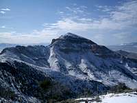
 Rex Peak in the Crawford Mountains
Crawford Mountains

Rex Peak

Rex Peak
Rex Peak - (7,996')
The Crawford Mountains are located near the Utah and Wyoming border by the city of Randolph. The mountains rise abruptly out of the valley forming a steep escarpment on the west side of the range. The range runs in a northeast to southwest direction. It is a popular place for paragliding. The Crawford Mountains were mined extensively from 1902 through 1972 utilizing both underground and surface mining techniques. The primary method for extracting the phosphate ore was stope mining.
The highest mountain in the range is Rex Peak. It is one of the few named peaks here. The mountain is surrounded by dirt roads that were used to mine phosphate. Evidence of mining activity can still be seen in many of the canyons. The Crawford Fault is located along the western base of the Crawford Mountains and in the Bear River flood plain. The central part of the fault shows evidence for late Pleistocene activity. The Crawford Uplift is the result of two parallel fault systems. The east bounding fault is expressed as an eroded mountain front that is deeply incised by drainages. The younger west bounding fault is expressed as a steep mountain front that rises abruptly from the Bear River Valley.
The flat, grassy Bear River Valley around Randolph conceals its elevation at 6,280 feet above sea level. The Bear River loops its way lazily past a short distance to the east of town, on its way from the 13,000 foot peaks of the Uinta Mountains to the south which can be seen in the distance, to the Great Salt Lake. Beyond the river, the valley abruptly ends as the face of the Crawford Mountains rise to nearly 8,000 feet. To the west of town, sagebrush-covered hills rise gradually. Two creeks, Big Creek and Little Creek, flow out of canyons at the northwest and southwest corners of Randolph.
This area is known for its cold temperatures. The coldest temperature ever recorded in Utah was in Peter Sinks in the Bear River Mountains. The city of Woodruff holds the record in a Utah community for having the coldest temperature at -50. The valley that the city sits in regularly has temperatures below zero during winter. The climate in the area is semi-arid with less than 14 inches of annual precipitation, much of this coming in winter as snowfall. The vegetation is mostly green shrubs and trees that is comprised of sagebrush and rabbitbrush.
On March 14 of 1870, Randolph H. Stewart and other Mormon pioneers arrived at and founded Randolph. Cold winters, on account of the high elevation, made it a struggle to establish the settlement, but they were successful. The summers are pleasant with lots of sunshine and blue skies. Ranching is the major occupation today, as it always was. The city of Randolph was named after Randolph H. Stewart and is the largest city near the range. Woodruff is the smaller town located south of the city of Randolph. Woodruff Creek flows through a wide, flat canyon out of the mountains to the west and through the middle of the town. The valley is green with grass and even swampy in places, while the hills can look pretty dry at times. Woodruff was settled in 1870 by a group of Mormon pioneers from Bountiful, Utah. They named it after Wilford Woodruff, president of the LDS Church at the time, who was a frequent visitor to the area.
 Tangent Peak in the Hogup Mountains
Hogup Mountains
The Hogup Mountains are located at the northwest corner of the Great Salt Lake. This range is separated into two main ridges which are divided by a large valley and the highpoint of the road, Big Pass. The western ridge has the highest peaks including, Tangent Peak, 7,047 feet. Scorpio Peak, 6,660 feet, is located at the southern end of the range. Shelter Peak, 5964 feet, is on the west side.
The eastern ridge of the Hogup Mountains is lower in elevation. Race Benchmark, 6,614 feet is located on this ridge. The Fingerpoint is a small peninsula on the southeast side of the range. Deadman’s Knoll is farther to the west and below that is Broom Mountain. This leads south to Hogup Ridge along Clyman Bay. This range has outstanding views of the northern end of the Great Salt Lake.
This area can only be reached by driving long distances on dirt roads. Passenger Cars can probably be driven on the main roads but a high clearance vehicle is recommended since most of the side roads are rough. The range is separated into two main parts with a large valley in the middle. Big Pass is east of Tangent Peak. The eastern peaks are directly above the lake and the highest peaks are farther west. Dolphin Island can be seen to the east in the Great Salt Lake. Although, this part of the lake is often very dry.
Hogup Cave was a major discovery in Great Basin Archaeology. C. M. Alkens made excavations during the 1960s that revealed hunter-gatherers at Hogup Cave relied on plant foods such as pickleweed. They also hunted deer, pronghorn antelope, wild sheep, and bison. Hogup Cave was similar to Danger Cave in the Silver Island Range, although they are approximately sixty miles apart, the caves are archaeologically related. Hogup Cave contained data from approximately 6350 BC. Both caves showed the life styles of successive people who, over thousands of years, adapted to changes in the desert environment.
This area is known historically for the railroad. It was built to travel past Little Mountain, Promontory Point, Lakeside, and at the southern end of the Hogup mountains. The benchmark on the summit of Tangent Peak is labeled as Terrace. Its name comes from the ghost town of Terrace, Utah which was established in 1869 as an operations base of the Central Pacific Railroad on the route of the First Transcontinental Railroad. The railroad was complete when Union Pacific and Central Pacific met at what is now called Golden Spike Historical Site.
 Tangent Peak |
 Tangent Peak |
 Racetrack Benchmark |
Hogup Mountains
Tangent Peak - (7,047')
Tangent Peak is the highest summit in the Hogup Mountains. It’s an easy hike to the summit but the long drive to get there keeps the crowds away. The drive involves many miles of dirt roads and this is a place where you wouldn’t want your vehicle to break down. Tangent Peak is located on the western ridge of the range. The standard route starts from Big Pass. Then you can hike west up to the ridge and follow it north to the summit. It has over 2,300 feet of prominence and most people were hiking to it because of that reason.
Scorpio Peak - (6,660')
Scorpio Peak is south of Tangent Peak on the same ridgeline. One route would be the do a long ridge traverse between the two peaks. This would also go over unnamed Peak 6,782 along the way. Another route would be to drive south of Big Pass and park below the east side of Scorpio Peak. This route has about 1,500 feet of elevation gain.
Race Benchmark - (6,614')
Race Benchmark is located on the eastern ridge of the Hogup Mountains. It has a better view of the Great Salt Lake than Tangent Peak farther west. The peak can also be climbed from Big Pass or a place just north of it. Race Benchmark is the highpoint of this area of the Hogup Mountains. Peak 6,485 is farther south.
Matlin Mountains
The Matlin Mountains are a small range located near the northwestern corner of the Great Salt Lake. They are northwest of the Hogup Mountains. This range is usually accessed from the north near Kelton or the east near the turnoff to Golden Spike. The mountains run northwest to southeast and are divided by a dirt road in the middle. This road can be used as access to hike to the top of highest peak which is 5,970 feet at the southern end of the range. The Baker Hills are to the east and Coyote Hill and the Horse Hills are located to the west. An old railroad grade trail ran through the area in the 1880's until the early 1900's.
Matlin Mountains HP - (5,970')
The highpoint of the Matlin Mountains is easy to get to if you have a 4WD vehicle. The same driving directions for the Hogup Mountains can be followed south of Kelton. Then you’ll get to a junction near Table Mountain and instead of going south you'll turn west toward the Baker Hills. Follow this road as it goes up to a saddle that divides the Matlin Mountains in two sections. From here there is about five hundred feet of elevation gain.
Crocodile Mountain - (4,810')
Crocodile Mountain sits near the northwest corner of the Great Salt Lake by the Mud Flats. It is an oddly shaped uplift that is located east of Peplin Flats. Across the other side of the flats is Peplin Mountain which is higher than Crocodile Mountain by over five hundred feet. You will actually drive past both of these peaks when traveling to the Hogup Mountains which are farther south. A dirt four-wheel drive side road leads to the saddle on Crocodile Mountain. The highpoint, 4,810 feet, is to the north and another point labeled as, Loco, 4,715 feet, is to the south.
 Frary Peak on Antelope Island - by lcarreau
Antelope Island
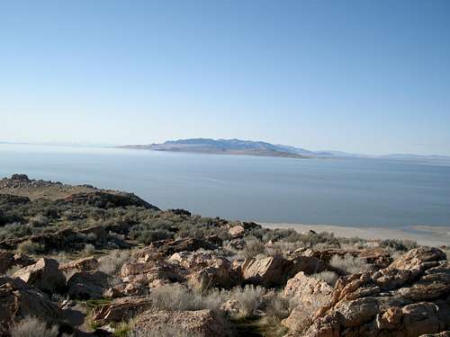
Antelope Island is the largest and most accessible island in the Great Salt Lake. There is a seven mile long causeway that connects it with the mainland near the city of Syracuse. The island occupies an area of 28,022 acres. Antelope Island got its name in 1845 after a successful antelope hunt by John C. Fremont and Kit Carson. Fremont wrote: "On the island we found grass and water and several bands of antelope. Some of these were killed, and in memory of the grateful supply of food they furnished, I gave their name to the island."
The highest mountain on the island is Frary Peak. It rises for over 2,300 feet above the Great Salt Lake. It is a unique experience to be able to climb a mountain surrounded by water on all sides. A maintained trail goes all the way to the top. There is a great view of the Wasatch Range from the summit. Hiking off-trail is usually not encouraged on the island. You must also be done with your hike before dark because the entrance to the island is gated. Other mountains include Buffalo Point, Dooly Knob, Beacon Knob, Elephant Head, The Sentry and Mollys Nipple.
Bison were introduced to the island in 1893, and now there are approximately 600 to 700 of them. They are managed by the Utah Division of Parks and Recreation. Visitors are welcome at the island's bison corral and management facilities. During the annual bison roundup each fall, visitors can watch a working bison ranch in action as the animals are herded, branded, inoculated and released. After reading the comments from people who have climbed Frary Peak, you will notice that many of them have encountered bison too.
The island also has millions of waterfowl because of the extensive marshlands around the Great Salt Lake. It is visited by numerous migrating birds, and inhabited by those who stay around during winter in Utah instead of flying elsewhere. There are healthy populations of pronghorn antelope for which the island was named. Antelope were reintroduced in 1993 and can be viewed from various lookout points. Other animals include deer, elk, bighorn sheep, bobcats, and coyotes. If you camp on the island, expect to hear coyotes at night.
Antelope Island State Park is located on the northern portion of the island. It was established in 1981 as part of the Utah State Parks System. The island's shore is relatively flat with beaches and plains to the base of the ridges. The causeway was once submerged due to record high lake levels for a decade, making it accessible only by boat. The lake receded in July 1993. Antelope Island was then reopened, complete with a visitor's center, rest rooms and showers, RV and primitive camping, a marina and picnicking facilities.
 The Sentry |
 Dooly Knob |
 Antelope Island |
Buffalo Point - (4,785')
Buffalo Point is located at the northwestern end of Antelope Island. It is one of the easiest hikes in the area and offers an outstanding view from the summit. There are two main routes to the top. The easiest is from the Buffalo Point Interpretive and Picnic Area. A trail can be seen leading up the hillside from here. The more scenic route is from the Lakeside Trail. This follows a trail along the Great Salt Lake shore from Bridger Bay to White Rock Bay.
Elephant Head - (5,126')
Elephant Head is located on the western side of Antelope Island. With a little imagination, it does resemble the head of an elephant. The White Rock Trail starts out as a service road. It then turns into a trail and reaches a junction. At this point you can choose to go left and start the Split Rock Loop trail or continue on to Elephant Head which can be seen to the west. There is a great view looking down to Split Rock Bay.
Dooly Knob - (5,278')
Dooly Knob is located north of Frary Peak. It is approached from the same trailhead. There is a junction with a side trail heading up the ridge toward Dooly Knob. The summit is indeed a rocky pointed knob. The peak was named after John Dooly Sr. He was a businessman and rancher who purchased Antelope Island. He then introduced a dozen bison. The state of Utah later bought the island and turned it into a state park. The bison herd would flourish on the island where hundreds of them now live.
Stringham Peak - (6,374')
Stringham Peak is located on the ridge north of Frary Peak. It only requires a short side trip so these two peaks are usually hiked together since they use the same approach. Stringham Peak was named after Briant Stringham. He was an early explorer of Cache Valley and the Ogden area but is best known for helping manage the Mormon Church's Tithing Herd of wild horses on Antelope Island. At the time there were nearly 1,000 wild horses that were roaming the island.
Frary Peak - (6,596')
Frary Peak is the highest peak on Antelope Island. It is a popular hike because a trail goes all the way to the summit. It can be hiked year round and winter is a great time to visit. There are also bison which may be seen anywhere on the island. Captain Howard Stansbury set up base camp at Antelope Island to survey the Great Salt Lake during the years of 1849-50. Later several private homesteads were established on the island. The peak was named after George and Alice Frary and their family. They were homesteaders that actually ended up staying for a long time on the island.
The Sentry - (5,446')
The Sentry is located several miles south of Frary Peak. It probably received its name because it looks like it's standing guard above the southern part of the island. A nice trail was built that goes around the peak as a loop but not to the summit. Hiking to the top of the peak is not difficult. You'll need to pick up a permit at the Fielding Garr Ranch before the hike.
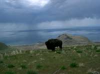
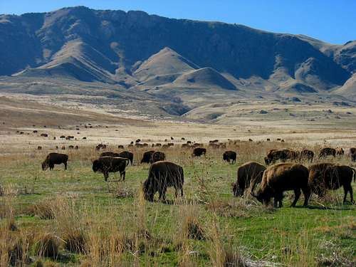 Bison below Frary Peak on Antelope Island - by Rocky Alps
Stansbury Island
Stansbury Island is the second largest island in the Great Salt Lake. It is located at the southern end of the lake. The water level determines if it is an island but during low water periods it has been a peninsula. It is now connected to the mainland by a nice gravel road and is surrounded on the west and south by evaporation ponds. The island is approximately 11.5 miles long and 4.5 miles wide, and covers about 22,314 acres. The Great Salt Lake was officially surveyed in 1850 by Howard Stansbury, for whom the island was named.
The highest peak on the island is located north of Castle Rock and called the Stansbury Island HP at 6,649 feet. It rises about 2,000 feet above the lake. Even though the range is low in elevation, it is very rugged. The rock is made of sharp layers of quartzite. The scrambling on the ridgeline is very enjoyable. From the summit you can see the Great Salt Lake, Antelope Island, Promontory Point, the Oquirrh Mountains, and Wasatch Mountains. The best hike may be to do a traverse of the entire ridge.
A popular mountain biking trail is near the central part of the island. The trail is about 10 miles long. A single track takes you up over the ridgeline, where there are steep switch-backs, and most riders walk their bikes in some spots. After crossing a mountain, the trail drops down into a valley and then joins a dirt road on the east side. Riders usually follow dirt roads back around the island back to the trailhead. The best time to be on the island is late in the evening when the sun is setting on the Great Salt Lake. The place is also popular with target shooters and you are sure to hear gunshots. Today the island is used as winter range for cattle, on both private ranches and BLM ground. Unlike Antelope Island, there are no developed campgrounds or other facilities on the island.
Much of the island is public land, managed by BLM, and is open to people. Some of the west side is privately owned and also a section on the east side. As a result, the public has easy access to the south half of the island, but the sandy beaches and coves on the north end are accessible only by boat, or by hiking along the ridge in the center of the island. Ancient Indian sites have been found on the island. Petroglyphs have been carved into basalt boulders and are found in several locations. The remains of rock shelters can also be seen but are difficult to find.
 Stansbury Island |
 Stansbury Island |
 Stansbury Island |
Stansbury Benchmark - (6,553')
Stansbury Benchmark is the name of the peak located north of Stansbury Island HP. It's not done as much because it's lower in elevation. Most people reach this peak from a ridge traverse between it and the highpoint. If you follow the ridge directly you’ll run into 4th class scrambling. You can avoid this by dropping down the west side and ascending a gully to the summit.
Stansbury Island HP - (6,649')
This is the highest point on Stansbury Island. There is a big gap on the ridge between Castle Rock and the highpoint to the north. The best way to get from one to the other is to go over to the west and drop down and then scramble along the ridge until you see up a wide chute. You can go up that chute and hike along the ridge to the summit of the Stansbury Island HP.
Castle Rock - (6,610')
Castle Rock is located south of Stansbury Island HP. Many people combine it with the highpoint of the island. You'll want to park below the no trespassing signs to avoid any trouble. The route ascends up to the ridgeline south of Castle Rock. There are some scrambling along the ridge but routefinding is quite easy from here to the summit of Castle Rock.
Stansbury Island South - (6,070')
This peak is located at the southern part of the range. You don't have to worry about crossing private land here. There is a mountain bike trailhead below the west side of the peak. This is where you can park and start hiking up the peak. I climbed this peak a few years ago and it was a nice hike with a little scrambling near the top of the ridge. There was a cairn on the summit at the time.
 Craner Canyon below Craner Peak - by Dean
Lakeside Mountains
The Lakeside Mountains are located at the southern end of the Great Salt Lake just north of Interstate-80. They are northeast of the Cedar Mountains and east of the Grassy Mountains. The range is divided into three sections. The highest mountain in the range is Craner Peak, which is located on the south end. The middle section of the range is a long ridge with the name Sally Mountain. The northernmost section is labeled as Death Ridge with Lakeside Butte above the road. Other mountains include Table Mountain, Black Mountain, and Jedediah Mountain.
To get there from Salt Lake City or Wendover, drive and take exit 77. Then take the northern road that parallels I-80 for several miles before it bends north towards Rowley and the MagCorp magnesium plant. Continue north as you aim towards the magnesium plant in the distance but watch for all of the mileage markers that you'll see on the right side of the road. Just after milepost 12, watch for an unmarked road that takes off to the left. Just beyond the RR tracks, it becomes a dirt road and follow it west past some old corrals in less than a mile and follow the road as it curves back to the north. At 3.5 miles from the highway, watch for the Craner Canyon road on the left.
Craner Peak is one of the Utah prominence peaks with over 2,000 feet of prominence. Many of the ranges that are located around the Great Salt Lake are prominent. This mountain range is not well known even though it is located near major roads. You can get to the trailhead for Craner Peak via a dirt road. A high clearance vehicle is recommended because of ruts. The hike up the mountain starts in open but the summit is not visible from here. It can be seen once you hike up to the ridge. Keep on the lookout for rattlesnakes when hiking in this area.
Lakeside is an outpost for the railroad. It is located on a peninsula where the Lucin Cut-off causeway across the lake briefly touches the mainland. The settlement is on a remote area at the western shore of the Great Salt Lake. It served as the base camp for the West Desert Pumping Station project which was a battery of pumps designed to reduce the water level of the Great Salt Lake. The largest magnesium plant in the USA sits just east of Craner Peak at Rowley Utah and is easy to notice because of all the smoke in the air. MagCorp manages this plant which provides over 400 jobs to the local economy. There is also a weather station located on top of a ridge of the Lakeside Mountains.
 Craner Cliffs |
 Black Mountain |
 Craner Canyon View |
Jedediah Mountain - (5,849')
Jedediah Mountain is in the central area of the Lakeside Mountains. It's north of Black Mountain and south of Sally Mountain. The highest point is 5,849 feet elevation and the south peak, which is named on maps, is only eleven feet lower. The easiest way to approach the mountain is from its west side. The summit has a good view of the Great Salt Lake and of the military area nearby. There is a metal structure that was lying down on its side on the summit.
Black Mountain - (6,551')
Black Mountain is located north of Craner Peak. When viewed from Craner Peak it has a pyramid shaped appearance. The name of the peak may have come from the black colored rock bands around the summit. The distance between Craner Peak and Black Mountain is about one and half miles. On the east side of the mountain are Peepstone Canyon and Vindicator Canyon. On the west side is the Marblehead Quarry.
Craner Peak - (6,625')
Craner Peak is the highest summit in the Lakeside Mountains. You can get there from I-80 east of Delle. A road goes north into Lakeside Valley toward MagCorp. The best access is from Craner Canyon. There are two suggested routes. One starts near Craner Spring. It goes west up to the ridgeline and then north to Craner Peak. Another route starts lower down on Craner Canyon road and ascends the peak from the east.
 Grassy Mountain - by MikerHiker
Grassy Mountains
The Grassy Mountains are located west of the Great Salt Lake. The range is small and covers an area that is about 12 miles long and 4 miles wide. The highest peak in the range is labeled as Grassy Mountain, 6,596 feet. Farther to the south is Cobble Hill. To the west is Finger Ridge and to the east are the Puddle Valley Knolls. Most of the peaks are unnamed in this range. They are around 5,000 feet in elevation with the highest peaks exceeding 6,000 feet. You can climb year round as long as any of the dirt roads used to access these mountains are dry. Spring and Fall are ideal times to hike here.
You can get to Grassy Mountain by driving west of Salt Lake City on I-80 towards the city of Wendover. Take exit 62 and head north. This starts out as nice paved road but then it becomes necessary to take one of the dirt roads that head west. These roads will take you closer to the mountain. Few people know about these mountains but the highpoint of the range happens to be a Utah Prominence Peak.
This mountain range is west of the Lakeside Mountains and separated by Puddle Valley. Puddle Valley received it name because its base is made of clay and has no drainage. This means that large puddles form after heavy rain storms. The Great Salt Lake mud flats separate the range from the Newfoundland Mountains to the northwest. Ripple Valley is on the southwest side of the range. To the north is German Valley. The southern end of the range has several dirt roads that go north toward the highpoint and to points farther west.
The Grassy Mountain Facility is located near the Grassy Mountains. It is a hazardous waste, storage, treatment, and disposal facility. The site is remote and only one square mile in area. In fact, it is over twenty miles from any town. Because of its desert setting, the site is ideal for land disposal. The yearly precipitation averages only 6 inches. Relative humidity rarely exceeds ten percent. There are no streams or rivers within a fourty mile radius of the facility. The nearest surface water is the Great Salt Lake which is thirty miles to the northeast.
 Grassy Mountains |
 Grassy Mountain |
 Grassy Mountains |
Grassy Mountain - (6,596')
Grassy Mountain is the highpoint of the Grassy Mountains. The peak can be accessed by turning off of I-80. There is a road that goes toward the mountain range. There are two ways to approach the peak. The route from the east starts in Puddle Valley and has 1,400 feet of elevation gain. The route from the west is shorter and has less elevation gain because a dirt road goes close to the peak. From here it's an short hike that can be done with other peaks in the area. You'll get a good view of the Lakeside Mountains and of higher ranges such as the Stansbury Mountains.
The Cobblers - (5,948')
The Cobblers are a group of peaks located in the southern area of the Grassy Mountains. Cobble Hill, 5,740 feet, is the only named summit. The other Cobblers have been given delicious dessert nicknames. South of Cobble Hill is Apple Cobbler, 5,777 feet. The two peaks at the south end are Banana Cobbler, 5,837 feet and the highest Peach Cobbler, 5,948 feet. These low elevation peaks provide a nice hike during winter.
 Desert Peak view in the Newfoundland Mountains - by Dean
Newfoundland Mountains
The Newfoundland Mountains are one of the most remote mountain ranges in this part of Utah. The area is about 15 miles long and 4 miles wide. The range is shaped like a sea horse and located west of the Great Salt Lake. The mountains run north to south and rise for over 2,700 feet above the valley. It is surrounded by the Great Salt Lake Desert mud flats. Some of the rock walls and boulders have odd erosional features with large huecos and arches. The vegetation in the mountains is sparse with juniper, sagebrush, and grass.
The hardest thing about the Newfoundland Mountains may be just getting there. Given better vehicle access, this might be a well traveled place for climbers but there are few people. Access is limited to an easily-missed entry point from the railroad's right of way at the north end of the range or from the southeast from Lakeside. This entry may be blocked off at any time so be prepared. This is controlled by the military so permission may also be needed. If you are able to get through, there is a long drive over miles of dirt roads. In this part of Utah, it is a good idea to go prepared including having a spare tire.
The highest mountain in the range is Desert Peak. There is little water and the area is very dry. This is how the mountain received its name. It is a rugged peak with steep granite and quartz monzonite cliffs. There are no trails in the range so you can pretty much hike wherever you like. From the summit, you can see the Cedar Mountains to the south and Pilot Range to the west. They are over 30 miles away and the view gives a feeling of isolation. There are no other named peaks but the entire ridgeline can be traversed. The southern part of the range is located on the Hill Air Force Range Military Area.
As the mining boom of the American West took place, people moved from where they lived to even the most open and unforgiving places in the West. The Newfoundland Mountains were no exception. Despite the remote location, inhospitable topography, dry, salt-laden wind, and scant wildlife, people came. They lived here under the hottest and harsh of conditions. But the list of reasons to visit the Newfoundland Mountain Range today is very compelling. The range has been explored for gold, silver, lead, and copper. The Desert Flower Mine was mined for tungsten until the 1950’s. Mining in the range has ended but remains can still be found. Livestock are in the area on a seasonal basis and recreational use such as hiking and camping is still low.
 Desert Peak |
 Desert Peak View |
 Desert Peak |
Desert Peak - (7,005')
Desert Peak is the highest in the Newfoundland Mountains. It's located in the northern part of the range. If you are able to get to the mountain then you're doing well. It's a long way out there and will take most people at least two hours from I-80 to get there on dirt roads. It can be approached from several directions. From the southwest above Miners Basin is the shortest route. Another route is from Dell Canyon on the east side of the range.
South Newfoundland BM - (6,058')
This is the highest point in the southern area of the Newfoundland Mountains where few people go. The Utah Test and Training Range is also located at the southern part of the island. It looks like the summit is located just north of their range and it should be okay to hike to. You would probably have to approach the peak from the northeast or northwest. I'm not sure because few people go over there to climb it.
 Newfoundland Mountains from the Silver Island Mountains - by gjagiels
Silver Island Mountains

Graham Peak

Lamus Peak & Jenkins Peak
Silver Island Mountains - (7,563')
The Silver Island Mountains is located near the Nevada-Utah border northeast of Wendover. This range is geologically impressive with several different rock layers exposed in a colorful arrangement. The mountains are 32 miles in length and run in a northeast to southwest direction. It is on the west side of the arid and barren Great Salt Lake desert. The mountain range is called an island because it is surrounded by the salt and mud flats of the ancient Lake Bonneville. The terrain has steep washes, canyons, and mountains.
The highest mountain in the range is Graham Peak, 7,563 feet. It is located near the northern side of the range. There are eight named summits and several unnamed points in range that are also worth climbing. They include Cobb Peak, Jenkins Peak, Campbell Peak, Lamus Peak, Rishel Peak, Tetzlaff Peak, Leppy Peak, Volcano Peak, and Crater Island. The best time to climb is during spring and fall. Summer is usually too hot and unpleasant to climb anything here. Winter is also a good time to visit but only when the roads are dry.
The Silver Island Mountains and Pilot Range were important landmarks to the early pioneers. On the northeast part of the range is Donnor Canyon which was named after the ill fated Donnor-Reed party. They crossed the harsh Salt Lake desert just north of the Hastings Cutoff Trail. The area was a major route used by people trying to make their way to California. Mining was also and important resource in the range. The area is now a favorite place for rock hounds. There are several caves that were used by Native Americans. Excavations at nearby Danger Cave have proven occupation of the area as early as 8300 BC. The first recorded crossing of the desert was made in 1845 by Captain John C. Fremont's survey party, with scouts Kit Carson and Joe Walker.
The Silver Island Mountains Backcountry Byway is 54 miles long. The drive should take about two to three hours at a leisurely pace. It loops around the base of the range of jagged volcanic peaks. Some of the mountains bear names of land-speed legends of the Bonneville Salt Flats. They include W.D. Rishel, Ab Jenkins, John Cobb, Sir Malcolm Campbell and “Terrible” Teddy Tetzlaff. The Bonneville Salt Flats are the flattest place in the U.S. and is a very photogenic environment. It is a nice side trip off I-80 and is very beautiful later in the day. There are spur roads from the main loop that go into Jenkins, Cave, Silver Island, and Donner Canyons.
The Bonneville Salt Flats are located over an area of 30,000 acres. It is administered by the BLM and is located east of the Silver Island Range. The area is named in honor of Captain B.L.E. Bonneville, whose expeditions in the 1830's proved the area was part of an ancient basin. The salt flats potential for racing was first recognized in 1896 by W.D. Rishel. He was looking for a bicycle race course from New York to San Francisco. Daredevils started trying automobile speed record on the flats. By 1949, the raceway on the Bonneville Salt Flats was the standard course for world land speed records. On this natural race course the 300, 400, 500, and 600 mile per hour land speed barriers were broken.
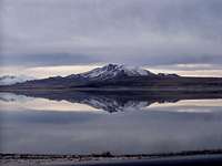
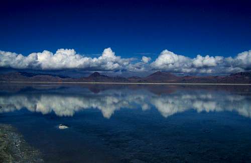
 Fremont Island and the Promontory Mountains - by imontop
The Great Salt Lake
In 1846, the Mormons left Nauvoo, Illinois because of religious persecution and went searching for a place where they could practice their religion freely. They traveled across Iowa and went to Winter Quarters, Nebraska. On April 5, 1847, an advance company led by Brigham Young set off from Winter Quarters on their trek across the country, 1,040 miles to a new home. Salt Lake City was founded in 1847, on July the 24th, by the Mormons. When they arrived their religious prophet Brigham Young reportedly stated, "This is the place." At first it was called the State of Deseret referring to the honey bee in the Book of Mormon. Then they named it the Great Salt Lake City after the salty inland lake that was located in the desert to the west.
Many of the mountain ranges in Northern Utah are located around the Great Salt Lake. Anyone who has seen a map of Utah will notice the lake that dominates this area. It is the largest lake in the Western United States. The present lake is about 75 miles long and 35 miles wide, with a maximum depth of 33 feet. After a series of wet years, the lake's surface area may be much larger but it will be only a little bit deeper. Great Salt Lake is salty because it does not have an outlet. Much of the precipitation that falls each year evaporates leaving salt behind. The salt content varies depending on the water level, but percentages of salt are usually around 14% to as high as 27%, eight times higher than the ocean. This gives the water its buoyancy.
The Great Salt Lake is what remains of prehistoric Lake Bonneville, which covered some 20,000 square miles of land in what is now Utah, Nevada, and Idaho about 10,000 to 30,000 years ago. The most obvious reminders of Lake Bonneville are the ancient terraces etched into the landscape along the lakes former shorelines. The terraces were eroded by wave action and are relatively flat areas that follow a contour line. After the ice age the earth's climate became drier and Lake Bonneville gradually receded to form Great Salt Lake. The Bonneville shoreline trail travels along the mountain sides of much of the Wasatch Front. Over time, the Great Salt Lake has varied slightly from elevations of 4,192 to 4,212 feet above sea level.
The Great Salt Lake and its islands provide outstanding scenery and recreational opportunities in Northern Utah. There are eight named islands in the lake that have never been totally submerged during historic time. All have been connected to the mainland by exposed shoals during periods of low water. The largest islands in the Great Salt Lake include Antelope, Stansbury, Fremont, Carrington, Dolphin, Cub, Badger, Strongs Knob, Gunnison, and Goose Island. Antelope and Stansbury are the most developed islands. The shoreline of these islands have formed extensive wetlands making the Great Salt Lake one of the most important places for migrating and nesting birds. The high salinity of the lake makes it habitable for only a few species, including brine shrimp and algae.
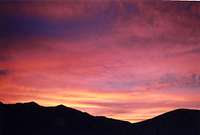
 Storm above Bountiful - by MikerHiker
When to Climb
Bison

Northern Wasatch
The lower elevation Desert Ranges are best climbed in fall, winter and spring. During winter, expect some snow after recent storms and cold spells. Dirt roads may be impassible if they are wet. Try to wait one or two weeks before traveling to more remote areas. During the summer months expect daytime temperatures to be between 80 to 100 degrees. This is quite hot for most people so you may want to avoid that time.
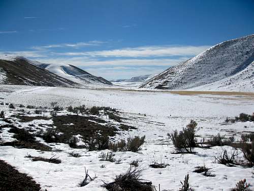
The Northern Wasatch Mountains can be hiked year round. The high peaks receive just as much snow as other areas in the Wasatch. Considerable snow will fall from December through March in winter. The mountain ranges in the northwest corner of the state, such as the Raft River Mountains, Grouse Creek Mountains, and Goose Creek Mountains may hold snow well into late spring and early summer depending on current conditions.
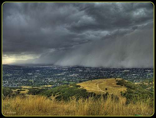
The warmest weather usually last from the months of July through September. The temperatures will be cooler at the higher elevations although lower mountains will still be warm. In the mountains weather can change at any time and afternoon thundershowers can be expected. In winter, temperatures will be around 30 degrees and sometimes much colder.
 Silver Island Mountains - by gjagiels
Recreation Areas
Golden Spike National Historical Site

Bonneville Salt Flats
Golden Spike is located northwest of the Promontory Mountains. The small settlement of Promontory was an early construction camp. It was a typical camp used by workers until it was decided that it would become the meeting place for the two railroads. There are several historic markers that tell of the significance of this. The status of the town varied from complete abandonment, to cattle town, to a national historic site under the National Park Service. This is where the Central Pacific Railroad from the east and the Union Pacific Railroad from the west met on May 10, 1869. They drove four symbolic spikes, two of which were gold, celebrating the completion of the first transcontinental railroad.
Antelope Island State Park
Antelope Island State Park is located on the northern portion of the island. It was established in 1981 as part of the Utah State Parks System. The island's shore is relatively flat with beaches and plains to the base of the ridges. The steep mountains are visible from most of the northern Wasatch Front. The causeway was once submerged due to record high lake levels for a decade, making it accessible only by boat. The lake receded in July 1993. Antelope Island was then reopened to visitors, complete with a visitor's center, rest rooms and showers, RV and primitive camping, a marina, and group picnicking facilities.
Bonneville Salt Flats Sunset
Great Salt Lake State Park
The Great Salt Lake State Park provides recreation for picnicking, boating, and swimming. The marina is located on the south shore of the Great Salt Lake, 16 miles west of Salt Lake City along Interstate 80. A marina with 300 slips is available for year round boating on the lake that never freezes. The entrance fee is $2 a day. A favorite thing for boaters is to travel to some of the islands in the lake. A favorite spot is Carrington Island. It was used as a gunnery range during WWII. Some of the targets and relics of the war are still on the island. The salty water requires that you flush out your boat engines when you enter the lake and rinse off your boat hull and trailer before you leave.
Bonneville Salt Flats
The Bonneville Salt Flats are located over an area of 30,000 acres. It is administered by the Bureau of Land Management and is located along I-80 east of the Silver Island Range. The area is named in honor of Captain B.L.E. Bonneville, whose expeditions in the 1830's proved the area was part of an ancient basin. The salt flats potential for racing was first recognized in 1896 by W.D. Rishel. He was looking for a bicycle race course from New York to San Francisco. Daredevils started trying automobile speed record on the flats. By 1949, the raceway on the Bonneville Salt Flats was the standard course for world land speed records. On this natural race course the 300, 400, 500, and 600 mile per hour land speed barriers were broken.
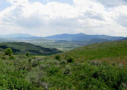
 Whites Valley in the West Hills
Peak Lists
Here are links to the Utah County and Prominence Peaks Lists. I made a few lists below of those peaks.
Utah County Highpoints List
This is a list of the Utah County Highpoints by SP member Dean. There are over 20 peaks on the list for Utah.
Utah’s 2,000 foot Prominence Peaks List
This is a list of Utah’s 2,000 foot Prominence Peaks by SP member redsplashman23. There are over 80 of these peaks in Utah.
Utah’s 100 Most Prominent Peaks List
The 100 most prominent peaks in Utah by SP member redsplashman23. Some are located on private land so this is difficult to complete.
| NORTHERN UTAH COUNTY HIGHPOINTS | ||
| Mountain | County | Easiest Route |
|---|---|---|
| Bull Mountain | Box Elder | 4wd Road or from Clear Creek Trailhead : Class 2 |
| Bridger Peak | Rich | From Swan Flat Road : Class 2 |
| Naomi Peak | Cache | From Tony Grove : Class 1 |
| Willard Peak | Weber | From Willard Basin : Class 2 |
| Thurston Peak | Davis and Morgan | From Francis Peak : Class 2 |
 Thatcher Mountain in the Blue Spring Hills
Northern Utah has over fifty prominence peaks. Some mountains are in the Wasatch Range, while others are in the quiet northwest corner of the state, and many mountains are located in the desert to the west. Some peaks are on private land and permission must be granted while others are on military land and may never be climbed. The prominence rank on the list below is based on peaks with over a thousand feet of prominence in Utah.
| NORTHERN UTAH MOST PROMINENT PEAKS | ||||
| Mountain | Range | Elevation (Feet) | Prominence Rank | Prominence (Feet) |
|---|---|---|---|---|
| Peaks with 3000+ feet Prominence | ||||
| Mount Ogden | Northern Wasatch | 9,570 | 17 | 3,810 |
| Bull Mountain | Raft River Mountains | 9,920 | 19 | 3,720 |
| Box Elder Peak | Wellsville Mountains | 9,375 | 27 | 3,452 |
| Willard Peak | Northern Wasatch | 9,764 | 33 | 3,244 |
| Naomi Peak | Bear River Range | 9,979 | 34 | 3,159 |
| Graham Peak | Silver Island Mountains | 7,563 | 37 | 3,043 |
| Peaks with 2000+ feet Prominence | ||||
| Logan Peak | Bear River Range | 9,710 | 39 | 2,995 |
| Desert Peak | Newfoundland Mountains | 7,005 | 46 | 2,785 |
| Lewis Peak (Wanship BM) | Northern Wasatch | 9,304 | 47 | 2,784 |
| Thurston Peak | Northern Wasatch | 9,706 | 51 | 2,690 |
| Messix Peak | Promontory Mountains | 7,372 | 54 | 2,452 |
| Stansbury Island HP | Stansbury Island | 6,649 | 56 | 2,400 |
| Frary Peak | Antelope Island | 6,596 | 57 | 2,396 |
| Gunsight Peak | Malad Range | 8,244 | 59 | 2,364 |
| Tangent Peak | Hogup Mountains | 7,047 | 63 | 2,307 |
| James Peak | Bear River Range | 9,422 | 66 | 2,261 |
| Durst Mountain | Northern Wasatch | 9,284 | 78 | 2,064 |
| Goose Creek Mountains HP | Goose Creek Mountains | 8,684 | 81 | 2,004 |
| Peaks with 1000+ feet Prominence | ||||
| Craner Peak | Lakeside Mountains | 6,625 | 82 | 1,995 |
| Eyrie Peak (Peak 8136) | Northern Wasatch | 8,136 | 86 | 1,956 |
| Red Butte | Grouse Creek Mountains | 9,000 | 87 | 1,940 |
| Grassy Mountain | Grassy Mountains | 6,596 | 88 | 1,936 |
| Grandview Peak | Northern Wasatch | 9,410 | 91 | 1,910 |
| Redrock Peak | Northern Wasatch | 8,170 | 92 | 1,910 |
| Howell Benchmark | North Promontory Mountains | 7,114 | 102 | 1,804 |
| Peak 7940 | Goose Creek Mountains | 7,940 | 108 | 1,760 |
| "Long Peak" | Promontory Mountains | 7,075 | 115 | 1,725 |
| Monte Cristo Peak | Monte Cristo Range | 9,148 | 137 | 1,568 |
| Crater Island | Silver Island Mountains | 5,743 | 180 | 1,352 |
| Little Mountain | Little Mountain Range | 5,607 | 185 | 1,344 |
| Cal Mtn Benchmark | West Hills | 6,880 | 186 | 1,340 |
| West Benchmark | West Hills | 7,196 | 187 | 1,336 |
| "China Town Peak" | Northern Wasatch | 8,220 | 202 | 1,280 |
| Rex Peak | Crawford Mountains | 7,996 | 215 | 1,246 |
| Blue Spring Hills HP | Blue Spring Hills | 6,506 | 216 | 1,246 |
| Bountiful Peak | Northern Wasatch | 9,259 | 218 | 1,239 |
| "Blacksmith Peak" | Bear River Range | 8,455 | 221 | 1,235 |
| Temple Peak | Bear River Range | 9,026 | 229 | 1,216 |
| Bovine Mountains HP | Bovine Mountains | 7,305 | 233 | 1,208 |
| Hansel Mountains HP | Hansel Mountains | 6,303 | 239 | 1,193 |
| Monument Peak | Hansel Mountains | 5,999 | 247 | 1,171 |
| Sally Mountain | Military Range | 5,861 | 248 | 1,171 |
| Bald Eagle Mountain | North Pilot Range | 8,028 | 255 | 1,158 |
| Peak 6718 | West Hills | 6,718 | 268 | 1,138 |
| South Newfoundland BM | Newfoundland Mountains | 6,058 | 277 | 1,118 |
| Mount Tarpey | Promontory Mountains | 6,979 | 285 | 1,109 |
| Pine Benchmark | Grouse Creek Mountains | 8,528 | 286 | 1,108 |
| "Chokecherry Peak" | Promontory Mountains | 7,218 | 287 | 1,108 |
| Sharp Mountain | Bear River Range | 9,082 | 291 | 1,102 |
| Cedar Ridge | North Promontory Mountains | 6,371 | 292 | 1,101 |
| Meadow Creek Butte | Goose Creek Mountains | 7,238 | 294 | 1,098 |
| Pigeon Mountain | Pigeon Mountains | 5,369 | 350 | 1,004 |
This is a list of other interesting peaks in Northern Utah which have less than a thousand feet of prominence.
| OTHER NOTABLE PEAKS | ||||
| Mountain | Range | Elevation (Feet) | Prominence (Feet) | |
|---|---|---|---|---|
| Peaks with less than 1000 feet Prominence | ||||
| Dove Creek Mountains HP | Dove Creek Mountains | 8,372 | 992 | |
| Ingham Peak | Grouse Creek Mountains | 8,490 | 945 | |
| Lynn Benchmark | Dove Creek Mountains | 8,291 | 922 | |
| Thatcher Mountain | Blue Spring Hills | 6,240 | 850 | |
| Twin Peaks | Goose Creek Mountains | 8,584 | 844 | |
| Dry Creek Mountain | Goose Creek Mountains | 7,580 | 760 | |
| Dennis Hill | Dove Creek Mountains | 7,324 | 704 | |
| Bally Mountains HP | Bally Mountains | 8,060 | 671 | |
| Rocky Pass Peak | Grouse Creek Mountains | 7,497 | 607 | |
Books and Maps
1) Utah Mountaineering Guide
By Michael R. Kelsey. Descriptions are brief but this is the best book available for many of the major mountains in Utah. It includes Bull Mountain, Frary Peak, the Bear River Range, and Northern Wasatch Mountains. There is a map and photo of each peak. He also describes winter routes up many of the mountains.
2) High In Utah (County Highpoints)
By Michael Weibel. This book has information on climbing all of Utah's county highpoints including Bull Mountain, Naomi Peak, and Willard Peak.
3) Utah Atlas and Gazetteer
This atlas shows Northern Utah and obscure mountain ranges in the northwestern part of the state.
External Links
Mick’s Mountain Page
This website has trip report and photos for mountains in the Northern Wasatch, and other areas of the Wasatch Mountains.
Newfoundland Mountains
A good trip report on the Newfoundland Mountain Range with several photos.
Silver Island Mountains
Website with photos of many of the mountains in the Silver Island Mountain Range.