
|
|
Mountain/Rock |
|---|---|
|
|
42.90450°N / 0.7334°W |
|
|
Hiking, Mountaineering, Trad Climbing, Skiing |
|
|
Spring, Summer, Fall, Winter |
|
|
7762 ft / 2366 m |
|
|
Overview
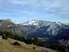
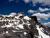
This summit is also known as Petretxema, Petraxema or Ansabère, and stands close to the Mesa de los Tres Reyes on the french-spanish border. It is placed in the upper valley of Ansó (province of Huesca), with regular road access to the main trailhead. Nevertheless, the area (Barrancos of Tacheras/Gamueta/Las Eras/Linza) well deserves a visit as a good number of two-thousanders stand around it and almost all of them can be climbed without any real difficulty.When climbed in a good weather, Petrechema offers a good day out and fine views of the Pyrenees, ranging even to Midi d'Ossau and Collarada. In winter time it makes a good starting point for climbers initiating the use of ice axe and crampons.
 |  |  |  |  |
Getting There
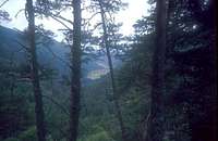 The valley of Belabarce is the last one at Navarra before reaching Zuriza and Linza from Pamplona
For the spanish approach, start from the mountain hut of Linza (see SP page of Mesa de los Tres Reyes, route Linza). You will have to get there from Pamplona or Huesca, the biggest closer cities. Follow the road linking both of them (N-240) until the crossing of Venta Carrica. This is a crossing about (will check) sixty kilometers from Pamplona, where you can find a petrol station and the beginning of the road to Sigüés / Salvatierra de Esca / Roncal. Follow this road (NA-137) for thirty kilometers, until you get to Isaba. After Isaba keep going north (NA-1370) for three more kilometers and turn right on the crossing marked as (Zuriza /Ansó). This small road (NA-2000) will take you across the valley of Belabarce and to the camping area at Zuriza, under the Sierra de los Alanos. When you finish coming down from Belabarce (that will be some thirteen kilometers after Isaba), turn left for the camping area and drive around it until the end of the road. It is not in a very good state, so don't drive fast. You will see the dirt roads to Barranco de las Eras and Barranco de Gamueta to the right, but pay them no attention. Keep going on the main road until a final turn right, around a rocky hill, sets you on the small flat valley known as Plano de la Casa and the mountain hut of Linza.
Nearest spanish railway stations: Pamplona / Huesca
Nearest spanish airports: Pamplona / Zaragoza
 The small village of Lescun is the french trailhead for Petrechema
Red Tape
No special requirements to be met. No need for permissions. Though not far away of the french National Park of the Pyrenees, there are no special protective measures for flora or fauna in this area (apart from those suggested by common sense and respect for nature).When To Climb
Most climbs take place in late spring, summer and autumn. Winter climbs are nice enough but require good equipment and a certain experience. Moreover, the western ridge might be dangerous if you happen to be around it when covered by ice. |  |
Camping and Mountain Huts
 Linza Mountain Hut
Linza Mountain Hut, right at the end of the road and placed at some 1300 meters high.
A couple of official camping sites are quite close to the trailhead in Linza. One of them placed in Zuriza, scarcely five kilometers away, and the other in the neighbouring (to the west) valley of Belagua (Camping Asolaze - see links section).
Other summits around the area
Mesa de los Tres Reyes(2444 m)Acherito(2362 m)
Chinebral de Gamueta(2312 m)
Sobarcal (2249 m)
Anzotiello(2230 m)
Lapakiza de Linzola (2112 m)
Txamantxoia / Maz (1945 m)
Gorreta de los Gabachos (2262m)
Mallo Gorreta (2255 m)
Peña Ezkaurre(2049 m)
Petraficha (2149 m)
Quimboa Alto (2196 m)
Chipeta Alto (2189 m)
Peña Forca (2391 m)
Rincón de Alano(2353 m)
 |
 |
 |
 |
 |
 |
External Links
- Asolaze Camping site
Basic information on services and contact possibilities of the Asolaze Camping site (Isaba-Navarra).
- Zuriza camping site
Spanish language info on the Zuriza camping site, five kilometers south of Plano de la Casa and Linza mountain hut.
eza - Oct 20, 2004 3:51 pm - Hasn't voted
Untitled CommentThank you so much, edouet. Will add your info to the page as soon as possible.
edouet - Oct 20, 2004 1:04 pm - Hasn't voted
Untitled CommentFrom the village of Lescun ( stunning views of all the peaks of the area ), follow the road to the bridge called " Pont Lamareich " ( ask local people, or better: buy french map scaled 1/25000 " Vallée d'Aspe ).
Follow the obvious track westwards until a nice plateau where streams melt ( 1400m ). Views of Petraxema.
Go left to the forest. Huts at 1560m, from where you can see the Col de Petraxema. Steep but easy walk on screes and cobbles.
Col de Petraxema - 2080 m -: either go left towards Axerito ( care: some climbing, not fitted for beginners ), either go right towards the summit of Petraxema ( folloow the cairns, or the trekkers! ).
eza - Oct 20, 2004 3:51 pm - Hasn't voted
Untitled CommentThank you so much, edouet. Will add your info to the page as soon as possible.
visentin - Feb 24, 2011 4:12 pm - Voted 10/10
nameHi Eza ! For several reasons I would put the double name in the title of this mountain: "Ansabère/Petrechema". Ansabère for the french name, but above all because the "aiguilles d'Ansabère" are just too famous amongst climbers, no one knows them under another name; Petrechema in the second part to avoid the confusion with the almost identical "Petragème" french name, which designates another peak... named in Spain Sobarcal ! :)
eza - Feb 25, 2011 11:44 am - Hasn't voted
Re: nameHi, Eric Agreed about the double name, this is an old page and for some reason or other it had escaped (up to this moment!) to the unwritten rule: peaks on the border line of the Pyrenees get both their spanish and french names. And there's also the relationship with the Aiguilles d'Ansabère, you're right there too. I find it rather hard to place the french name first, though... Petrechema was my first two-thousander ever, it's a special mountain for me... Would you mind if I keep the spanish name in the first place?
visentin - Feb 25, 2011 11:59 am - Voted 10/10
Re: nameNo problem ! By some strange coincidence it was also my first attempted summit in the Pyrenees ! (foggy, had to turn back), before Anie was a success the day after.. 1999... nice memories !
eza - Feb 25, 2011 12:52 pm - Hasn't voted
Re: nameYes, those first climbs seem to stay in our memory for ever... :)