|
|
Mountain/Rock |
|---|---|
|
|
36.51292°N / 50.69846°E |
|
|
Mountaineering |
|
|
Summer |
|
|
13747 ft / 4190 m |
|
|
Overview
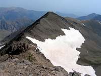
For more pictures/info, see the page for the nearby Kandigan Peak. Southeast Face
Elevation Note: Experience has proven to me that the most accurate maps of the Central Alborz Mountains are those with a scale of 1:50 000 produced by the Iranian armed forces. The elevations shown on these maps have generally agreed closely with measurements with my own GPS/altimeter. Other details (high points on ridgeline, valleys…) have also proven to be accurate. For the Siyalan area, however, the map turned out to have a few inaccuracies. It marked Siyalan as having an elevation of 4123 m. My GPS/altimeter measured 13760 ft (4194 m). The Soviet military map gives an elevation of 4178 m. Other maps used by mountain climbers in Iran give a rounded figure of 4200 or 4250 m. The Iranian 1:50 000 map also failed to accurately show the nearby 4015 m Kandigan Peak (it only shows a bump on the ridgeline and contour lines of 3840-3860 m while in fact this is a very prominent peak that rises 150 m above its saddle with Siyalan). For these reasons, I have chosen to use my own measurement of 4190 m as Siyalan’s elevation.
Click for Introduction to the Central Alborz Mountains
Click for a detailed map of the Central Alborz Mountains.


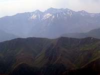
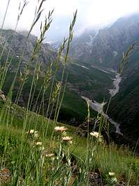
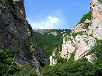
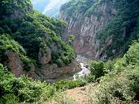
Siyalan is a giant mountain that rises to the south of the Caspian Sea south of the coastal town of Shahsavar (Tonkabon) in the western portion of the Central Alborz Mountains of northern Iran. To the north, the slopes of Siyalan drop steeply down to the bottom of the Dohezar River Valley. In a few short Kilometers, this valley reaches the narrow strip of land between the Caspian Sea and the Alborz Mountains.
The distance between the summit of Siyalan and the Caspian shoreline (25 m below sea level) is 36 Km (22 miles). The distance between the summit of Siyalan and the point at the bottom of the Dohezar Valley where the elevation is 1000 m is only 12 Km (7.5 miles).
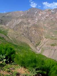
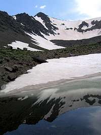
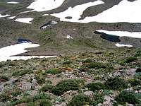
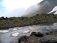
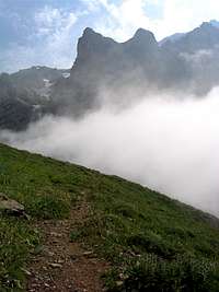
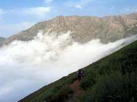
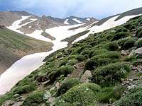
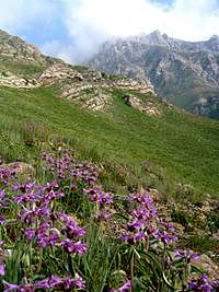
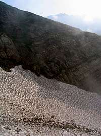
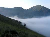
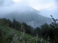
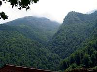
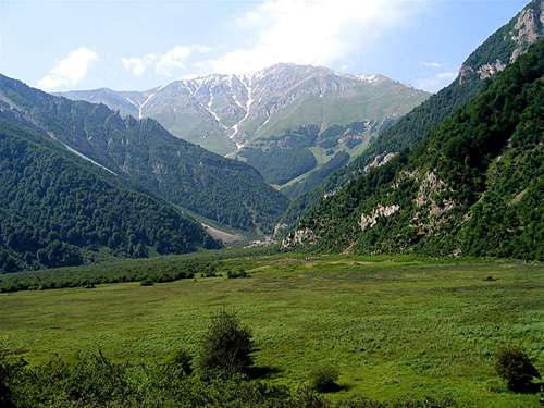
Siyalan and its nearby peaks create an impenetrable barrier to the moist air generated by the Caspian Sea. Every morning clouds begin to form over the Caspian shore. By the afternoon, fog often fills the valleys and rises up the northern slopes of Siyalan. These slopes are covered by a dense subtropical forest up to around 2200 m. Above that, lush meadows lead to alpine tundra and alpine lakes. When we visited the area in late June, snowfields seemed to continue at the bottom of the valleys down to around 2600 m. Traversing these snowfields that were at times nestled among steep rocky areas did present somewhat of a challenge. I was hoping to see the Caspian Sea from the summit of Siyalan but clouds and haze made this impossible. At night, however, the obvious line formed by the light of the coastal communities marked the sea shore very clearly.
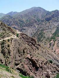
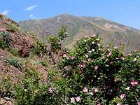
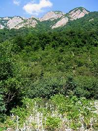
To the south, the slopes of Siyalan drop down to the bottom of the Alamoot River Valley. A scattered growth of juniper trees cover these slopes up to an elevation of 2700 m. Shorter distance and less elevation gain mean that Siyalan is often climbed via its southern slopes. The starting spot is the village of Haniz (2150 m). A 13 Km (8 mile) hike with 2040 m (6700 ft) of vertical will get you to the top. Most hikers go on to descend the northern slopes which are much more scenic. From the summit of Siyalan, you will need to hike 20 Km (12.5 miles) and descend 3000 m (9850 ft) to reach the Asal Mahaleh Village near the Dohezar Valley.
Below you will find a brief description along with some photos of what you will encounter on the hike. Please refer to the “Climb South, Descend North” Route Page for much more details. Check out the page for Kandigan Peak for more photos.
Southern Slopes:
Juniper trees on the southern slopes up to 2700 m.