
|
|
Mountain/Rock |
|---|---|
|
|
40.73355°N / 110.50572°W |
|
|
Duchesne |
|
|
Hiking |
|
|
Summer |
|
|
12707 ft / 3873 m |
|
|
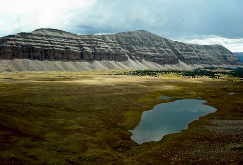
The northwest face of Stone Benchmark
Overview
 Stone Benchmark in the middle  Stone Benchmark at left At 12707 feet, Stone Benchmark with prominence of 647 feet ranks 40th on Scott's list of Utah 12,000+ Foot Peaks with 200+ Feet Prominence. Stone Benchmark is one of five peaks over 12000 feet which line the ridge which forms the west boundary of Garfield Basin. From south to north/ smallest to largest, it is peak number three. Swasey Knob and Bluebell Lake Peak lie to the south and South Porcupine and Porcupine Mountains lie to the north. |
The closest 13000 footer is Wilson Peak (13060), Utah's 17th highest, which lies 3.7 miles to the NE. Kings Peak (13528), Utah's highpoint lies 7.5 miles to the ENE. Mount Emmons (13440) lies 10.7 miles to the east and East Lovenia (13032) lies 4.5 miles to the WNW. The 12000 footers Cleveland (12584), Squaw (12855), and Explorer (12708) lie to the WSW, yellow peaks in back of a low red ridge.
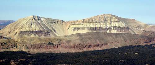
Cleveland and Squaw as viewed from Stone Benchmark
Of all the peaks surrounding Garfield Basin, I think this one has the most interesting summit. The ridge immediately surrounding the summit is filled with block after block, fissure after fissure, some of which you can walk through. The very top is almost completely flat, atop a large block with many small fissures. The benchmark disk is located at N40 44.013 W110 30.343.
|


There are no short routes to the summit. It is about 24 miles round trip from the Center Park Trailhead to the south. Most people would not want to climb this peak by itself but would do it as part of a multiday trip to several summits. The best months to climb are July, August, and September.
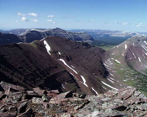
Stone Benchmark is the gray peak in the back at left.
Getting There
Access from the south is via the Center Park Trailhead.Red Tape
Group size is limited as per wilderness area rules. Many lakes have proximity restrictions. These restrictions change from time to time so check the sign board at the trailhead to see what restrictions are currently in place.Camping
There are 5 established campgrounds near the Center Park Trailhead as descriped in the trailhead page. There are numerous places to camp in Garfield Basin.Routes
From Center Park on the south Topo map  The terrain just NE of the summit This is a long (24.5 miles RT) but scenic loop hike starting at the Center Park Trailhead and hitting Swasey Knob, Bluebell Lake Peak, and Stone Benchmark. A very strong hiker could do it in a day. About half of the hike is on a nice well defined trail and half off trail, with most of the off trail portion being on a ridge which mostly alternates between easy walking or a class 2 boulder hop. On the north side of Stone there is one no exposure class 3 maneuver. Just south of Bluebell Lake Peak it is class 2+ for a short distance. Head north on the trail to Garfield Basin. After about 2.9 miles, leave the trail at N40 38.259 W110 27.603 and head for the 11193 benchmark to be found at N40 38.636 W110 29.439. Follow the ridge west and then northwest to the 11842 benchmark, the remains of which are found at N40 38.686 W110 29.439. Follow the ridge north to Swasey Knob (12124) and then north to Bluebell Lake Peak (12260) where you will find another benchmark at N40 41.467 W110 30.144. |
 Kings-Emmons ridge from Bluebell Lake Peak  Lake 11082 and the way to Doll Lake From here it is another 3.1 miles north to Stone Benchmark. From the trailhead it is a total of 11.7 miles to the summit and you gain 3650 vertical feet. This final section of ridge I didn't actually do myself but all indications are that it is similar to the rest of the ridge. I descended to Lake 11082 and then climbed back up to a point just north of Stone the next day via Doll Lake. To return you can either retrace your steps (1400 vertical feet of gain) or make a loop out of it and head down to Doll Lake, then Lake 11082, and rejoin the Garfield Basin Trail at N40 42.557 W110 28.680 as shown on the map. It is about 12.8 miles back to the trailhead by this rolling terrain route and you will gain 1580 vertical feet while descending 3820 feet. |
I think it is best to do this loop clockwise to get the ridge part done early in the day when the likelihood of thunderstorms is the least. But if the weather is nice, the other way works too.
 Some towers just north of the summit |  The north ridge starts out very jagged |  The north ridge from the north |
Garfied Basin Rim Loop
There are seven peaks above 12000 feet ringing Garfield Basin and they all can be done in one trip. See Garfield Basin Rim Loop.
Mountain Weather
Here is a link to the current seven day forecast for Stone Benchmark.
Partly sunny with 20% chance of afternoon showers.