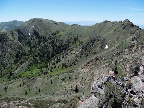
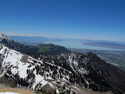
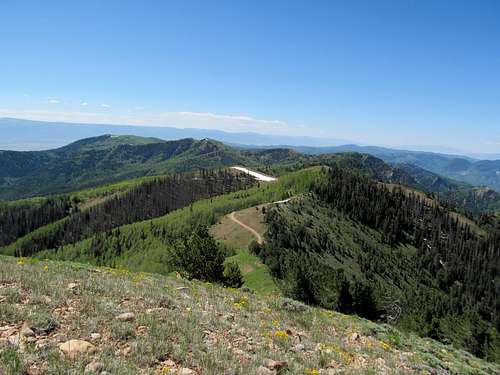
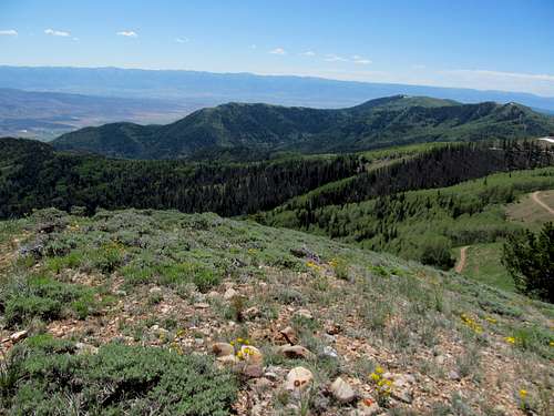
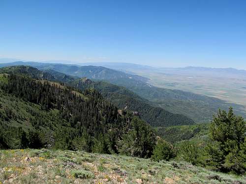
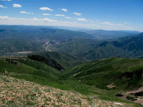
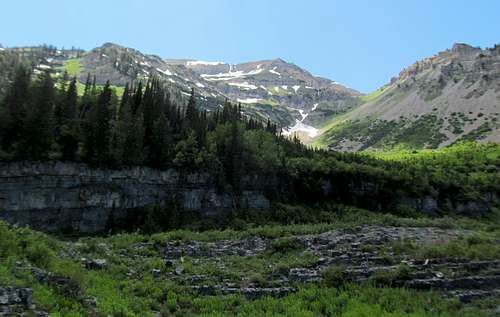
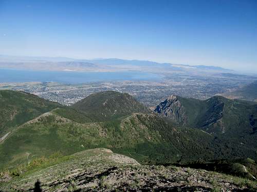
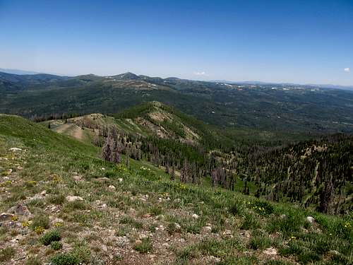
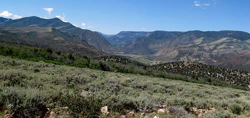
Slogging Black Crook Peak - June 1st, 2013
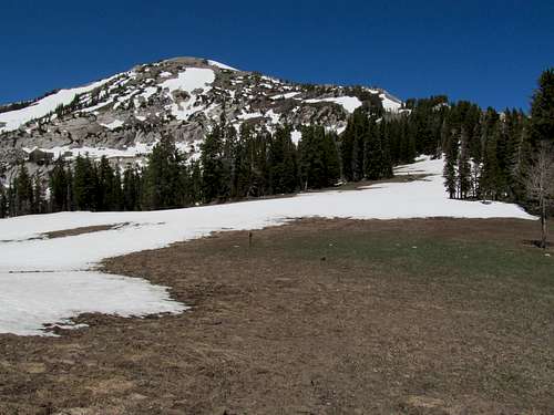
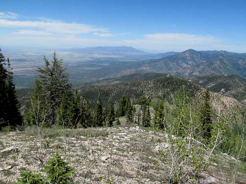
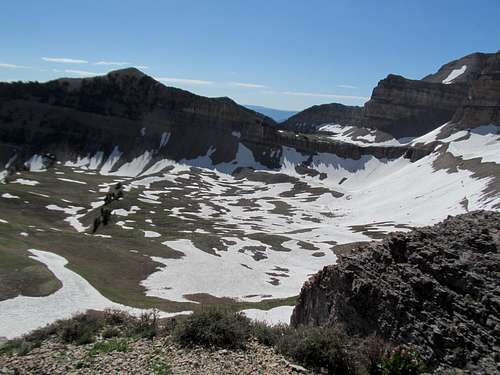
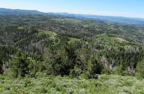
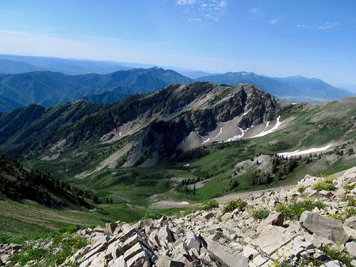
Expecting guests arriving at SLC airport Monday at midnight, followed by a quickie tour of Southern Utah and then another Vegas bachelor party, I anticipated little sleep the following week. And still being exhausted from the long 3 day trip to New Mexico the past weekend for Memorial Day, I decided to stick closer to Salt Lake and climb a few peaks nearby. Black Crook especially took ahold of my mind; it had been one of the first peaks I noticed from atop Flattop Mountain when I first moved to Utah, glimpsing the West Desert for the first time, spying a semi-major mountain range (a combination of the Tintics and the Sheeprocks, and wondering “what the hell are those mountain ranges and why the hell have I never heard of them”? And that lingering intrigue surrounding the peak stayed in my mind as it stayed in my peripheral all through spring as I wandered to and forth around the West Desert. Greg had additionally hinted at the peak being a pain in the ass, but he had done it in winter and much of his problems had to do with the cold, snow, and frostbite, so I figured I would be fine during the summer. Especially the first weekend of June; that had to be perfect right? Late enough for the snow to melt, but not before the summer got too hot.
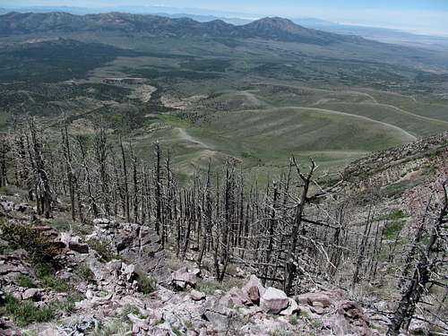
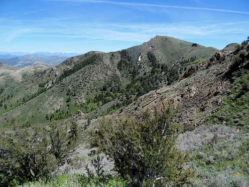
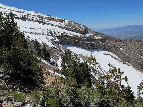
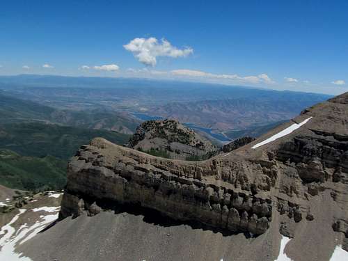
I raced down the Pony Express road down towards Vernon, another blip in the wall Utah desert town circa the stone age. Finding the right roads to Black Crook didn’t prove all that hard, though the last few miles were a little steep and rocky. Though I was on the right road I couldn't verify the fact lacking a GPS, but nevertheless I set off up the drainage I thought had a chance at being the correct route. All things considered this first part was the worst. I followed game trails only to find myself completely wallowed in some of the thickest brush, making no progress as I waded horizontally back and forth trying to find my way out, as going straight up the slope would have been impossible. Eventually I backtracked and moved further towards the center of the drainage, where the terrain got marginally better.
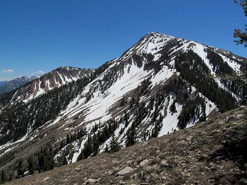
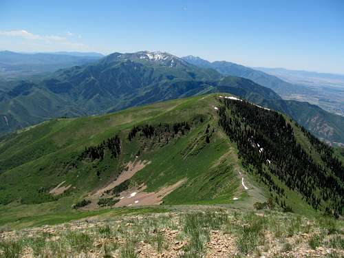
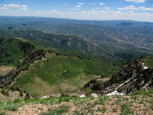
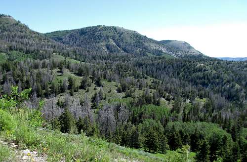
I was up to a late start and after wearing myself out already in the brush I was feeling the blistering heat as I made my way up the drainage, eventually curving towards the left side of the drainage, doing a little scrambling along the way. In hindsight I think I may have taken the worst possible route. Greg’s route on SP ascended the right to the right of my drainage, while Eric Willhite’s route ascended the drainage paralleling me on my left. Eventually I reached the head of the drainage and spied higher peaks further down the ridge from me.
Even the closest one looked to be light years away after my ordeal, and I wondered at which, if any, was the correct peak I wanted to get to; hopefully the one slightly closer and not the one with summit towers another two or three bumps and ridges away from the more proximate high peak.
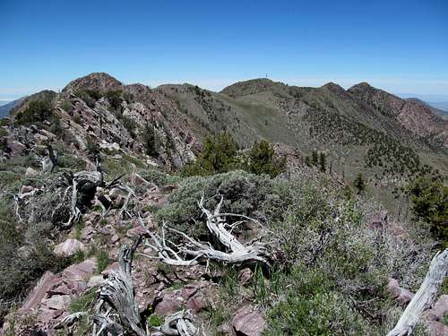
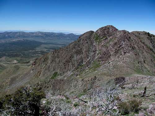
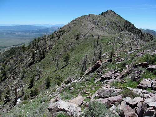
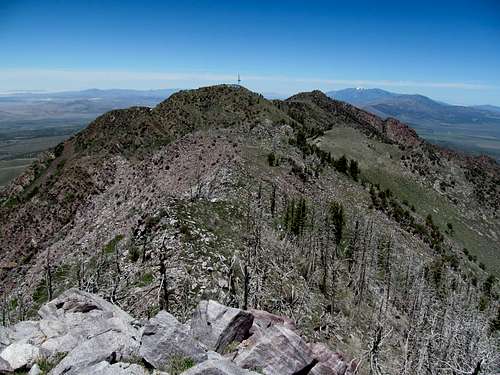
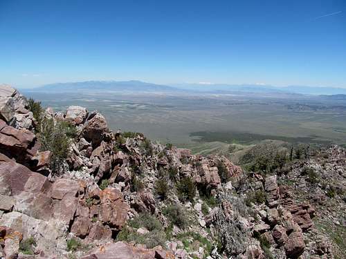
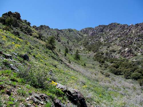
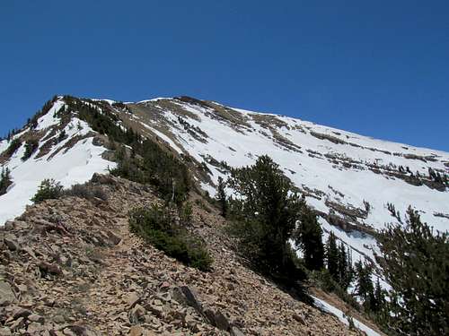
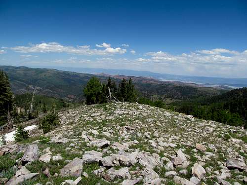
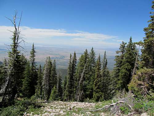
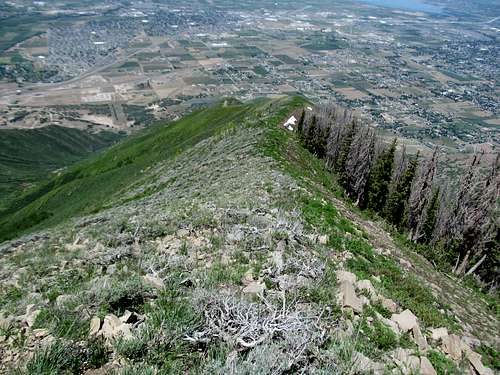
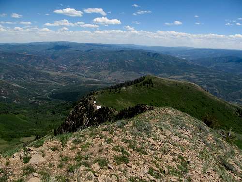
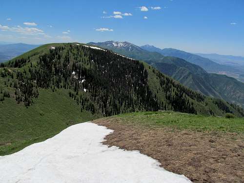
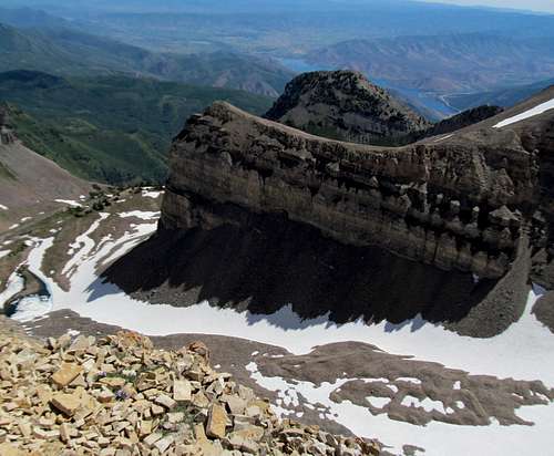
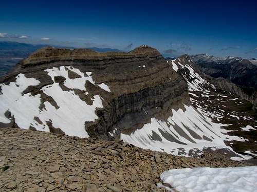
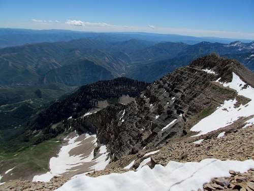
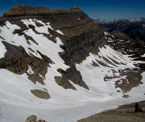
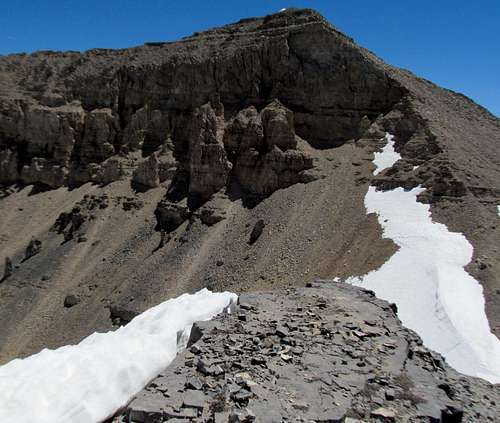
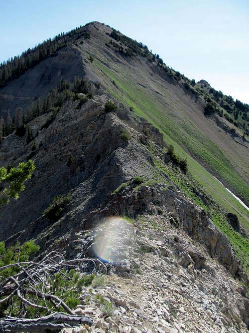
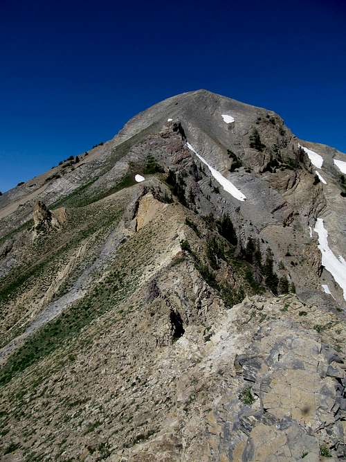
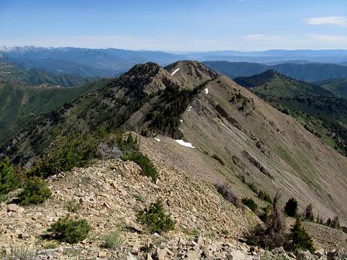
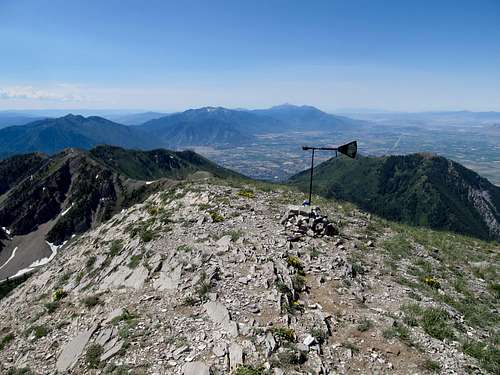
Some scrambling interspersed with shaded game trails brought me to a semi-prominent summit, where I identified the rocky outcrop a few bumps away and pegged that, hopefully, as the true summit, as I didn’t remember any accounts of Black Crook having buildings or any other structures on its summit. After a downclimb of maybe a hundred feet or so through bare trees I made my way over another bump, doing some scrambling along the right side of the ridge where, grabbing a handhold at chest level, the loose shitty rock began sliding under my hand and a huge chunk of it broke off. I wasn’t on a cliff or anything, so there was no risk of me plummetting anywhere, but the goddamn rock plummeted down right on my knee. Fortunately I had a chance to react and push back against the boulder to mitigate the impact, but my knee was still sore and and I swore once more at this piece of shit mountain.
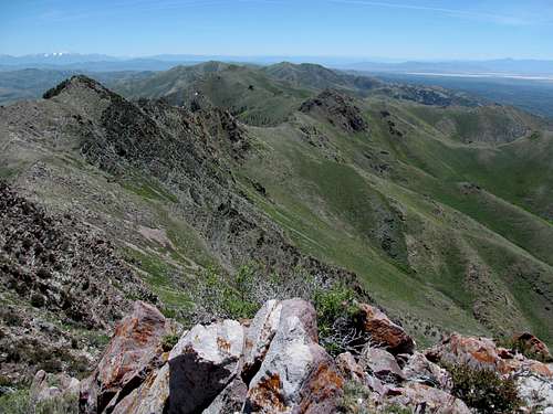
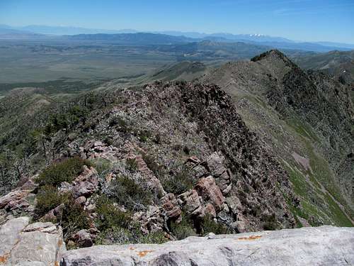
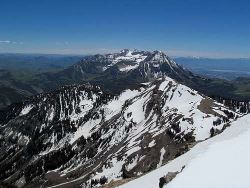
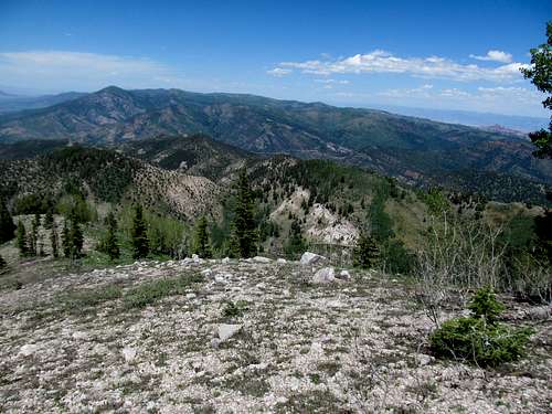
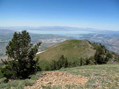
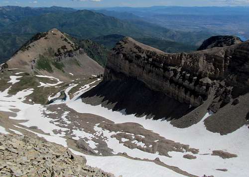
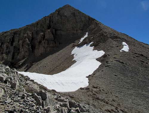
For the final summit block I swung left along the ridge and scrambled up a rocky gully in the center of the peak, eventually cresting atop a surprisingly narrow summit, the highest point a jagged piece of rocky flipping off the sky and the west desert surrounding it. Fitting.
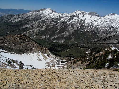
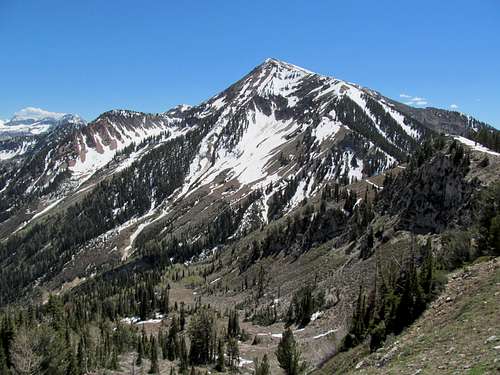
I was still unsure of whether or not I was on the correct summit, especially since I was unable to locate a summit register, but I was 60% sure, and that was good enough, especially seeing that I needed to get back to the city to catch the Bruins game.
The descent still had its shitty parts, especially all the uphill sections, but I was able to avoid the worst of the brush descending the drainage as I stuck along the rocky areas on the right.
I had time to check out the old Camp Floyd, a State Historical area, along the way back, before getting back home and watching the Bruins take the first game of the Eastern Conference Finals.
Box Elder Slog - June 2nd, 2013
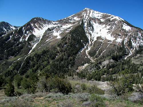
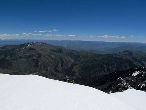
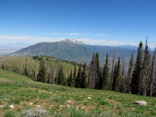
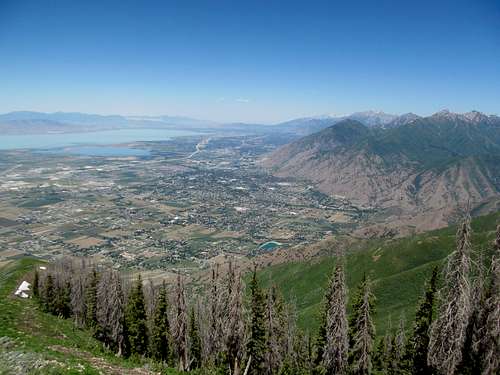
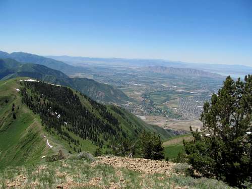
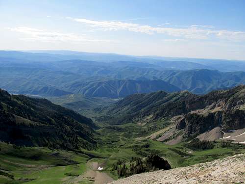
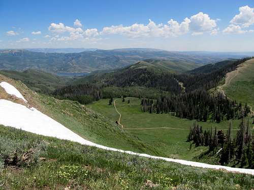
I wanted to get Box Elder Peak, the one in the Wasatch, out of the way early on Sunday so I could get groceries done and get to sleep early for the upcoming Southern Utah/Vegas trip. Alas, it was not to be, as I once more got off to a late start. The peak looked mostly dry from my purview driving by it the previous day, so I figured the crux of the climb would be navigating between all the shitty Utah drivers to and from American Fork Canyon. While that proved irritating indeed, the blistering early morning heat proved to be pretty debilitating too as I started up the Deer Creek trail from the Granite Flats parking spot and through the trees.
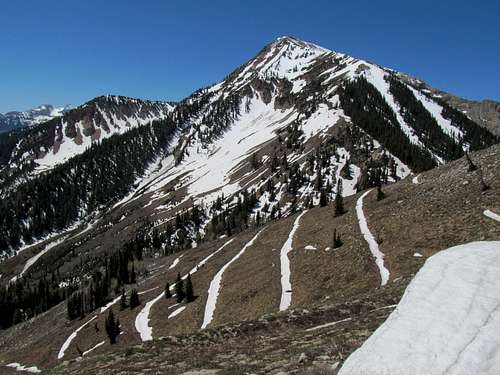
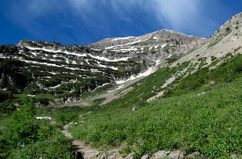
Despite the temperatures I made pretty good progress up, past a pretty cool waterfall after the trees started opening up, towards the saddle north of Box Elder. What did concern me now though were views of a pretty prominent line of snow coming down the northeast ridge of the peak, my planned ascent route. Snow began overcoming the melted trail as I approached the ridgeline leading to the saddle and the trail junction, but these difficulties were only the beginning.
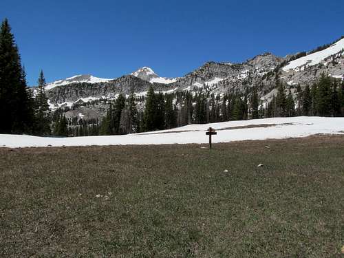
The trail junction at the saddle itself was extraordinarily pretty, amid a freshly melted high meadow and in the shadow of the surprisingly proximate granite summits of the Alpine Ridge peaks.
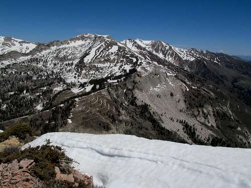
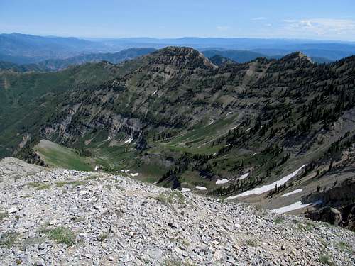
I took a break before making the sharp descent to the base of the Box Elder massif, then started up what would be among the shittiest 1800 feet of my life.
The snow was deep and slushy, resulting in constant postholing for most of the way to the summit, and by the time I was past the worst of the snow higher up along the ridge sheer exhaustion as well as a suddenly bone-chilling wind made the home stretch hell the rest of the way.
The scenery was cool though, especially fault lined rocks of the peak’s northwest ridge, reminding me of the topography of the Lost River Range up in Idaho.
The descent was marginally better, with some of the snow making for easier progress, and the snowless areas weren’t too troublesome. Just as I was regaining my mojo dogging it down the snow through a deep snow pocket tripped me up, my leg sinking above waist deep while the rest of me flipped over forward and upside down. I cursed as it took a few minutes to dislodge my leg out of the snow and the deadfall below it, and cursed the mountain, and the entire weekend in general, the rest of the way down, even as I cruised down the easy trail back to my car.
I took advantage of the remaining time I had to try and rest up as much as I could before what would be a fun but hectic vacation, but the ordeals of Black Crook and Box Elder still wore heavy on my mind and body as I got back to the grind two weekends later.
Digging up Salt & Mine Camp - June 15th, 2013
Salt Benchmark
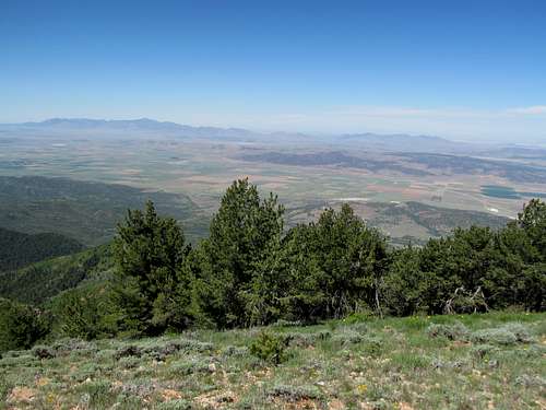
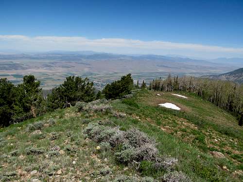
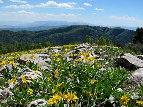
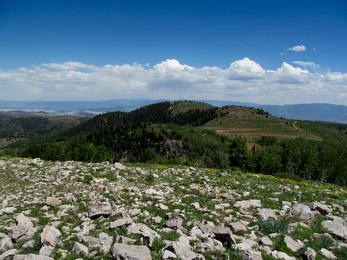
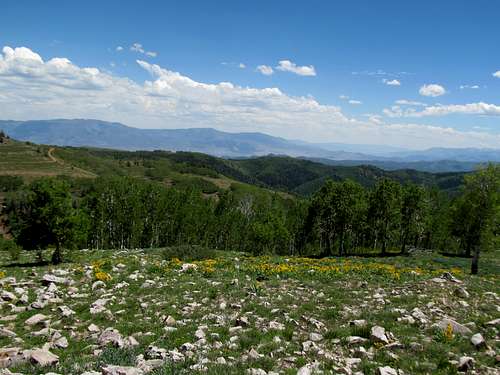
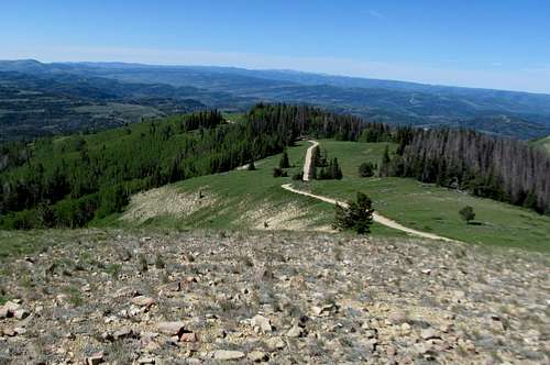
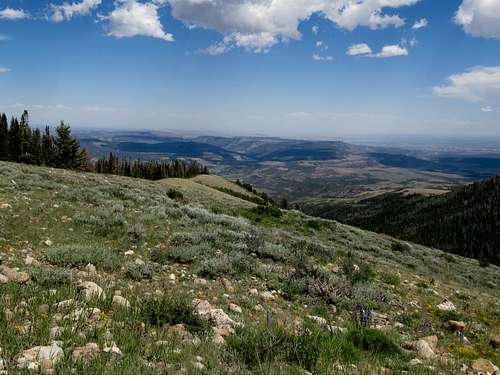
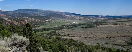
Once more I planned my Saturday around the Bruins, now in their final leg of their playoff run playing for the Stanley Cup. I originally planned for Loafer Mountain but one look at the still snowy summit environs from down in the Utah Valley and I felt my inner exhaustion (and likely laziness) kicking in and wondered about an easier alternative. I pulled over at the new Starbucks on US-6 off I-15 and read up on the access for Salt Benchmark and Mine Camp Peak, two range highpoints and P2K’s that had grabbed my attention countless times while driving through the main corridor running through the heart of Utah. It would involve a lot of dirt road driving and not a lot of hiking, but I decided that despite the driving these two summits would make for a more relaxing day.
So I continued south to Nephi and took the road towards Fountain Green and into the San Pitch Mountains. The road up Log Canyon was rocky but not too difficult, while the dirt road running north along the ridgeline towards Salt Benchmark was narrow, occasionally rutted, but not as bad as advertised. The road winds all the way to the base of the highpoint and only maybe four or five hundred feet below it, but I parked somewhat short of there due to the sighting of a few snow drifts ahead. In hindsight I probably could have easily driven through them but hey, what was wrong with burning a few bonus calories on an easy peak.
I ascended up a ATV track and cruised over two minor summits south of Salt Benchmark before descending and ascending to the top of the peak. The views were mellow and relaxing, and I straight shotted it back to the road and walked it the rest of the way back, making for a nice loop.
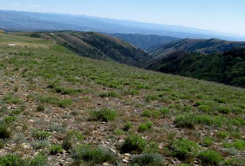
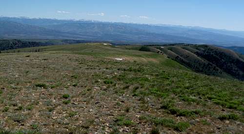
Mine Camp Peak
I returned to the highway and sped down towards Fillmore to hit the access road for Mine Camp. The road, smooth at first, was rougher, steeper, and rockier, and the snowdrifts near the top of the road deeper and more hazardous. I braved it by one but stopped at another that blocked the entire road, and walked the rest of the way on foot. The area was pretty popular with ATV’ers as well as a few locals from down in Fillmore; they were curious about gaining the peak, and I pointed them in the right direction before skipping ahead of them, following the game trail coming down the right side of the road.
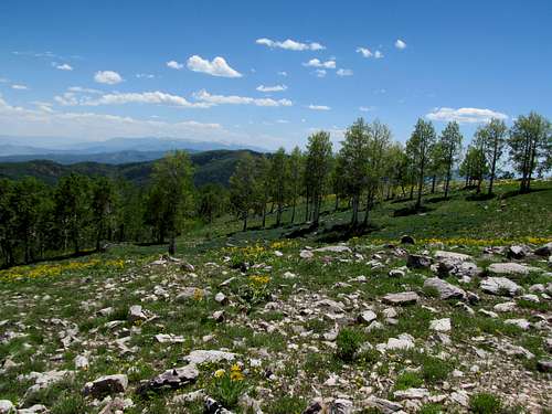
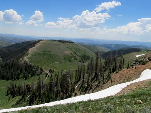
Mid June proved to be a delightful time to stand atop the broad, rock-strewn summit, the wildflowers being in full bloom and the still snow grazed Tushars to the south standing in stark contrast with the desert below.
On the way down I ended up chatting with some ATV’s from SLC for longer than I had planned, shooting the shit and politely declining a beer; I would save that for the later Stanley Cup matchup, which my chattiness made me slightly tardy for as I sped back to Salt Lake as fast as I could. The game was a good one, the Bruins won, but unfortunately I would have only one more win to enjoy for the season in a matchup that ultimately didn’t go the B’s way.
Spanish Fork Vistas - June 16th, 2013
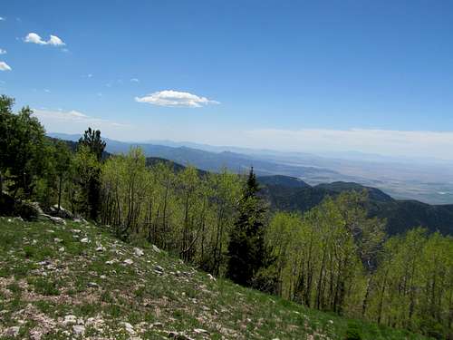
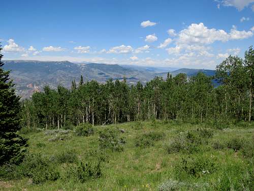
I didn’t get too drunk with the win though seeing as I wanted to get Spanish Fork Peak via Maple Canyon the following day. June seemed like rinse, repeat in Utah…Bruins game, late start, blistering heat, but despite my fears the ascent up Maple Canyon wasn’t too bad despite the heat. The trail waded through the shade the first three to five miles up the drainage, through surprisingly dense tree cover that reminded me more of the hiking back east, in which the initial miles of an ascent unerringly featured a single featureless track through miles and miles of thick tree cover.
Eventually the views opened up as the trail climbed steeply to Maple Lake, with high snow filled drainages of the summit ridges hovering above. Instead of heading straight towards the summit the trail putzed away and around, leading to the western side of the peak where it traversed first through a cool spruce forest and then across the steep western slopes of the peak leading straight down into the Utah Valley.
The section passinig Crowd Ridge was especially remarkeable, peering down on the ridge as it descends over 4000 feet straight down into the valley in less than three or so miles.
Finally the trail curled back east and towards the triangulation tower atop the summit.
There were a few other hikers that had just arrived, including surprisingly a fellow Masshole. We chatted about home and his one in awhile trips to Utah, where he would visit clients several times a year and get Wasatch peaks such as Spanish Fork during his brief visits.
Blurred Vision on Timp & South - June 22nd, 2013
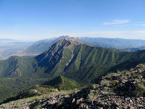
I was a little better rested after a weekend spent mostly near Salt Lake, and while I batted around ideas for destinations further north or south, I stuck around the following weekend for one and one reason only: Timp. Timpanogos is perhaps the signature hike of Utah, especially the Salt Lake area, where the long trek up for the locals seemed to be a rite of passage. Hearing all the hype surrounding the peak, I was pleasantly surprised that the great peak lived up to every word breathlessly aired about it, but unfortunately the lens on my camera, which I had bought new only weeks before, was conked out, and I was dismayed after returning to find all the pictures I had painstakingly taken all painfully blurry, especially on the left side. A damn shame for sure, but hopefully I’ll be back at some point for Bomber and North Timp armed with a functioning camera.
Despite the fact that it was a little longer I decided on the Timpooneke superhighway over the Aspen Grove route, figuring that I could cruise faster in order to make it back for the Bruins. Far from being an early bird, I still made it to the recently expanded TH parking lot early enough not to have to worry about wrangling up a spot. I cruised up the trail in the cool early morning, making good progress in the early morning shade.
Many words, thoughts, and camera frames have been expended upon Timp and its Timpooneke approach. All I can really add to the record is how the wonderment of the route increases exponentially as you plod further and higher. After traipsing through the trees the first few miles the landscape opened up into the middle basin, with the higher snow lined ridges peeking out and waterfalls hiding in plain sight.
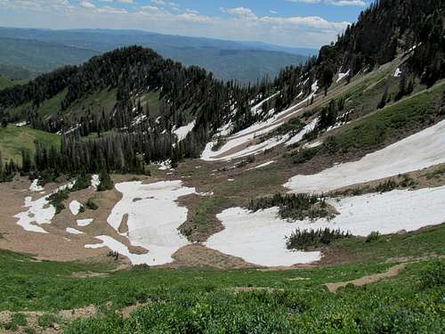
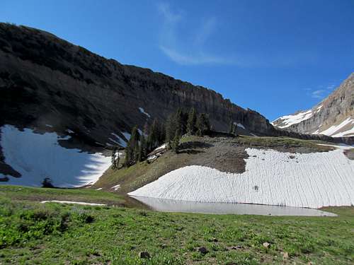
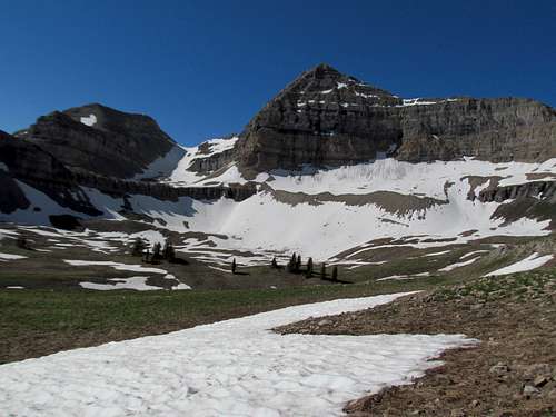
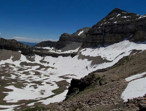
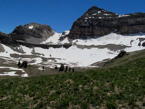
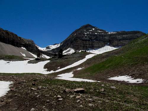
It was still probably early in the season for pure hiking conditions along the trail, but early enough, as there was only a couple areas snowed over, including a small but easy traverse just a little bit below entering into the upper basin. And that entry left me floored, with the vast grandness of the Timpanogos massifs standing plainly before you, terraces, sheer cliffs, glaciers, and a scene that defies comparison, as grand as any in the Wasatch and even competitive with tableaus further up in the Northern Rockies.
A couple more areas where trailfinding was slightly hindered by snow stood between me and the summit. After skipping a switchback by walking straight up a mellow, sun-cupped snowfield, I hit the last stretch of the trail bearing straight for the saddle and, once there, the scene transformed once more.
If the word grandeur accurately conveys the eastern aspect of Timp in the Upper Saddle, the word sheer could only be appropriate for its opposite, western slope. The trail the rest of the way travelled through impossibly steep slopes lined endlessly with colorful and endless fields of talus stretching seemingly all the way down in the Utah Valley. I found myself in the shade and handling rocks cold to the touch along a small section where the trail involved a little bit of minor scrambling through a chimney like area.
The summit was far from anticlimactic, but considering the sublime qualities of an ascent and views already witnessed through most of the route, the top with its small hit was not exactly transcendent on its own merits either.
I had little time to linger.
Up next was the traverse to South Timp and back. With puck drop for the Bruins game still lingering keenly in my mind I navigated my way towards the south saddle despite some route finding errors; after descending a bit you’re tempted to follow along the cool rocks along the ridge crest.
I soon cliffed out and had to backtrack to find a previous trail junction, and continued down the trail proper, passing below the spot where I had stood prior. Another party following me ended up doing the plain downclimb where I had turned around, which they described as exceeding class 5.
They were here of course to do the famous glissade down Timp Glacier, yet another rite of passage in these here strange parts. It was cool walking by the glacier, seeing the head of it rising up plainly from the saddle.
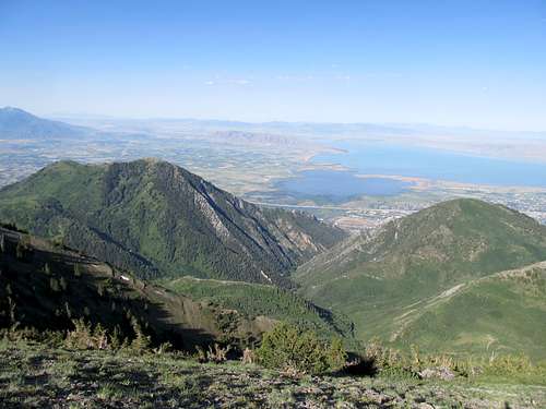
The ascent up South Timp was short but painful, marked by scree first then some pretty goddamn loose talus further up. Eventually the ridge gentled and I partook in the fire flames views back to the sheer cliffs of Timp, which seemed close to eye level (which would be expected considering their relative elevations).
The traverse down and back was tedious but now on familiar ground.
I greeted a party ascending South Timp as well (what the hell is wrong with them???), and a couple hippies I had passed and chatted with earlier now headed towards the glacier. I enjoyed the views atop Timp for a second time before starting down, half jogging portions and around the pilgrimage of hikers still making their way up. I was wearing my buddy’s bouncer shirt from back home in Boston, with Bud Light clearly strewn on the side, so I figure that dissuaded most people from making conversation and instead to quickly yield the trail to moi so moi could make my way back as quickly as possible for the Bruins…tis Utah after all. And yet, the beauty of that Upper Basin still overwhelmed me, and I took more pictures of it even as I hesitantly left it behind.
The lower slopes reminded me, strangely enough, of the topography of the Bear River Range further north. I wonder if they are of the same geology, the latter range possibly what eventually becomes of Timp as the elements continue to erode down the massive cliffs and rock faces. Unfortunately, my Bruins eroded in front of my eyes as I watched the game in a bar back in Salt Lake later that evening. It would be one of the last wins I would get to watch for the seasons, but they had done our city proud and given me a slew of good memories to accompany and correspond with the ones made almost simultaneously in the mountains.
Strawberry & A Point for the Bruins - June 23rd, 2013
Adding to the hockey dismay was, when going through the day’s pictures, finding them blurry due to a faulty lens. Fortunately the camera was still fairly new and came with a warranty, but unfortunately I would still need to use it for Sunday’s destinations before I could ship it back to the manufacturer later on in the week. With an increasingly desperate Stanley Cup series winding down later in the week for better or for worse, I was determined to hit up Bruin Point, a nearby drive up P2K, to irrationally try and bring my team some mojo from a few thousand miles away. Along the way it would make sense to hit up Strawberry Peak, another P2K over ten thousand feet.
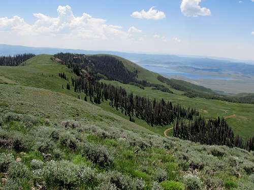
While neither summit offered any interesting mountaineering, the area both encompassed had long fascinated me. The two summits stand atop vast tracts of highlands standing between and around US-40 and US-6; after ascending the lower Mt. Elliott the prior month I was fascinated by how these long Roan/Book Cliffs, stretching impressively north of I-70 all the way into Colorado and encompassing within their massive labyrinths some of the wildest places in the country (particularly Desolation Canyon and the Green River), eventually rose to gentle and mellow high pastures and woodlands and cresting out at Bruin Point and Strawberry.
Strawberry Peak
One of the few radio stations you can pick up in this area of Utah is the local ESPN affiliate, and I bore the burden of listening to the pundits alternate between covering the developing Aaron Hernandez story (still in its pre-arrest stages) and sickening and non-stop talk of Dwight Howard’s free agent prospects. The road to Strawberry was pretty rough, particularly the Reservation Ridge section south of the peak before the turnoff to Timber Canyon. Many sections were severely rutted, others had sudden bumps and potholes, and overall the road was a rotten experience until you ascended the slopes leading towards the top of Strawberry.
I parked right below the summit and enjoyed the views, a surprisingly panoramic and central one of the Wasatch Range with bonus views of the Uintas to boot.
Bruin Point & Cat & Indian Head
I backtracked through the rough and dirty roads and, instead of taking the same road back to US-6, continued down south, swinging up to Cat Peak, a small ranked summit south of Strawberry at the edge of the ridge leading down to US-6. The road then swung west and I followed it with one more stop for a quick cross country romp up Indian Head, apparently a P1K. I was happy to find a register with some of the usual signatures (Dean, Greg, etc), and started down back to the car. Not expecting any heavy hiking for the day, I made the trip wearing sneakers. The short descent through sagebrush didn’t seem daunting and I hopped up between and around the small stunted bushes all the way until my left ankle hit a hole at a wrong angle and I suffered a mild to medium twist. I hobbled the rest of the way down, grabbed some shitty fast food in Price, and drove through the afternoon heat up the short but steep and rocky road leading to the top of Bruin Point.
The views were pretty impressive but despite its higher elevation it provides an inferior experience (as expected) to the views of Mt. Elliott lower and further to the south.
My ankle had swelled and I could only hobble at a slow pace as I explored the summit and nearby areas of Bruin Point, including a short walk along the rim past the buildings south of the main highpoint. I continued down the improving gravel roads hoping to explore the West Tavaputs Plateau, a gateway to the vast wilderness of Desolation Canyon and the Green River that I had explored extensively via Google Earth. Unfortunately the road ended at gates indicating private ranches, and I had to retreat prematurely back to Salt Lake, listening to ESPN break the news of Doc River’s new gig with the Clippers on the way back.
Provo & East Peak Torment - June 29th, 2013
My trusty and loyal Asolo boots were in their last legs. The leather lining on the bottom had been wearing out for a long time now, and I noticed its diminished traction on rock surfaces during the Black Crook trip a few weeks earlier (though some of it could just as well be attributed to the inherent shittiness of the peak). It seemed appropriate that Timp would serve as the proper finale for a pair of boots that had accompanied me up almost two hundred or more summits since I first bought them in the spring of 2010, and I ordered a pair of cheaper boots during the week. My left ankle felt better by mid-week, and Saturday it was probably 80%, so despite the new boots I figured the security of an ankle brace would be good enough for an ascent of Provo and East Provo peaks.
I had wanted to venture further south, possibly check out Bluebell Knoll, Thousand Lakes Mountain, and the Fishlake Plateau areas for the weekend, but my parents told me to stick around. They had an extra iPhone on the family plan and decided to mail it to me, and they wanted me to sign for the package to make sure it arrived in one piece that Saturday. Fine, I said reluctantly, unhappy to have to stick around Salt Lake and reluctant to ditch the comforts of the Flip Phone Life. (I know, tough life I live, huh?) Thus Provo, which I figured would make for a quick ascent before I returned in the early afternoon for the package. I had given my old camera to a coworker, so I asked for a temporary take-backsy for the weekend while my new camera was still being worked on.
I braved the drive through Utah County and down the long, slow and bumpy Squaw Peak Road, which contrasted with the beauty of the early morning sun bearing down on the twin Provo summits to the south. I put my boots on at the trailhead and gauged my feet. My ankles always seem easily twisted, and as a result I’ve always preferred larger boots with high ankle support, which my last pair of Asolos provided me; I had wrenched and twisted my ankles on descents countless times in those without any pain or problems due to the nice buffering from the tight ankle support. After so many peaks they had been for a long time perfect fits, and I noted how loose these new boots felt around my ankles.
It was easy enough to find the cairned junction and the side trail leading up to Provo Peak. I stood in the shade for most of the ascent but despite that the heat of the day, one of the hottest in the summer I think, was still noticeable. The trail passed through some surprisingly narrow brush/tree cover before opening up for the last thousand or so feet of ascent through basic talus.
The trail was great all the way to the summit, which present pretty good views especially of Cascade Mountain to the north.
The rest of the trip sucked balls in the worst way. Even after so many peaks and loose terrain navigated and sketchy areas traversed and climbed I would still rank the east face of Provo Peak among the worst footing I’ve ever had the displeasure of stepping on, just the worst combination of steepness, looseness, and rock (scree) quality.
The downclimb took forever, the traverse through the saddle areas surprisingly sketchy as you pass through some edgy areas and around other ledges, and I was exhausted by the time I huffed and puffed my way through the relatively better terrain up East Provo. All while racing the clock of the iPhone headed my way back at my mailbox.
The traverse back was indescribably worse, particularly that last ascent the last two hundred feet or so below Provo Peak’s summit, as I crawled my way at times up the impossible scree.
I fast walked rather than jogged the rest of the way down the trail, and thought I was homefree as I trampled down the 4WD track the last half mile or so back down to my car. I saw a bunch of ATV’ers doing circles around the parking area and remember being irritated by the sight when I twisted my right ankle, the good one, pretty badly along the steep downsloping road. I screamed and shouted in pain and dismay; the left ankle had held up pretty well with the help of the brace, but now my right ankle was sprained and in worse shape. I started to hobble my way down, the right ankle already weak when I twisted it again on the loose road. This second time felt infinitely worse, I felt something give in there, and I lay on the road screaming in pain and swearing at the top of my lungs. The ATV’ers, likely hearing my copious expulsion of f-bombs, drove away, and I barely managed to hobble my way down to the trailhead.
Slow Day on Racetrack & Tabby - June 30th, 2013
I partied and raved in Park City with a coworker and his friends that night, waking up late on Sunday with surprisingly no hangover but with the right ankle still mush. I had briefly entertained thoughts of a day trip down to the Fishlake area for Sunday, but the late start and a lingering fatigue from the night before made me venture upon less ambitious goals. While hobbling along a road or sidewalk was fine, I was dismayed to find my right ankle wobbling and unable to support myself even walking atop mulch covered areas walking back to my car, and I decided that today was not the day for any serious hiking. I decided to try and get nearby Racetrack Benchmark and Tabby Mountain in the southern Uinta foothill/highlands, both P1K’s over 10,000’ and the latter a summit in the Utah Top 100 prominence list.
Racetrack Benchmark
Racetrack was an ordeal, starting with the surprisingly rough and rocky road leading towards the summit. On any other day the ascent would be a joke, but I parked a little short of the described starting point by mistake and ended up adding a mile or so to my ascent. It made a difference as I did a little loop around the peak. The two or three miles and few hundred feet of gain took me almost two hours to complete on two bad ankles (one severely worse than the other). I had already decided to consign the cheap boots I bought to an amazon return, opting to shell out the extra cash for a new pair of Asolos (and still, good ankle support seems harder and harder to come by in hiking shoes these days, and even the new pair did not offer as much support as my old pair). For now, I used my old Asolos, bringing them out for one last romp and wearing a brace on each ankle. Still, I felt weak and uneasy every time I stepped on any type of rock or uneven surface on that right ankle. Fortunately, my glacially slow pace up and down the peak allowed me to avoid doing too much sweating on yet another one of the summer’s hottest days.
Tabby Mountain
I continued the drive westwards then hooked back northeast through Hanna and Tabiona for the long and rocky drive up Tabby Mountain. I think the peak could be done in a passenger car such as my old Camry, but it would have been a long and trying ordeal up steep and rocky sections and rutted areas on the plateau/top…comparable to me trying to hike on a badly sprained and swollen ankle, pretty much. You had to walk around the true summit area to find views, not an easy feat for me, and most of the best views are gained while driving up and down the slopes of the peak.
I returned to Salt Lake praying for a quick recovery. Plans to Idaho loomed next week, and I didn’t want to lose time or weekends now that the season for the Northern Rockies was approaching full bloom.
Comments
No comments posted yet.