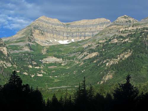
Almost twelve years after my first Wasatch hike, a sunrise hike of Mount Timpanogos, I’d finally finish the ranked Wasatch 11ers with a summit of South Timpanogos. The Timpanogos Massif is chock full of great trails and interesting terrain, with the higher ridgelines and peaks being very similar in appearance to the mountains in Glacier National Park, and during each visit to this mountain I’d been able to take a different route. Somehow, despite all of the previous Timp adventures, I had never gotten around to hiking up the Aspen Grove Trail, so it worked out that I was able to save arguably the most scenic route on one of the best mountains in the Rockies for last.
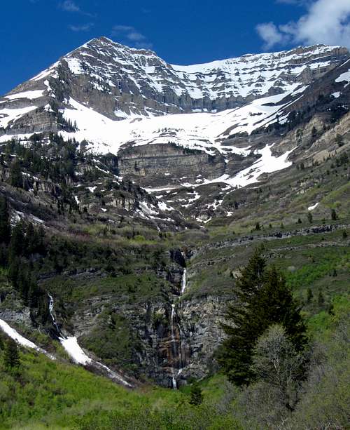
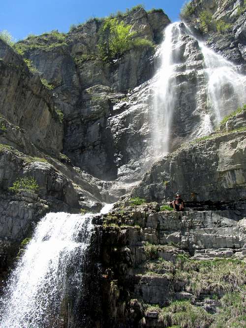
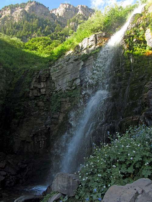
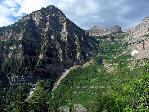
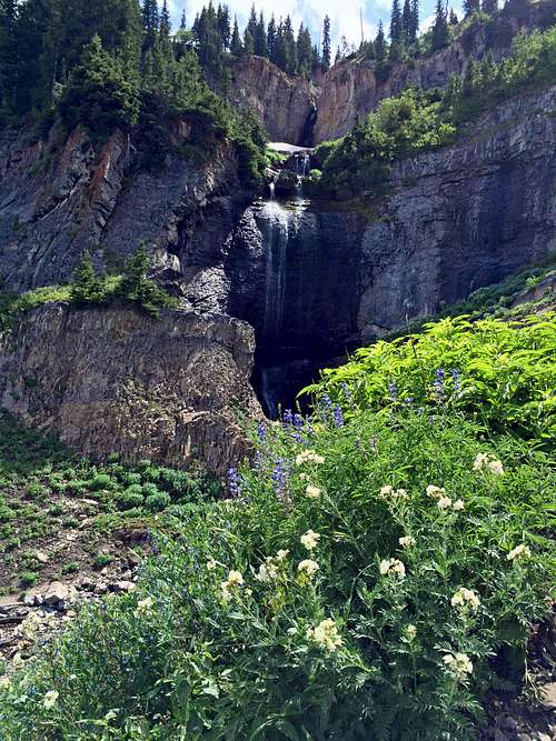
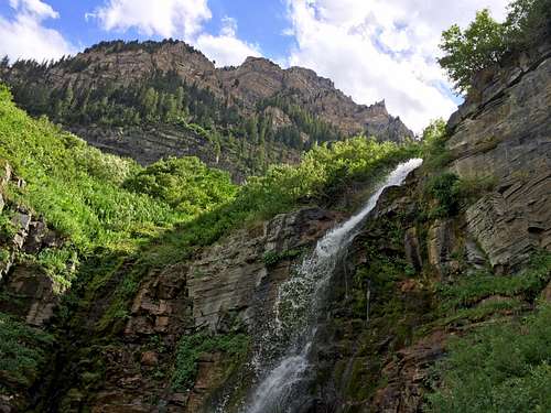
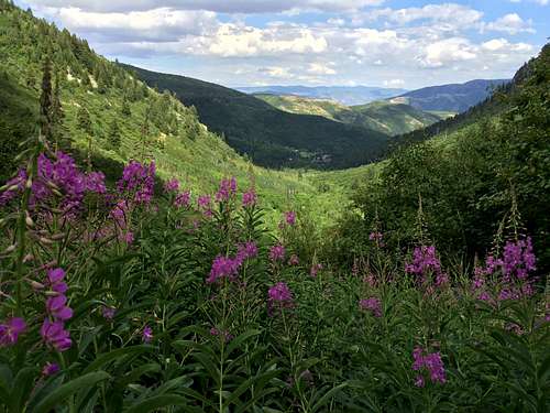
![South Timp over Stewart Falls]() South Timpanogos rising up ...
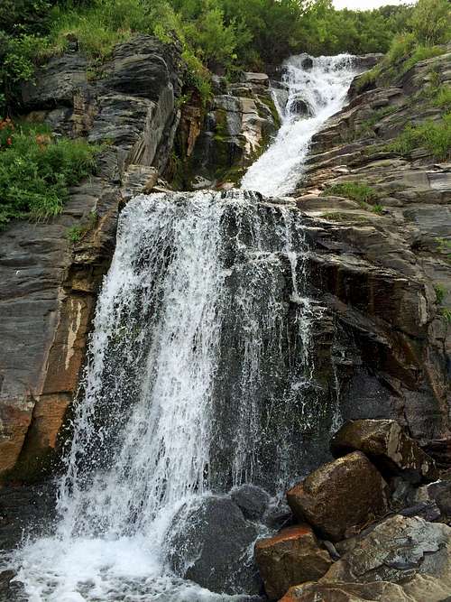
South Timpanogos rising up ...![Stewart Falls]() ... above Stewart Falls
... above Stewart Falls
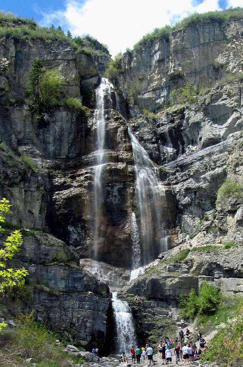
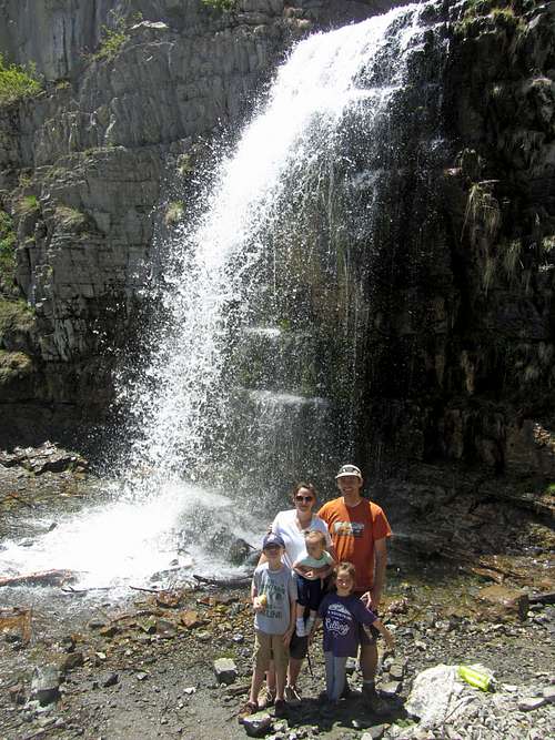
At first I had wanted to try the Razorback Ridge / Razorback Terrace Route, but after seeing the angle of the slope along the terrace and all of the loose-looking scree leading down towards a series of cliffs, I decided on an easier route. Hitting the south summit either via the main summit trail or the glacier / snowfield would be easier, and if we had the energy afterwards, I was also considering traversing from there to the lesser-known peaks on the Coxcomb Ridge to the south, and then somehow getting from there back to the Aspen Grove trailhead. To scope out the lesser known trails in that area, I decided to do a family hike of the trail to Stewart Falls leading through Sundance (we'd hiked the trail leading from Aspen Grove to the falls, but neither of the other two trails leading to the falls):
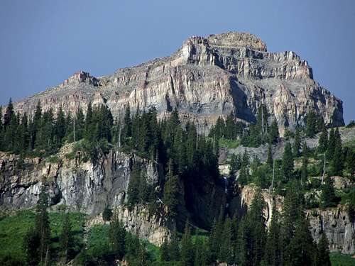
![Coxcomb Ridge Southeast Peak]() Coxcomb Ridge Southeast Peak
Coxcomb Ridge Southeast Peak![Coxcomb Ridge Southwest Peak]() Coxcomb Ridge Southwest Peak
Coxcomb Ridge Southwest Peak
According to a trail map found on the Sundance Resort web site, after the scramble along Coxcomb Ridge and then back down Sundance Ridge to Arrowhead Peak, there is a hiking trail leading from there back down to Stewart Falls, where one could then hike back to the Aspen Grove parking lot via another trail (one I was familiar with after several family hikes). We would wait until the day of the hike to see how we were feeling before committing to the longer ridge traverse, though.
A Little Place Called Aspen Grove
Due to the popularity of the Aspen Grove Trail, or any trail on Mount Timpanogos for that matter (it’s a magical place where BYU & UVU college students, weekend warrior hikers, and hardcore trail runners all instinctively flock like the salmon of Capistrano), we decided to avoid the crowds by hiking on a Monday. Since the day’s forecast was showing valley temperatures in the upper 90’s and a busy work schedule the month leading up to the hike had made it hard to get in as many lunchtime jogs as I would have liked, we were leaning towards hitting the main summit and then the south summit before descending back down the Aspen Grove Trail.
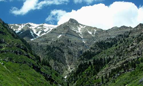
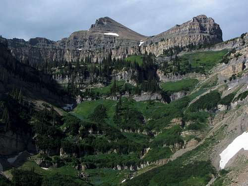
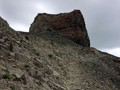
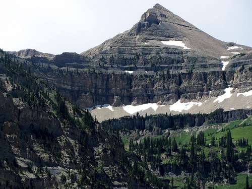
![South Timpanogos]() South Timpanogos
South Timpanogos
Just before reaching the Aspen Grove parking lot around 8 am, we passed the Alpine Loop tollbooth station, where I was hoping to flash my Annual National Parks Pass to take care of the $6 entrance fee for the Cache-Uinta National Forest (since, as I understand as printed on the back of the card, should cover entrance and amenities fees for any federal lands, including national forests), but since the booth was closed I wasn’t able to do this, and without cash on hand and no way to pay via credit card if my assumption was wrong, I figured it didn’t make any sense to fill out a self-issue permit and put it in the trailhead drop box. This would come back to bite me later, but upon starting our hike up the trail, we soon encountered a sign which perhaps gave a better explanation as to why the parking lot was so empty, even for a Monday, and which presented a more serious obstacle to our hiking plans for the day.
![Aspen Grove Trailhead]() Aspen Grove Trailhead
Aspen Grove Trailhead
Just a few hundred feet up the trail, we encountered a couple sheets of paper attached to a wooden trail marker, stating that a section of the Aspen Grove trail higher up on the mountain was closed for maintenance starting that very day and continuing intermittently throughout the summer. This made me a bit angry, since I had just checked the forest service website a couple days earlier and there was no evidence of any closure notices there (and there’s been no trace of this trail closure on their site to the day of me posting this trip report, for that matter). We decided that since we’d driven all the way down here that we were going to do this hike regardless, and would either come up with a good sob story for whoever tried to stop us or just blaze our own path up and around the maintained trail if we had to. Besides, the fact that there were no such closure signs at the booth or trailhead signpost made us hopeful that if there was a closure that it would occur after we’d made it past where the trail maintenance was occurring (since it was likely they’d be more tolerant of us passing through on our way down instead of going up).
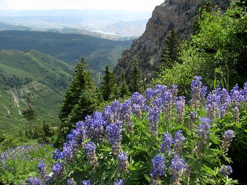
![Roberts Horn from Aspen Grove]() Roberts Horn from Aspen Grove
Roberts Horn from Aspen Grove![Elk Point over wildflowers]() Elk Point over wildflowers
Elk Point over wildflowers
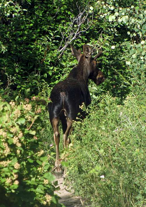
![Moose on the loose]() Moose on the loose
Moose on the loose
We continued up the trail admiring the awesome scenery, slightly nervous that we would eventually encounter an overzealous forest ranger or trail worker, but early on the only thing we ran into was a moose. At first we followed her up the trail (keeping our distance), which at the beginning was paved, until in a seeming fit of annoyance she finally got off of the trail and then started shadowing us on a game trail running parallel with the hiking trail. Fortunately, she finally decided to leave us alone.
![Aspen Grove waterfall]() Aspen Grove waterfall
Aspen Grove waterfall![Elk Point from lower Aspen Grove Trail]() Elk Point from lower Aspen Grove Trail
Elk Point from lower Aspen Grove Trail
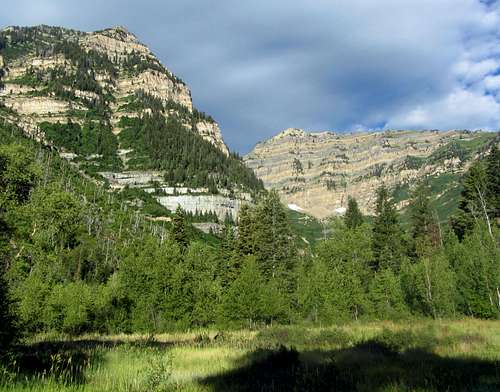
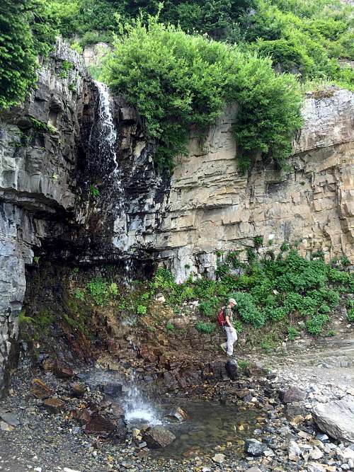
This gave me the chance to finally relax and enjoy our surroundings, which were top-notch. I was quickly able to deduce that while the Timpooneke Trail didn’t work our legs quite as much going up (which perhaps is why many consider it a better way to hike the mountain, if sore joints are a factor), the steeper grade on the Aspen Grove Trail was more than compensated for by the lush green surroundings and the many waterfalls. I couldn’t believe that it had taken me this long to hike up the Aspen Grove Trail, but in a way it was cool to think that I had inadvertently saved probably the most scenic trail in all of the Wasatch for last in my little peak-bagging endeavor. The first waterfall we encountered was nice enough that it is definitely somewhere I’ll consider bringing the family in the future if we’re ever in the mood for a short little hike in the area and want to do something besides Stewart Falls.
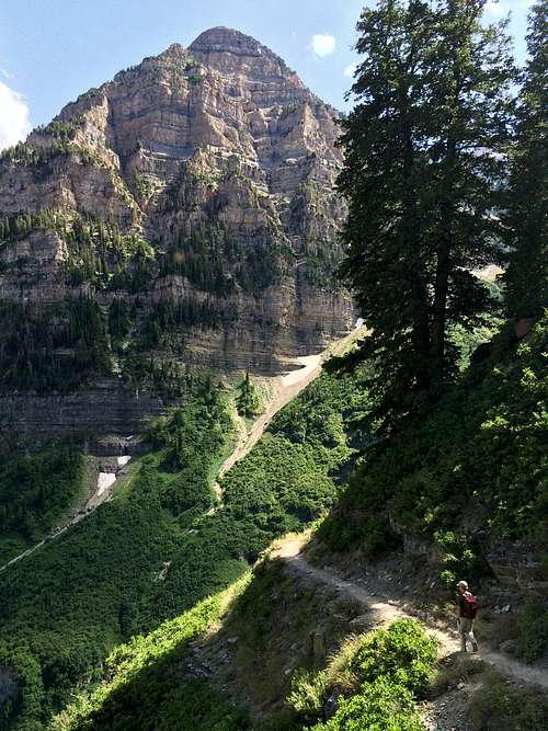
![Getting Higher]() As the trail gained elevation ...
As the trail gained elevation ...![Primrose Cirque]() ... we gained better views of Primrose Cirque
... we gained better views of Primrose Cirque
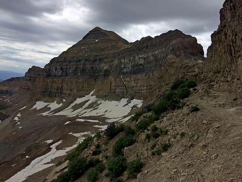
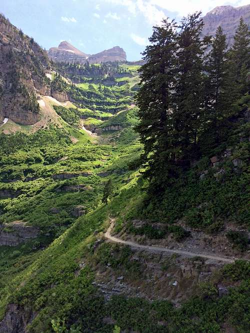
![The Shoulder]() The Shoulder ...
The Shoulder ...![South Timp over Primrose Cirque]() ... and South Timpanogos reveal themselves
... and South Timpanogos reveal themselves
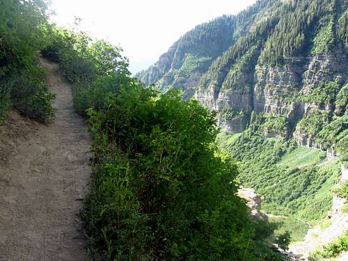
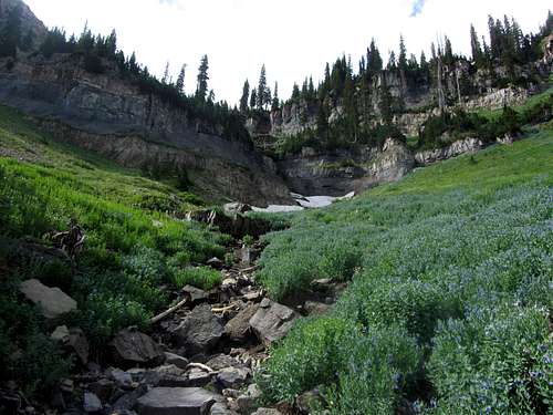
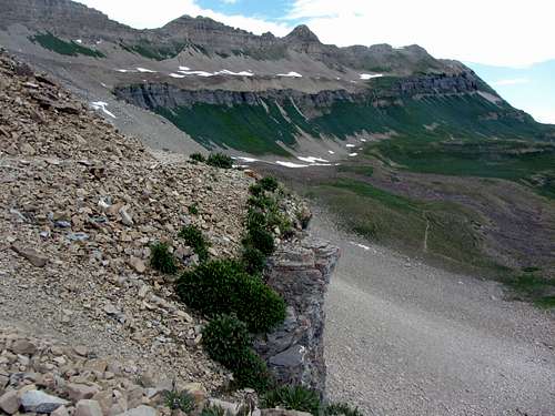
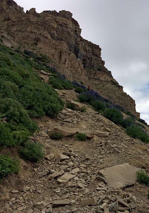
We encountered another scenic waterfall before the trail turned east, and then cut back to the west for one very large switchback. At this point we could make out the summit of South Timpanogos up above us, which was my primary goal for the day. We could see a few other fellow hikers on the trail above us in the distance, and I was more hopeful as time went on that this meant that the trail maintenance crew would not make an appearance today (not to say I don’t usually appreciate the great work that they do). We passed one section where apparently a large boulder slide had covered the trail, which may have been one of the aforementioned spots where maintenance work had been planned.
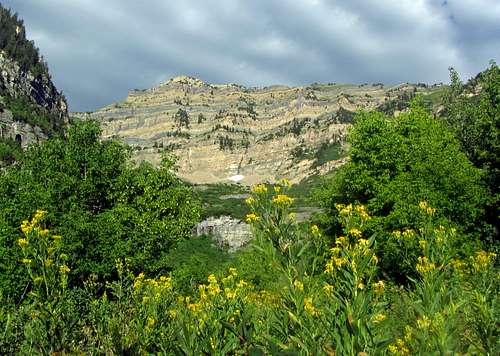
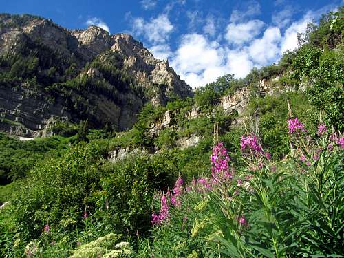
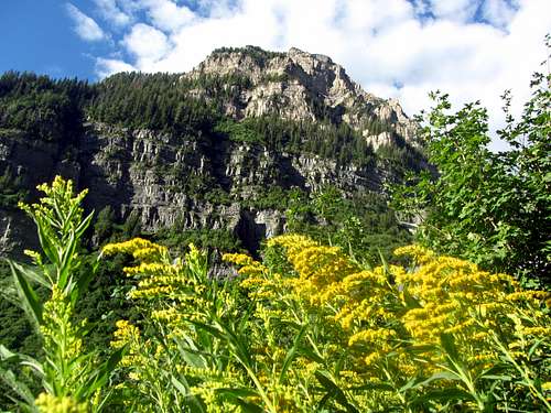
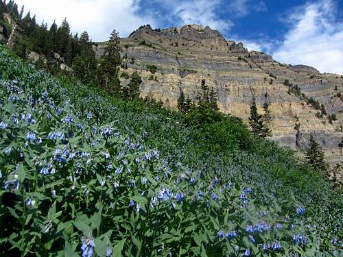
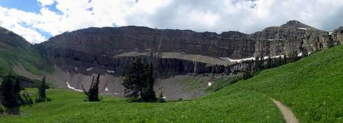
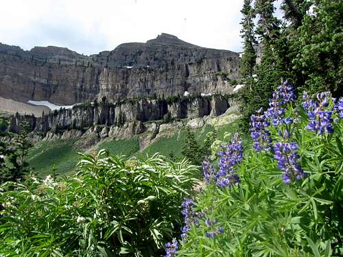
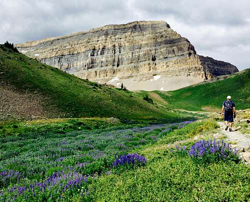
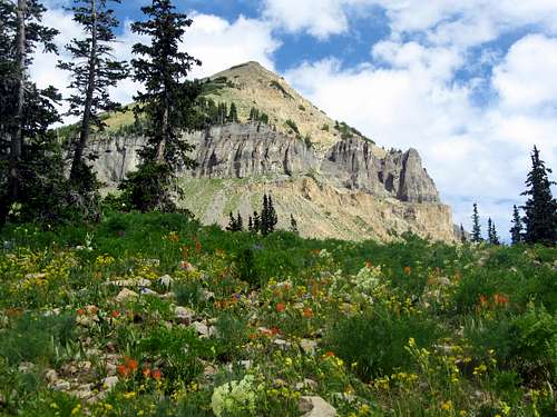
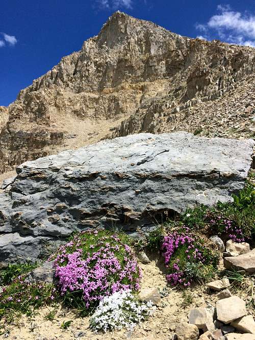
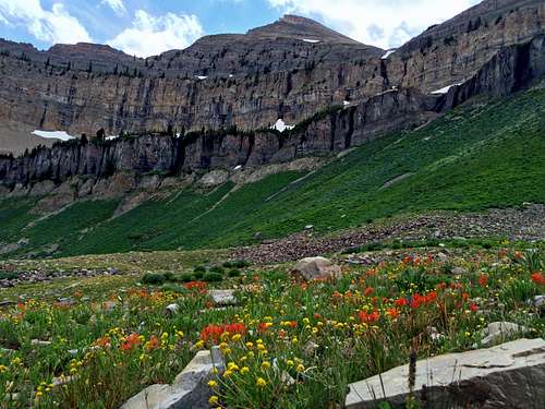
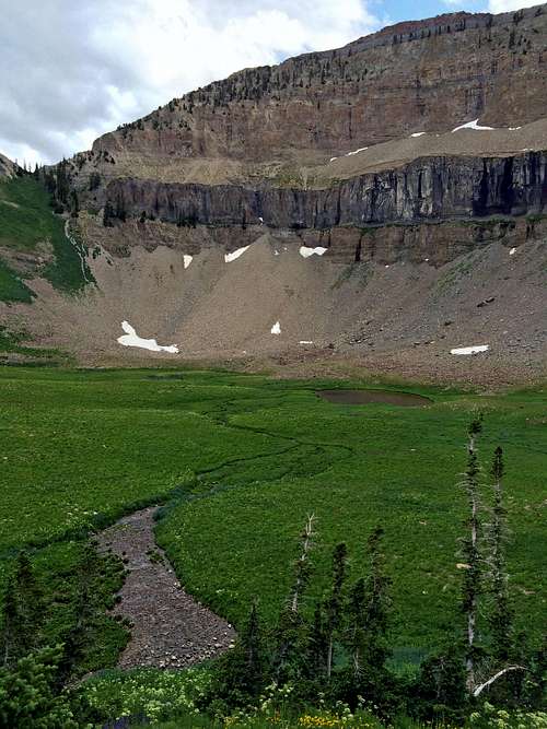
This section of the trail passed several green meadows with various colors of wildflowers. Up above us to the south, the entire Razorback Ridge was visible, and despite it still being early in the summer, that route looked snow-free except for a couple small patches of snow. Still, I was glad we were not risking life and limb on that route, as the scenery on the main trail was good enough for me. We continued through more fields of wildflowers until the main summit of Mount Timpanogos finally revealed itself.
![Timp from Hidden Lakes meadow]() From the meadow we had nice views of Mount Timpanogos ...
From the meadow we had nice views of Mount Timpanogos ...![Roberts Horn from Hidden Lakes meadow]() ... and Roberts Horn
... and Roberts Horn
![Runoff below the Shoulder]() Runoff below the Shoulder
Runoff below the Shoulder
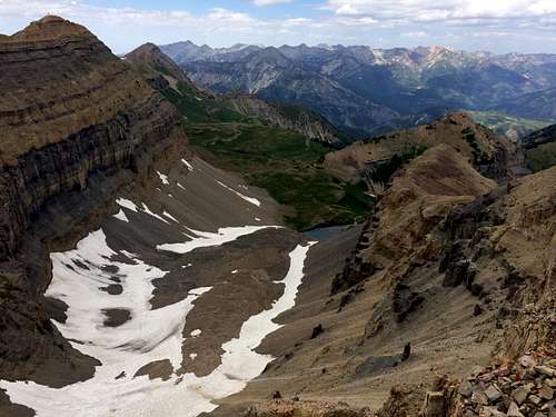
Upon arriving at Emerald Lake, the highest lake in the Wasatch Range and only one significantly higher than 10,000 feet, I was surprised to see that there was actually less snow than when I’d hiked up here before, even though that hike was done a couple weeks later in the summer. Despite a decent snowpack, I’m guessing that the recent hot temperatures had something to do with the snowfield/glacier melting out sooner than usual. If we’d been set on continuing along the Coxcomb Ridge after South Timpanogos, then I would have opted to go up the snowfield to shorten our overall route, since with the area just below the saddle all melted out to reveal the scree underneath it would’ve actually been easier to ascend snow-free, especially since we didn’t have ice axes with us. But, since I was feeling more on the lazy side this day (even though from this point on we were lucky enough to have cloud cover there to protect us from the draining heat of the sun), we decided to just stay on the main trail and then go from the main summit to the south summit instead, going back down the snowfield/glacier in a semi-loop.
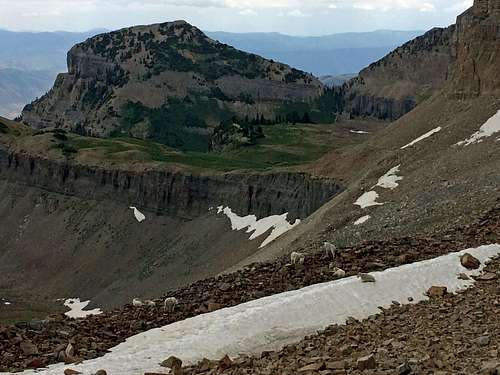
![Timpanogos northern ridge]() Timpanogos northern ridge (including Bomber Peak)
Timpanogos northern ridge (including Bomber Peak)![Goat party]() Goat party
Goat party
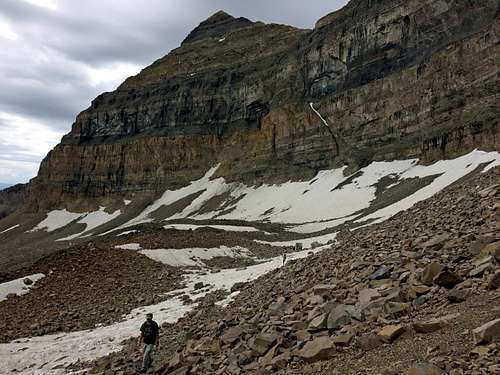
![Boulder field trail]() Boulder field trail
Boulder field trail![Steep path to saddle]() Steep path to saddle
Steep path to saddle
The trail was a bit harder to follow as it continued underneath the cliffs below the main summit, but there were always cairns to lead the way along the more faint sections of trail. Off among the boulders to the side of us we saw several mountain goats, including several infants, but unfortunately my camera died at that point and my phone’s digital zoom wasn’t as effective as the optical zoom would’ve been in getting the best pictures. After taking a short snack break to watch the goats, we continued up the steep and slightly loose section of trail connecting with the Timpooneke Trail just below the saddle overlooking Utah Valley.
![Mount Timpanogos]() Mount Timpanogos summit
Mount Timpanogos summit![Tower before Timp summit]() Tower below Timp summit
Tower below Timp summit![Almost to Timp summit]() Almost to Timp summit
Almost to Timp summit
It seemed that there were many more people on the Timpooneke Trail this day (maybe they somehow knew of the potential Aspen Grove Trail closures?), so when a large group of twenty or so college students brandishing a giant UVU flag came up behind us, we decided to pick up the pace to leave them behind us. I guess as I’ve gotten older I’ve come to appreciate quiet mountain solitude a bit more, despite no intentional efforts on my part to have a “keep off my lawn” attitude. I just need to remember that others have just as much of a right to visit these places as I do, and making the effort to come on weekdays like this would at least minimize the chances of running into big groups and contributing to the over-crowding problem myself.
![East summit view]() Mount Timpanogos summit view to the east ...
Mount Timpanogos summit view to the east ...![South ridge]() ... and to the south
... and to the south
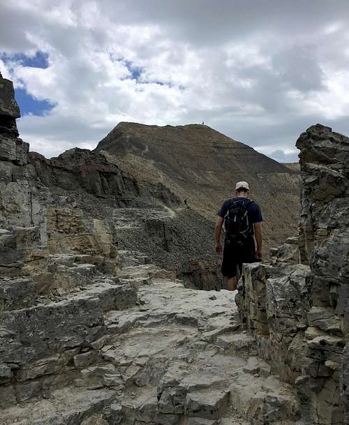
The closer we got to the main summit, the more I began to feel the effects of the elevation, but we were able to push on and pass a few more people before getting to the top. From our own little picnic spot away from the crowd inside the summit shack we were able to survey the remainder of our route from here to the south summit, and I was excited to show David the seldom-traveled trail leading from here to the saddle.
My Ranked Wasatch 11er Finisher
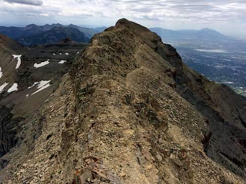
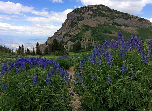
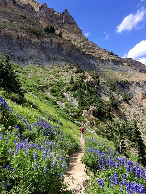
![South Ridge trail]() Ridge leading from the main summit of Mount Timpanogos ...
Ridge leading from the main summit of Mount Timpanogos ...![Hike to South Timp]() ... to South Timpanogos
... to South Timpanogos
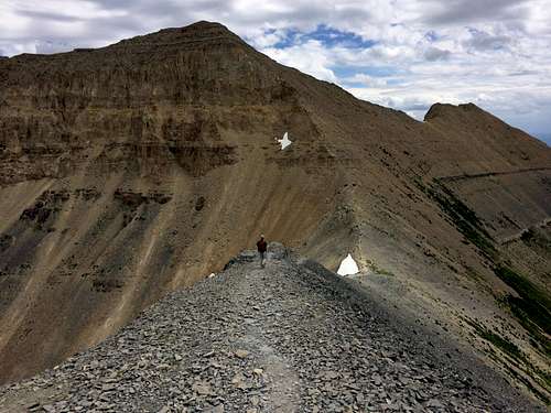
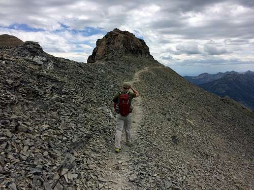
![Timp south ridge]() Along the ridge ...
Along the ridge ...![Trail along south ridge]() ... we followed a less-used trail
... we followed a less-used trail
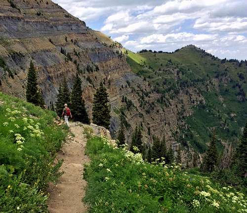
David was impressed with the trail leading from the main summit to the saddle above the snowfield, and I have to admit that it’s one of my favorite areas of the Wasatch. There is a little exposure, and a couple very short sections where the trail fades and it may be wise to use your hands, but it’s still a trail hike that almost anyone could do (not much harder than the earlier trail leading to the main summit).
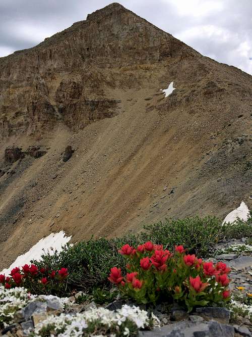
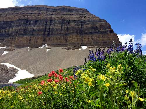
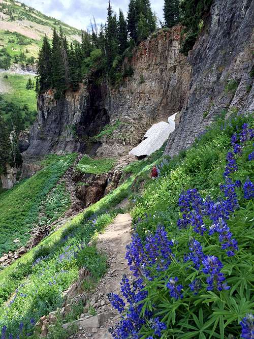
![South Timp wildflowers]() Some resilient wildflowers ...
Some resilient wildflowers ...![More South Timp wildflowers]() ... below South Timpanogos
... below South Timpanogos
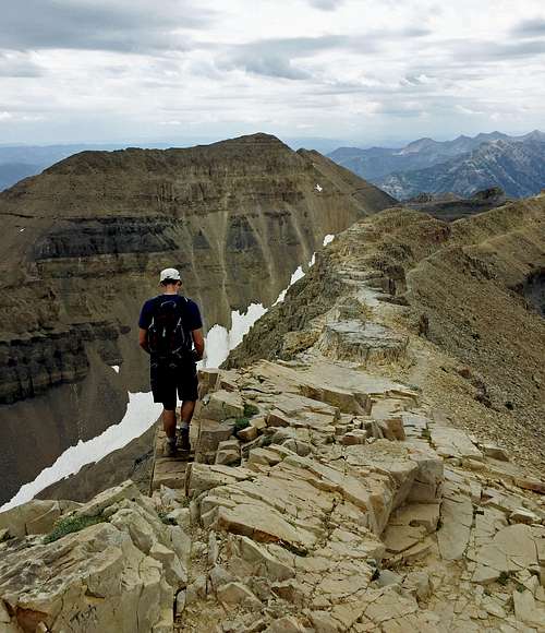
![South Timp exposure]() Some steep terrain ...
Some steep terrain ...![Almost to South Timp]() ... near the top of South Timpanogos
... near the top of South Timpanogos
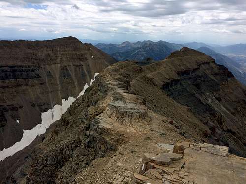
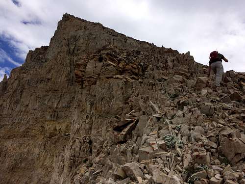
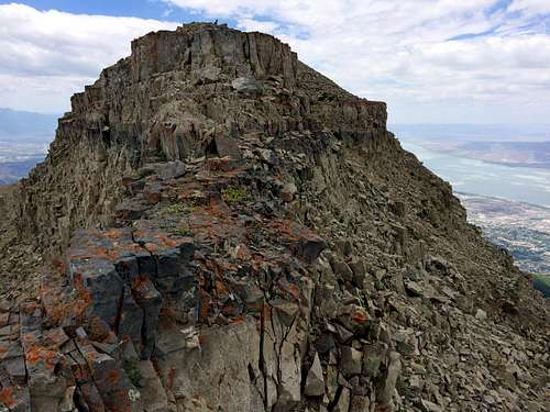
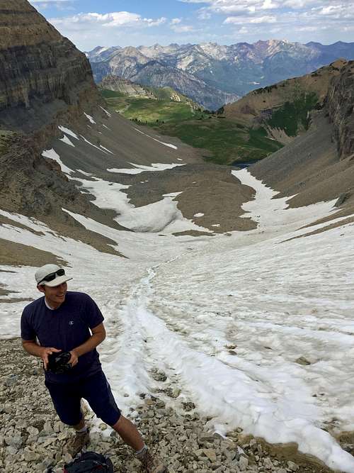
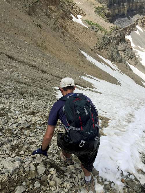
Upon reaching the saddle I gazed up at South Timpanogos, the final ranked Wasatch 11er that had somehow eluded me all of these years, despite previous summits of its more well-known nearby neighbor. The trail completely disappeared at this part, meaning I’d have to earn it by ascending five hundred feet up some loose scree and talus. David led the way, and despite the rock being a bit loose, the grade wasn’t steep enough for there to be much danger of knocking any rocks down on each other. We contoured back around to the north past one steep rock wall by using a few short and easy scrambling moves, after which we finally arrived on the summit.
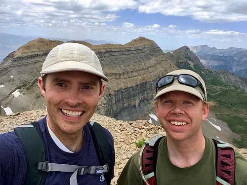
![South Timp summit pic]() Partners in crime ...
Partners in crime ...
![South Timp summit]() ... on the summit of South Timpanogos
... on the summit of South Timpanogos
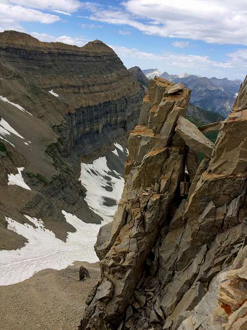
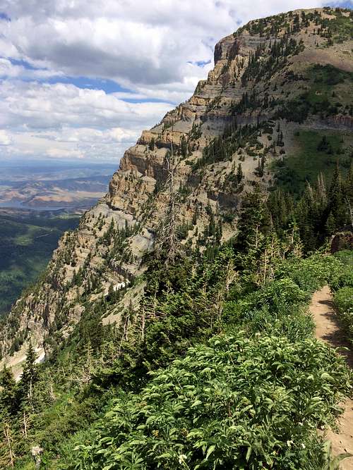
From the top, we could see every one of the other Wasatch 11ers, and in particular I’d have to say that the summit view looking north from here was one of the best I’d seen in the range. Below us to the east we also had nice views of Cascade Cirque and Deer Creek Reservoir. While the route continuing south along the ridgeline towards the lesser-known Coxcomb Ridge peaks looked interesting, we both decided that we were fine with taking the easier way down this time.
![South Timp summit view]() From the top of South Timpanogos we had a nice view ...
From the top of South Timpanogos we had a nice view ...![Trail from Timpanogos Summit]() ... looking back towards the main summit of Timp
... looking back towards the main summit of Timp
![Busting out the garbage bags]() Getting set up ...
Getting set up ...![Scree-skiing]() ... for my snowfield attack run
... for my snowfield attack run
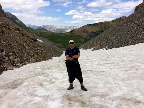
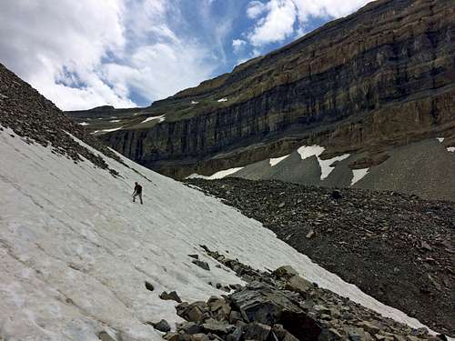
We made it back down to the saddle in short order, at which point we descended some scree until we came to the top of the permanent snowfield. The scree skiing was quite enjoyable, although the rocks were small enough that a few got in through the top of my boots. The last time I’d been here with my dad and brothers, we descended the snow by simply sliding down on our bottoms. While I didn’t think it was that dangerous, I remembered it being a bit difficult to control my speed without any equipment to deal with the snow (using my hands for balance a couple times resulted in some snow-burn). This time I came better prepared, with garbage bags to slide on and snow gloves to use for slowing down when needed (David brought a pair of his own gloves as well).
![Garbage Bag Kilt]() "What is that guy wearing?"
"What is that guy wearing?"
Despite the fact that the snow was melting more quickly this summer, and this time there were several exposed rocks, I never felt unsafe going down this way. After donning our unglamorous yet effective makeshift garbage bag kilts and gloves, I led the way down by keeping one leg bent underneath me and the other sticking straight forward downhill, with my gloved hands out on each side to assist with balance and speed control (by digging them into the snow to slow down). Since I wasn’t sitting down, I was safely able to cruise down over the sections with exposed rocks, and in just a couple of minutes had already descended several hundred feet. David followed suit, and before we knew it the grade had lessened to the point where we could simply continue walking over the snow.
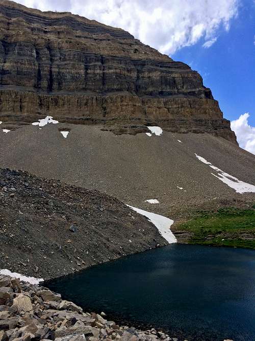
![Descending snow above Emerald Lake]() Descending snow above Emerald Lake
Descending snow above Emerald Lake![Emerald Lake]() Emerald Lake
Emerald Lake
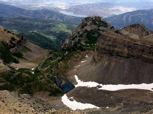
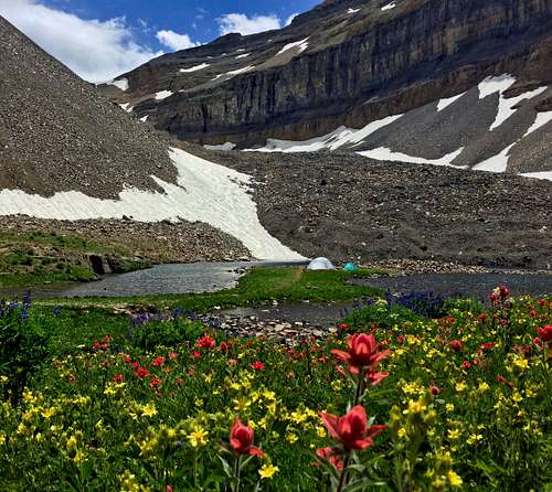
We took the more direct right fork in the snowfield to get down to Emerald Lake more quickly, and carefully traversed over one last steep section of snow above a slope dropping down into the lake. The slow was slushy enough that it was easy enough to cross without fear of sliding down into the ice-cold lake, but we were careful nonetheless. After admiring the campsite on the narrow neck of land in the middle of the lake, we continued skirting around the water until we found ourselves back on the Aspen Grove Trail.
![Camping in paradise]() Camping in paradise ...
Camping in paradise ...![Wildflowers below Timp]() ... below Mount Timpanogos
... below Mount Timpanogos
Making our way back down the trail, I was pleasantly surprised by the lack of people. It was as if we had the entire mountain to ourselves on the way down, since we actually hadn’t seen another person since our short stay on the main summit of Mount Timpanogos, and we wouldn’t see anyone else until getting back down by one of the lower waterfalls.
![Wildflowers in front of Elk Point]() More wildflowers in front of Elk Point ...
More wildflowers in front of Elk Point ...![Hidden Lakes basin flowers]() ... and South Timpanogos
... and South Timpanogos
![Hidden Lakes meadow]() Hidden Lakes meadow
Hidden Lakes meadow
I didn’t feel too special though, because karma finally kicked in on our near-perfect hike when I ventured off of the trail for a little waterfall pic and ended up almost impaling my leg on a chopped tree branch jutting up from the ground behind some vegetation on a little side-trail leading down to the water (it was a little bloody but not deep enough to require any stitches). The water and spray did offer some nice relief from the heat, though.
![Primrose Cirque descent]() Descending Primrose Cirque was like walking into a painting
Descending Primrose Cirque was like walking into a painting![Scenic Aspen Grove wildflowers]() Going back down the steep trail ...
Going back down the steep trail ...![Scenic Aspen Grove waterfall]() ... we spotted more little waterfalls
... we spotted more little waterfalls
Eventually we got back down to the car, where unfortunately I also discovered a little parking ticket/note on my windshield. I looked around for a forest ranger for a chance to plead my case by busting out my National Parks pass, but with none in sight and me not wanting to risk the chance of an actual ticket arriving in the mail, we drove back down to Sundance for me to get some cash (took a while wandering around to find an ATM and then a shop to break a twenty for me to get the smaller bills I needed) and then sped back up to the trailhead to just go ahead and pay the $6 with the self-issue permit the ranger left with the note.
![Primrose Cirque wildflowers]() Steep slopes of Roberts Horn ...
Steep slopes of Roberts Horn ...![Elk Point]() ... and Elk Point
... and Elk Point
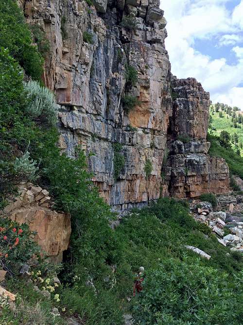
![Waterfall cool-off]() Waterfall cool-off
Waterfall cool-off![Aspen Grove walls]() Aspen Grove walls
Aspen Grove walls
The whole entrance fee situation with national forests irks me a bit, since most of the time they get away with charging people for entering when technically they’re only supposed to charge for use of facilities (I can see how this is hard to enforce without having someone guard each toilet though, which is probably why they are vague in their explanation and just hope that everyone will end up paying who passes through), but I guess it’s a small price to pay for experiencing some of the best mountain terrain around.
![Looking up at Elk Point]() Looking up at Elk Point ...
Looking up at Elk Point ...![Looking up at Primrose Cirque]() ... and Primrose Cirque
... and Primrose Cirque
Despite the cut leg and self-issue permit fiasco at the end, hiking to the top of South Timpanogos via the Aspen Grove Trail was an awesome experience, and an excellent way to finish off my little goal of summiting all twenty ranked Wasatch peaks over 11,000 feet in elevation. It has provided me with all sorts of fun memories in the mountains, and given me a greater appreciation for the many wilderness areas we’re so lucky to enjoy right at our doorstep. Since I’m just an average day hiker, it also provided the perfect amount of challenge for someone who likes a good non-technical scramble but doesn’t want to travel too far or spend too much time away from the family to get in a good hike.
![Aspen Grove waterfall]() Being treated to top-notch waterfall ...
Being treated to top-notch waterfall ...![Aspen Grove wildflowers & greenery]() ... and wildflower views on our way back down the Aspen Grove Trail
... and wildflower views on our way back down the Aspen Grove Trail
I have to give a shout-out to David for helping me achieve this goal. He’s always been willing to make the long drive down from Cache Valley for an early morning Wasatch hike, and has usually been up for almost any crazy route I’ve proposed doing (he did talk me out of trying the Razorback Ridge route though, which I’m glad for). For exactly half of the ranked eleveners, I climbed them for the first time with David, and I’ve been lucky to have had such a reliable and like-minded hiking partner for them. He has much loftier long-term mountaineering goals than I do, but I’m glad that he’s been able to help me achieve mine (he’s almost done with the Wasatch 11ers himself, and will have no problem finishing the remaining ones, especially considering that one of his goals is to climb all of the highest Teton peaks, which are generally much more difficult and technical).
![Aspen Grove lower falls]() Aspen Grove lower falls
Aspen Grove lower falls
It’s doubtful that I’ll ever get caught up chasing another list, but I definitely intend to continue my mountain adventures the same as before. I may trend towards some easier overall hikes in the future (my son is just barely getting to the point where I think it’s time to try taking him on some of the longer summit hikes), but my desire to get out into the mountains still burns bright. Maybe someday I’ll end up climbing all of the unranked Wasatch 11ers as well, but I’m in no hurry, since there are still many other mountains scattered around the Western United States that I’d like to see as well.
![Jordan River Trail]() Until I figure out my next mountain goal, hopefully the lunchtime jogs along the Jordan River Trail ...
Until I figure out my next mountain goal, hopefully the lunchtime jogs along the Jordan River Trail ...![Oquirrh Lake]() ... and evening walks around Oquirrh Lake will keep me in shape
... and evening walks around Oquirrh Lake will keep me in shapeSouth Timpanogos Stats
DISTANCE:
14 miles roundtrip
ASPEN GROVE TRAILHEAD:
6,890 feet
MOUNT TIMPANOGOS ELEVATION:
11,750 feet
SOUTH TIMPANOGOS ELEVATION:
11,722 feet
ELEVATION GAIN:
5,300 feet
DIFFICULTY:
Class 2+
TIME:
8.5 hours
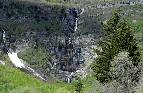
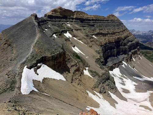
![South Timpanogos]() Zoomed-in shot of South Timpanogos from Primrose Point
Zoomed-in shot of South Timpanogos from Primrose Point


Comments
Post a Comment