-
 11136 Hits
-
 87.76% Score
-
 25 Votes
|
|
Mountain/Rock |
|---|---|
|
|
49.18277°N / 20.14697°E |
|
|
7818 ft / 2383 m |
|
|
- Zbojnická Chata, in the valley Veľká Studená Dolina">
- More
Intro
Svistowy Stit, Swistowy Szczyt, Mittelgebirge, Kozephegyseg 2383 Massive peak in the main Tatra chain, the central culmination point above valleys of Svistova, Rovienky and Velka Studena. In Velka Studena Valley
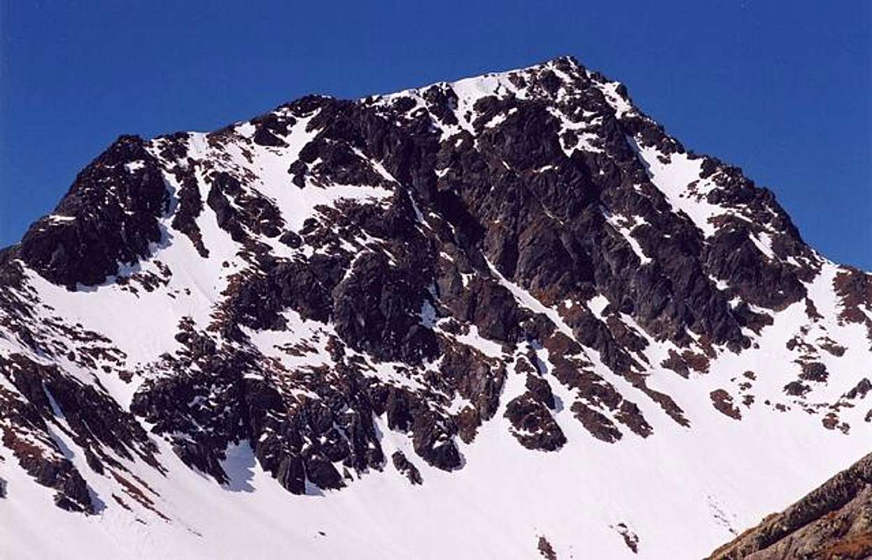
Though non-marked, Svistovy Stit attracts attention of many high mountain tourists throughout the years having fame
of one of the greatest summit viewpoints in High Tatras.
Moreover it is one of the easiest High Tatra peaks to climb (very close to Zbojnicka Chata Chalet) for the whole year what explains its popularity in winter season (wonderful ski-touring escapade!)
First Known Ascent:
20.VII.1897 - August Otto and Johann Hunsdorfer senior (guide)
There is a serious probability that the summit was reached earlier by cartographers or huntsmen.
First Winter Ascent:
16.II.1913 - Gyula Komarnicki (ski ascent)
Svistovy Stit (2383)
 Svistovy Stit (2383)
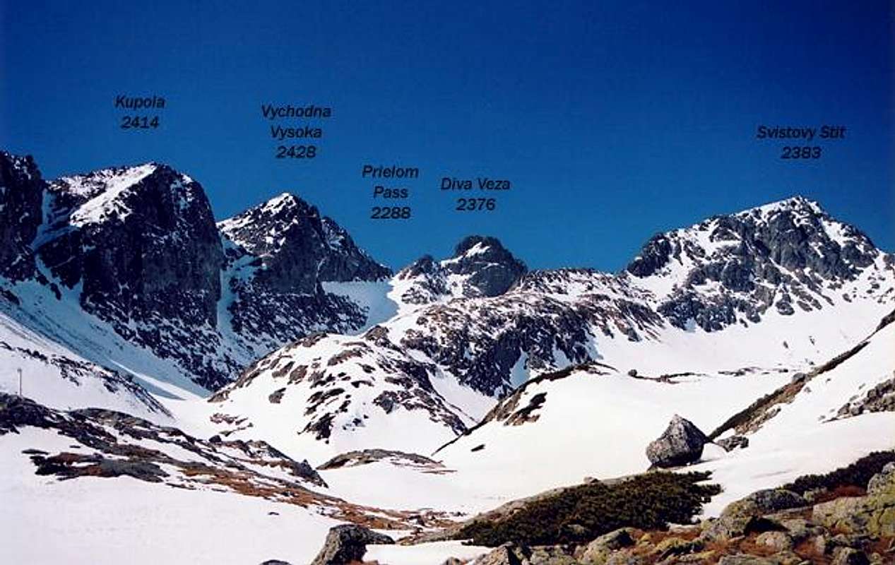
Svistovy Stit(2383) rises high above valleys of: Svistova(south-west), Rovienky(north) and Velka Studena(east) neighbouring on the south-west to close Diva Veza massif (separated by Dive Sedlo pass) and Hranata Veza on the north-east(separated by wide, grassy saddle of Svistove Sedlo).
Svistovy's long summit ridge is formed by a few non-prominent culminations, 2 of them distinguish themselves as massif's summits, these are:
Getting There
You can visit the area both from Slovak and Polish side of the mountains, but when planning climbing Svistovy Stit and other beatiful peaks in the area of Velka and Mala Studena Valleys it is definetely better to base on Slovak side. The key thing when planning a stay in Slovak High Tatra is to get to Poprad - major city in the area with very good communication links with the rest of the country, from there you should go to the most famous High Tatra resort of: Stary Smokovec where all main trailheads of the area are located. You can of course find accomodation anywhere at Tatra southern foothills, thanks to an electric train line you will find yourself anywhere you want at the right time! Slovak bus and train connection search Coming from Polish side as always you must get to Zakopane first, very well developed bus and train communication with the whole Poland, especially nearby Cracow City (100 km). Everyone who'd like to visit the area of eastern part of High Tatras from north should take one of many buses or minibuses going in the direction to Palenica Bialczanska ("Morskie Oko") and get off one stop before the final one at Lysa Polana - former Polish/Slovak road bordercrossing point. Slovak bus stop is just about 200 metres behind the border. PKS Cracow – Zakopane bus departures PKP - Polish Railways connection search PKS Zakopane - buses The nearest airports to Tatra mountains are located in Cracow(100 km)in Poland and in Poprad nearby in Slovakia. Cracow Airport Poprad-Tatry Airport
Routes Overview
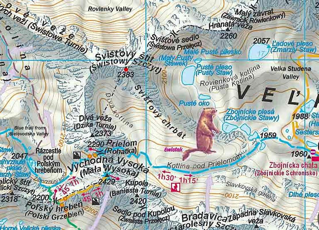
No marked routes leading to the summit of Svistovy Stit Marked routes of the area: Stary Smokovec(1010) – Hrebienok(1285) Green marks or road ,3 km ,0.50 h ( or cable car railway for 90 SK – over 2 Euro) Hrebienok – Velka Studena Valley – Zbojnicka Chata Chalet(1960) Blue marks ,6 km ,680 meters of height difference ,2 h Zbojnicka Chata Chalet – Prielom Pass(2288) Blue Marks ,2.2 km ,330 m of HD ,1 ¼ h Terycho Chata Chalet(2015) – Priecne Sedlo Pass(2352) – Zbojnicka Chata Chalet(1960) one way route! Yellow Marks ,5.5 km ,2 ½ h Climbing Routes : Svistovy climbing routesSvistovy Stit area - Map
 Tatry Wysokie (High Tatra) map, in scale 1:25 000, description in 6 languages, ISBN 83-87873-26-8, available in all shops and book stores in Zakopane . Here you can check the net version
Tatra Maps (English version)
Tatry Wysokie (High Tatra) map, in scale 1:25 000, description in 6 languages, ISBN 83-87873-26-8, available in all shops and book stores in Zakopane . Here you can check the net version
Tatra Maps (English version)Red Tape
It is Tatra National Park(TANAP) area, there are no entry fees but you can hike using only marked trails. Watch out for strict rules of wildlife conservation. Stay always respectful to mountain nature! From 1.11 to 15.06 year by year all marked routes in TANAP(the whole Slovak side of Tatras) are being closed for tourist activity (besides the routes leading to mountain chalets). On 21.12.2007 Slovakia along with Poland signed Schengen Agreement and accessed to "open borders" Schengen Area,however one must remember that National Park regulations prohibiting crossing the border beside marked trails in the whole area remain in force.
When To Climb
Best time for climbing/hiking: August – October. June/July: frequent t-storms, heavy rainfall periods and foggy weather. Svistovy Stit is a very popular winter hiking target. Planning visiting Tatra Mountains in winter, don't forget to check actual HZS avalanche forecastCamping
Huge choice of accomodation offers at whole southern Tatra foothills area, very differentiated from expensive, luxury hotels to cheaper guest houses and private rooms. In the mountains: Definitely the best base to stay overnight when planning climbing Svistovy Stit is beautifully situated Zbojnicka Chata chalet(1960) in Velka Studena Dolina valley . The chalet was completely burnt down in June 1998 ,but was rebuilt and now offers great conditions and a real mountain atmosphere . Zbojnicka Chata Chalet Hrebienok (at the entry to Velka and Mala Studena valleys) : Hotel Hrebienok Bilkova Chata Hotel Camping in Tatra National Park is strictly forbidden .Mountain Conditions
Severe and extremely changeable high mountain climate …be always prepared for sudden weather breakdowns ! Rescue Phone Number: 18 300 Horska Sluzba - Tatra Mountain RescueExternal Links
- Tatra Mountains by Goorol
Tatra photo galleries


