
|
|
Mountain/Rock |
|---|---|
|
|
34.88960°N / 111.7803°W |
|
|
5667 ft / 1727 m |
|
|
Overview
The Fin is a very exciting climb with plenty of exposure. This formation gets very little traffic on the summit, and there's no maintained trail to the base. One can complete this climb at a casual pace and be back to the car in just over 4 hours.
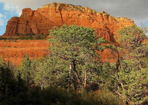
Platform leading to The Fin
Climbers may choose from (one of two) 3rd class scrambles to the base of the climb. The most obvious is a ridge line that will take you to the middle of the slick rock layer where you can take a fairly airy traverse west to a drainage that will take you to the top of the slick rock. From there you can scramble to the bottom of a pronounced 4th class ramp, with one 5th class spot, that leads to the summit ridge. The climb becomes 5th class, and is rated 5.7 at the top of the ramp, where you will climb the west arete in 2 pitches. From that point the summit ridge is 4th class. The rap anchor is a questionable tree, so you might want to bring a bolt kit along with the following: stoppers, cams to BD #3, pitons and 2-60m ropes. Note: On a recent page comment it has been said that there is a pin near the top of P2 to back up the shaky tree rap anchor. I don't advocate for more bolting in nearly all cases, but this is one place that could use one.
 |  |  |  |  |
Getting There
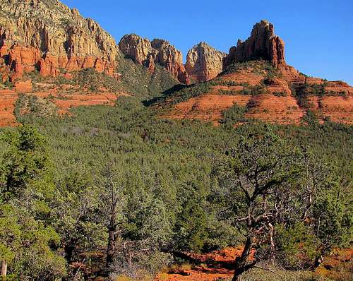
The Fin as viewed from Mormon Canyon
As you proceed a short distance up the wash, look off to your southeast.
The Fin rises like a fin over the juniper/ cypress forest filling Mormon Canyon.
Red "Rock" Tape
The Coconino National Forest has implemented the Red Rock Pass Recreational Fee Program. This innovative program is designed to increase visitor information and conservation, education services, enhance the recreation experience, and perpetuate a healthier forest ecosystem.The Forest Service has partnered with the Sedona-Oak Creek Canyon Chamber of Commerce, the Arizona Natural History Association and the Friends of the Forest to provide "one stop shopping" at three Gateway Visitor Centers. This partnership provides visitors with enhanced information on the greater Sedona area attractions, activities, restaurants, shopping, opportunities for sightseeing, hiking, archaeology and rock-art tours, and other activities on the Coconino National Forest.
Red Rock Passes can be purchased at many commercial vendors, government offices and vending machines throughout the area.
When To Climb
Spring and fall are the most popular times to climb. Summer rains soak the sandstone making it more dangerous to climb. It is recommended not to climb for a few days after a rain.
Camping
Nearby camping in the Coconino Nat'l Forest :| Bootlegger | Apr 15-Oct 31 |
| Cave Springs | Apr 13-Oct 15 |
| Manzanita | Year Round |
| Pine Flat West | Mar 5-Oct 26 |
| Beaver Creek | Year Round |
| W. Clear Creek | Year Round |