
|
|
Mountain/Rock |
|---|---|
|
|
36.04427°N / 52.00690°E |
|
|
Mountaineering |
|
|
Summer |
|
|
12776 ft / 3894 m |
|
|
Overview
Click for Introduction to the Central Alborz MountainsClick for a detailed map of the Central Alborz Mountains.
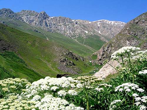 From Daryook River Valley
The Lehra Peaks are located in the Central Alborz Mountains of Northern Iran near Mt. Damavand close to the capital city of Tehran. With its superior height of 5671 m, Mt. Damavand rises far above the other nearby peaks. The base of the giant cone of Mt. Damavand covers an area 25-30 Km in diameter. Except for a small area to the northwest, Damavand is otherwise surrounded by Haraz Valley and its branches. For this reason, Damavand often appears as a single peak that seems to rise above a plain. The facts, however, is that Damavand sits in the middle of the Alborz Mountains. Its only connection to the other mountains is via one of its northwestern ridgelines that drops down to an elevation of 3650 m where it creates a ridge-top plateau known as “Valaroo” or “Sar Dagh”. Continuing west, the ridgeline goes to create a series of peaks called the Lehra Peaks (13.5 Km northwest of the summit of Damavand). East to west, the most prominent of these peaks are:
Peak 3886 m
Peak 3894 m
Peak 3890 m
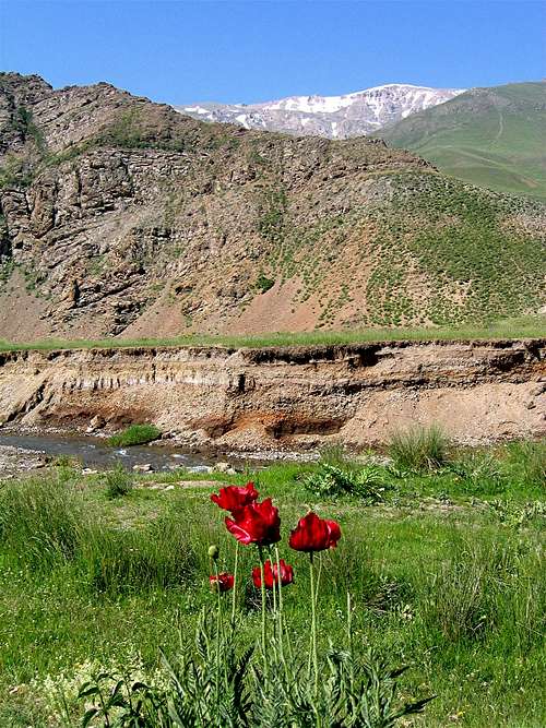
To the west, the 3650 m Lehra Pass separates the western-most Lehra Peak from the 4075 m Kaoon Peak. The northern slopes of the Lehra Peaks are rocky and steep creating walls in many places. These slopes go down to the bottom of the Daryook River Valley (2700-3000 m). The southern slopes are quite gentle (at least on the upper parts) and drop to the Sesang River Valley (3300-3400 m).
The Lehra Peaks are usually climbed from the village of Nomar (2150 m) to the northeast. From Nomar, you will hike along the Daryook River to the Lehra Saddle where you will gain access to the much gentler southern slopes. I do not do technical climbing but it appeared to me that good rock climbing opportunities could be found on the northern slopes. This area, however, is not known to be famous for rock climbing.
From the summits of the Lehra Peaks you will have great views of Mt. Damvand to the southeast. The twin summits of the 4338 m Dokhaharan Peaks and the other 4000 m peaks around them, create an awesome sight to the south and southwest
 Lehra from above Nomar Village
Getting There
 The northern slopes
From eastern Tehran, drive the Haraz Road (Tehran-Amol) past the towns of Baijan and Kahrood until you see a sign that says “Amol 55 Km”. A few Kimlometers beyond this sign you will find a dirt road on the left (west) side of the road. This road is well-graded and is passable by most/any car. It might be inconspicuously signed for “Panjab” or “Nomar”. Drive the road 25 km to its end at the village of Nomar (also known as Nomarestagh). Distance from eastern Tehran is roughly 130 Km.