Triple Threats - June 16th, 2012
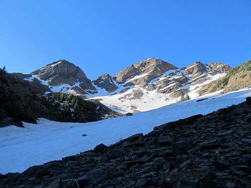
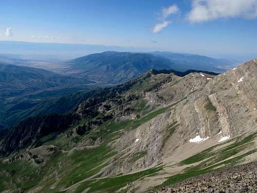
All winter the great peaks of the Wasatch stared down at me in the city, mocking me with their unclimbed aloofness. I determined to change that once the snowmelt started trickling down in full force. My first target, and hopefully first Wasatch 11er, would be Broads Fork Twin Peaks, which rose so very prominently above my office building in Midvale. I researched the routes and options up in Broads Fork Basin and figured that Sunrise and Dromedary would be nice to circle in as well, had I the additional energy. The full loop would be somewhere around 6,200' gain. Having personally never gained more than maybe a few hundred more than 5,000', and not wanting to reclimb Sunrise, I tentatively mapped out a descent from the Sunrise/Dromedary saddle; there was not a lot of information on this approach, besides the fact that it was loose.
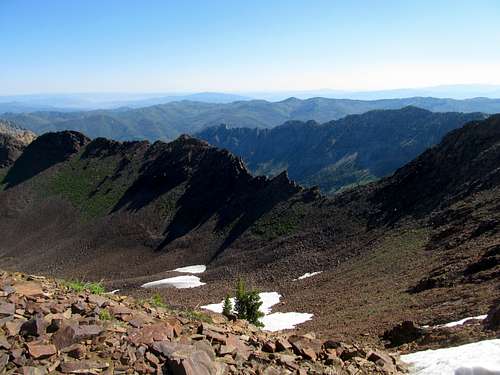
I started early morning up the steep trail with apprehensions, mainly about the crack crux of the Standard Broads Fork route. The trail up was steep, but with another hot day in the valley I was glad to ascend quickly to higher terrain before the sun started doing its work in the lower canyons. The climber's trail past the meadows was fairly easy to find as it circled around a lake, but was tougher to trace a little higher up as it wandered amid a broad series of cascades from the fresh snowmelt. Picking my way through the occasionally brushy cascades, I ended up ascending a slow a little bit too much to the right (west) of the snowfields leading up to the BF/Sunrise saddle. Descending back down to the snowfields required a little bit of bushwhacking through the small evergreen trees, but eventually I was making my way up the snow. Conditions were perfect. The morning sun made the snow nice and crusty without being icy or slippery. It was a pleasure to ascend even as it steepened towards the saddle, and I went by choice up a steeper snow gully (there was snowless terrain available if I had wanted) until about 50 feet below the saddle crest.
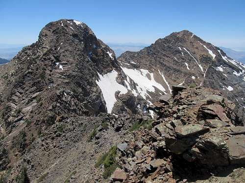
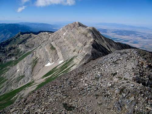
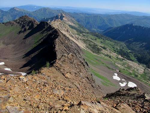
The saddle between BF and Sunrise was narrower and rockier than I had expected. I traversed slowly along the ridge while observing a small climbers’ trail to the left (south) side of the ridge. Lacking foresight or imagination, my biggest concern for this trip was the BF Twin Peaks crux/crack climbing section. I began the initial ascent up the summit block on the lookout for the exit ledges, then followed them to a face I recognized somewhat from the pictures on SP. Up ahead at the ledge terminus was a major crack in the mountain, also a possibility, but some overhanging rock on that section made me opt for the face before me.
I ascended it carefully, mostly sure that I was indeed going up the standard route. Face facing rock, the climbing wasn’t too bad, and I soon found myself atop the ridge crest looking down and trying to memorize the area for my descent. Then some easy scrambling amid surprisingly high evergreens, and I found myself atop my first Wasatch 11er.
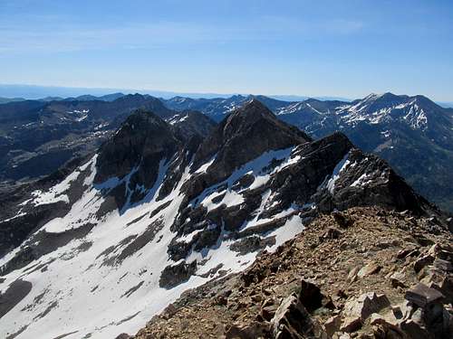
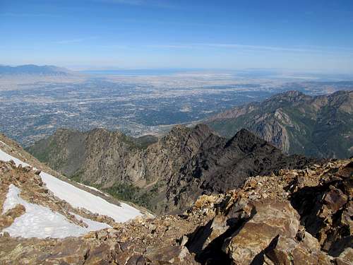
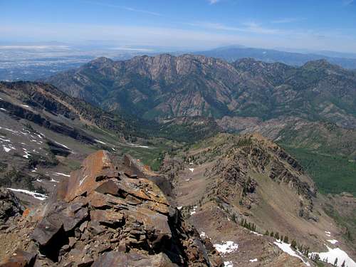
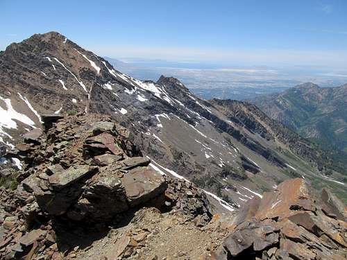
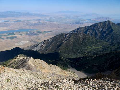
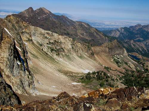
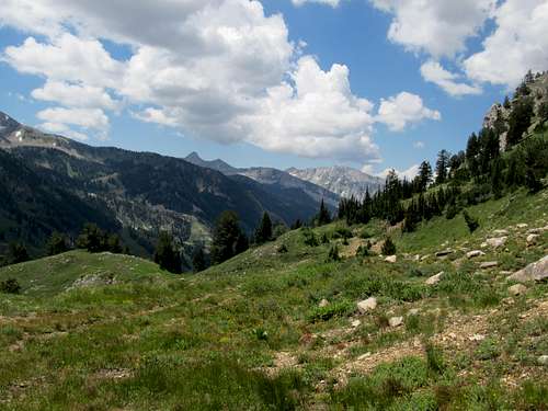
The views were outstanding, especially to the long, Sierras-like canyons on the other side of Little Cottonwood. I gazed at the loose rock up the lower of the Twin Peaks and decided against that unranked summit. Whatever energy I had I would save for Sunrise and Dromedary.
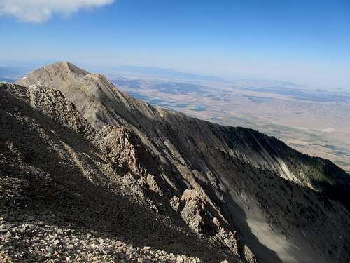
Thus a careful descent, finding my way carefully to where I had ascended the crux. I carefully downclimbed the same steps, ass facing out, and breathed a sigh of relief, thinking the worst to be over. Next was the traverse back across the narrow saddle to the summit block of Sunrise.
I wasn’t sure whether I wanted to do the easier but looser contour south and lose a hundred or so feet. The alternative would have been to ascend the class 4/possible low class 5 buttress lining the west side of Sunrise. As it happened, I defaulted into the latter route when I lost the climber’s trail contouring around the southwestern slope of Sunrise. Well, buttress it was.
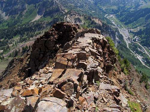
The SP route page outlines two options to ascend the West Buttress, and I obviously opted for the easier one, to the climber’s left. It wasn’t too bad; the ledges were small and occasionally loose, but holds were more than plenty, and all I had to do was carefully map each move for each limb and execute it without too much difficulty, while occasionally snapping a picture. I topped out while watching a group of 3 or 4 below ascend the snow up to the BF/Sunrise Saddle, and wondered if they saw me ascending the Buttress, just in case I got into trouble later along the route. But then, why worry, with the worst definitely being over…right?
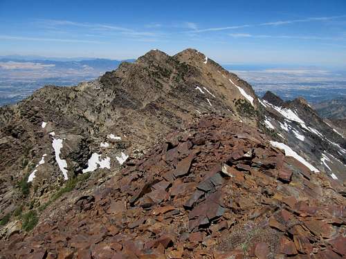
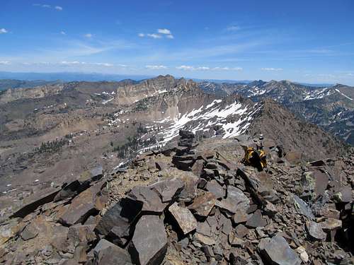
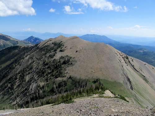
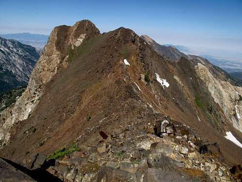
Some more scrambling brought me on top of Jepsen’s Folly, then a careful downclimb followed by some rough, slightly loose boulders and a few scrambling moves over more solid ones brought me to the top of Sunrise. The traverse over had taken me longer than planned, maybe an hour? But here I was, supreme joy mixed with supreme arrogance. I spontaneously burst into song, screaming the words to “Call Me Maybe” down into the reaches of LCC, the anthem of supreme accomplishment, I suppose. Now, one more minor summit and I could call it a day.
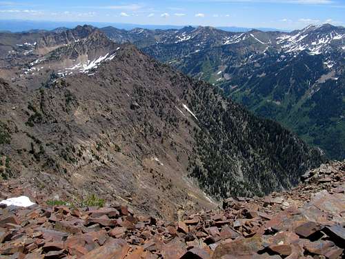
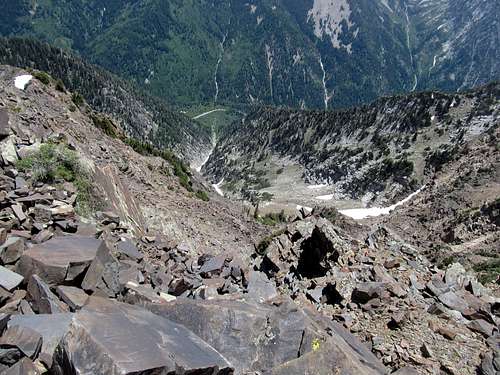
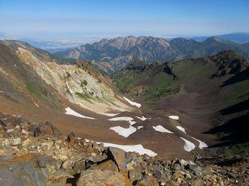
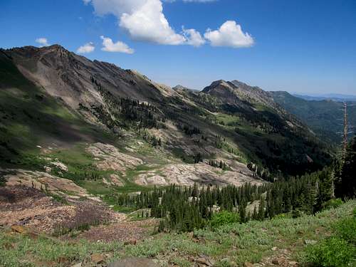
I carefully descended down the eastern slope of Sunrise, each step ever more carefully as the climber’s trail deteriorated towards the saddle. Dromedary beckoned ahead, taunting me ever more so as I found myself traversing a painful sidehill towards Tanners Gulch, along the south side of the ridge. I was following goat trails, but I hindsight I think the proper route is higher on the ridge crest. Following the path of lesser resistance along the slope I eventually found myself cliffed out above Tanners Gulch, yet to the south and maybe 20-50 feet below the Sunrise/Dromedary Saddle proper. This was interesting, and I was perplexed not being able to locate any reasonable way of descending into the Gulch. I started halfway down a very loose and rotten chimney, until at a certain point where I realized it really wasn’t a good idea to keep going.
After a long time contemplating, I carefully did turned myself around and was barely able to scamper like a helpless puppy up the loose dirt and rotten pebbles back out the chimney. Seeing this chimney from afar a few minutes later from safer ground made me realize that I had made the right decision. I had stopped in an overhanging section in the middle of the chimney. Any false move in the descent would have sent me tumbling down into Tanners Gulch with much forward momentum. There were a mess of jumbled boulders blocking easy passage through the middle of the chimney as well. They looked sketchy when I was standing a few feet above them, and ten times more so when viewed from a proper angle; had I even touched them I’m pretty sure they would have all tumbled down, and me with them, or them over me.
Casting stubbornness aside I ascended back closer to the ridge crest and, whadoyaknow, found a class 3/4 descent into the saddle. Realizing the extent of my possible mistake in the chimney, I noted with relief that at least a descent from the Sunrise/Dromedary saddle would be a scree-skiing cakewalk. So I started up Dromedary, a final ascent that encapsulated in a few hundred feet the rottenness and looseness of the entire day. It was getting later, and my impatient, fat self crudely huffed and puffed up the loose rock, often swearing in frustration as the slope gave and rocks flew down the slope below me.
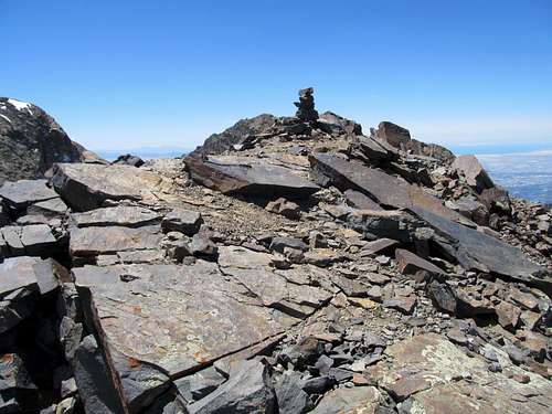
The final hundred or so feet or so provided some welcome relief from the looseness as I ascended some solid class 3 ledges to my final summit of the day. More than an hour had passed since Sunrise, and I had gone from supremely untouchable to supremely humbled. I snapped a few quick pictures and wondered at the best way to complete the descent.
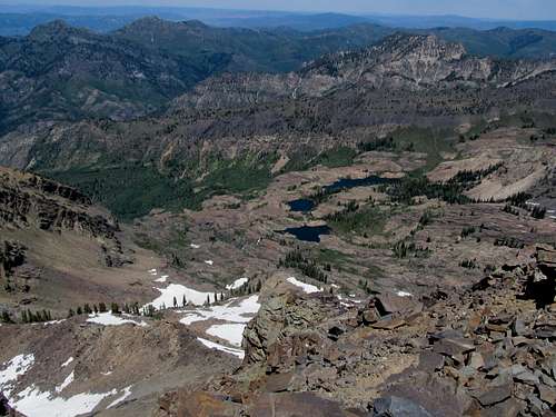
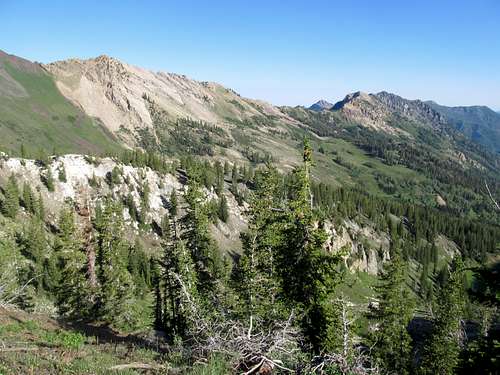
I could go back to the Sunrise/Dromedary saddle via what I knew was an easy descent, but that involved downclimbing the extremely loose west face of Dromedary. The optimist in me leaned towards possibly better terrain east of Dromedary, completing a full loop around the cirque, so ignorant about the rest of the route, I ambled downwards. The terrain wasn’t too bad, but knowing of cliffs above Lake Blanche, I decided to contour north rather than northeast so as to avoid that route. Again, in hindsight, I found out later that due northeast to the saddle, then an easy traverse north, was the way to go; back in the present, I transitioned quickly from moderate dirt/grass slopes to a series of cliffs lining the north face of Dromedary. Not knowing any better I figured I could descend or traverse around each cliff, one by one. I couldn’t tell you how I did it, with ice, snow, and impromptu fresh melt waterfalls all surrounding me, but somehow I managed to make it through the cliffs with only one close call where I slipped on an icy section traversing down a narrow ledge, fortunately catching myself on a grassy area before involuntarily dropping down another ledge. Apparently at the time I was nervous enough not to have thought of taking pictures during the traverse down.
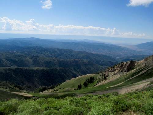
What a relief it was to finally be down, and what a relief it was to downclimb the slippery snow, get lost amid the cascades again, and feel my tired legs pump down the steep trail back down into Big Cottonwood. I saw various parties in various stages up and down the Broads Fork route, and talked to a couple on the descent down the last of the snowfields before bidding them adieu as we found the actual trail back to Broad Fork Meadows, but from there until maybe within a hundred yards of the trailhead I encountered not a single person on a major trail, within 10 miles of the city, on a beautiful summer Saturday.
So much for SLC being an outdoorsy city.
Nabbing Nebo - July 7th, 2012
It was a few weeks later when I felt strongly the call of the Wasatch again. Obviously, as the days rolled by, the fact that I had still not climbed the ultraprominent highpoint of the range above me began to roil me. I resolved to solve this sheer and taunting mountain on a Saturday morning, enjoying the sunrise as I drove up from Payson through the canyons and meadows lining the Mt. Nebo scenic byway.
Things were made a little more complex by a brief workout at the gym Friday night, when I hit my ankle on a machine and lightly bruised it. I parked at the North Peak trailhead and started walking quickly up the steep hill lining the beginning of the route, testing my new ankle brace. Coming from the north seemed to make the most sense, as I could knock out along the way North Peak, a ranked Wasatch 11’er.
Time was of the essence though, as weather reports indicated that thunderstorms could commence in the area as early as 11 AM. But for now, the sky was bluebird clear as I made my way along the scenic ridge with the sun rising further above the Wasatch Plateau behind me.
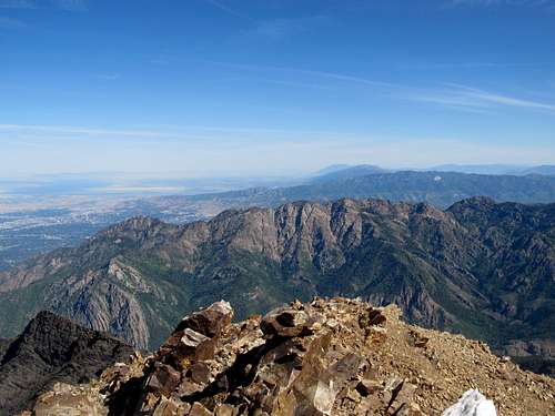
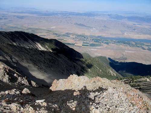
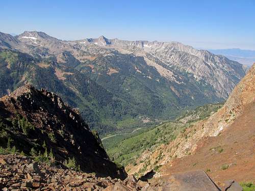
The trail curved around through some trees before dropping in a small drainage below the northeast face of North Peak. A few switchbacks took me up to the saddle, where the views of Nebo here perfected matched the cover picture of my copy of Randy Winters’ Wasatch 11ers guide. I left the trail and ascended some relatively easy terrain to the top of North Peak, then descended down the featureless south slope in a straight line back to the trail visible at Wolf Pass below.
A large group from one of the nearby towns, whom I had passed before the saddle, had now caught up as I was up on North. I passed them again while exchanging friendly greetings again up the steep 800 feet to the top of the false summit north of Nebo, then started across the surprisingly loose traverse to the base of the peak. The rocks here were cool, and those still amid the morning shadows, oddly cool to the touch. As I started up the last loose section to the summit a runner passed me by. I greeted him atop the summit, him an aspiring ultra-runner who had ascended the peak in quite an impressive time (I forget exactly, something like an hour to 90 minutes tops?).
The rest of the families caught up, their kids ranging from ecstatic to exhausted.
All of us enjoyed a friendly chat about mountains and such, and though we lingered on quite a bit on a clear day, all of us soon hastened to descend in anticipation of the still unseen deterioration of the weather.
The ankle had held up under the brace, but I found new ways to hurt myself only a few hundred feet below the summit. I was taking a picture and about to place my camera back in my pocket when, standing completely still on level ground, my foot managed to slip on some pebbles. I fell, and cut my right forearm against the sharp rocks for a mighty long and bloody gash (which I might add still shows light scarrage now, 5 months after the fall). It was merely a flesh wound, but I did worry about infection as I hurried as quickly as possible down the mountain, my arm a bloody mess and hopefully an ominous portent for those still looking to ascend the mountain. As it should have been, for the skies began to darken as I contoured around North Peak past Wolf Pass, and really darkened once I reached the saddle north of North Peak.
I heard thunder echo above right as I was descending the initial switchbacks down into the trees, and this persisted as drizzle turned into a steady rain as I made my way back towards the car. With well wishes for those whom I still saw ascending, I drove down the rest of the Nebo Loop, noting that the highest reaches of the peak seemed covered under a light layer of thunderstorm hail.
It was sunny by the time I pulled into Nephi, but ominous thunderheads loomed in every direction as I drove back to SLC.
Superior to Monte Cristo - July 8th, 2012
All night Saturday I wondered and doubted about the next day. I was tired, bloodied from Nebo, and wary of another day’s forecast of early afternoon thunderstorms. I leaned towards something quick and local, and continued to lean towards Superior and Monte Cristo.
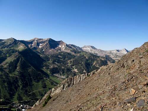
And so I was Sunday morning finding my way through Alta town center and ascending the steep road as it goes from gravel to dirt to trail up sharply to Cardiff Pass. It was already quite hot and humid in the morning, and I passed along several parties on my way to the pass.
From here I got a little off track but eventually managed to find the climber’s trail as it contoured up, down, and around a few minor bumps until it dropped me off at the base of Superior. I stayed in the rubble on the climber’s left to begin with for a few hundred feet, then started up the more solid rock on the ridge as the trail disappeared. Up and over several sections, with one downclimb through a loose chute on the right (north of the ridge), all while occasionally finding the south side climbers trail as it occasionally reappeared.
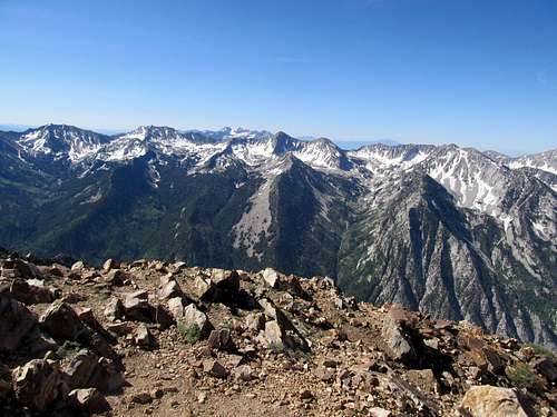
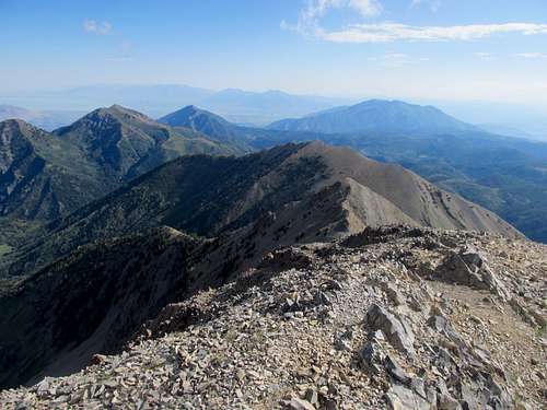
Overall the scrambling wasn’t too bad, though some faces were more vertical than others. The gangway known in places as the “Incan Wall” was a delight to walk across, and though the few false summits were annoying, reaching the true summit was a delight.
I was met up there by a couple of climbers who had gone up the South Ridge, and said that apart from one section it was a pretty basic climb.
The traverse to Monte Cristo looked bad, but after a boulder hop down Superior I found the going to be quick and easy. I gained a ridge via a small grassy ramp mentioned in some route descriptions, then downclimbed a little to the base of Monte Cristo. The smooth looking rock was actually the best part of the day, offering fun and easy scrambling with plenty of holds.
The clouds were starting to form, and as I chatted Wasatch Peaks with another climber who had eventually caught up I kept an eye on the clock.
Then it was a quick traverse back to Superior, then a downclimb as annoying as anticipated. I slowly went boulder by boulder down the ridge, while descending the climber’s trail whenever I could.
Nevertheless one section found me traversing a little too far to the left, and I had to do a couple tricky ledge traverses to get back on course. I was relieved to be down the ridge, but outsmarted myself a little before Cardiff Pass when I tripped on a steep slope while trying to avoid some extra elevation gain.
Fortunately I avoided further ground or object contact with my bandaged arm, and quickly ran down the trail from Cardiff Pass straight to my car. I dropped off my belongings, and seeing brunch still open at the wooden Alta lodge across from me, decided to spoil myself with some delicious gourmet food and red wine to complete an early day.
Comments
No comments posted yet.