I didn’t originally plan on writing up a report for either of these two climbs because they weren’t necessarily two of my most difficult or eventful summits, but the bottom line is that Mount Superior and Pfeifferhorn are two of my favorite Wasatch peaks. Both of their standard approaches are accessed through Little Cottonwood Canyon (abbreviated LCC). Since I didn’t climb these peaks in the same day or even in consecutive days, it wasn’t really a doubleheader, but being only a part-time weekend warrior, doing relatively long hikes/climbs two weekends in a row is about as ambitious as I get nowadays.
Upon moving up to Sandy, I was excited to experience a new part of the Wasatch Range. I’d heard that there were actually more quality hikes and scrambles in the Tri-Canyon area of the Central Wasatch (Millcreek Canyon, Big Cottonwood Canyon, and Little Cottonwood Canyon) than in the Southern Wasatch, despite the fact that the range’s two highest peaks were found down south. Since we now lived closest to Little Cottonwood Canyon, and this area was surrounded by several notable mountains, I figured it was as good a place as any to start. After buying John Veranth’s “Hiking the Wasatch” book I quickly formulated a list of the peaks that appealed to me the most. Having always been a fan of challenging scrambles, any peaks requiring 3rd or 4th class moves on their easiest routes immediately jumped out to me. I was also looking for something easy enough for my wife to try though, so Twin Peaks and Lone Peak were out of the question. Next on the list were Mount Superior and Pfeifferhorn, which were still no slouches in comparison. Our plan was to knock them out in consecutive weekends, so a clear skies forecast for August 12th and August 19th was the only green light we needed.
Liz’s First (& Last) Scramble - Aug. 12, 2006
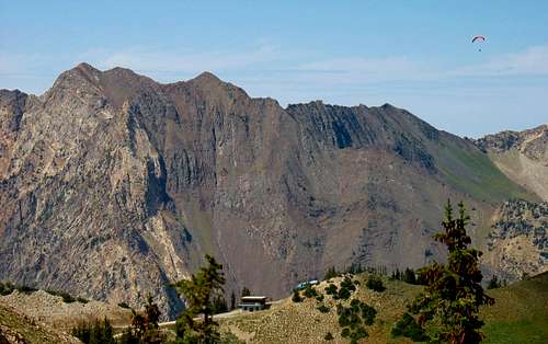
We elected to start hiking by 6 am so that we’d still have time to make it to my company picnic at 1 pm in Park City. This was assuming that we’d take three and a half hours to get to the top (recommended time in Veranth’s book), a little less than that to get down, and an hour to drive to Park City. Liz had already done quite well on several other long hikes, and the description in the book made it seem like this one wouldn’t be that difficult. We left our apartment in Sandy at 5:30 and drove up the main road in Little Cottonwood Canyon until we arrived at the small town of Alta half an hour later. I assumed that the trailhead would be easy enough to spot off of the main road, but after looking up and down the road between the police station in Alta and the guard shack in front of the dirt road leading up to Albion Basin, I realized that I should have done more research. We could see exactly where we needed to go to get to Cardiff Pass and the east ridge of Mount Superior towering above us, but I saw no sign of a trailhead and at these early hours there were no other people nearby to ask for directions.
![Flowers by Cardiff Pass]() Cardiff Pass wildflowers
Cardiff Pass wildflowers![Alpenglow on Alpine Ridge]() Alpenglow on Alpine Ridge
Alpenglow on Alpine Ridge![Other side of Little Cottonwood Canyon]() Mount Baldy over Alta
Mount Baldy over Alta![Zoom Shot of American Fork Twin Peaks]() American Fork Twin Peaks
American Fork Twin Peaks
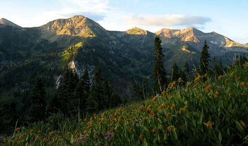
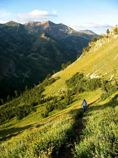
The paved road snaking up past the police station seemed like a good place to begin (I later discovered that this is indeed where the trail starts), so we finally started at 6:30 as the dawn sky began to light up. After winding past the police station and a few houses, the paved road stopped and a dirt road continued in its place leading to the northeast. Since Mount Superior was northwest of us and I wasn’t confident that we were on the right trail, I decided we could blaze a trail through the first opening in the trees we came across, and eventually meet up with the trail to Cardiff Pass. Luckily for us, an ATV trail branched off to the left a few hundred feet up the road and gradually narrowed into an actual hiking trail. I noticed several other trails leading up the slope on either side, but as we progressed up the slope I became convinced that we were on the right track. The bright green grass and yellow wildflowers reminded me of summer hikes I’d done in the lower elevation foothills of the Swiss Alps, and the glow of the rising sun on the peaks above Snowbird offered a stunning view. Dominating the skyline to the southwest was the majestic Pfeifferhorn, which was our goal for the next weekend. We caught our first glimpse of the sun upon reaching the top of Cardiff Pass, and at this point we decided to take a short break before continuing west along Mount Superior’s east ridge.
![Meadow below Cardiff Pass]() Sunrise on the trail
Sunrise on the trail
![Goat Just Chillin']() Goat at Cardiff Pass
Goat at Cardiff Pass
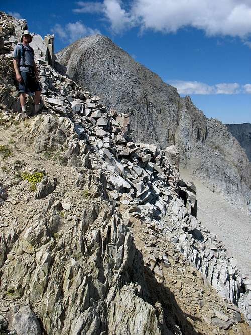
![Brandon on airy east ridge]() Airy east ridge
Airy east ridge
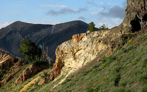
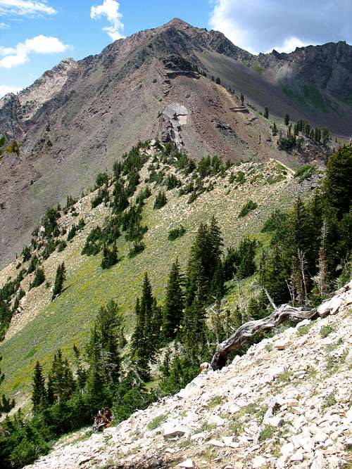
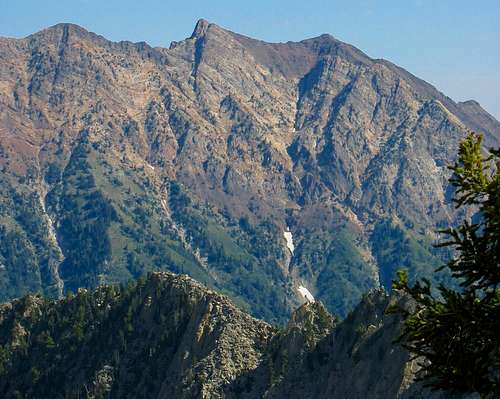
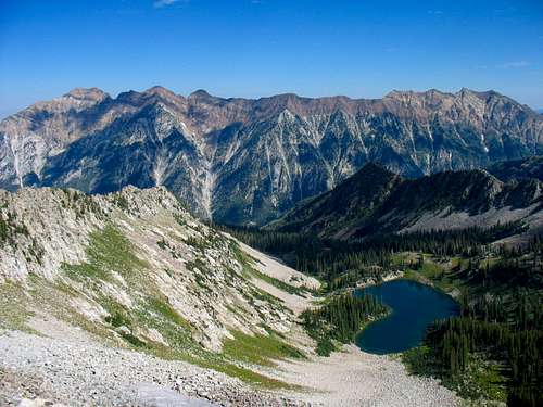
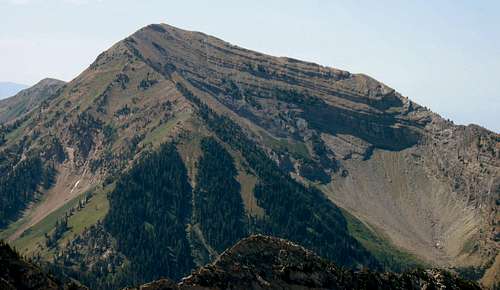
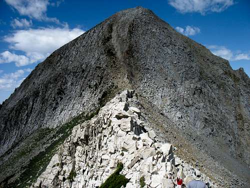
Looking west, our view of Mount Superior was blocked by a large rock outcropping. A small goat trail (which I though was a goat trail judging by the goat sitting on a nearby rock, but was in fact the actual trail) wound around the south side of the outcropping, but since the slope wasn’t too steep I thought we should climb straight over the top. Liz had done some steep snow hiking/scrambling on Cascade Mountain, but had never done any scrambling on steeper rock, so I was interested to see how she would handle it. At first she was a little hesitant about knowing where to put her hands and feet to most efficiently move up the rocks, but after following me for a hundred feet or so she started to get the hang of it. We reached the top of the outcropping and could now see the imposing east ridge of Mount Superior staring us right in the face. Rugged Cardiac Ridge was off to our right (along with several mountain goats scaling the cliffs), and the main Little Cottonwood Canyon road we had driven up earlier was visible far below us to the left. The trail flattened out for a few hundred feet but then steepened once again, indicating the start of the most sustained scrambling route of any Wasatch mountain’s standard route.
![Fun Scrambling]() Liz scrambling
Liz scrambling![Mount Superior from above Cardiff Pass]() East ridge of Mount Superior
East ridge of Mount Superior![Final Scramble to Monte Cristo]() Final scramble to the summit
Final scramble to the summit
None of the scrambling moves were that difficult, but there were a couple times when I’d start up one way only to realize that I should have gone the other way. I felt that my route-finding was slowly improving throughout the climb, and Liz was doing well at keeping up, but I could tell that she was starting to get tired. Each time we topped out on a false summit I could sense her disappointment, but I kept assuring her that the true summit wasn’t too much farther, even though I knew that wasn’t necessarily true. We’d already attempted Cascade Mountain and Box Elder Peak that summer without making the summit, so I was determined to not strike out three times in a row. A few hundred feet below where I thought the summit was, we suddenly heard howling. My first thought was that someone had hiked up with their dog but after a few seconds we could discern several different sources of howling, which could only have come from a pack of coyotes. It seemed illogical since we were above tree line, but just to be safe we immediately picked up the nearest sharp-looking rocks we could find, which would accompany us all the way from that point to the summit. We never found the source of the howling, so it was possible that with all of the steep cliffs nearby the sound had echoed up from somewhere below.
![Monte Cristo from Superior]() Monte Cristo from Mount Superior
Monte Cristo from Mount Superior![Alpine Ridge from Mount Superior]() Alpine Ridge from Mount Superior
Alpine Ridge from Mount Superior
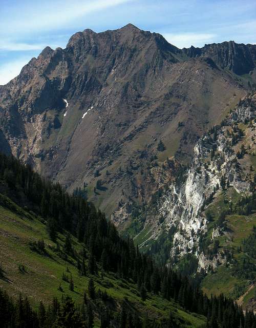
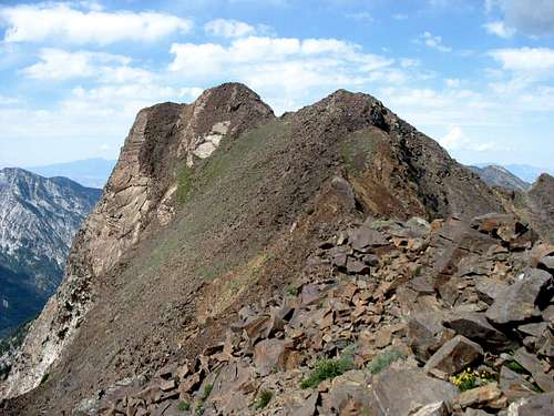
We had taken a little longer to get up than I had planned, but the higher summit of Monte Cristo beckoned us on. After a less demanding hike over the ridge between the two peaks, we faced one last steep scramble up a smooth stone slab below the 11,132 foot summit. The view from the top made me glad that we had put forth the extra effort. The jagged peaks of Cottonwood Ridge loomed in the distance to the west, and to the south we could see the entire Alpine Ridge rising above the other side of Little Cottonwood Canyon. We chatted with a couple hikers at the summit, one of whom said this hike was similar to Mount Sneffels in Colorado, meaning I had to put it on my to-do list. We ate a relaxing lunch on top, but didn’t stay too long because the considerable exposure was making Liz dizzy.
![Monte Cristo summit shot]() Cottonwood Ridge from Monte Cristo summit
Cottonwood Ridge from Monte Cristo summit
Going down took us longer than it did coming up, mainly due to a sprained knee by Liz. The one good thing was that we could see the entire trail down the south ridge on the way back (which we had stayed on only part of the time on the way up, due to my limited route-finding skills), and we discovered that the trail actually did lead around the south side of the rock outcropping above Cardiff Pass instead of straight over the top of it. We were already running too late to make it to my company lunch in Park City, so to ease the strain on her knee we took our time and didn’t get back down until 3 pm. We both enjoyed the hike, but the steep scrambling had taken its toll on Liz. She’d always had bad knees (hardly any cartilage between the joints), but after seeing what the steep terrain did in terms of swelling and pain, she decided that Mount Superior/Monte Cristo would be her first and last scramble. She said I could still go ahead and do Pfeifferhorn without her though, as long as I could find someone else to go with me.
Mount Superior Stats
DISTANCE:
5.6 miles roundtrip
CARDIFF PASS TRAILHEAD: 8,640
feet
SUMMIT ELEVATION (MONTE CRISTO):
11,132 feet
ELEVATION GAIN: 2,75
0 feet
DIFFICULTY:
Class 3
TIME:
8 hours
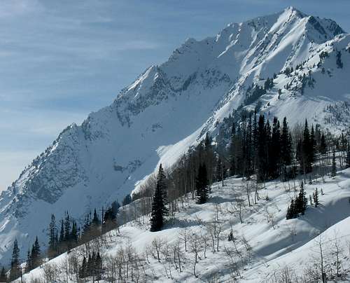
![Mount Superior from Alta Guard Station in Winter]() Mount Superior from town of Alta
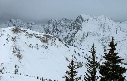
Mount Superior from town of Alta![Cottonwood Ridge from Alta Supreme Lift]() Mount Superior from Alta ski resort
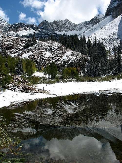
Mount Superior from Alta ski resort![Monte Cristo reflection]() Monte Cristo from Lake Blanche
Monte Cristo from Lake BlancheTackling the Little Matterhorn - Aug. 19, 2006
That next week I explained to a few of my colleagues from work why it was that we never made it to the picnic, and after showing them some pictures from our hike they remarked that it looked like fun and that they wished they had come along too. I doubt it’s the norm, but most everyone where I work is either into hiking as well or at least understands why other people like it. Unknown to me beforehand, one of my friends from college who had just started working in our office had a similar affinity for the outdoors as well, and after showing me some of his pictures from a recent climb of Sundial Peak (an impressive peak accessible from Big Cottonwood Canyon), I knew I’d found a good hiking partner. I told him about my plans to climb Pfeifferhorn (nicknamed “Little Matterhorn” by some), and he said he’d be glad to join me.
![Pfeifferhorn Sunrise]()
Pfeifferhorn from Cardiff Pass
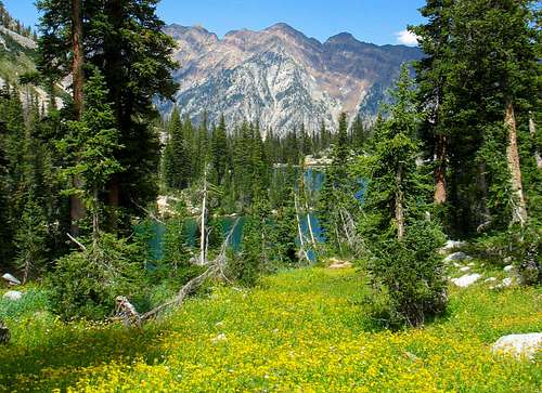
![Monte Cristo & Superior from above Red Pine Lake]() Monte Cristo from Red Pine Lake
Monte Cristo from Red Pine Lake
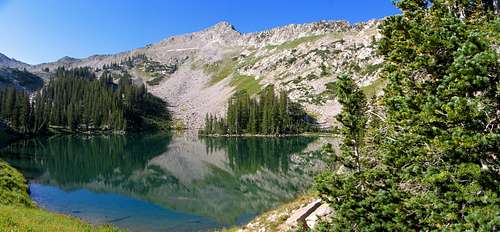
We started next Saturday’s hike a bit later (8 am), but Kendrick assured me that he and his brother Jarom, who he’d invited to come along, wouldn’t slow me down. It was quite the opposite, in fact. On all of my previous hikes I was usually the one who set the pace, but Kendrick and Jarom were machines. We only took a couple short breaks on the way up to Red Pine Lake (one of them being a nice lookout spot overlooking the mouth of Little Cottwonwood Canyon across from the towering summits of Twin Peaks, Sunrise Peak, and Dromedary Peak), and they were able to drag me up in just over an hour. The lake seemed like a good place for second breakfast, so this time we took a longer break and snapped a few pictures. The ridge above the lake looked impressive, but the more-impressive Pfeifferhorn had not yet revealed itself.
![Tanner s Gulch from Red Pine Trail]() Tanner's Gulch
Tanner's Gulch![Red Pine Lake & Pfeifferhorn East Ridge]() Red Pine Lake
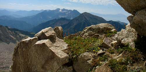
Red Pine Lake![Wildflowers above Red Pine Lake]() Red Pine wildflowers
Red Pine wildflowers![Cottonwood Ridge behind Red Pine Lake]() Twin Peaks and Sunrise Peak behind Red Pine Lake
Twin Peaks and Sunrise Peak behind Red Pine Lake
After eating we followed the trail along the east side of the lake, and at the southwest corner of the lake the trail stopped in an area where some boy scouts were camping. We knew that we had to get to the ridge above the lake to the south and then turn west on the ridge to get to the Pfeifferhorn, but we figured that the best way to get there would be to go straight up the boulder-strewn slope now facing us to the southeast. Some steep bushwhacking took us straight to Upper Red Pine Lake, with White Baldy directly overhead. We stopped to reassess our surroundings, and after spotting a hiker back to the west ascending a steep-looking spine leading towards the ridge we realized that we had overshot our next waypoint. We backtracked through the dried out remains of yet another lake, and upon reaching the spot where we’d seen the hiker we discovered a new trail. It was quite steep, but at least now we knew we were going in the right direction. Topping out on the ridge, we finally caught our first glance of Pfeifferhorn’s summit to the west.
![Cottonwood Ridge through the trees]() What a scene ... just miles from Salt Lake City
What a scene ... just miles from Salt Lake City
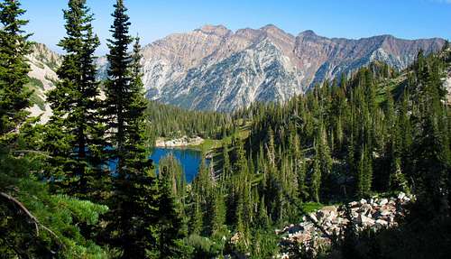
![Cottonwood Ridge from above Red Pine Lake]() Cottonwood Ridge
Cottonwood Ridge
![Timpanogos from east ridge]() Mount Timpanogos
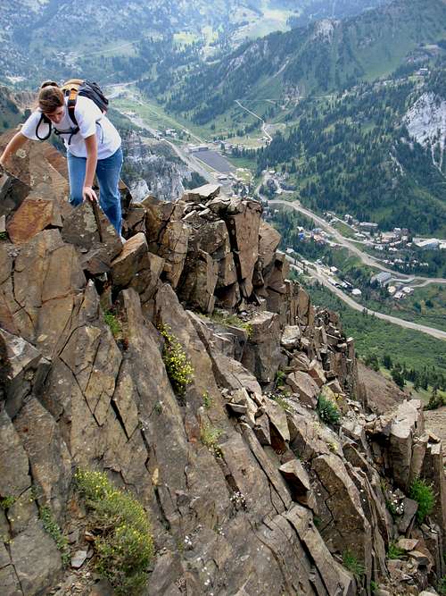
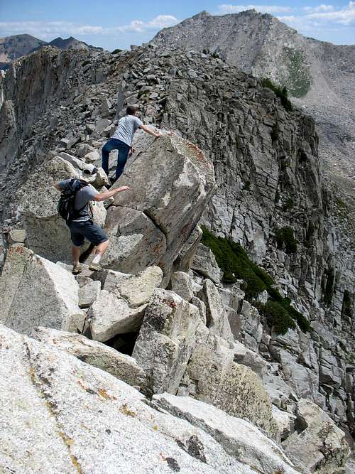
Mount TimpanogosThe trail flattened out from this point, leading closer to our destination. Arriving at the east ridge of the Pfeifferhorn, we could now see the steep northern side of the peak dropping down abruptly into Maybird Gulch. The short scrambling section traversed a narrow ridge composed of large granite boulders. We initially tried going straight over the top, but occasionally we found that dropping down a few feet on the north side presented an easier alternative. I didn’t have a problem with any of the moves, but being six feet tall I could see how shorter hikers might have trouble maintaining three points of contact on the rock while stretching towards the next handhold or foothold. Liz probably would have turned back at this section. Crossing the ridge, there were now only a few hundred feet of steep trail separating us from the summit. The dirt was slippery and loose, so every now and then I had to grab onto the nearby weeds to keep my footing, but eventually I made it to the top.
![Box Elder Peak from east ridge]() Box Elder Peak
Box Elder Peak
![Pfeifferhorn east face]() Pfeifferhorn east ridge
Pfeifferhorn east ridge
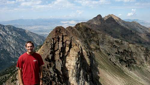
![Kendrick on east ridge]() Kendrick with Pfeifferhorn in background
Kendrick with Pfeifferhorn in background![Timp and Box Elder]()
Timpanogos and Box Elder from near Pfeifferhorn summit
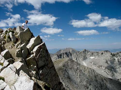
![Pfeifferhorn Summit]() Pfeifferhorn Summit
Pfeifferhorn Summit
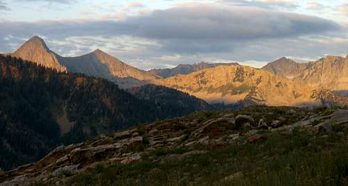
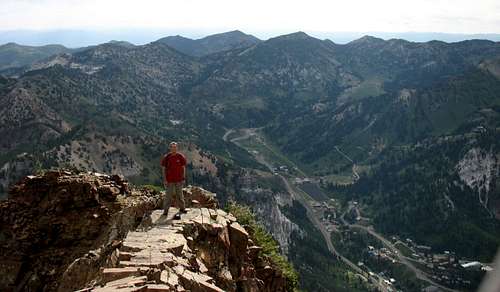
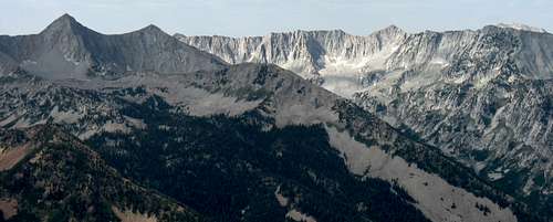
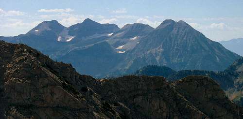
There were unique views in every direction. Looking back the way we had come from the east we could see the more rounded peaks above the ski resort of Snowbird. To the south were Mount Timpanogos and Box Elder Peak rising above the houses in Utah Valley. In the west, gazing down over the sheer cliff below Pfeifferhorn, we could see Thunder Mountain and Lone Peak, comprising the most rugged part of the Alpine Ridge (Google maps reveal it to be the largest contiguous section above tree line of any area in the Wasatch). To the north the entire Cottonwood Ridge was in plain sight, from Twin Peaks in the west to Mount Superior in the east. We took a long lunch break at the top, admiring the natural beauty all around us. Just a week ago I had no idea that there were peaks of this caliber in the Wasatch, and now I was hooked on the area.
![Pfeifferhorn Ridge Scramble]() Ridge scrambling
Ridge scrambling![Brandon on Pfeifferhorn summit]() Lone Peak and Thunder Mountain from Pfeifferhorn summit
Lone Peak and Thunder Mountain from Pfeifferhorn summit
Going down was relatively quick and easy, and even though there were parts of the route without a trail (in between the upper and lower lakes of Red Pine, which on our different path down crossed a couple fields of bright yellow wildflowers) we now knew exactly where we needed to go. Both hikes over the last two weekends had ended up being quite scenic, and to this day the Pfeifferhorn in particular remains my favorite overall hike in the Central Wasatch. Its easy trail hiking, boulder-hopping, and scrambling, as well as the lake, wildflower, and summit views, combine to offer everything that a hiker could ask for. Pfeifferhorn isn’t the most difficult peak to bag, but it still feels satisfying sitting at the top. There are many other mountains within the western United States I’d like to see, but I definitely feel lucky to live so close to these ones.
Pfeifferhorn Stats
DISTANCE:
10 miles roundtrip
WHITE PINE TRAILHEAD:
7,626 feet
SUMMIT ELEVATION:
11,326 feet
ELEVATION GAIN:
3,700 feet
DIFFICULTY:
Class 3
TIME:
7 hours
![Maybird Gulch]() Pfeifferhorn from Maybird Gulch
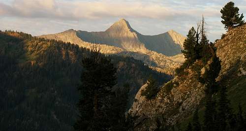
Pfeifferhorn from Maybird Gulch![Pfeifferhorn from Mount Baldy]() Pfeifferhorn from Hidden Peak
Pfeifferhorn from Hidden Peak


Comments
Post a Comment