
-
 1811 Hits
-
 76.66% Score
-
 7 Votes
|
|
Mountain/Rock |
|---|---|
|
|
38.10573°N / 107.49018°W |
|
|
Hinsdale |
|
|
Hiking, Mountaineering, Scrambling |
|
|
Spring, Summer, Fall |
|
|
13222 ft / 4030 m |
|
|
Overview
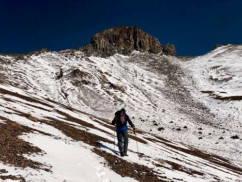 UN 13222 as seen from Porphyry Basin
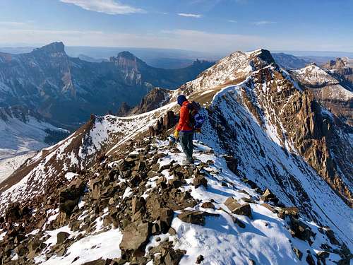 UN 13222
Peak can be climbed alone or combined with other 13ers along a ridge. A common combination is with 13340A, "El Punto", Heisshorn.
Colorado Rank: 460
Quad: Uncompahgre Peak
Parent Lineage: 13340 ("Porphyry Peak")
Wilderness: Uncompahgre
Class: 4
Nearby Peaks:
- Unnamed 13340 A 0.59 miles
- "El Punto" 1.22 miles
- Unnamed 13681 2.04 miles
- Silver Mnt. A 2.21 miles
- "Fortress Peak" 2.24 miles
- "Heisshorn" 2.25 miles
- "Big Blue Peak" 2.28 miles
- Precipice Peak 2.63 miles
- Redcliff 2.67 miles
- UN 13377 2.71 miles
- Uncompahgre Peak 2.81 miles
- Matterhorn Peak 2.82 miles
- UN 13206 2.89 miles
- Coxcomb Peak 2.95 miles
- UN 13100 B 3.04 miles
- Wetterhorn Peak 3.31 miles
Getting There
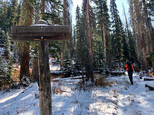 Pophyry Basin Trail
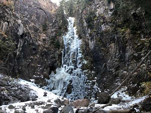 Waterfall
If you have time, stop for a short stroll to a beautiful waterfall about 1.5 miles from the trailhead. There is marker for the trail at the road and a small pull out parking lot.
Route
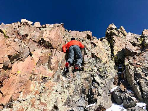 UN 13222 - class 4
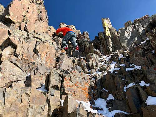 UN 13222 - class 3
Take the trail to Porphyry Basin - the trail follows a small drainage as it turns left and begins to switchback up above the cliffs through a channel cut by the stream. Porphyry Basin is fairly flat and sits at approximately 12,600 to 12,800 feet. Pinnacle Ridge rises up in the west with peaks rising to 13,222 and 13,315 feet. The entire length of this trail is in the Uncompahgre Wilderness.
UN 13222 is not initially visible. Keep going up ascending the grassy slopes until you see the shape of the peak (see photo). The terrain will change into gravel. The goal is to reach the saddle east of UN 13222. From the saddle traverse on loose ledges, loose terrain and follow small cairns. The route initially traverses, then it switchbacks back at class 3, it has some rest ledge with more stable terrain. At some point you reach class 4 section, which is pretty solid and does require a few small climbing moves on relatively stable holds. Once above this only a few class 3 moves will get you to the ridge and from there it is an easy stroll to the summit. The views are spectacular.
Red Tape
Parking, hiking, and even primitive camping are free. The peak is located in Wilderness area, so wilderness area rules apply.
Leave No Trace. Travel and Camp on Durable Surfaces. Dispose of Waste Properly. Leave What You Find. Minimize Campfire Impacts. Respect Wildlife. Be Considerable of Other Visitors.
When to Climb
Summer and early autumn are the easiest with roads being open. Winter provides a long approach and avalanche danger. Spring could be an a nice outing and the scree slopes could be still covered with snow.
Camping
There is great free camping along the Middle Fork Road. It is also possible to sleep at the trailhead.
Developed campground would be Silver Jack Campground.