
-
 6634 Hits
-
 84.27% Score
-
 18 Votes
|
|
Mountain/Rock |
|---|---|
|
|
46.44265°N / 14.15146°E |
|
|
Hiking, Mountaineering, Scrambling, Skiing |
|
|
Spring, Summer, Fall, Winter |
|
|
6903 ft / 2104 m |
|
|
Overview
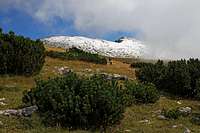
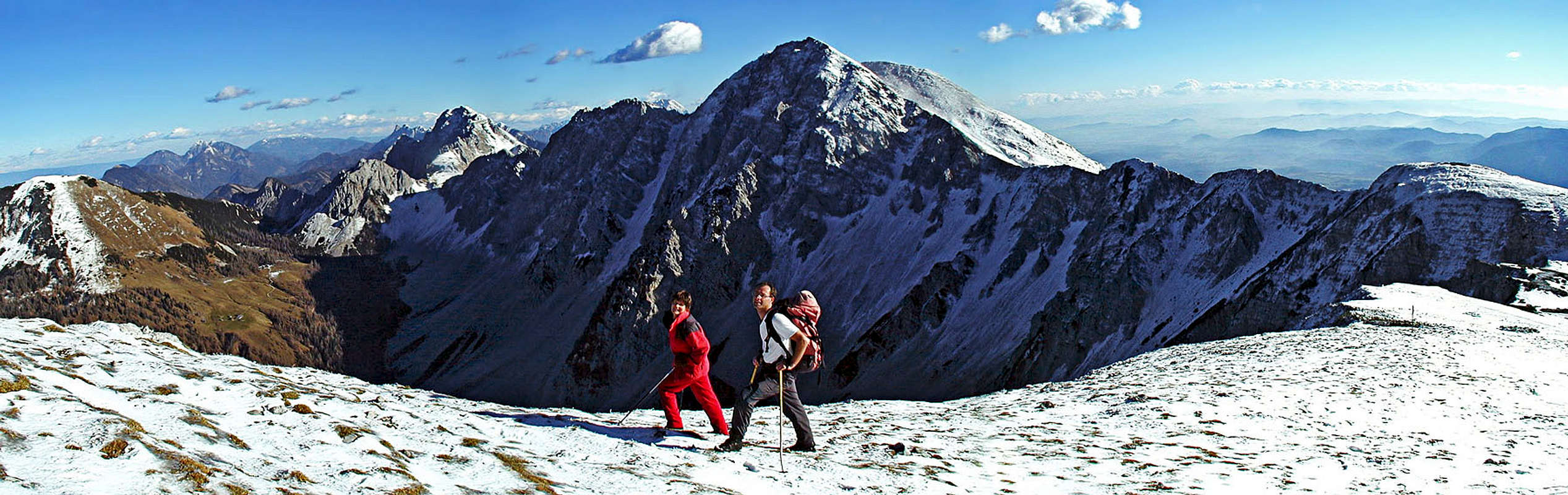
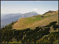
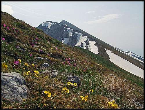 On the western ridge of Vajnež
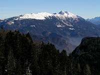 Vajnež and Stol from the west
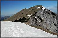 Vajnež from Potoški Stol
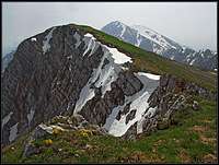 The summit of Vajnež
Even if Vajnež, together with the neighbouring Belščica ridge is closely attached to Stol / Hochstuhl, the highest summit of Karavanke / Karawanken, it is a nice mountain, attractive as from the Slovenian side, as from the Austrian side. So, we are on the main crest of Karavanke / Karawanken, this page will describe the mountain world between Medvedjak / Baerensattel, 1698 m, and Vajneževo sedlo / Weinasch Sattel, 1972 m, beyond which there are already the rocks of Potoški Stol, belonging to the main summit.
From Medvedjak / Baerensattel the main ridge of Karawanks stretches first a bit towards the SE, then it turns even into the S direction. In this part it is rocky and crumbly, but once it even hosted a marked and partly secured path which is supposedly today qute decayed and a few passages already require some easy climbing. The ridge ends on the summit of Belščica (also Mali vrh), 2017 m, west of Vajnež. On the summit of Mali vrh from the W another, more humble ridge comes. Below, above Medji dol (valley) it is still rocky, but above it loses sharpness and is easilly passable. The marked path (Slovenska planinska transverzala) crosses it without any difficulty from below Medvedjak / Baerensattel (saddle).
From the summit of Mali vrh to Vajnež a long and smoothly rising, also easilly passable ridge ascends - the whole area with the grassy southern slopes below the ridge is also called Belščica. Towards the S-SW here are very nice terrains for tour skiing. The summer marked path (Slovenska planinska transverzala) goes a little below the ridge - crossing the slopes to Vajneževo sedlo / Weinasch Sattel.
The N and NE slopes of Vajnež are more demanding. They are steep and rocky. Here we are already in the central part of Karavanke/Karawanken, where they are the highest and already completely alpine. The walls are not attractive for climbing, but they don't offer plausible passages. As in the area of Stol/Hochstuhl, also in the N slopes of Valnež there are several steep ravines, reaching high up towards the main ridge. Except the ravine which comes up on Vajneževo sedlo / Weinasch Sattel, these ravines are not much visited. As the passages on main ridge are steep, it looks that also tour skiers avoid them.
 Above Hrašenska planina
On the southern (Slovenian) side of the massif, there are some nice alpine meadows, connected by good paths. On the lower terraces, some alpine meadows are reachable by car, others offer pleasant possibilities for easy and quite panoramic hiking. On the upper terrace, above the tree line, there are a few huts, originating in ex sheep pastures. The westernmost alpine pasture is called Hrašenska planina, further towards the east there is a small hut on the place, called Na močilih. A bit further to the east there was once Belška planina (pasture), but today there's no hut, only a small bivouac.
Getting There
All approaches from the southern (Slovenian) side start in the valley of river Sava.
1. On the west, a good starting point for hikes is Javorniški rovt. We park near a small lake (Pri Žagi), by the creek of Javornik, 940 m.
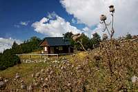
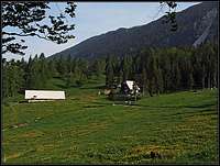 Potoška planina
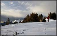 Stamare meadow
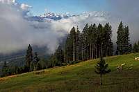 Stamare meadow
2. The second good trailhead is Potoška planina (meadow), cca 1280 m. It can be reached with car by a narrow mountain road. In Moste/Žirovnica we drive shortly into Završnica valley, then turn up towards Valvasorjev dom (hut), but pass below it and further towards the west and up on Potoška planina.
3. From Potoška planina the mountain road continues further. Soon it reaches Olipova planina (meadow), then (the right branch) just below Stamare alpine meadow, 1400 m. There, also an unmarked path towards the ridge starts.
4. The fourth good trailhead on the southern side is Valvasorjev dom (hut), 1170 m, also reachable by car. This big hut serves mostly the ascents on Stol/Hochstuhl, but can be used also for Vajnež, especially if we are on one of the nice round tours.
5. From the north basically the only good starting points are in the valley of Baerental / Medvedji dol (or Rute). From the main valley of Drau/Drava river we deter south in Feistritz/Bistrica, the first big parking place is near the mountain hut on 960 m., but usually (in summer) we can drive also higher into the valley (to the parking place Im Winkel, good 1100 m).
Panorama
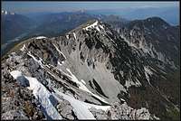
 Towards Stol/Hochstuhl
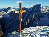 Summit cross
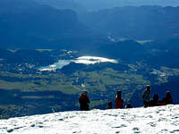 Bled lake from Vajnež
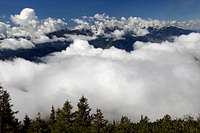
The views from the summit of Vajnež are as broad and excellent as from Stol/Hochstuhl. The most attractive is the view on Julian Alps with Triglav, then also down on Gorenjska plane with Bled lake, further to the south across the hilly Slovenia down to the Adriatic coast is seen, towards the east the summit of Stol/Hochstuhl and its rocky neighbours dominate and towards the north wiews are open far to the groups of Dachstein and Hohe Tauern.
Routes Overview

1. From Javorniški rovt
From the parking place "Pri Žagi" you go by the small artificial lake and the so-called "Trilobit hut". There you continue towards the NE by a good, marked path into Medji dol (valley). Soon the northern rocks of Srednica, 1726 m, start squeezing the valley. But the path is still good. From a small basin on 1500 m it ascends up again and soon reaches the Seča meadow, some 50 meters of altitude below the saddle Seča/Medvedjak/Baerensattel. By the huts on Seča meadow, the marked path joins us from the left (Slovenska planinska transverzala) and we continue by it towards the right. It turns to the southern direction, into a small valley between the main Karavanke ridge on the left and the side ridge of Srednica and Kamnitnik, 1858 m. At the end of the valley it slowly turns right, ascending comfortably on the side ridge and there turns left again, continuing below the main ridge (of Belščica) towards the SE. Left above the path, there's the summit of Mali vrh which we can ascend in minutes. If we don't intend to continue, that can even be a goal of the tour.
 On Belščica ridge
While the marked path continues below the S slopes of Belščica ridge towards Vajneževo sedlo (saddle) it is best to gain the main ridge anyway and continue by it. It goes up and down only a little, but is far more panoramic. The main ridge brings us on top of Vajnež, if we go by the marked path below it, we must turn on the saddle left and ascent the summit from the south. The whole tour is easy, the ascent takes some 3 h. This is also a beautiful ski tour. The valley of Medji dol is covered with forrest, but skiing is still quite good, the upper part of the tour is ideal. On the slopes of Srednica there can be a threat of avalanches! In the part from Seča meadow (Baerensattel) to the summit of Mali vrh, you can in summer take also the route by the main ridge of Karavanke/Karawanken. That is called "Skalaška pot". It is quite demanding, on several places secured with pegs and cables, but there are also parts where the route was destroyed and requires some easy climbing. The ridge is crumbly. Over the alpine meadows on the southern side of the mountain many a bit shorter unmarked paths bring you below the ridge of Belščica. For example: the paths over Stamare meadow and Olipova planina (meadow) bring you up on Hrašenska planina and Belška planina.
2. From Potoška planina
 Belška planina from the bivouac
This is the quickest and shortest ascent on the summit of Vajnež. The meadow, 1280 m, can be reached by car. From there we continue walking by the mountain road towards the NW, but only a few minutes, to the so-called Urbas water source. There a good path (inscription: "Belška planina"!) deters right. It first crosses the forrested, partially rocky slopes towards the NW, not gaining much altitude. After some 15 minutes it starts ascending more steeply up through a nice beech forrest. It goes in several turns and is well beaten, clear to follow. After gaining enough altitude it starts crossing towards the left and soon exits on the broad meadows below the ridge of Belščica. The place is called "Pri močilu" - (By the water source) and there is nowadays a small bivouac, allways opened. The ex shepherds hut has 2 beds. On the left we see the hut on Belška planina (alpine meadow). From the bivouac you continue by your own judgement. A weak path goes up across the slopes towards the right, joins the marked path, so you can go on Vajneževo sedlo and from there on top. But again it is more nice to gain the main ridge as soon as possible and continue by it towards the right on top. 2 h 30 min from Potoška planina.
3. From Stamare meadow
 Hrašenska planina
This meadow, 1400 m, is the end point of the mountain road and from there to the main ridge the ascent is quite short. A well beaten, but not marked shepherds path goes first left up into the woods, then in a few steeper turns up and higher again crosses quite far towards the left (NW). After less than 30 min it exits on Hrašenska planina, where we turn right and ascend by a shallow valley on the grassy slopes below Belščica. From there, we can ascend the humbe Kamnitnik, or continue on Mali vrh or further to the east on Vajnež. 2 h 30 min from Stamare.
4. From Valvasor hut
The hut stands on 1170 m, the ascent goes over Rjave peči (Brown rocks). It is of course possible to ascend from Valvasorjev dom by the marked path on the summit of Stol and from there go by the main ridge towards the west on Vajnež. That's an excellent round tour (with the descent by the above described path #2). See the description on the page of Stol/Hochstuhl! But here I will briefly describe the path which goes from Valvasor hut on Vajnež directly. In the upper part some orientation skills are needed, but there you are already on the open terrain, well below the summit. From the hut we go by the road up and further towards the west (towards Potoška planina) by a good mountain road, which is also marked as a former mountain path. After some 15 minutes it goes flat (the place is called Ravni) and there we go right in the forrest. In the beginning the path is less intelligible, but soon it gets stronger, winding in several turn up the beech forrest. This hunters path takes the passage between two rock formations, actually rubble crags where we could anyway not go comfortably. Above the passage the path goes all the time towards the left and across the slopes. We are already out of woods, among denese pine bushes. The path is clear and on some point turns right sharply. There it starts ascending again. Years ago we were tempted and went there directly up (and to the right), but the ascent was very steep and we profited only a little. It is better to follow the path around the flat side ridge, then leave it and ascend Vajneževo sedlo by the shallow valley. Otherwise the hunters path continues far left towards the bivouac and Belška planina (meadow). 2 h 30 min. So, all three above described routes, plus all the southern ascents on Stol/Hochstuhl, can be combined to make great round tours. They can be done in any direction. If, for example we ascended Vajnež directly, we can go from its summit towards the east. If we don't want to ascend also Stol/Hochstuhl, there's an option to take from the saddle below Stol a narrow ravine, filled with rubble, wich takes us down on the normal path to Valvasor hut.
5. Northern ascent
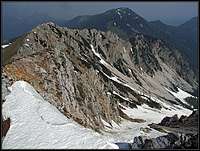
 The N scree ascent
From Stouhuette we follow the marked path towards the valley end (towards Klagenfurter Huette / Celovška koča. When the path reaches broad scree fields between Stol/Hochstuhl and Vajnež/Weinasch, we start ascending by a path which goes to the entry of Stol/Hochstuhl northern ferrata. However we pass below the north rib and continue by the broad screes towards the right, ascending all the time (the scree field on the right is called Dolga riža, the left one, accompanying up the North rib of Stol is called Široka riža). Our target is the notch - the saddle - Vajneževo sedlo - a bit left of Vajnež summit. Before we gain the main ridge and the saddle, we must overcome a steep and unpleasant ravine which even requires some care and easy climbing. This ravine is far more recommendable when it is filled with snow. For good skiers this is one of the most popular and nice ski tours above Baerental / Medvedji dol. From the saddle it's then only some 10 minutes to the top. Altogether 3 h.
6. From Prešernova koča
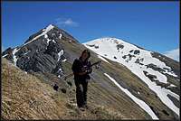 Traversing from Stol to Vajnež
The above four ascents brought you on the summit of Vajnež from the valleys or at least from parking places on roads. But if you are doing a crossing tour on Karavanke/Karawanken, or a longer round tour, you might be coming on the summit of Vajnež from the east, from below Stol, where on a small side bump of Mali Stol Prešernova koča stands. From the hut you go on the saddle (Med Stoli) between Mali Stol and the highest point and from there take the marked path towards the west. It crosses the southern slopes of Veliki Stol and gains the main ridge west of it. If you ascended the main summit, you can continue from it towards Vajnež directly by the W ridge. It is a bit crumbly, steep and unpleasant but there are no serious difficulties. From below Stol W ridge, the marked path goes comfortably further towards the west. It keeps a bit below the crest on some places only coming on it. When approaching Potoški Stol, the path gets a bit narrow on a few places, but it is still easy and comfortable. Finally it detours the summit of Potoški Stol, descends on Vajneževo sedlo and continues westwards as described. From Prešernova koĄa to Vajnež you have some 40 minutes.
Maps
You can find on-line maps here: Austrian on-line map: http://www.austrianmap.at/ Slovenian on-line map: http://www.geopedia.si/ (then click on the left "Pohodništvo" to get the marked paths layer on the map)
Mountain huts
- Valvasorjev dom, 1171 m, parking place.
- Prešernova koča, 2172 m, 15 minutes below the summit of Stol/Hochstuhl, 2 h 30 min from Valvasorjev dom.
- Dom Pristava (above Javornik creek), 979 m, parking place.
- Stouhuette in Baerental / Medvedji dol, 960 m, parking place.
- Klagenfurter Huette, 1663 m, 2 hours from Stouhuette. On alpine meadows you can find also many private huts, where they might offer you drink and food.
When to Ascend?
 Early September
 JFS - skiing from Vajnež
We can ascend Vajnež in any time of season. Winter tours are of course longer and more demanding. Where there are steep passages, additional care and equipment is needed. For tour skiing only the usual gear is needed.
Red Tape
No restrictions.
Your Help Is Needed
- Do you have pictures and descriptions from winter/ski tours?
- Do you have information about the ravines west of Dolga riža - those coming up on Belščica ridge?